Map of Pinhook village

Map of Pinhook village

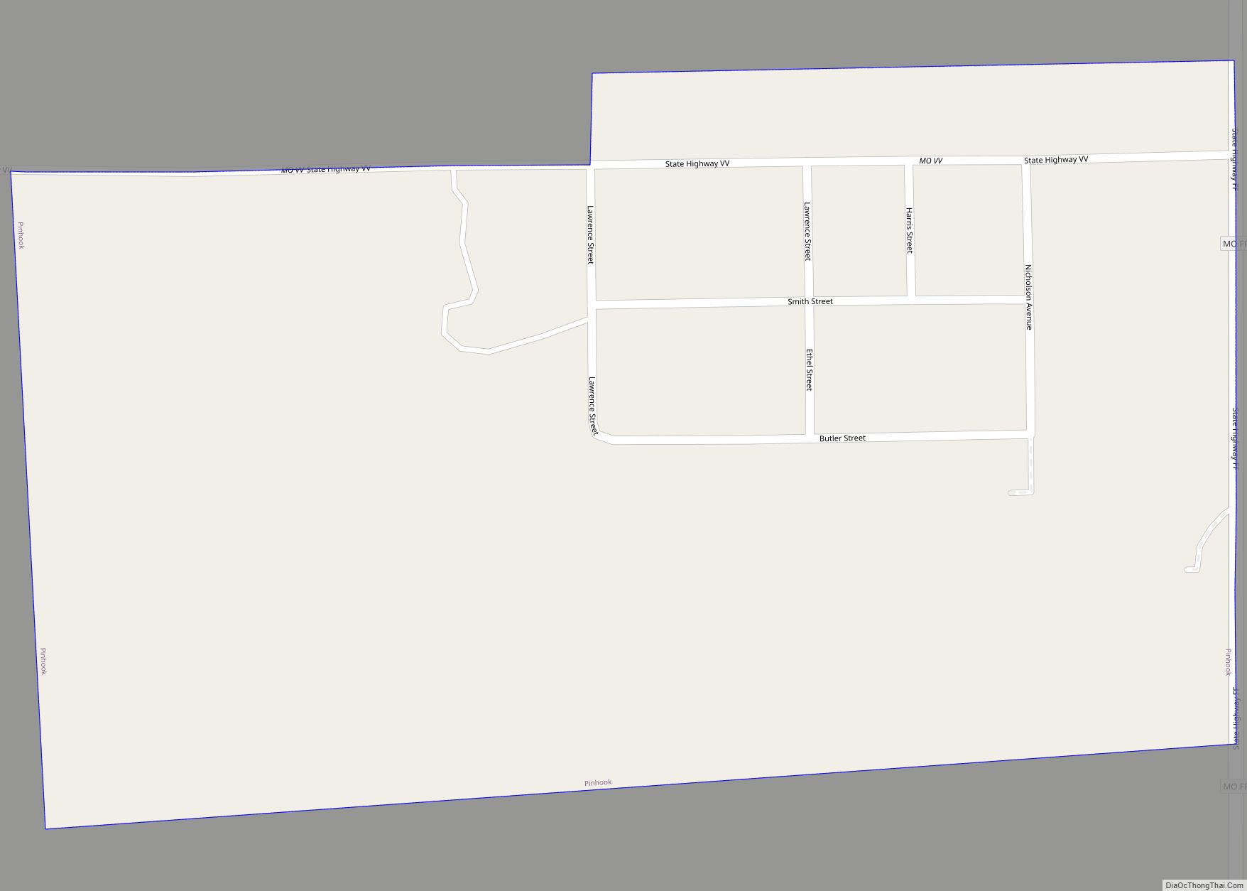
Pinhook is an inactive village in Mississippi County, Missouri, United States. The population was 6 at the 2020 census. It was settled in the 1920s by sharecroppers. The community takes its name from a nearby ridge of the same name which in turn was so named on account it having the form of a pinhook. … Read more

Map of Pineville city, Missouri

Map of Pineville city, Missouri

Pineville is a city in and the county seat of McDonald County, Missouri, United States. The population was 791 at the 2010 census. Pineville city overview: Name: Pineville city LSAD Code: 25 LSAD Description: city (suffix) State: Missouri County: McDonald County Elevation: 899 ft (274 m) Total Area: 3.29 sq mi (8.53 km²) Land Area: 3.29 sq mi (8.53 km²) Water Area: 0.00 sq mi … Read more

Map of Plattsburg city

Map of Plattsburg city

Plattsburg is a city in and the county seat of Clinton County, Missouri and is part of the Kansas City metropolitan area in the western part of the state, within the United States. It developed along the Little Platte River. As of the 2020 census, the city population was 2,222. Plattsburg city overview: Name: Plattsburg … Read more

Map of Platte Woods city

Map of Platte Woods city

Platte Woods is a city in Platte County, Missouri and is part of the Kansas City metropolitan area within the United States. The population was 385 at the 2010 census. Platte Woods city overview: Name: Platte Woods city LSAD Code: 25 LSAD Description: city (suffix) State: Missouri County: Platte County Elevation: 1,024 ft (312 m) Total Area: … Read more

Map of Platte City city

Map of Platte City

Platte City is a city in and the county seat of Platte County, Missouri within the United States. The population was 4,691 at the 2010 census. The city is part of the Kansas City metropolitan area. Platte City overview: Name: Platte City LSAD Code: 25 LSAD Description: city (suffix) State: Missouri County: Platte County Elevation: … Read more

Map of Pleasant Valley city, Missouri

Map of Pleasant Valley city, Missouri

Pleasant Valley is a city in Clay County, Missouri, United States. The population was 2,743 at the 2020 census. It is part of the Kansas City metropolitan area. Pleasant Valley city overview: Name: Pleasant Valley city LSAD Code: 25 LSAD Description: city (suffix) State: Missouri County: Clay County Elevation: 830 ft (250 m) Total Area: 1.25 sq mi (3.25 km²) … Read more

Map of Pleasant Hope city

Map of Pleasant Hope city

Pleasant Hope is a city in Polk County, Missouri, United States. The population was 614 at the 2010 census. It is part of the Springfield, Missouri Metropolitan Statistical Area. Pleasant Hope city overview: Name: Pleasant Hope city LSAD Code: 25 LSAD Description: city (suffix) State: Missouri County: Polk County Elevation: 1,119 ft (341 m) Total Area: 1.57 sq mi … Read more

Map of Pleasant Hill city, Missouri

Map of Pleasant Hill city, Missouri

Pleasant Hill is a city in Cass and Jackson counties, Missouri, United States. The population was 8,113 at the 2010 census. It is part of the Kansas City metropolitan area. Pleasant Hill is home for the National Weather Service Kansas City/Pleasant Hill, Missouri office, which serves 37 counties in northern and western Missouri and seven … Read more

Map of Plevna CDP, Missouri

Map of Plevna CDP, Missouri

Plevna is an unincorporated community and census-designated place in southeastern Knox County, Missouri, United States. It is located approximately 17 miles (27 km) southeast of Edina on Missouri Route 15. As of the 2020 census, its population was 7. Plevna was platted in 1877. According to author and name historian Robert Ramsay, the community is named … Read more

Map of Pollock village, Missouri

Map of Pollock village, Missouri

Pollock village overview: Name: Pollock village LSAD Code: 47 LSAD Description: village (suffix) State: Missouri County: Sullivan County FIPS code: 2958898 Online Interactive Map Pollock online map. Source: Basemap layers from Google Map, Open Street Map (OSM), Arcgisonline, Wmflabs. Boundary Data from Database of Global Administrative Areas. Pollock location map. Where is Pollock village? Pollock … Read more

Map of Pocahontas town, Missouri

Map of Pocahontas town, Missouri

Pocahontas town overview: Name: Pocahontas town LSAD Code: 43 LSAD Description: town (suffix) State: Missouri County: Cape Girardeau County FIPS code: 2958628 Online Interactive Map Pocahontas online map. Source: Basemap layers from Google Map, Open Street Map (OSM), Arcgisonline, Wmflabs. Boundary Data from Database of Global Administrative Areas. Pocahontas location map. Where is Pocahontas town? … Read more

Map of Pontiac CDP, Missouri

Map of Pontiac CDP, Missouri

Pontiac is a census-designated place in southern Ozark County, Missouri, United States. It lies six miles south of Isabella and 18.5 miles southwest of Gainesville, on the northeast shore of Bull Shoals Lake. A post office called Pontiac has been in operation since 1887. The community was named in honor of the Ottawa Indian chief … Read more