Plattsburg is a city in and the county seat of Clinton County, Missouri and is part of the Kansas City metropolitan area in the western part of the state, within the United States. It developed along the Little Platte River. As of the 2020 census, the city population was 2,222.
| Name: | Plattsburg city |
|---|---|
| LSAD Code: | 25 |
| LSAD Description: | city (suffix) |
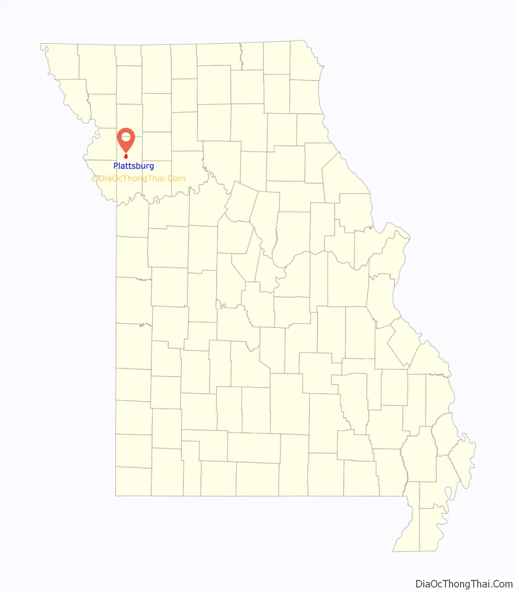
| State: | Missouri |
| County: | Clinton County |
| Founded: | 1833 (as Concord, MO) 1835 (as Plattsburg, MO) |
| Elevation: | 929 ft (283 m) |
| Total Area: | 3.63 sq mi (9.39 km²) |
| Land Area: | 3.60 sq mi (9.33 km²) |
| Water Area: | 0.03 sq mi (0.07 km²) |
| Total Population: | 2,222 |
| Population Density: | 617.05/sq mi (238.26/km²) |
| ZIP code: | 64477 |
| Area code: | 816 |
| FIPS code: | 2958250 |
| GNISfeature ID: | 2396228 |
| Website: | plattsburgmo.com |
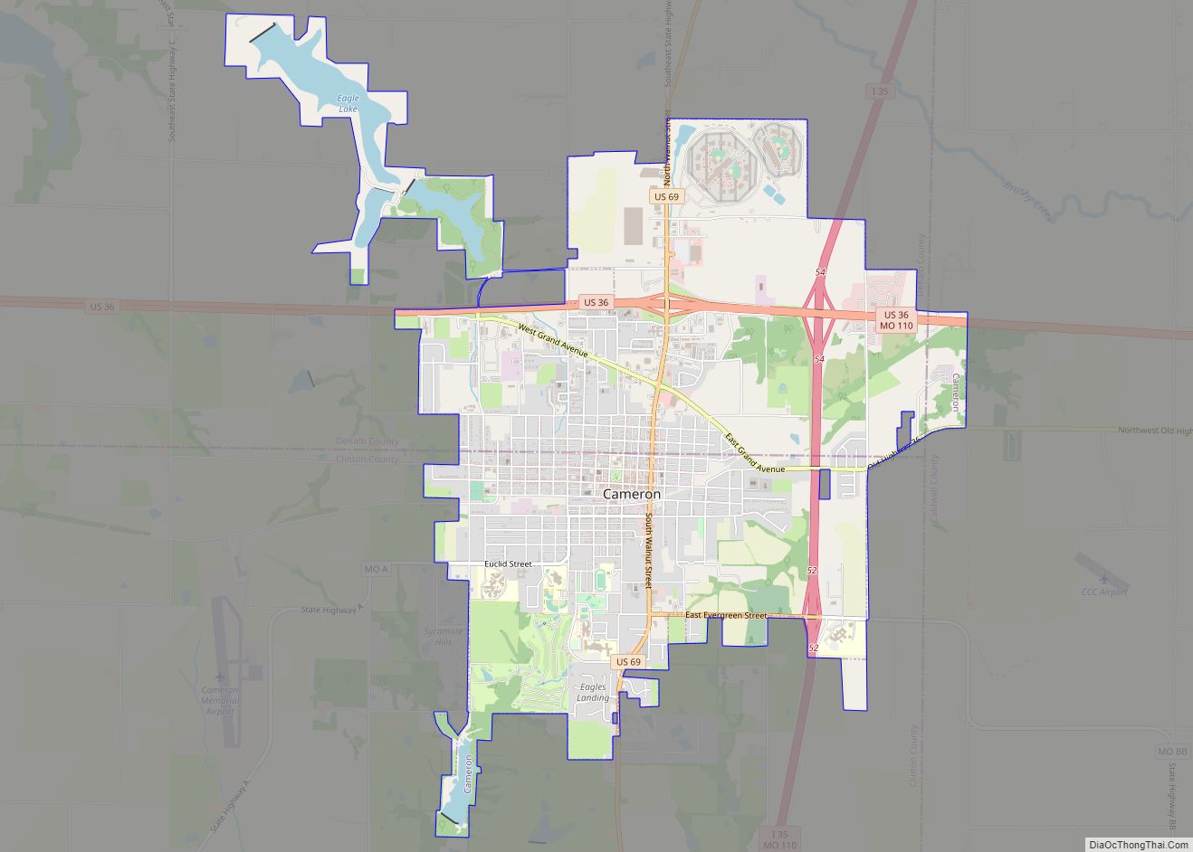
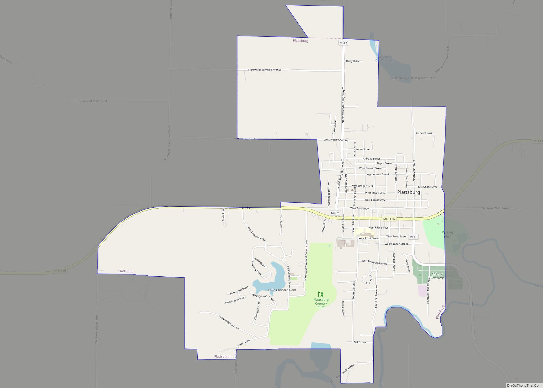
Online Interactive Map
Click on ![]() to view map in "full screen" mode.
to view map in "full screen" mode.
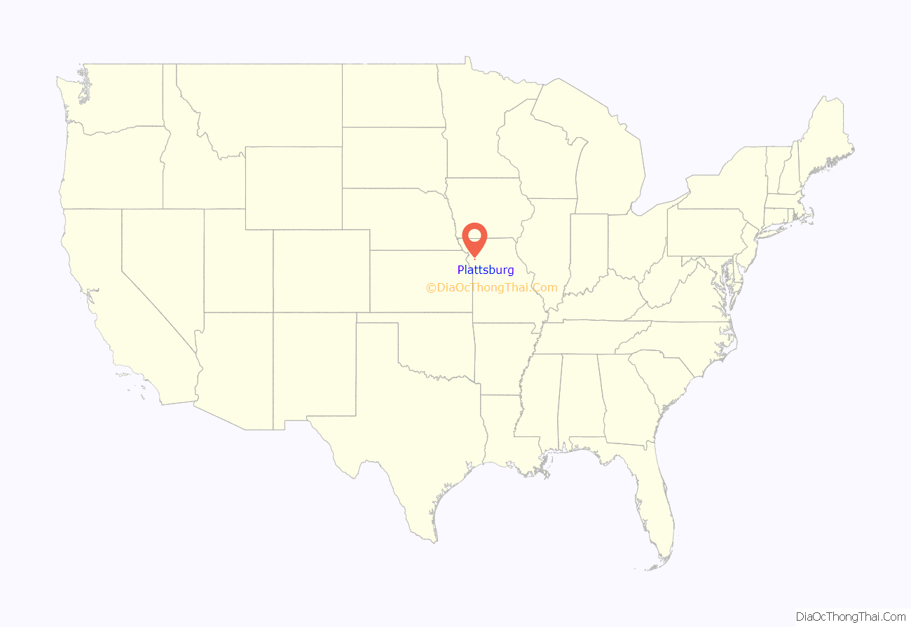
Plattsburg location map. Where is Plattsburg city?
History
The area along the rivers had been occupied for thousands of years by indigenous peoples. Historic American Indian tribes in the area included the Ioway, Fox and Sac tribes, who ceded land to the United States in the Platte Purchase. This area became part of northwest Missouri.
The European-American settlers first called their settlement Concord. (This has been used for a contemporary man-made lake and surrounding housing development in the city.) Later the city was renamed Springfield. After the discovery that there was an earlier Springfield, Missouri, settlers named it “Plattsburg,” after Plattsburgh, New York. This is the seat of Clinton County, New York. Both it and Clinton County, Missouri were named for George Clinton, one of the Founding Fathers, the first governor of New York, and vice president of the United States from 1805 to 1812.
The area was settled chiefly by migrants from the Upper South, especially central Kentucky and western Virginia. It was near a region called “Little Dixie” in Missouri because of the strong Southern presence. These migrants brought their slaves and culture with them. For a brief period of time during the 1830s, Plattsburg was home to a Federal land office for areas of northern Missouri that were newly opened to settlement by European Americans after the Platte Purchase in 1836. Until then, Plattsburg was one of the farthest western non-military settlements.
The area became a leading producer of both hemp and tobacco, both major commodity products of the Bluegrass Region of central Kentucky. They were labor-intensive and dependent on labor of enslaved African Americans labor. David Rice Atchison, the US senator from here, was pro-slavery. As the county seat, Plattsburg was a center of trade and politics, with a variety of retail stores and professions. At one point, when Kansas City was a major beef processing and export center, Plattsburg was known as “the Beef Capital of the World”.
By 1860, the county had a total population of 7,848. The 1,144 enslaved African Americans comprised 17% of the total. During the American Civil War, two minor battles took place nearby. The town was occupied by both Confederate and Federal forces. In 1863, elements of William Quantrill’s guerrilla band captured a unit of Federal troops encamped in the county courthouse located in Plattsburg.
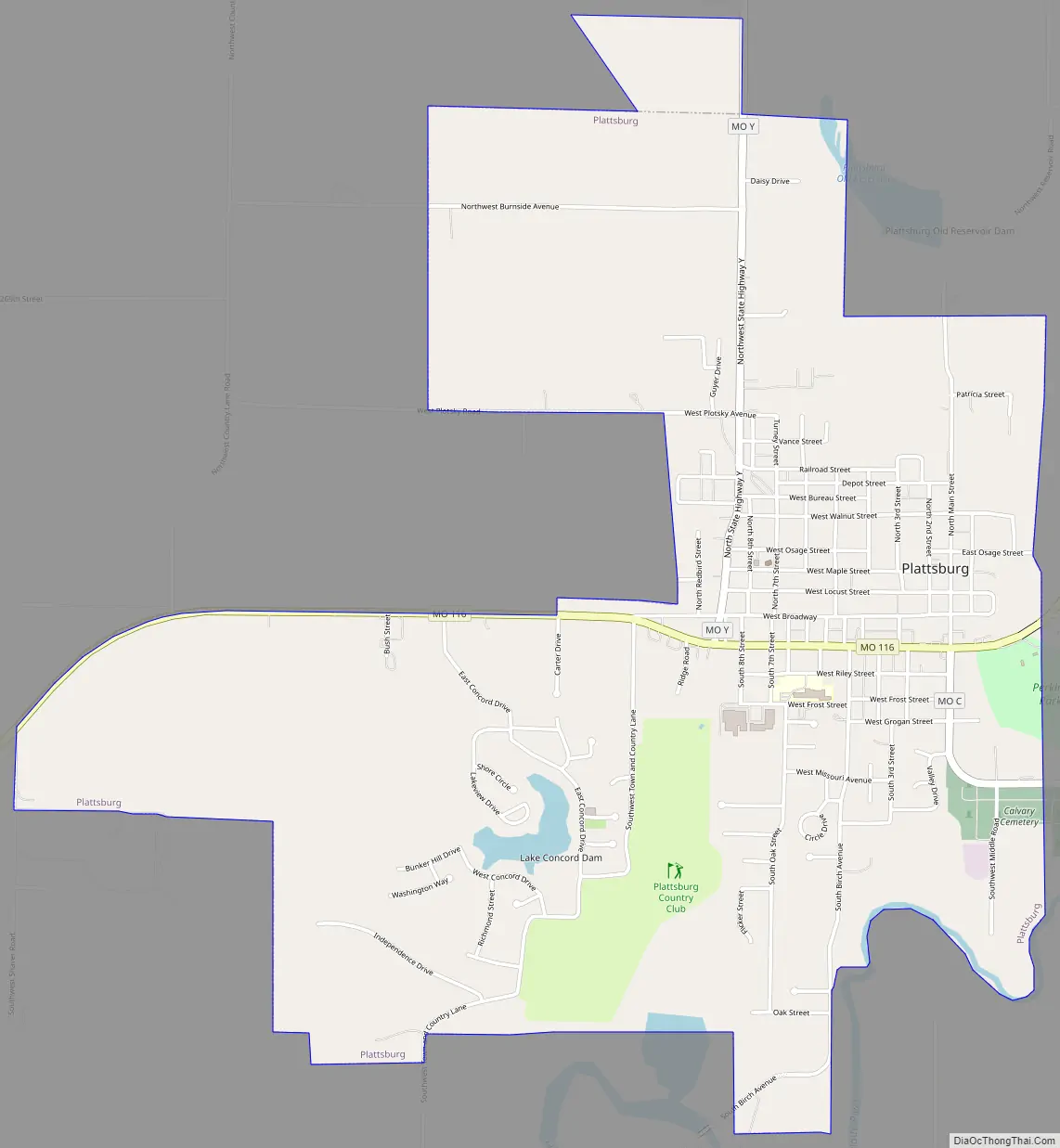
Plattsburg Road Map
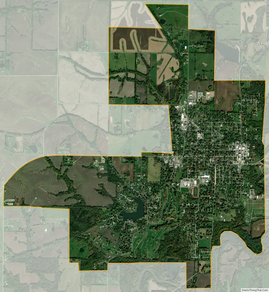
Plattsburg city Satellite Map
Geography
According to the United States Census Bureau, the city has a total area of 3.63 square miles (9.40 km), of which 3.60 square miles (9.32 km) is land and 0.03 square miles (0.08 km) is water.
See also
Map of Missouri State and its subdivision:- Adair
- Andrew
- Atchison
- Audrain
- Barry
- Barton
- Bates
- Benton
- Bollinger
- Boone
- Buchanan
- Butler
- Caldwell
- Callaway
- Camden
- Cape Girardeau
- Carroll
- Carter
- Cass
- Cedar
- Chariton
- Christian
- Clark
- Clay
- Clinton
- Cole
- Cooper
- Crawford
- Dade
- Dallas
- Daviess
- De Kalb
- Dent
- Douglas
- Dunklin
- Franklin
- Gasconade
- Gentry
- Greene
- Grundy
- Harrison
- Henry
- Hickory
- Holt
- Howard
- Howell
- Iron
- Jackson
- Jasper
- Jefferson
- Johnson
- Knox
- Laclede
- Lafayette
- Lawrence
- Lewis
- Lincoln
- Linn
- Livingston
- Macon
- Madison
- Maries
- Marion
- McDonald
- Mercer
- Miller
- Mississippi
- Moniteau
- Monroe
- Montgomery
- Morgan
- New Madrid
- Newton
- Nodaway
- Oregon
- Osage
- Ozark
- Pemiscot
- Perry
- Pettis
- Phelps
- Pike
- Platte
- Polk
- Pulaski
- Putnam
- Ralls
- Randolph
- Ray
- Reynolds
- Ripley
- Saint Charles
- Saint Clair
- Saint Francois
- Saint Louis
- Sainte Genevieve
- Saline
- Schuyler
- Scotland
- Scott
- Shannon
- Shelby
- Stoddard
- Stone
- Sullivan
- Taney
- Texas
- Vernon
- Warren
- Washington
- Wayne
- Webster
- Worth
- Wright
- Alabama
- Alaska
- Arizona
- Arkansas
- California
- Colorado
- Connecticut
- Delaware
- District of Columbia
- Florida
- Georgia
- Hawaii
- Idaho
- Illinois
- Indiana
- Iowa
- Kansas
- Kentucky
- Louisiana
- Maine
- Maryland
- Massachusetts
- Michigan
- Minnesota
- Mississippi
- Missouri
- Montana
- Nebraska
- Nevada
- New Hampshire
- New Jersey
- New Mexico
- New York
- North Carolina
- North Dakota
- Ohio
- Oklahoma
- Oregon
- Pennsylvania
- Rhode Island
- South Carolina
- South Dakota
- Tennessee
- Texas
- Utah
- Vermont
- Virginia
- Washington
- West Virginia
- Wisconsin
- Wyoming