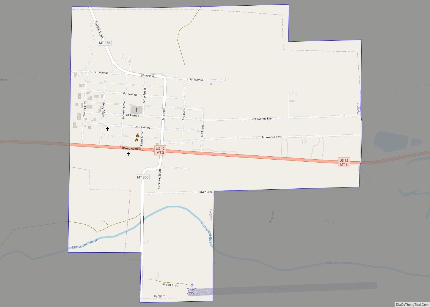
Roy is a census-designated place (CDP) in Fergus County, Montana, United States. Roy CDP overview: Name: Roy CDP LSAD Code: 57 LSAD Description: CDP (suffix) State: Montana County: Fergus County Total Area: 3.40 sq mi (8.82 km²) Land Area: 3.40 sq mi (8.82 km²) Water Area: 0.00 sq mi (0.00 km²) Total Population: 96 Population Density: 28.20/sq mi (10.89/km²) FIPS code: 3064675 GNISfeature ID: 775990 ... Read more
Montana Cities and Places
Roundup is a city in and the county seat of Musselshell County, Montana, United States. The population was 1,742 during the 2020 census. Roundup city overview: Name: Roundup city LSAD Code: 25 LSAD Description: city (suffix) State: Montana County: Musselshell County Elevation: 3,215 ft (980 m) Total Area: 1.29 sq mi (3.35 km²) Land Area: 1.29 sq mi (3.35 km²) Water Area: 0.00 sq mi ... Read more
Savage CDP overview: Name: Savage CDP LSAD Code: 57 LSAD Description: CDP (suffix) State: Montana FIPS code: 3066550 Online Interactive Map Savage online map. Source: Basemap layers from Google Map, Open Street Map (OSM), Arcgisonline, Wmflabs. Boundary Data from Database of Global Administrative Areas. Savage location map. Where is Savage CDP? Savage Road Map Savage ... Read more
Santa Rita is a census-designated place (CDP) in Glacier County, Montana, United States. The population was 113 at the 2010 census. It is located along Montana Secondary Highway 213, 5 miles north of Cut Bank. Santa Rita CDP overview: Name: Santa Rita CDP LSAD Code: 57 LSAD Description: CDP (suffix) State: Montana County: Glacier County ... Read more
Silver Gate is an unincorporated community and census-designated place (CDP) in Park County, Montana, United States. As of the 2010 census, it had a population of 20. Prior to 2010, it was part of the Cooke City-Silver Gate CDP. The community sits northeast of Yellowstone National Park on the Beartooth Highway (U.S. Route 212). It ... Read more
Silesia is a census-designated place and unincorporated community in Carbon County, Montana, United States. As of the 2010 census it had a population of 96. Clarks Fork Yellowstone River flows to the east of town. It is about 10 miles from Laurel. Silesia CDP overview: Name: Silesia CDP LSAD Code: 57 LSAD Description: CDP (suffix) ... Read more
Sidney is a city in and the county seat of Richland County, Montana, United States, less than 10 mi (16 km) west of the North Dakota border. The population was 6,346 at the 2020 census. The city lies along the Yellowstone River and is in proximity to the badlands of the Dakotas. Sidney is approximately midway between ... Read more
Sheridan is a town in Madison County, Montana, United States named after the Civil War general Philip Sheridan. The population was 694 at the 2020 census. Sheridan is known as the “heart of the Ruby Valley.” Seven mountain ranges surround the town: Tobacco Root Mountains, Highland Mountains, McCartney Mountain, The Pioneers, The Ruby Range, The ... Read more
Shepherd is a census-designated place (CDP) in Yellowstone County, Montana, United States. The population was 193 at the 2000 census. Shepherd is a Billings suburb located to the northeast. The unincorporated town was named after R.E. Shepherd, a prominent early settler and owner of the Billings Land and Irrigation Company and the Merchants National Bank. ... Read more
Shelby is a city in and the county seat of Toole County, Montana, United States. The population was 3,169 at the 2020 census. Shelby city overview: Name: Shelby city LSAD Code: 25 LSAD Description: city (suffix) State: Montana County: Toole County Elevation: 3,297 ft (1,005 m) Total Area: 5.96 sq mi (15.43 km²) Land Area: 5.78 sq mi (14.97 km²) Water Area: 0.17 sq mi ... Read more
Shawmut is a census-designated place and unincorporated community in Wheatland County, Montana, United States. Its population was 42 as of the 2010 census. Shawmut has a post office with ZIP code 59078, which opened on October 27, 1885. The community is located along U.S. Route 12 and Montana Highway 3. Shawmut CDP overview: Name: Shawmut ... Read more
Seeley Lake is a census-designated place (CDP) in Missoula County, Montana, United States. It is part of the ‘Missoula, Montana Metropolitan Statistical Area’. The town sits beside the 1,031.5 acres lake Seeley Lake. The population was 1,659 at the 2010 census, an increase from its population of 1,436 in 2000. The community of Seeley Lake ... Read more