Sidney is a city in and the county seat of Richland County, Montana, United States, less than 10 mi (16 km) west of the North Dakota border. The population was 6,346 at the 2020 census. The city lies along the Yellowstone River and is in proximity to the badlands of the Dakotas. Sidney is approximately midway between Glendive, Montana and Williston, North Dakota.
| Name: | Sidney city |
|---|---|
| LSAD Code: | 25 |
| LSAD Description: | city (suffix) |
| State: | Montana |
| County: | Richland County |
| Elevation: | 1,949 ft (594 m) |
| Total Area: | 3.31 sq mi (8.56 km²) |
| Land Area: | 3.29 sq mi (8.51 km²) |
| Water Area: | 0.02 sq mi (0.05 km²) |
| Total Population: | 6,346 |
| Population Density: | 1,930.64/sq mi (745.34/km²) |
| ZIP code: | 59270 |
| Area code: | 406 |
| FIPS code: | 3067900 |
| GNISfeature ID: | 0776533 |
| Website: | http://www.cityofsidneymt.com/ |
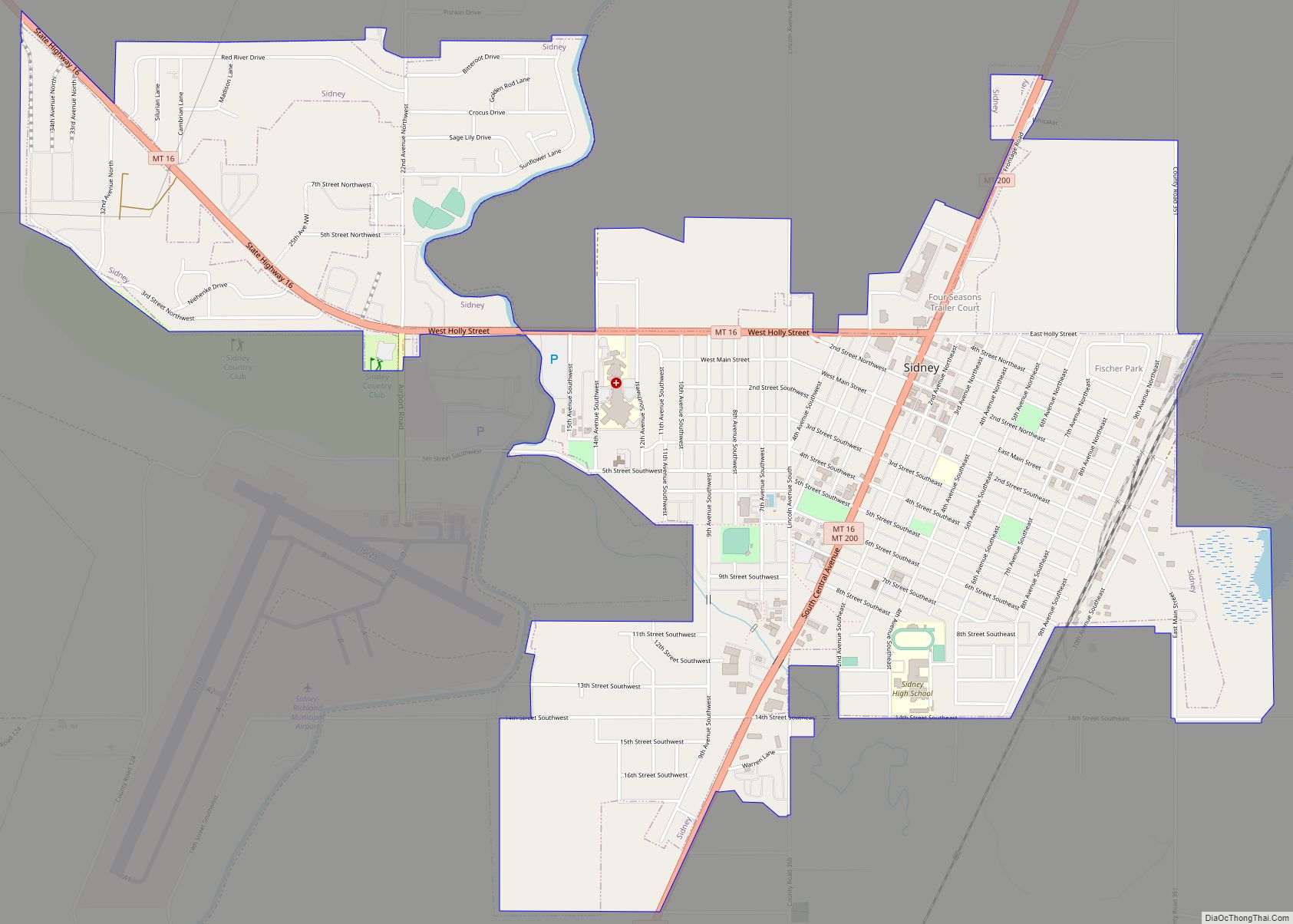
Online Interactive Map
Click on ![]() to view map in "full screen" mode.
to view map in "full screen" mode.
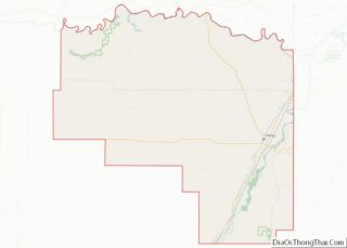
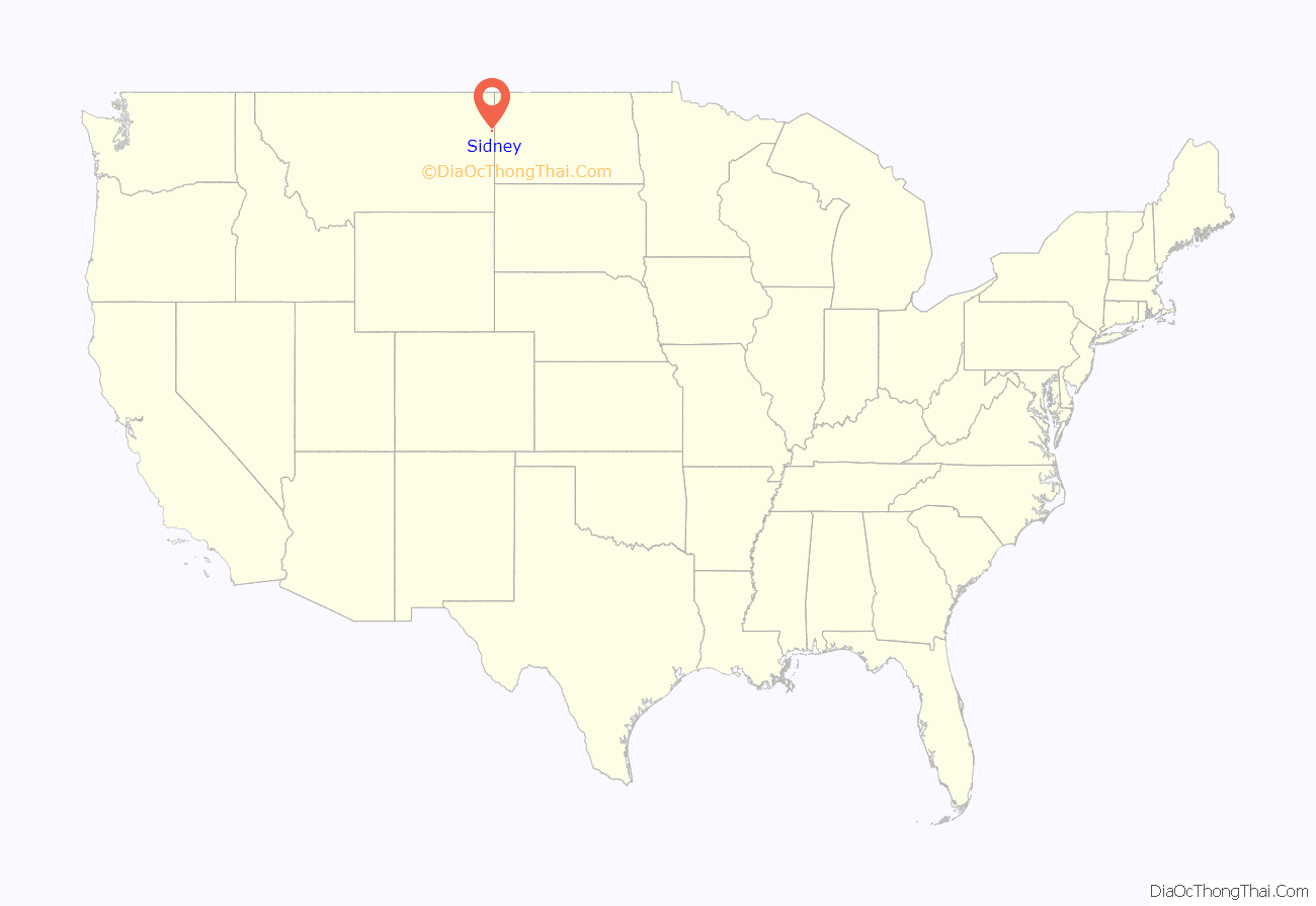
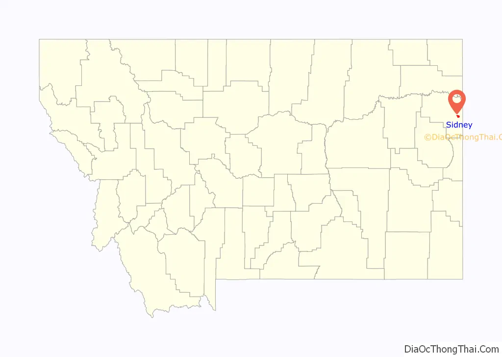
Sidney location map. Where is Sidney city?
History
Settlers began arriving in the area in the 1870s, and a post office was established in 1888. Six-year-old Sidney Walters and his parents were staying with Hiram Otis, the local justice of the peace, and Otis decided that Sidney was a good name for the town. The following year, Montana became a state and Sidney was incorporated in 1911.
Sidney was originally part of Dawson County, but became the county seat of Richland County at its inception in 1914.
Agriculture became an important part of the region after the Lower Yellowstone Irrigation Project was completed in 1909. A dam was built on the river south of Glendive, which diverted water from the river into a 115.2 km (71.6 mi) main canal, which runs north–south, parallel to the Yellowstone, irrigating land from Glendive north up to Fairview, where it dumps into the Missouri River. This project irrigates 51,429 acres (208.13 km) and serves water to 450 farms, according to the manager of the Lower Yellowstone Irrigation Districts.
During the Great Depression, Montana artist J. K. Ralston painted a Federal Arts Project mural at the Richland County Courthouse in Sidney.
The town received a boost in 1924 when the Holly Sugar Company opened up a sugar refinery in Sidney to process locally grown sugar beets.
The area experienced an oil boom and bust in the late 1970s and early 1980s, bringing an influx of people to the town for a short period of time. Around the start of the 21st century, the town started experiencing another surge in oil exploration activity.
The town’s museum, the MonDak Heritage Center, was founded in 1967. The museum houses artifacts and archives that detail the history of life in eastern Montana and western North Dakota since the first pioneers arrived in the late 19th century.
Sidney Road Map

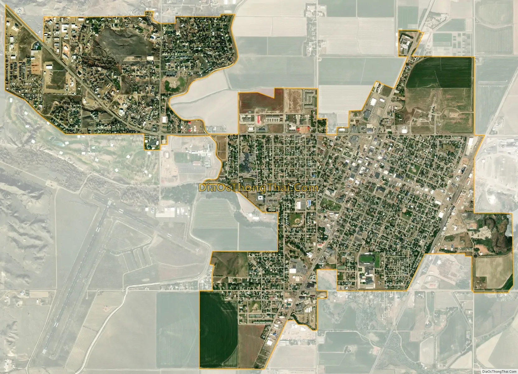
Sidney city Satellite Map
Geography
Sidney is located in the northeastern part of the state at 47°42′45″N 104°9′41″W / 47.71250°N 104.16139°W / 47.71250; -104.16139 (47.712519, -104.161486), at an altitude of 1,949 feet (594 m).
According to the United States Census Bureau, the city has a total area of 2.68 square miles (6.94 km), of which 2.66 square miles (6.89 km) is land and 0.02 square miles (0.05 km) is water.
Sidney is 270 miles (430 km) northeast of Billings, and 190 miles (310 km) south of Regina, Saskatchewan.
Sidney experiences a semi-arid climate (Köppen BSk) with long, cold, dry winters and hot, more humid summers.
See also
Map of Montana State and its subdivision:- Beaverhead
- Big Horn
- Blaine
- Broadwater
- Carbon
- Carter
- Cascade
- Chouteau
- Custer
- Daniels
- Dawson
- Deer Lodge
- Fallon
- Fergus
- Flathead
- Gallatin
- Garfield
- Glacier
- Golden Valley
- Granite
- Hill
- Jefferson
- Judith Basin
- Lake
- Lewis and Clark
- Liberty
- Lincoln
- Madison
- McCone
- Meagher
- Mineral
- Missoula
- Musselshell
- Park
- Petroleum
- Phillips
- Pondera
- Powder River
- Powell
- Prairie
- Ravalli
- Richland
- Roosevelt
- Rosebud
- Sanders
- Sheridan
- Silver Bow
- Stillwater
- Sweet Grass
- Teton
- Toole
- Treasure
- Valley
- Wheatland
- Wibaux
- Yellowstone
- Alabama
- Alaska
- Arizona
- Arkansas
- California
- Colorado
- Connecticut
- Delaware
- District of Columbia
- Florida
- Georgia
- Hawaii
- Idaho
- Illinois
- Indiana
- Iowa
- Kansas
- Kentucky
- Louisiana
- Maine
- Maryland
- Massachusetts
- Michigan
- Minnesota
- Mississippi
- Missouri
- Montana
- Nebraska
- Nevada
- New Hampshire
- New Jersey
- New Mexico
- New York
- North Carolina
- North Dakota
- Ohio
- Oklahoma
- Oregon
- Pennsylvania
- Rhode Island
- South Carolina
- South Dakota
- Tennessee
- Texas
- Utah
- Vermont
- Virginia
- Washington
- West Virginia
- Wisconsin
- Wyoming