Map of Westville borough, New Jersey

Map of Westville borough, New Jersey

Westville is a borough in Gloucester County, in the U.S. state of New Jersey. As of the 2020 United States census, the borough’s population was 4,264, a decrease of 24 (−0.6%) from the 2010 census count of 4,288, which in turn reflected a decline of 212 (−4.7%) from the 4,500 counted in the 2000 census. … Read more

Map of Weston CDP, New Jersey

Map of Weston CDP, New Jersey

Weston is an unincorporated community and census-designated place (CDP) located in Franklin Township, in Somerset County, New Jersey, United States. As of the 2010 United States Census, the CDP’s population was 1,235. Situated on the east side of the Millstone River north of East Millstone and south of Zarephath (which has grown to include some … Read more

Map of Westfield town, New Jersey

Map of Westfield town, New Jersey

Westfield is a town in Union County, in the U.S. state of New Jersey, located 16 miles (26 km) southwest of Manhattan. As of the 2020 United States census, the town’s population was 31,032, an increase of 716 (+2.4%) from the 2010 census count of 30,316, which in turn reflected an increase of 672 (+2.3%) from … Read more

Map of West Wildwood borough

Map of West Wildwood borough

West Wildwood is a borough in Cape May County, in the U.S. state of New Jersey. The city, and all of Cape May County, is part of the Ocean City metropolitan statistical area, and is part of the Philadelphia–Wilmington–Camden, PA-NJ-DE–MD combined statistical area, also known as the Delaware Valley or Philadelphia metropolitan area. As of … Read more

Map of Whitesboro CDP, New Jersey

Map of Whitesboro CDP, New Jersey

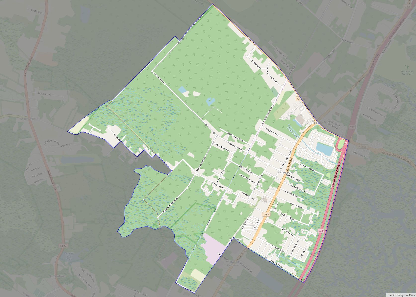
Whitesboro is an unincorporated community and census-designated place (CDP) located within Middle Township in Cape May County, New Jersey, United States. Until the 2000 Census the area had been part of the Whitesboro-Burleigh CDP, which was split in 2010 into separate CDPs for Burleigh and Whitesboro. As of the 2010 United States Census, the CDP’s … Read more

Map of White Meadow Lake CDP

Map of White Meadow Lake CDP

White Meadow Lake is an unincorporated community and census-designated place (CDP) located within Rockaway Township, in Morris County, New Jersey, United States. As of the 2010 United States Census, the CDP’s population was 8,836. White Meadow Lake CDP overview: Name: White Meadow Lake CDP LSAD Code: 57 LSAD Description: CDP (suffix) State: New Jersey County: … Read more

Map of White House Station CDP

Map of White House Station CDP

White House Station CDP overview: Name: White House Station CDP LSAD Code: 57 LSAD Description: CDP (suffix) State: New Jersey County: Hunterdon County FIPS code: 3480720 Online Interactive Map White House Station online map. Source: Basemap layers from Google Map, Open Street Map (OSM), Arcgisonline, Wmflabs. Boundary Data from Database of Global Administrative Areas. White … Read more

Map of White Horse CDP

Map of White Horse CDP, New Jersey

White Horse is an unincorporated community and census-designated place (CDP) located within Hamilton Township, in Mercer County, New Jersey, United States. As of the 2010 United States Census, the CDP’s population was 9,494. White Horse CDP overview: Name: White Horse CDP LSAD Code: 57 LSAD Description: CDP (suffix) State: New Jersey County: Mercer County Elevation: … Read more

Map of Wharton borough

Map of Wharton borough, New Jersey

Wharton is a borough in Morris County, in the U.S. state of New Jersey. As of the 2020 United States census, the borough’s population was 7,241, an increase of 719 (+11.0%) from the 2010 census count of 6,522, which in turn reflected an increase of 224 (+3.6%) from the 6,298 counted in the 2000 census. … Read more

Map of Westwood borough, New Jersey

Map of Westwood borough, New Jersey

Westwood (known as “The Hub of the Pascack Valley”) is a borough in Bergen County, in the U.S. state of New Jersey. Westwood is part of the New York metropolitan area. Many of its residents regularly commute to New York City for work and leisure, many using public transportation. As of the 2020 United States … Read more

Map of Woodcliff Lake borough

Map of Woodcliff Lake borough

Woodcliff Lake is a borough in Bergen County, in the U.S. state of New Jersey. As of the 2020 United States census, the borough’s population was 6,128, an increase of 398 (+6.9%) from the 2010 census count of 5,730, which in turn reflected a decline of 15 (−0.3%) from the 5,745 counted at the 2000 … Read more

Map of Woodbury city, New Jersey

Map of Woodbury city, New Jersey

Woodbury is the county seat of Gloucester County in the U.S. state of New Jersey. The city, and all of Gloucester County, is part South Jersey and of the Philadelphia–Wilmington–Camden, PA-NJ-DE–MD combined statistical area, also known as the Delaware Valley or Philadelphia metropolitan area. As of the 2020 United States census, the city’s population was … Read more