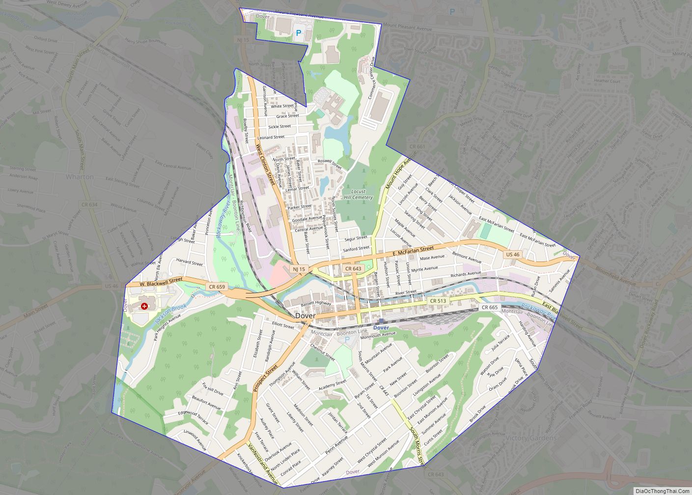
Wharton is a borough in Morris County, in the U.S. state of New Jersey. As of the 2020 United States census, the borough’s population was 7,241, an increase of 719 (+11.0%) from the 2010 census count of 6,522, which in turn reflected an increase of 224 (+3.6%) from the 6,298 counted in the 2000 census.
Wharton was originally incorporated as the borough Port Oram by an act of the New Jersey Legislature on June 26, 1895, created from portions of Randolph Township and Rockaway Township, subject to the results of a referendum passed on the previous day; the name was changed to Wharton on April 16, 1902, based on a referendum held that day and subject to legislation passed on March 27, 1902. The borough was named for Joseph Wharton of the Wharton Steel Company.
| Name: | Wharton borough |
|---|---|
| LSAD Code: | 21 |
| LSAD Description: | borough (suffix) |
| State: | New Jersey |
| County: | Morris County |
| Incorporated: | June 26, 1895 as Port Oram |
| Elevation: | 666 ft (203 m) |
| Total Area: | 2.14 sq mi (5.53 km²) |
| Land Area: | 2.08 sq mi (5.38 km²) |
| Water Area: | 0.06 sq mi (0.15 km²) 2.63% |
| Total Population: | 7,241 |
| Population Density: | 3,494.7/sq mi (1,349.3/km²) |
| ZIP code: | 07885 |
| Area code: | 973 |
| FIPS code: | 3480390 |
| GNISfeature ID: | 0885443 |
| Website: | www.whartonnj.com |
Online Interactive Map
Click on ![]() to view map in "full screen" mode.
to view map in "full screen" mode.
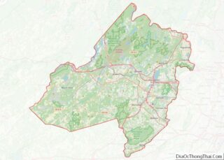
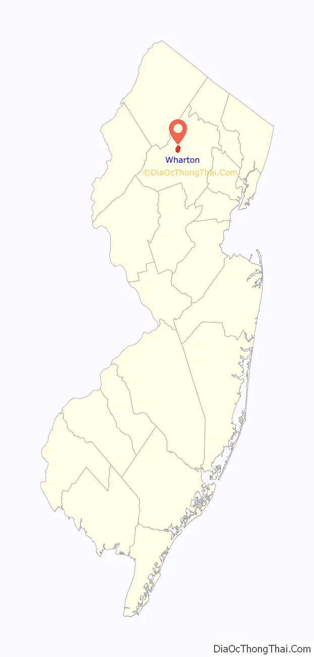
Wharton location map. Where is Wharton borough?

History
In 1831, the Morris Canal was completed from Newark to Phillipsburg, New Jersey across the Delaware River from the terminus of the Lehigh Canal. On the way, it passed through Boonton, Dover and Port Oram. On this route it tapped the Morris County ore fields and became a carrier for both ore and pig iron. Its main purpose, however, was as an extension of the Lehigh Canal to furnish a route for anthracite coal from the Pennsylvania mines to seaboard. Any local traffic was a gain to supplement the through anthracite freight and iron ore and its products soon became important sources of revenue. Sites on the canal were selected for docks and industry, including iron works.
On June 28, 1895, voters from the settlements Port Oram, Irondale, Luxemburg, Maryville and Mount Pleasant voted 143 to 51 to incorporate as the borough Port Oram, the largest of the communities in the area covering 2.25 square miles (5.8 km) west of Dover, New Jersey. A mayor, six councilmen, an assessor and a collector were elected to govern the new borough which had started life as an ore shipping port on the Morris Canal. These elected officials (mine superintendents, store owners, a railroad superintendent and a school teacher) represented the leaders of these settlements where iron ore was mined, smelted and shipped.
The borough was renamed in 1902 in honor of Joseph Wharton, who was born in 1826 in Philadelphia to an old family of Quakers. Wharton first studied at a local Quaker school after which he worked on a farm rather than attend college because his parents wanted him to mature, and during the winter studied chemistry at the laboratory of Martin Hans Boyè in Philadelphia. He started producing zinc and nickel, and gradually bought a controlling interest in Bethlehem Iron Works. As his business interests expanded he purchased substantial shares of several railroads involved in the coal and iron trade, also purchasing iron mines and furnaces near Port Oram. After selling his interest in Bethlehem Iron Works in 1901 and his nickel works to CVRD Inco in 1902, he continued to actively acquire and manage a large and diverse business empire that included iron smelting in Wharton until just before his death in January, 1909. Wharton also endowed the Wharton School of the University of Pennsylvania. The town was named after him at after a referendum in 1902.
In 1984, the long-time local bar The Heslin House and Hartley’s Store were destroyed in a gas leak explosion, in which flames as high as 100 feet (30 m) destroyed several area buildings.
Wharton was one of the filming locations for Cyndi Lauper’s music video “Time After Time” in 1984.
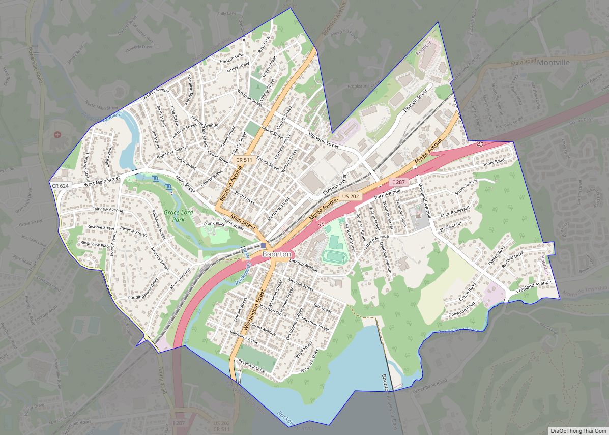
Wharton Road Map
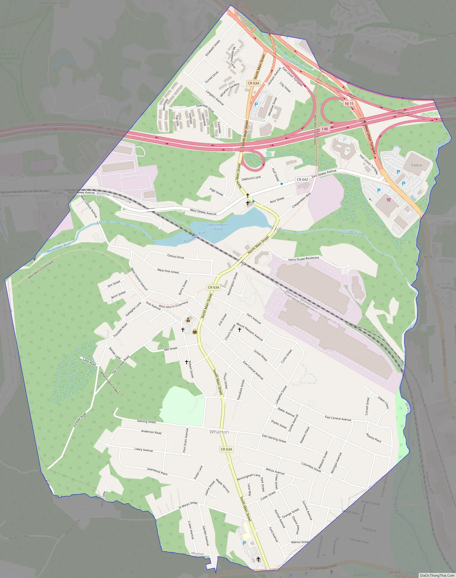
Wharton city Satellite Map

Geography
According to the United States Census Bureau, the borough had a total area of 2.13 square miles (5.51 km), including 2.07 square miles (5.37 km) of land and 0.06 square miles (0.14 km) of water (2.63%).
The borough borders the Morris County municipalities of Dover, Jefferson Township, Mine Hill Township, Rockaway Township, Roxbury Township.
Unincorporated communities in the borough include Irondale, Luxemburg, Maryville, Mount Pleasant and Port Oram.
Climate
The climate in this area is characterized by hot, humid summers and generally mild to cool winters. According to the Köppen Climate Classification system, Wharton has a humid subtropical climate, abbreviated “Cfa” on climate maps.
See also
Map of New Jersey State and its subdivision: Map of other states:- Alabama
- Alaska
- Arizona
- Arkansas
- California
- Colorado
- Connecticut
- Delaware
- District of Columbia
- Florida
- Georgia
- Hawaii
- Idaho
- Illinois
- Indiana
- Iowa
- Kansas
- Kentucky
- Louisiana
- Maine
- Maryland
- Massachusetts
- Michigan
- Minnesota
- Mississippi
- Missouri
- Montana
- Nebraska
- Nevada
- New Hampshire
- New Jersey
- New Mexico
- New York
- North Carolina
- North Dakota
- Ohio
- Oklahoma
- Oregon
- Pennsylvania
- Rhode Island
- South Carolina
- South Dakota
- Tennessee
- Texas
- Utah
- Vermont
- Virginia
- Washington
- West Virginia
- Wisconsin
- Wyoming