Map of Casa Colorada CDP

Map of Casa Colorada CDP

Casa Colorada is a census-designated place (CDP) in Valencia County, New Mexico, United States. The population was 272 at the 2010 census. It is part of the Albuquerque Metropolitan Statistical Area. Casa Colorada CDP overview: Name: Casa Colorada CDP LSAD Code: 57 LSAD Description: CDP (suffix) State: New Mexico County: Valencia County Elevation: 4,793 ft (1,461 m) … Read more

Map of Carrizozo town

Map of Carrizozo town

Carrizozo is a town in Lincoln County, New Mexico, United States. It is the county seat, with a population of 996 at the 2010 census. Founded in 1899, the town provided the main railroad access for Lincoln County, and the town experienced significant population growth in the early decades of the 1900s. However, with declining … Read more

Map of Carnuel CDP

Map of Carnuel CDP

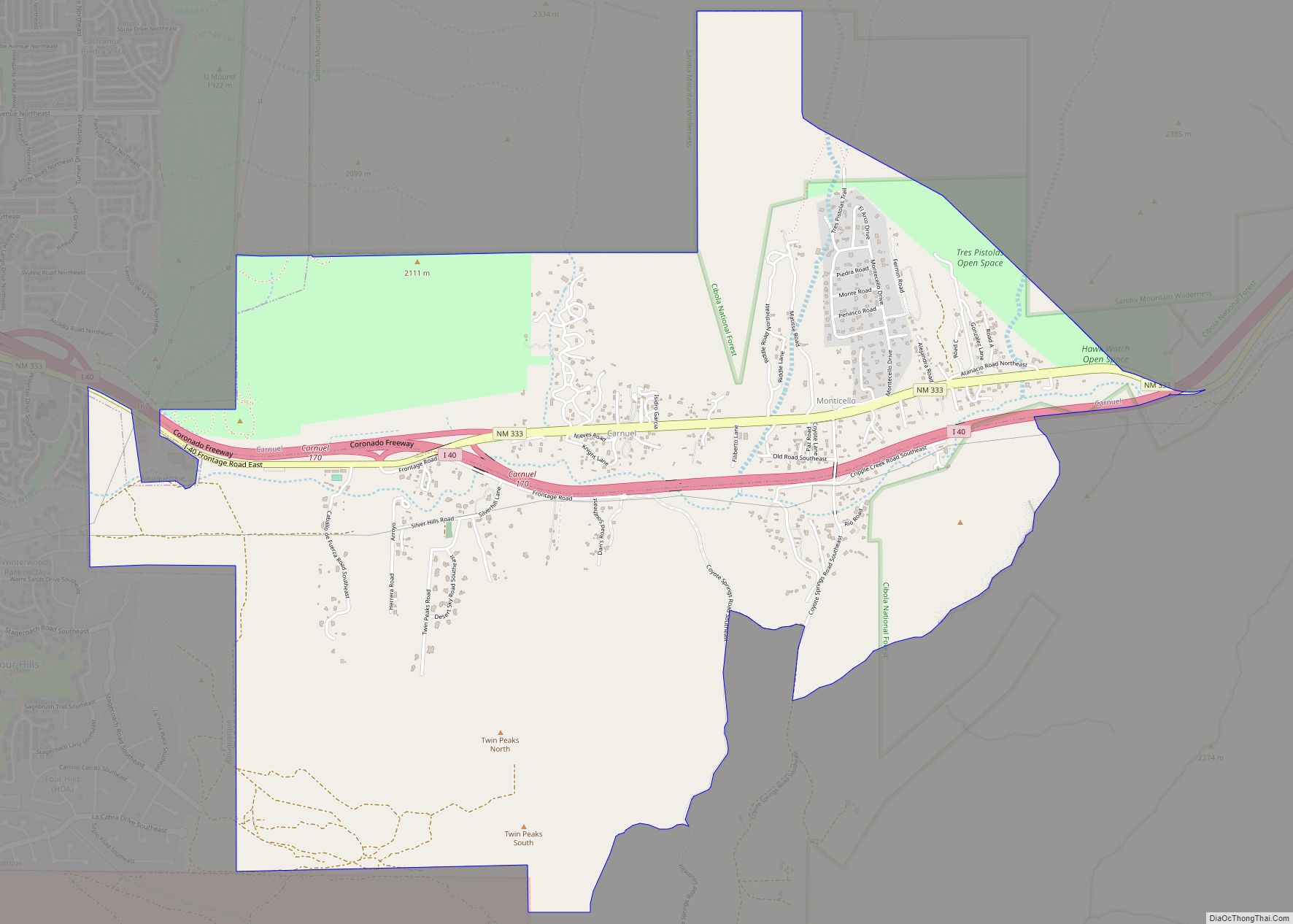
Carnuel is a census-designated place (CDP) in Bernalillo County, New Mexico, United States. The population was 1,232 at the 2010 Census. It is part of the Albuquerque Metropolitan Statistical Area. Robert Julyan theorizes that name of the community, which has been spelled both Carnuel and Carnué, derives from the Tiwa word for “badger place.” Carnuel … Read more

Map of Carlsbad city, New Mexico

Map of Carlsbad city, New Mexico

Carlsbad (/ˈkɑːrlzbæd/ KARLZ-bad) is a city in and the county seat of Eddy County, New Mexico, United States. As of the 2020 census, the city population was 32,238. Carlsbad is centered at the intersection of U.S. Routes 62/180 and 285, and is the principal city of the Carlsbad-Artesia Micropolitan Statistical Area, which has a total … Read more

Map of Capulin CDP, New Mexico

Map of Capulin CDP, New Mexico

Capulin is a census-designated place and unincorporated community in Union County, New Mexico, United States. Its population was 66 as of the 2010 census. Capulin had a post office until August 13, 2011; it still has its own ZIP code, 88414. U.S. routes 64 and 87 pass through the community. Capulin Volcano National Monument is … Read more

Map of Capitan village

Map of Capitan village

Capitan is a village in Lincoln County, New Mexico, United States, located north of the Lincoln National Forest between the Capitan and Sacramento Mountains at an elevation of 6,350 feet (1,950 m). The population was 1,489 at the 2010 census. Capitan was founded in the 1890s and incorporated in 1941. Capitan village overview: Name: Capitan … Read more

Map of Canova CDP

Map of Canova CDP, New Mexico

Canova is an unincorporated community and census-designated place in Rio Arriba County, New Mexico, United States. Its population was 118 as of the 2010 census. The community is located on the west bank of the Rio Grande. It is named after the extensive irrigation in the area, as it means “sluice” in Spanish. Canova CDP … Read more

Map of Cannon AFB CDP

Map of Cannon AFB CDP

Cannon Air Force Base is a United States Air Force base, located approximately 7 miles (11 km) southwest of Clovis, New Mexico. It is under the jurisdiction of Air Force Special Operations Command (AFSOC). The host unit at Cannon is the 27th Special Operations Wing (27 SOW), which activated on 1 October 2007. The 27 SOW … Read more

Map of Cañada de los Alamos CDP

Map of Cañada de los Alamos CDP

Cañada de los Alamos is a census-designated place (CDP) in Santa Fe County, New Mexico, United States. It is part of the Santa Fe, New Mexico Metropolitan Statistical Area. The population was 434 at the 2010 census. Cañada de los Alamos CDP overview: Name: Cañada de los Alamos CDP LSAD Code: 57 LSAD Description: CDP … Read more

Map of Causey village

Map of Causey village

Causey is a village in eastern Roosevelt County, New Mexico, United States. The population was 104 at the 2010 census. Causey village overview: Name: Causey village LSAD Code: 47 LSAD Description: village (suffix) State: New Mexico County: Roosevelt County Elevation: 4,026 ft (1,227 m) Total Area: 3.75 sq mi (9.71 km²) Land Area: 3.75 sq mi (9.70 km²) Water Area: 0.00 sq mi (0.01 km²) Total … Read more

Map of Chamita CDP

Map of Chamita CDP

Chamita is a census-designated place in Rio Arriba County, New Mexico, United States. Its population was 870 as of the 2010 census. New Mexico State Road 74 passes through the community. During its earlier years, the community was known as San Pedro De Chamita and served as the first county seat for Rio Arriba county. … Read more

Map of Chamisal CDP

Map of Chamisal CDP

Chamisal is a census-designated place (CDP) in Taos County, New Mexico. It is located along the scenic High Road to Taos. The population was 301 at the time of the 2000 census. Chamisal CDP overview: Name: Chamisal CDP LSAD Code: 57 LSAD Description: CDP (suffix) State: New Mexico County: Taos County Elevation: 7,474 ft (2,278 m) Total … Read more