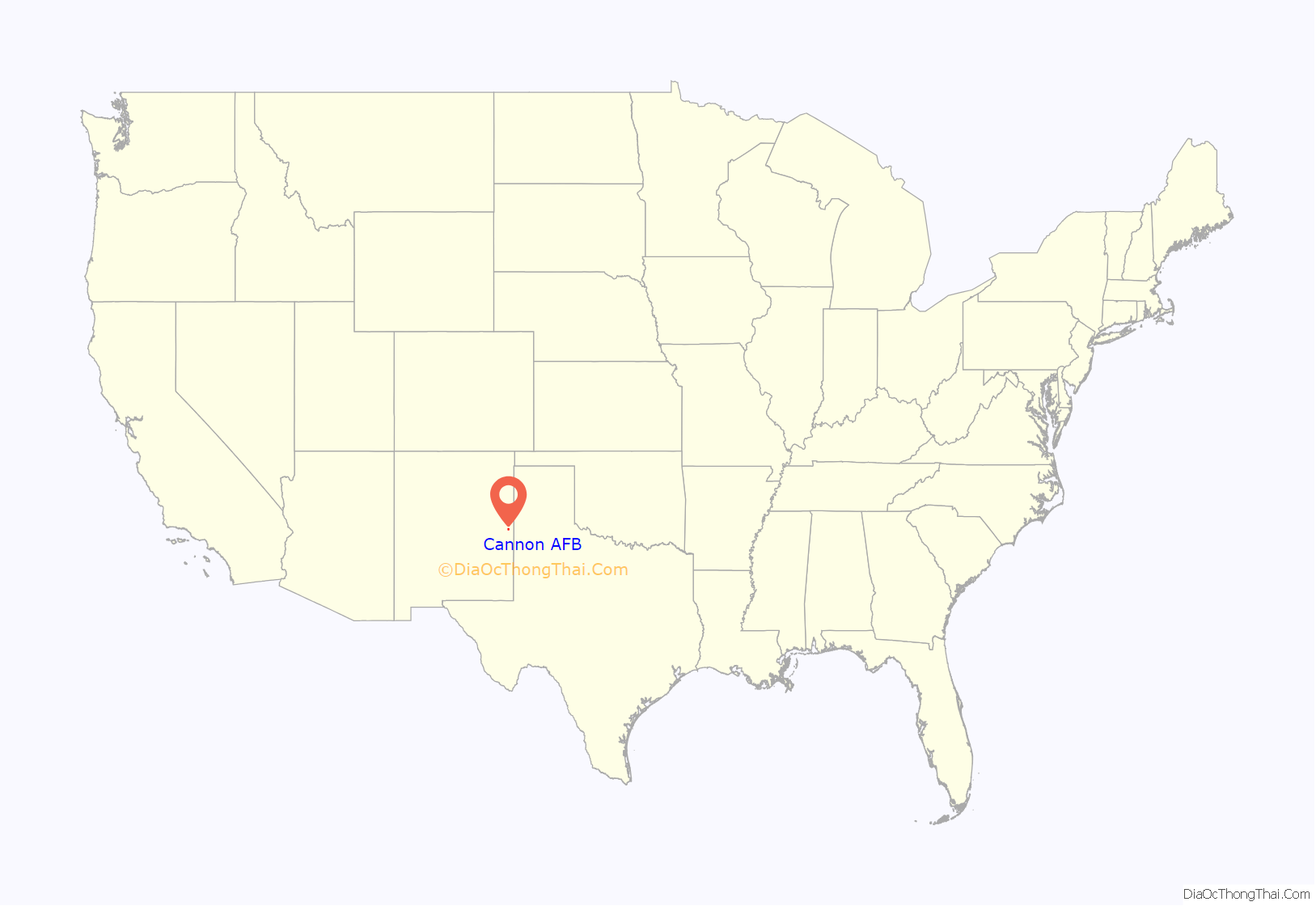
Cannon Air Force Base is a United States Air Force base, located approximately 7 miles (11 km) southwest of Clovis, New Mexico. It is under the jurisdiction of Air Force Special Operations Command (AFSOC). The host unit at Cannon is the 27th Special Operations Wing (27 SOW), which activated on 1 October 2007. The 27 SOW plans and executes specialized and contingency operations using advanced aircraft, tactics and air refueling techniques to infiltrate, exfiltrate and resupply special operations forces (SOF) and provide intelligence, surveillance and reconnaissance and close air support in support of SOF operations.
A variety of special operations aircraft are stationed at Cannon, including the AC-130W Stinger II, AC-130J Ghostrider, MC-130J Commando II, MQ-9 Reaper, CV-22 Osprey and U-28 Draco.
| Name: | Cannon AFB CDP |
|---|---|
| LSAD Code: | 57 |
| LSAD Description: | CDP (suffix) |
| State: | New Mexico |
| County: | Curry County |
| Elevation: | 1,309.2 metres (4,295 ft) |
| FIPS code: | 3510750 |
| Website: | www.cannon.af.mil |
Online Interactive Map
Click on ![]() to view map in "full screen" mode.
to view map in "full screen" mode.
Cannon AFB location map. Where is Cannon AFB CDP?
History
Cannon Air Force Base is named in honor of General John K. Cannon (1892–1955).
Airline service
The history of the base began in the late 1920s, when a civilian passenger facility, Portair Field, was established on the site.
Clovis was a stop on the first coast to coast “air/rail” service between Los Angeles and New York City which began in 1929. Transcontinental Air Transport (TAT) used a Ford Trimotor aircraft to fly passengers between Los Angeles and Clovis with en route stops at Kingman, AZ and Winslow, AZ as well as Albuquerque, NM. At Clovis, passengers heading east would then transfer and board an overnight train operated by the Atchison, Topeka and Santa Fe Railway to Waynoka, OK where they would connect to another TAT-operated Ford Trimotor aircraft the next morning and continue their journey to the Port Columbus Airport in Ohio (now the John Glenn Columbus International Airport) where they would transfer again for the final stage of the journey to New York City via the Pennsylvania Railroad. The same rail and flight services, transfers and connecting points were used by passengers heading west. In late 1930 the service had been modified to where the aircraft would fly the western portion of the service via Amarillo, TX rather than Clovis. Transcontinental Air Transport went on to merge with Western Air Express and form what would become Trans World Airlines (TWA) while Western Air Express would eventually once again regain its status as an independent air carrier and then subsequently be renamed Western Airlines. In later years, both TWA and Western evolved into major airlines operating extensive domestic and international route systems.
In 1948 a new carrier, Pioneer Airlines, began serving Clovis with the airport being one of several stops on a route between Albuquerque and Dallas Love Field. The other stops included Santa Fe, NM, Las Vegas, NM and Tucumcari, NM as well as Lubbock, TX, Abilene, TX, Mineral Wells, TX and Fort Worth, TX. A second route was then created between Amarillo and El Paso, TX with stops at Clovis, Roswell, NM, and Las Cruces, NM. This second route crossed at Clovis with the initial route between Albuquerque and Dallas which resulted in Clovis being a small hub for Pioneer Airlines where passengers were then able to connect between the two routes. Initially the airline used 21-seat Douglas DC-3 twin prop aircraft but then upgraded to the 36-seat Martin 2-0-2 twin prop aircraft in 1952.
In 1955 Pioneer was acquired by and merged into Continental Airlines which maintained the same basic service with DC-3 aircraft minus some of the stops and also subsequently upgraded its flights with Convair 340 twin prop aircraft followed by the British manufactured Vickers Viscount four engine turboprop in 1959 with the Viscount (which the airline referred to as the “Jet Power Viscount II” ) being the first turbine powered aircraft type to serve Clovis. The April 1, 1955 Continental system timetable listed three daily DC-3 flights serving the airport including a roundtrip Albuquerque – Santa Fe – Clovis – Lubbock – Abilene – Fort Worth – Dallas Love Field service as well as a one way westbound Houston Hobby Airport – College Station, TX – Temple, TX – Waco, TX – Dallas Love Field – Fort Worth – Abilene – Lubbock – Clovis – Santa Fe – Albuquerque flight. According to the September 27, 1959 Continental Airlines timetable, a Viscount propjet was being operated on a daily roundtrip routing of Albuquerque (ABQ) – Santa Fe (SAF) – Clovis (CVS) – Lubbock (LBB) – Abilene (ABI) – Fort Worth (via Greater Southwest International Airport) (GSW) – Dallas Love Field (DAL).
The Clovis Municipal Airport opened in 1959 and took over airline service for Clovis. However, for a brief period during the late 1970s, Texas International Airlines introduced 85-seat Douglas DC-9-10 jet service to Clovis, which was operated via Cannon. According to the March 15, 1978 Texas International system timetable, the airline was operating three departures every weekday from the airport with two nonstops to Albuquerque (ABQ) which offered connections via ABQ to TI DC-9 jet service on to Dallas/Fort Worth (DFW), Houston (IAH) and Los Angeles (LAX) as well as a nonstop flight to Hobbs, NM with this service continuing on to Carlsbad, NM. In 1978, Texas International reverted to using Convair 600 propjets via the Clovis Municipal Airport (CVN).
World War II
After the United States entered World War II, the first military unit to use the facility was a glider detachment. On 6 July 1942 the base was assigned to Second Air Force. In 1943, the military began to use the facility as a bomber base. Clovis AAF was assigned to II Bomber Command, Second Air Force. On 8 April 1943, the base was renamed Clovis Army Air Field. The host unit at Clovis AAF was the 16th Bombardment Wing, a training unit for Consolidated B-24 Liberator bomber crews for Europe. The 16th Bomb Wing arrived in January 1943.
By mid-1946, the airfield was placed on reduced operational status due to postwar funding cutbacks and decreased flying activities. On 16 October 1946, the 234th AAFBU was inactivated and on 1 November 1946, the airfield was placed under the administrative control of Colorado Springs Army Air Base, Colorado. Clovis AAF was placed on temporarily inactive status on 28 May 1947.
Cold War
With the establishment of the United States Air Force (USAF) in September 1947, Clovis AAF was reactivated. The 509th Airdrome Group, Clovis Detachment took over day-to-day responsibilities for the airfield on 16 December 1947. The 509th operated Clovis AAF as a detachment from its headquarters at Roswell Army Air Field, New Mexico, using the airfield as a deployment facility for the group’s B-29s. Clovis AAF was renamed “Clovis Air Force Base” on 13 January 1948. However, with no funds to host an active Strategic Air Command (SAC) bomb wing, Clovis AFB was placed on reserve/standby status on 1 July 1948. Its caretaker unit was the 234th Air Force Base Unit.
Clovis AFB remained on standby status until 1 April 1950 when jurisdiction was transferred from SAC to Air Training Command (ATC). ATC assigned the base as a sub post of Reese AFB, Texas on 12 May 1950, while construction ensued to bring the base up to USAF standards. Plans were made to make Clovis AFB a contract flying training facility, however, the advent of the Korean War changed the USAF’s plans for Clovis and jurisdiction was transferred to Tactical Air Command (TAC) as a fighter base on 23 July 1951.
The first USAF unit to use Clovis AFB was the Air National Guard’s 140th Fighter-Bomber Wing (140th FBW), which arrived in October 1951 after being activated due to the Korean War. The 140th FBW was a composite unit, made up of elements from the Colorado, Utah and Wyoming Air National Guards.
From the early 1970s to the early 1990s Cannon AFB was the sole operator of the F-111D Aardvark tactical fighter bomber. The F-111D aircraft were operated by the 522nd, 523rd, and 524th Tactical Fighter Squadrons. The mesas and canyons of the largely unpopulated terrain in eastern New Mexico were ideal for training crews to use the F-111s terrain following radar. To obtain crew practice dropping ordinance, the F-111s used the nearby Melrose bomb range.
21st century
On 13 May 2005, the Secretary of Defense recommended that Cannon Air Force Base be closed as part of the Base Realignment and Closure Commission (BRAC) process. However, on 25 August 2005, the BRAC Commission overturned the recommendation that the base be closed, but upheld the withdrawal of the base’s F-16 Fighting Falcon fighter aircraft. The USAF had until 31 December 2009 to propose a new use for Cannon AFB, otherwise the base would be closed in 2010. Cannon AFB attempted to reopen a rejected EIS alternative, by substituting an Environmental Assessment. Comments were accepted through 4 October 2010.
On 20 June 2006, it was announced that Cannon AFB would transfer from Air Combat Command (ACC) and become an Air Force Special Operations Command (AFSOC) installation. Initial word was that the 16th Special Operations Wing would transfer from Hurlburt Field, Florida. It was later decided that the 27th Fighter Wing would transfer from ACC to AFSOC and become the 27th Special Operations Wing. This action would entail expanding and realigning some aspects of both the 16th Special Operations Wing and AFSOC, also headquartered at Hurlburt Field. This designation means that the base will receive new aircraft to replace the F-16s lost in the BRAC realignment. Jurisdiction was formally transferred to AFSOC on 1 October 2007 and new airframes such as the CV-22 Osprey and AC-130H Spectre were assigned to the new wing at Cannon.
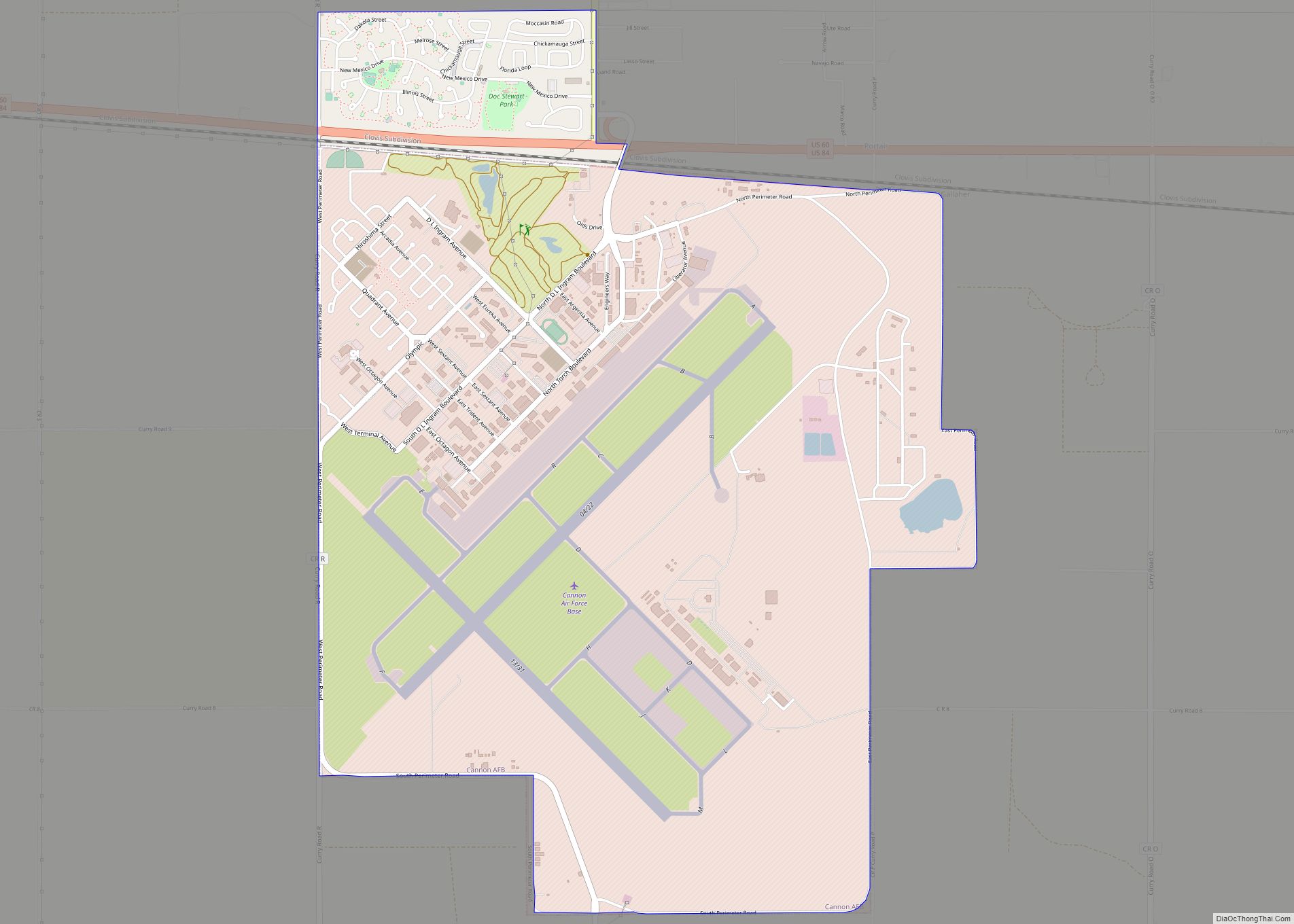
Cannon AFB Road Map
Cannon AFB city Satellite Map
Geography
According to the United States Census Bureau, the CDP portion of the base has a total area of 5.3 square miles (14 km), of which, 5.3 square miles (14 km) is land and 0.19% is water.
As of the census of 2000, there were 2,557 people, 921 households, and 575 families residing on the base. The population density was 481.8 people per square mile (186.0 people/km). There were 1,087 housing units at an average density of 204.8 per square mile (79.1/km). The racial makeup of the residents was 68.0% White, 13.3% African American, 0.7% Native American, 5.7% Asian, 0.3% Pacific Islander, 6.1% from other races, and 5.9% from two or more races. 12.1% of the population were Hispanic or Latino of any race.
There were 921 households, out of which 37.5% had children under the age of 18 living with them, 56.9% were married couples living together, 4.2% had a female householder with no husband present, and 37.5% were non-families. 37.4% of all households were made up of individuals, and 0.0% had someone living alone who was 65 years of age or older. The average household size was 2.16 and the average family size was 2.82.
On the base the population was spread out, with 20.2% under the age of 18, 52.8% from 18 to 24, 26.2% from 25 to 44, 0.8% from 45 to 64, and 0.0% who were 65 years of age or older. The median age was 22 years. For every 100 females, there were 153.4 males. For every 100 females age 18 and over, there were 171.4 males.
The median income for a household on the base was $18,465, and the median income for a family was $25,573. Males had a median income of $15,546 versus $14,635 for females. The per capita income for the base was $11,562. 12.0% of the population and 11.5% of families were below the poverty line, including 14.0% of those under the age of 18 and 0.0% of those 65 and older.
See also
Map of New Mexico State and its subdivision: Map of other states:- Alabama
- Alaska
- Arizona
- Arkansas
- California
- Colorado
- Connecticut
- Delaware
- District of Columbia
- Florida
- Georgia
- Hawaii
- Idaho
- Illinois
- Indiana
- Iowa
- Kansas
- Kentucky
- Louisiana
- Maine
- Maryland
- Massachusetts
- Michigan
- Minnesota
- Mississippi
- Missouri
- Montana
- Nebraska
- Nevada
- New Hampshire
- New Jersey
- New Mexico
- New York
- North Carolina
- North Dakota
- Ohio
- Oklahoma
- Oregon
- Pennsylvania
- Rhode Island
- South Carolina
- South Dakota
- Tennessee
- Texas
- Utah
- Vermont
- Virginia
- Washington
- West Virginia
- Wisconsin
- Wyoming
