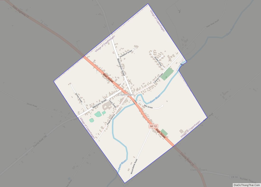
Map of Copake Lake CDP
Copake Lake is a community (and census-designated place) in southern Columbia County, New York, United States. The population was 823 at the 2010 census. The community is named after Copake Lake, a lake by the west town line of the town of Copake. Copake means “snake pond” in the native language. Copake Lake is located ... Read more
Map of Copake Lake CDP
Map of Copake Hamlet CDP
Copake Hamlet CDP overview: Name: Copake Hamlet CDP LSAD Code: 57 LSAD Description: CDP (suffix) State: New York FIPS code: 3618118 Online Interactive Map Copake Hamlet online map. Source: Basemap layers from Google Map, Open Street Map (OSM), Arcgisonline, Wmflabs. Boundary Data from Database of Global Administrative Areas. Copake Hamlet location map. Where is Copake ... Read more
Map of Copake Hamlet CDP
Map of Copake Falls CDP
Copake Falls is a hamlet and census-designated place (CDP) in Columbia County, New York, United States. The hamlet, once known as Copake Iron Works, is in the eastern part of the town of Copake, 1.5 miles (2.4 km) west of the Massachusetts state line. The CDP was designated after the 2010 census, so no population figure ... Read more
Map of Copake Falls CDP
Map of Cooperstown village, New York
Cooperstown is a village in and the county seat of Otsego County, New York, United States. Most of the village lies within the town of Otsego, but some of the eastern part is in the town of Middlefield. Located at the foot of Otsego Lake in the Central New York Region, Cooperstown is approximately 60 ... Read more
Map of Cooperstown village, New York
Map of Coopers Plains CDP
Coopers Plains is a hamlet and census-designated place (CDP) in the towns of Erwin and Campbell in Steuben County, New York, United States. As of the 2010 census, it had a population of 598. The community is in eastern Steuben County, in the northern part of Erwin and extending north into the southern part of ... Read more
Map of Coopers Plains CDP
Map of Constantia CDP
Constantia is a census-designated place (CDP) in the town of Constantia in Oswego County, New York, United States. Located on Oneida Lake, the community lies along State Route 49 and Scriba Creek. The population was 1,182 at the 2010 census. Constantia CDP overview: Name: Constantia CDP LSAD Code: 57 LSAD Description: CDP (suffix) State: New ... Read more
Map of Constantia CDP
Map of Constableville village
Constableville is a village in Lewis County, New York, United States. The population was 242 at the 2010 census. The village is named after William Constable, the son of an early landowner. The village is within the town of West Turin and is north of Rome. Constableville village overview: Name: Constableville village LSAD Code: 47 ... Read more
Map of Constableville village
Map of Cortland city, New York
Cortland is a city and the county seat of Cortland County, New York, United States. Known as the Crown City, Cortland is in New York’s Southern Tier region. As of the 2020 census it had a population of 17,556. The city of Cortland, near the county’s western border, is surrounded by the town of Cortlandville. ... Read more
Map of Cortland city, New York
Map of Cortland West CDP
Cortland West is a census-designated place and region in Cortland County, New York, United States. The population was 1,356 at the 2010 census. The area known as Cortland West is in the town of Cortlandville, on the west side of the city of Cortland. Cortland West CDP overview: Name: Cortland West CDP LSAD Code: 57 ... Read more
Map of Cortland West CDP
Map of Cornwall-on-Hudson village
Cornwall-on-Hudson is a riverfront village in the town of Cornwall, Orange County, New York, United States. It lies on the west bank of the Hudson River, approximately 50 miles (80 km) north of New York City. The population as of the 2020 census was 3,075. It is part of the Poughkeepsie–Newburgh–Middletown metropolitan area as well as ... Read more
Map of Cornwall-on-Hudson village
Map of Corning city, New York
Corning is a city in Steuben County, New York, United States, on the Chemung River. The population was 10,551 at the 2020 census. It is named for Erastus Corning, an Albany financier and railroad executive who was an investor in the company that developed the community. The city is best known as the headquarters of ... Read more
Map of Corning city, New York
Map of Corinth village, New York
Corinth (/ˈkɒrɪnθ/ KORR-inth) is a village in Saratoga County, New York, United States. The population was 2,559 at the 2010 census. The village takes its name from the Greek city of Corinth. The Village of Corinth is by the eastern town line of the Town of Corinth. The community asserts that it is the “Snowshoe ... Read more
Map of Corinth village, New York