Cortland is a city and the county seat of Cortland County, New York, United States. Known as the Crown City, Cortland is in New York’s Southern Tier region. As of the 2020 census it had a population of 17,556.
The city of Cortland, near the county’s western border, is surrounded by the town of Cortlandville.
| Name: | Cortland city |
|---|---|
| LSAD Code: | 25 |
| LSAD Description: | city (suffix) |
| State: | New York |
| County: | Cortland County |
| Elevation: | 1,129 ft (344 m) |
| Total Area: | 3.91 sq mi (10.14 km²) |
| Land Area: | 3.89 sq mi (10.09 km²) |
| Water Area: | 0.02 sq mi (0.05 km²) |
| Total Population: | 17,556 |
| Population Density: | 4,508.47/sq mi (1,740.74/km²) |
| ZIP code: | 13045 |
| Area code: | 607 |
| FIPS code: | 3618388 |
| GNISfeature ID: | 0947499 |
| Website: | cortland.org |
Online Interactive Map
Click on ![]() to view map in "full screen" mode.
to view map in "full screen" mode.
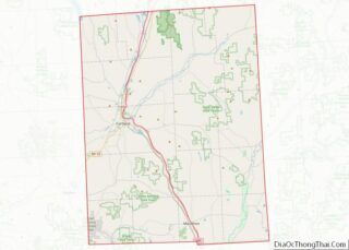
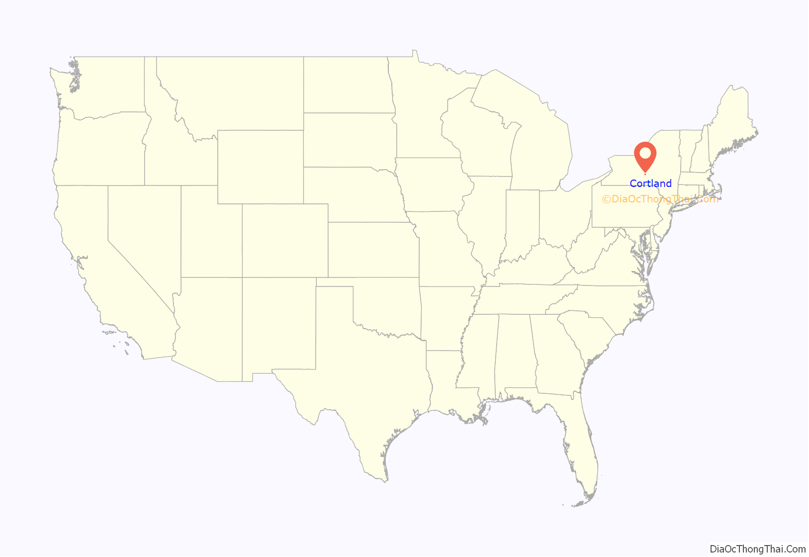
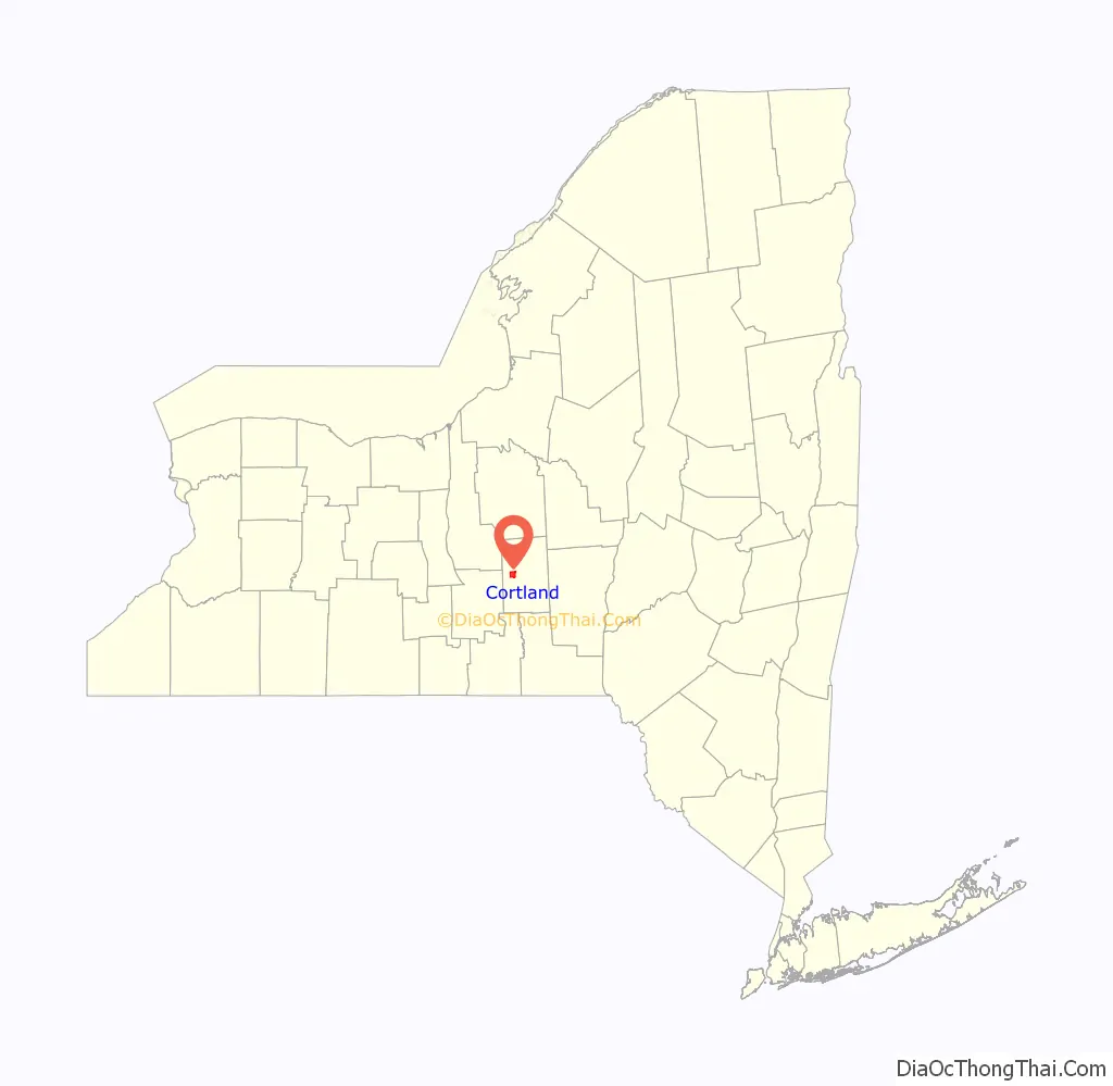
Cortland location map. Where is Cortland city?
History
The city is within the former Central New York Military Tract. It is named after Pierre Van Cortlandt, the first lieutenant governor of New York.
Cortland, settled in 1791, was made a village in 1853 (rechartered in 1864), and incorporated in 1900 as New York’s 41st city. When the county was formed in 1808, Cortland vied with other villages to become the county seat. Known as the “Crown City” because of its location on a plain formed by the convergence of seven valleys, Cortland is 1,130 feet (340 m) above sea level. Forty stars representing the 40 cities incorporated before Cortland circle the State of New York and Crown on the city’s official seal. The seven points of the crown represent the seven valleys surrounding Cortland. The 41st star in the center of the crown illustrates Cortland as the incorporated city closest to New York’s geographic center.
Cortland’s leading industry in the late 19th and early 20th centuries was the Wickwire Brothers wire-drawing mill, noted for its production of wire hardware cloth for use as window screens. The extent of the Wickwires’ wealth is demonstrated in the two magnificent mansions they commissioned. The Victorian Chateauesque-style home of Chester Wickwire is now operated as the 1890 House Museum & Center for Victorian Arts. Charles Wickwire’s 1912 home is now owned and operated by the SUNY Cortland Alumni Association. It is open to the public and used by the Alumni Association to host college-related events and house visiting dignitaries.
Cortland was also the location of Brockway Motor Company, a pioneering truck maker. Begun in 1875 as Brockway Carriage Works, it was taken over by Mack Trucks in 1956 and survived until 1977. The city continues to host an annual show of Brockway trucks.
From 1960 to 1992, Smith Corona typewriters were manufactured in Cortland.
Cortland boasts a classic octagon house. The Cortland Rural Cemetery is styled as a garden setting and is still in operation.
In 1868, Cortland became the home of the Cortland Normal School, which gradually developed into a four-year college. With graduate programs and research capacity, it has expanded into the State University of New York at Cortland.
In 2006, Cortland’s historic clock tower burned down. It was later rebuilt, with spaces in the building for both businesses and apartments.
The Cortland County Courthouse, Cortland County Poor Farm, Cortland Fire Headquarters, Cortland Free Library, First Presbyterian Church Complex, William J. Greenman House, Randall Farm, Tompkins Street Historic District, Unitarian Universalist Church, and United States Post Office are listed on the National Register of Historic Places.
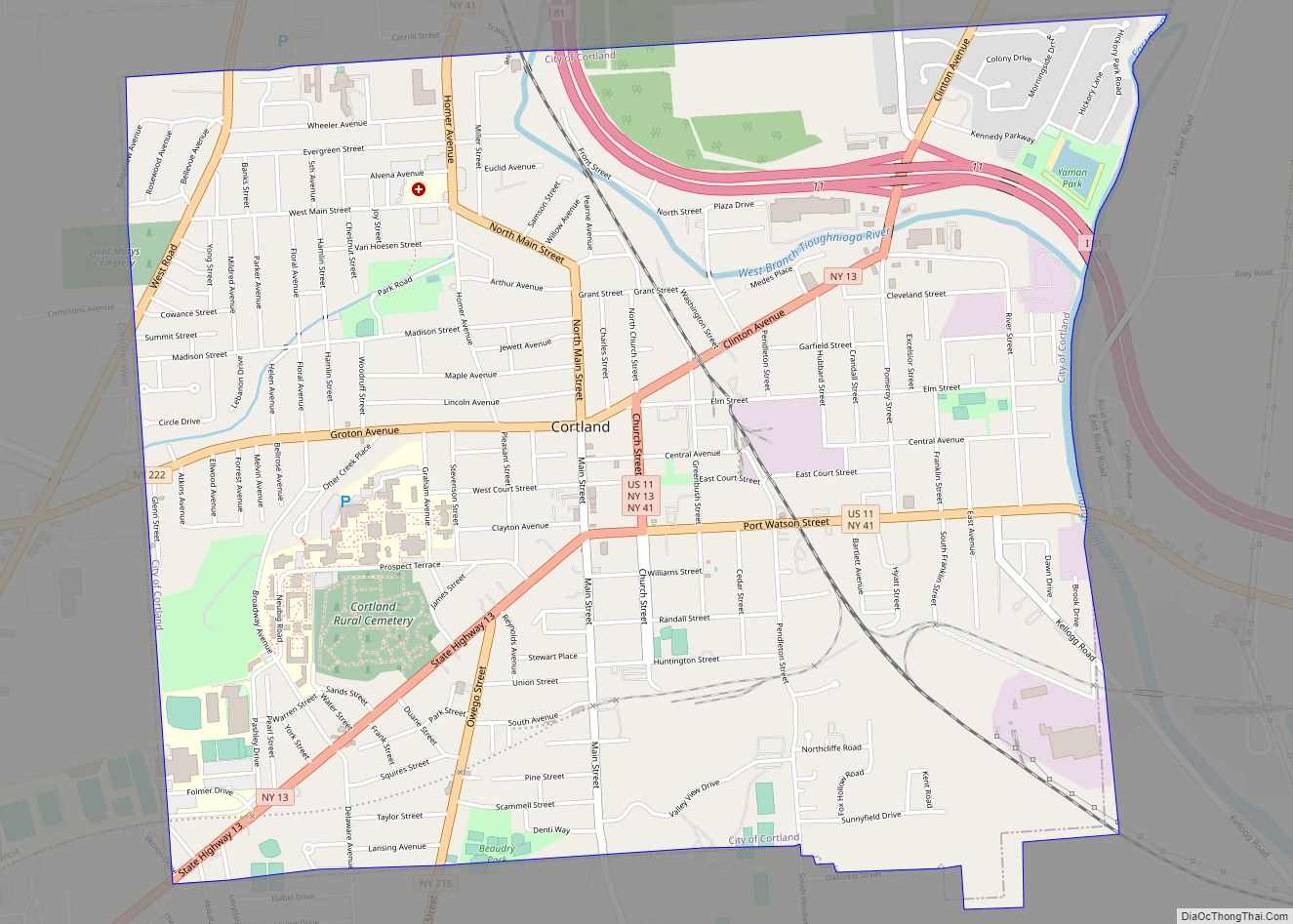
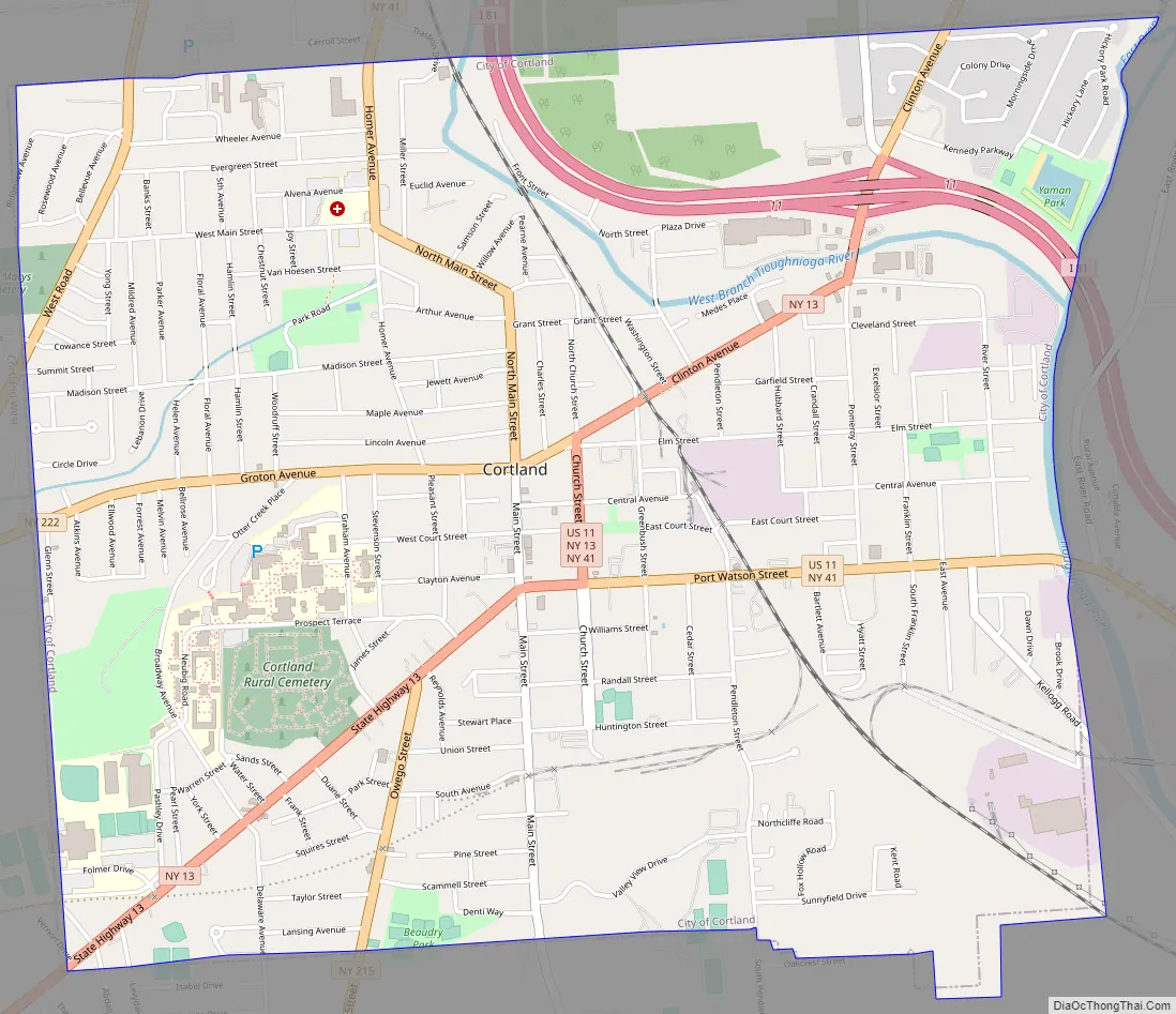
Cortland Road Map
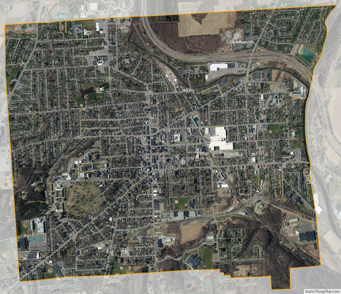
Cortland city Satellite Map
Geography
Cortland is in west-central Cortland County at 42°36′2″N 76°10′53″W / 42.60056°N 76.18139°W / 42.60056; -76.18139 (42.600658, −76.181284). Cortland lies between Syracuse and Binghamton; it is surrounded by the town of Cortlandville.
According to the United States Census Bureau, the city has an area of 3.92 square miles (10.14 km), of which 3.90 square miles (10.09 km) is land and 0.02 square miles (0.05 km), or 0.51%, is water.
The Tioughnioga River, a tributary of the Susquehanna River, flows southward past the city.
See also
Map of New York State and its subdivision:- Albany
- Allegany
- Bronx
- Broome
- Cattaraugus
- Cayuga
- Chautauqua
- Chemung
- Chenango
- Clinton
- Columbia
- Cortland
- Delaware
- Dutchess
- Erie
- Essex
- Franklin
- Fulton
- Genesee
- Greene
- Hamilton
- Herkimer
- Jefferson
- Kings
- Lake Ontario
- Lewis
- Livingston
- Madison
- Monroe
- Montgomery
- Nassau
- New York
- Niagara
- Oneida
- Onondaga
- Ontario
- Orange
- Orleans
- Oswego
- Otsego
- Putnam
- Queens
- Rensselaer
- Richmond
- Rockland
- Saint Lawrence
- Saratoga
- Schenectady
- Schoharie
- Schuyler
- Seneca
- Steuben
- Suffolk
- Sullivan
- Tioga
- Tompkins
- Ulster
- Warren
- Washington
- Wayne
- Westchester
- Wyoming
- Yates
- Alabama
- Alaska
- Arizona
- Arkansas
- California
- Colorado
- Connecticut
- Delaware
- District of Columbia
- Florida
- Georgia
- Hawaii
- Idaho
- Illinois
- Indiana
- Iowa
- Kansas
- Kentucky
- Louisiana
- Maine
- Maryland
- Massachusetts
- Michigan
- Minnesota
- Mississippi
- Missouri
- Montana
- Nebraska
- Nevada
- New Hampshire
- New Jersey
- New Mexico
- New York
- North Carolina
- North Dakota
- Ohio
- Oklahoma
- Oregon
- Pennsylvania
- Rhode Island
- South Carolina
- South Dakota
- Tennessee
- Texas
- Utah
- Vermont
- Virginia
- Washington
- West Virginia
- Wisconsin
- Wyoming