Map of Lake Luzerne CDP

Map of Lake Luzerne CDP

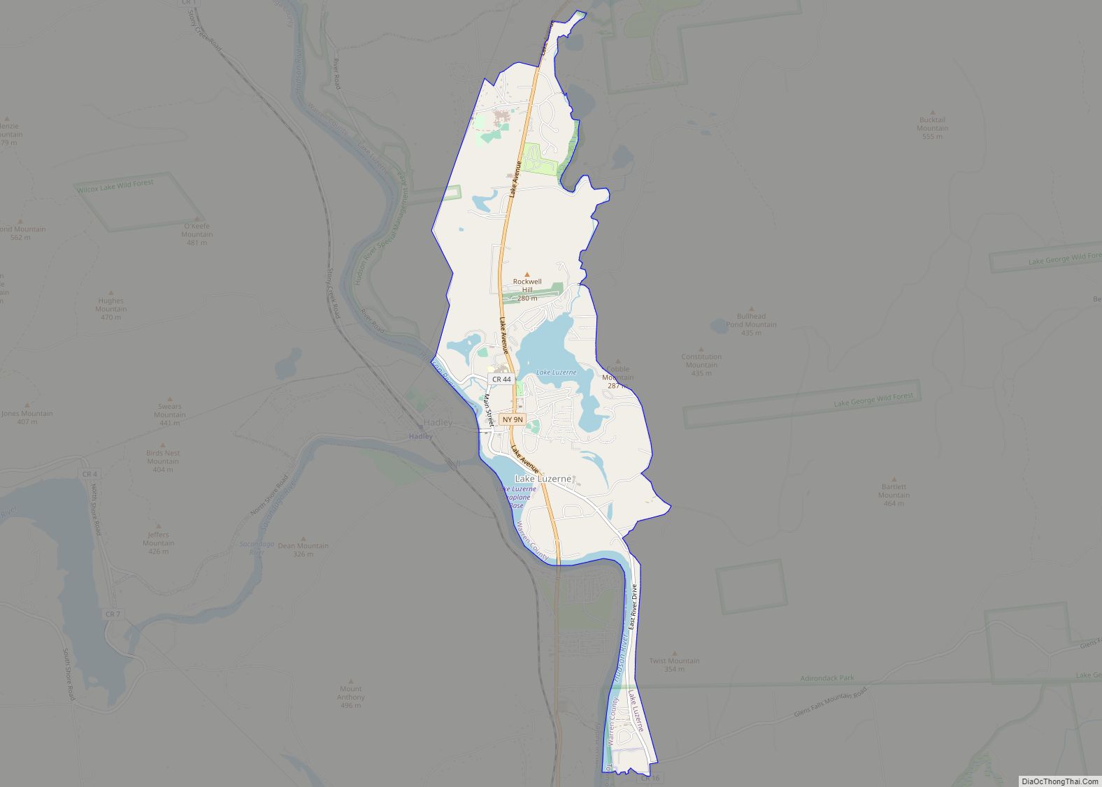
Lake Luzerne is the primary hamlet and a census-designated place (CDP) within the town of Lake Luzerne, Warren County, New York, United States. As of the 2010 census, the population was 1,227, out of 3,347 residents in the entire town of Lake Luzerne. Before that, the community was part of the Lake Luzerne-Hadley census-designated place. … Read more

Map of Lansing village, New York

Map of Lansing village, New York

Lansing is a village in Tompkins County, New York, United States, and a suburb of Ithaca. The population was 3,648 at the 2020 census. The Village of Lansing is in the Town of Lansing and is located just north of the City of Ithaca. Lansing village overview: Name: Lansing village LSAD Code: 47 LSAD Description: … Read more

Map of Leicester village

Map of Leicester village

Leicester is a village in the town of Leicester, Livingston County, New York, United States. The population was 468 at the 2010 census, out of 2,200 in the entire town of Leicester. The village and town are named after Leicester Phelps, an early inhabitant. Leicester village overview: Name: Leicester village LSAD Code: 47 LSAD Description: … Read more

Map of Leeds CDP, New York

Map of Leeds CDP, New York

Leeds is a hamlet and census-designated place (CDP) in Greene County, New York, United States. The population was 377 at the 2010 census. Leeds is located in the town of Catskill, near the northern town line. The community is located north of Route 23 and west of the New York State Thruway (Interstate 87) and … Read more

Map of Le Roy village, New York

Map of Le Roy village, New York

Le Roy is a village in Genesee County, New York, United States. The population was 4,391 at the 2010 census. The village lies in the center of the town of Le Roy at the intersection of State Routes 5 and 19. Le Roy village overview: Name: Le Roy village LSAD Code: 47 LSAD Description: village … Read more

Map of Lawrence village, New York

Map of Lawrence village, New York

Lawrence is a village in Nassau County, New York, United States. As of the 2010 United States Census, the village population was 6,483. The Village of Lawrence is in the southwestern corner of the Town of Hempstead, adjoining the border with the New York City borough of Queens to the west and near the Atlantic … Read more

Map of Laurens village, New York

Map of Laurens village, New York

Laurens is a village in Otsego County, New York, United States. The population was 263 at the 2010 census. The Village of Laurens is in the eastern part of the Town of Laurens. It is also north of the City of Oneonta. Laurens village overview: Name: Laurens village LSAD Code: 47 LSAD Description: village (suffix) … Read more

Map of Laurel CDP, New York

Map of Laurel CDP, New York

Laurel is a census-designated place (CDP) roughly corresponding to the hamlet of Laurel in Suffolk County, New York, United States. It is located mostly within the Town of Southold, with a small portion in the Town of Riverhead. The population was 1,394 at the 2010 census. Laurel CDP overview: Name: Laurel CDP LSAD Code: 57 … Read more

Map of Laurel Hollow village

Map of Laurel Hollow village

Laurel Hollow is a village in the Town of Oyster Bay in Nassau County, on the North Shore of Long Island, in New York, United States. The population was 1,952 at the 2010 census. According to Bloomberg BusinessWeek, Laurel Hollow was the eighth wealthiest town in America. Laurel Hollow village overview: Name: Laurel Hollow village … Read more

Map of Lattingtown village

Map of Lattingtown village

Lattingtown is a village located within the Town of Oyster Bay in Nassau County, on Long Island, in New York, United States. The population was 1,739 at the 2010 census. Lattingtown village overview: Name: Lattingtown village LSAD Code: 47 LSAD Description: village (suffix) State: New York County: Nassau County Elevation: 62 ft (19 m) Total Area: 3.82 sq mi … Read more

Map of Larchmont village

Map of Larchmont village

Larchmont /lɑːrtʃmɒnt/ is a village located within the Town of Mamaroneck in Westchester County, New York, approximately 18 miles (29 km) northeast of Midtown Manhattan. The population of the village was 5,864 at the 2010 census. In February 2019, Bloomberg ranked Larchmont as the 15th wealthiest place in the United States and the third wealthiest in … Read more

Map of Limestone CDP, New York

Map of Limestone CDP, New York

Limestone is a hamlet (and census-designated place) in Cattaraugus County, New York, United States. The population was 389 at the 2010 census. The former village lies in the southern part of the town of Carrollton and is 6 miles (10 km) north of the city of Bradford, Pennsylvania. The name is said to derive from the … Read more