Lake Placid is a village in the Adirondack Mountains in Essex County, New York, United States. As of the 2020 census, the population was 2,303.
The village of Lake Placid is near the center of the town of North Elba, 50 miles (80 km) southwest of Plattsburgh. Lake Placid, along with nearby Saranac Lake and Tupper Lake, constitute what is known as the Tri-Lakes region. Lake Placid has risen to international prominence having hosted the 1932 and the 1980 Winter Olympics, the 1972 and 2023 Winter World University Games as well as the 2000 Goodwill Games. The village is also known for being the hometown of singer-songwriter Lana Del Rey.
| Name: | Lake Placid village |
|---|---|
| LSAD Code: | 47 |
| LSAD Description: | village (suffix) |
| State: | New York |
| County: | Essex County |
| Elevation: | 1,801 ft (549 m) |
| Total Area: | 1.53 sq mi (3.97 km²) |
| Land Area: | 1.36 sq mi (3.53 km²) |
| Water Area: | 0.17 sq mi (0.45 km²) 10.80% |
| Total Population: | 2,205 |
| Population Density: | 1,620.13/sq mi (625.44/km²) |
| ZIP code: | 12946 |
| Area code: | 518 |
| FIPS code: | 3640761 |
| GNISfeature ID: | 0954931 |
| Website: | villageoflakeplacid.ny.gov |
Online Interactive Map
Click on ![]() to view map in "full screen" mode.
to view map in "full screen" mode.
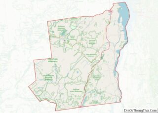
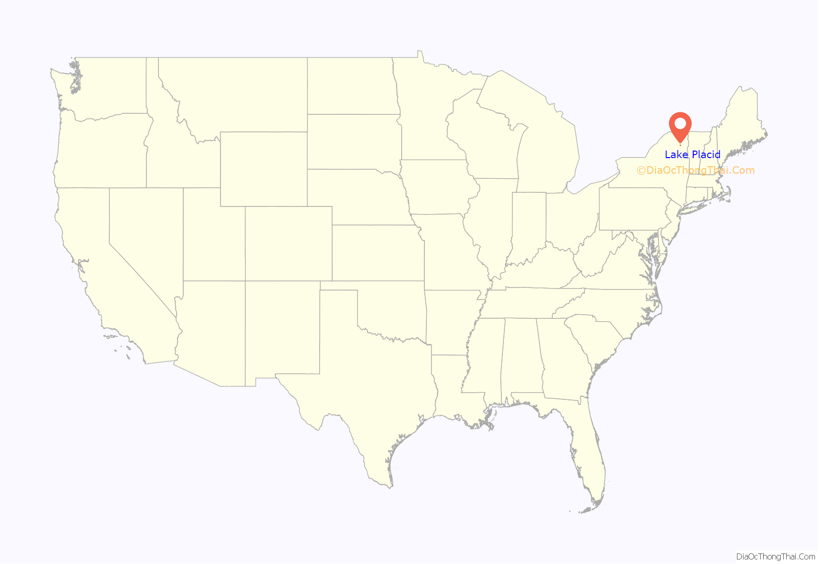
Lake Placid location map. Where is Lake Placid village?

History
Lake Placid was founded in the early 19th century to develop an iron ore mining operation. By 1840, the population of “North Elba” (four miles southeast of the present village, near where the road to the Adirondak Loj crosses the Ausable River), was six families. In 1845, the philanthropist Gerrit Smith arrived in North Elba and not only bought a great deal of land around the village but granted large tracts to former slaves. He reformed the land law and demonstrated his support of abolitionism.
The abolitionist John Brown heard about Smith’s reforms, and left his anti-slavery activities in Kansas to buy 244 acres (1.0 km) of land in North Elba. This parcel later became known as the “Freed Slave Utopian Experiment,” Timbuctoo. Shortly before his execution in 1859, John Brown asked to be buried on his farm, preserved as the John Brown Farm State Historic Site.
As leisure time increased in the late 19th century, Lake Placid was discovered as a resort by the wealthy, drawn to the fashionable Lake Placid Club. Melvil Dewey, who invented the Dewey Decimal System, designed what was then called “Placid Park Club” in 1895. This inspired the village to change its name to Lake Placid, an incorporated village in 1900. Dewey kept the club open through the winter in 1905, which aided the development of winter sports in the area. Nearby Saranac Lake had hosted an international winter sporting event as early as 1889 and was used year-round by patients seeking treatment for tuberculosis at sanatoria. The fresh, clean mountain air was considered good for them and was a common treatment for tuberculosis.
By 1921, the Lake Placid area could boast a ski jump, speed skating venue, and ski association. In 1929, Dr. Godfrey Dewey, Melvil’s son, convinced the International Olympic Committee (IOC) Lake Placid had the best winter sports facilities in the United States. The Lake Placid Club was the headquarters for the IOC for the 1932 and the 1980 Winter Olympics in Lake Placid.
In addition to the John Brown Farm and Gravesite, the Mount Van Hoevenberg Olympic Bobsled Run, New York Central Railroad Adirondack Division Historic District, and United States Post Office are listed on the National Register of Historic Places.
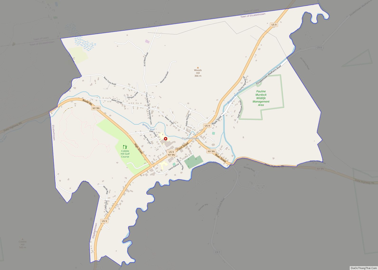
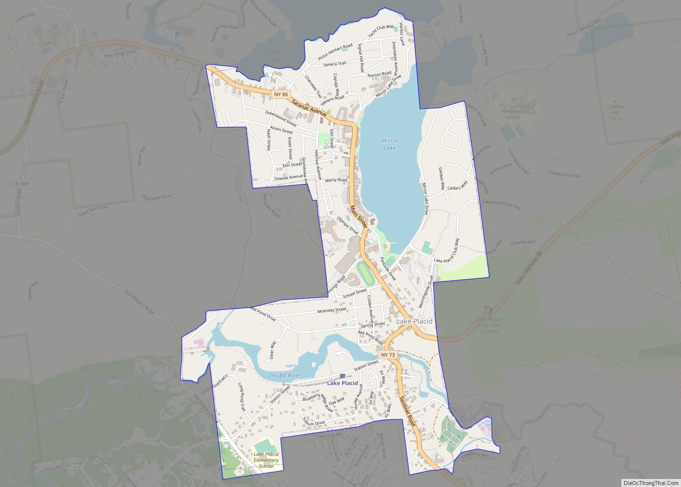
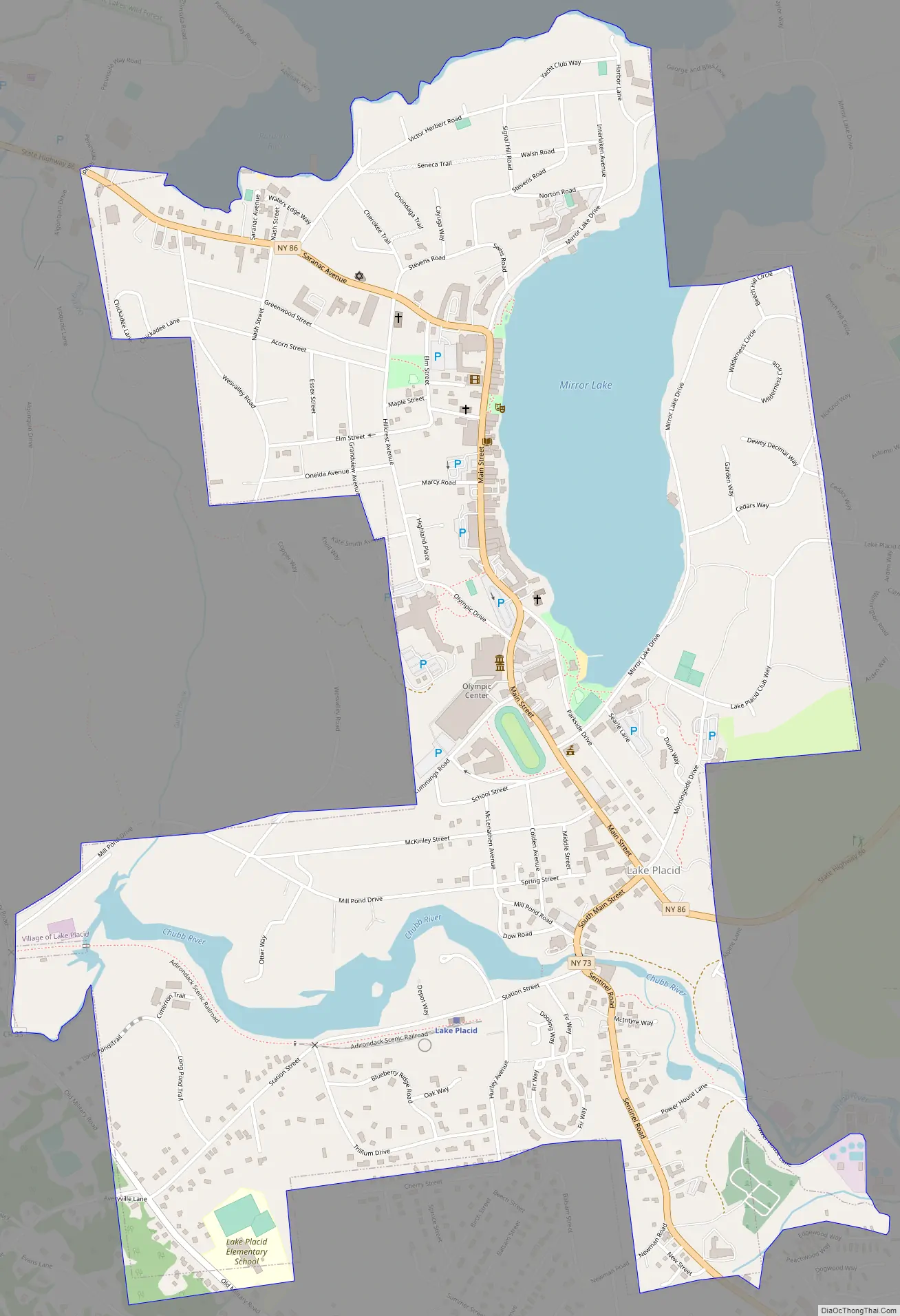
Lake Placid Road Map
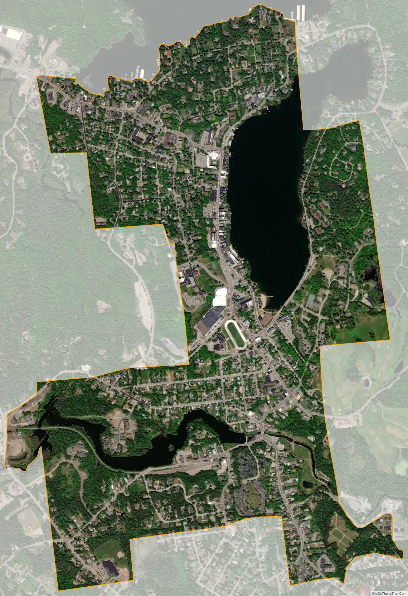
Lake Placid city Satellite Map
Geography
According to the United States Census Bureau, the village has a total area of 1.5 square miles (4.0 km), of which 1.4 square miles (3.6 km) is land and 0.15 square miles (0.4 km), or 10.79%, is water.
The village is located near the southern end of Lake Placid lake. More immediate to the village is Mirror Lake, which lies between the village and Lake Placid.
See also
Map of New York State and its subdivision:- Albany
- Allegany
- Bronx
- Broome
- Cattaraugus
- Cayuga
- Chautauqua
- Chemung
- Chenango
- Clinton
- Columbia
- Cortland
- Delaware
- Dutchess
- Erie
- Essex
- Franklin
- Fulton
- Genesee
- Greene
- Hamilton
- Herkimer
- Jefferson
- Kings
- Lake Ontario
- Lewis
- Livingston
- Madison
- Monroe
- Montgomery
- Nassau
- New York
- Niagara
- Oneida
- Onondaga
- Ontario
- Orange
- Orleans
- Oswego
- Otsego
- Putnam
- Queens
- Rensselaer
- Richmond
- Rockland
- Saint Lawrence
- Saratoga
- Schenectady
- Schoharie
- Schuyler
- Seneca
- Steuben
- Suffolk
- Sullivan
- Tioga
- Tompkins
- Ulster
- Warren
- Washington
- Wayne
- Westchester
- Wyoming
- Yates
- Alabama
- Alaska
- Arizona
- Arkansas
- California
- Colorado
- Connecticut
- Delaware
- District of Columbia
- Florida
- Georgia
- Hawaii
- Idaho
- Illinois
- Indiana
- Iowa
- Kansas
- Kentucky
- Louisiana
- Maine
- Maryland
- Massachusetts
- Michigan
- Minnesota
- Mississippi
- Missouri
- Montana
- Nebraska
- Nevada
- New Hampshire
- New Jersey
- New Mexico
- New York
- North Carolina
- North Dakota
- Ohio
- Oklahoma
- Oregon
- Pennsylvania
- Rhode Island
- South Carolina
- South Dakota
- Tennessee
- Texas
- Utah
- Vermont
- Virginia
- Washington
- West Virginia
- Wisconsin
- Wyoming