Map of Livonia Center CDP
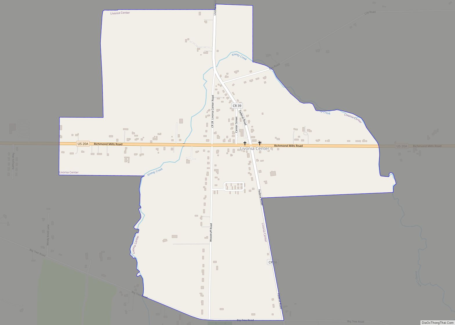
Livonia Center is a hamlet and census-designated place (CDP) in the town of Livonia, Livingston County, New York, United States. Its population was 421 as of the 2010 census. Livonia Center has a post office with ZIP code 14488, which opened on April 9, 1811. Livonia Center CDP overview: Name: Livonia Center CDP LSAD Code: ... Read more
Map of Livonia Center CDP
Map of Livingston Manor CDP
Livingston Manor is a hamlet (and a census-designated place) in Sullivan County, New York, United States. The population was 1,221 at the 2010 census. Livingston Manor is located in the southern part of the town of Rockland. New York State Route 17 runs by it. Livingston Manor CDP overview: Name: Livingston Manor CDP LSAD Code: ... Read more
Map of Livingston Manor CDP
Map of Liverpool village, New York
Liverpool is a lakeside village in Onondaga County, New York, United States. As of the 2020 census, the population was 2,242. The name was adopted from the city of Liverpool in the United Kingdom. The village is on Onondaga Lake, in the western part of the town of Salina and is northwest of Syracuse, of ... Read more
Map of Liverpool village, New York
Map of Little Valley village, New York
Little Valley is a village in Cattaraugus County, New York, United States and as the county seat, is the location of the county fair (held in August in the fairgrounds north of the village). The village is in the northwest corner of the town of Little Valley, which is north of Salamanca. The village population ... Read more
Map of Little Valley village, New York
Map of Little Falls city, New York
Little Falls is a city in Herkimer County, New York, United States. The population was 4,946 at the time of the 2010 census, which is the second-smallest city population in the state, ahead of only the city of Sherrill. The city is built on both sides of the Mohawk River, at a point at which ... Read more
Map of Little Falls city, New York
Map of Lisle village, New York
Lisle is a village in Broome County, New York, United States. The population was 320 at the 2010 census. It is part of the Binghamton Metropolitan Statistical Area. The village was named after a community in France. The village of Lisle is in the southeast part of the town of Lisle and is north of ... Read more
Map of Lisle village, New York
Map of Linwood CDP, New York
Linwood is a hamlet and census-designated place (CDP) in the town of York, Livingston County, New York, United States. Its population was 74 as of the 2010 census. Linwood had a post office until February 6, 1993; it still has its own ZIP code, 14486. Linwood CDP overview: Name: Linwood CDP LSAD Code: 57 LSAD ... Read more
Map of Linwood CDP, New York
Map of Long Lake CDP, New York
Long Lake is a census-designated place (CDP) in the town of Long Lake, Hamilton County, New York, United States. The population was 596 at the 2020 census, out of 791 in the town of Long Lake as a whole. Long Lake is within the Adirondack Park. Long Lake CDP overview: Name: Long Lake CDP LSAD ... Read more
Map of Long Lake CDP, New York
Map of Long Beach city, New York
Long Beach is an oceanfront city in Nassau County in New York, United States. It takes up a central section of the Long Beach Barrier Island, which is the westernmost of the outer barrier islands off Long Island’s South Shore. As of the 2020 Census, the city’s population was 35,029, up from the 2019 estimate ... Read more
Map of Long Beach city, New York
Map of Lodi village, New York
Lodi is a village in Seneca County, New York, United States. The population was 291 at the 2010 census. The Village of Lodi is in the north part of the Town of Lodi and is northwest of Ithaca, New York. It owes its name to the Italian city of Lodi. Lodi Point State Park is ... Read more
Map of Lodi village, New York
Map of Locust Valley CDP
Locust Valley is a hamlet and census-designated place (CDP) located in the Town of Oyster Bay in Nassau County, on the North Shore of Long Island, in New York, United States. The population was 3,406 at the 2010 census. Locust Valley CDP overview: Name: Locust Valley CDP LSAD Code: 57 LSAD Description: CDP (suffix) State: ... Read more
Map of Locust Valley CDP
Map of Lockport city, New York
Lockport is both a city and the town that surrounds it in Niagara County, New York, United States. The city is the Niagara county seat, with a population of 21,165 according to 2010 census figures, and an estimated population of 20,305 as of 2019. Its name derives from a set of Erie Canal locks (Lock ... Read more
Map of Lockport city, New York