Map of Nassau village, New York

Map of Nassau village, New York

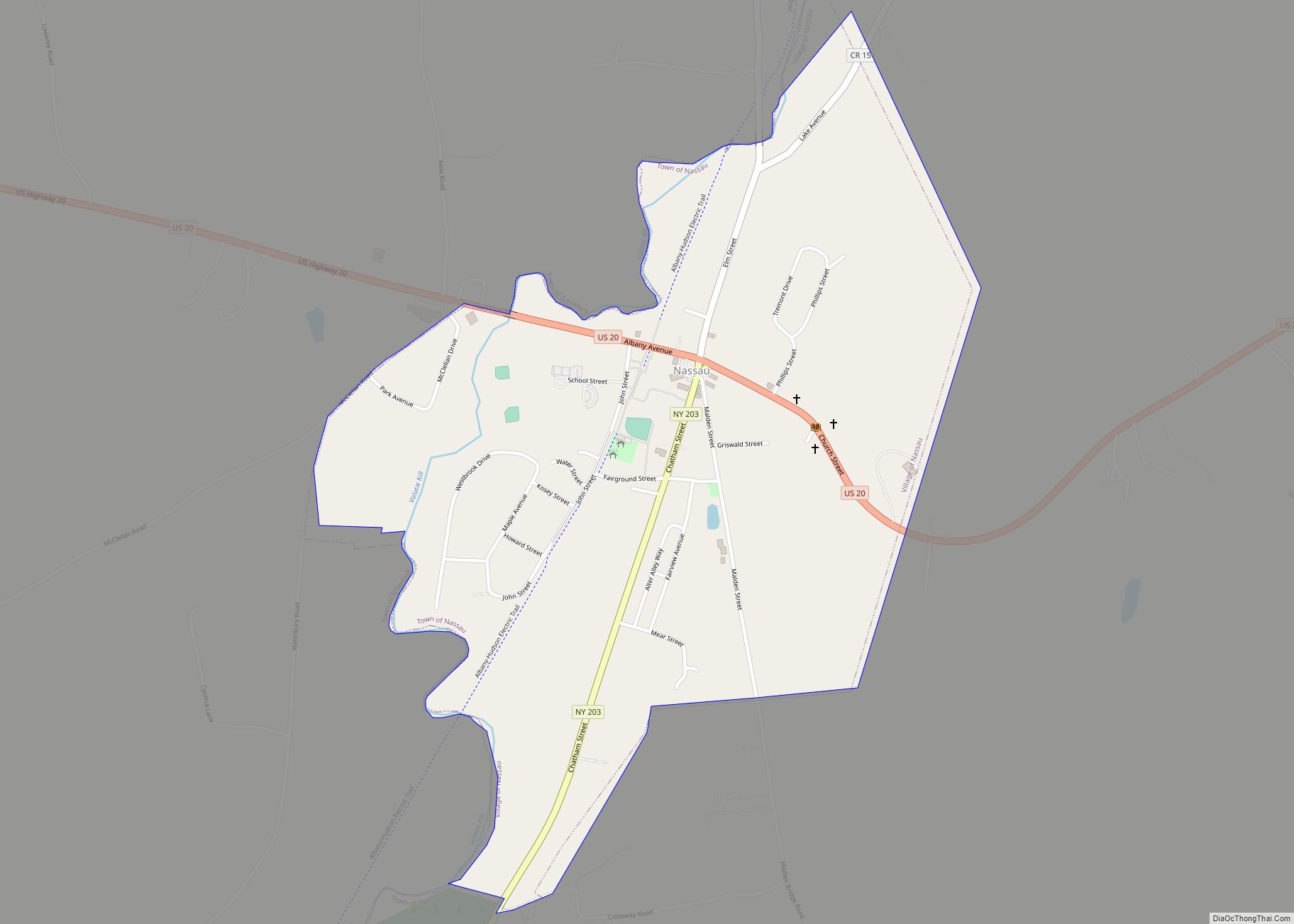
Nassau is a village located in the Town of Nassau in Rensselaer County, New York, United States. The population was 1,133 at the 2010 census. The Village of Nassau is in the southern part of the county in the Town of Nassau, with a small western portion in the Town of Schodack. Nassau is bordered … Read more

Map of Narrowsburg CDP

Map of Narrowsburg CDP

Narrowsburg is a hamlet (and a census-designated place) in Sullivan County, New York, United States. The population was 379 at the 2020 census. Narrowsburg is in the western part of the Town of Tusten at the junction of Routes 52 and 97. Narrowsburg CDP overview: Name: Narrowsburg CDP LSAD Code: 57 LSAD Description: CDP (suffix) … Read more

Map of Naples village, New York

Map of Naples village, New York

Naples is a village in Ontario County, New York, United States. The population was 1,041 at the 2010 census. It is a part of the Town of Naples, known as an important grape-growing region. Naples village overview: Name: Naples village LSAD Code: 47 LSAD Description: village (suffix) State: New York County: Ontario County Elevation: 804 ft … Read more

Map of Napeague CDP

Map of Napeague CDP

Napeague (/ˈnæpiːɡ/, NAP-eeg) is a census-designated place (CDP) that roughly corresponds to the hamlet with the same name in the Town of East Hampton in Suffolk County, New York, United States. The CDP population was 200 at the 2010 census. Napeague is located on a very narrow, low-lying strip between the Atlantic Ocean to the … Read more

Map of Napanoch CDP

Map of Napanoch CDP

Napanoch is a hamlet in Ulster County, New York, United States. It is at the junction of routes 209 and 55. The population was 1,131 at the 2020 census. Napanoch is on the Shawangunk Ridge National Scenic Byway, and is part of the Hudson River Valley National Heritage Area. Napanoch CDP overview: Name: Napanoch CDP … Read more

Map of Nanuet CDP

Map of Nanuet CDP

Nanuet is a hamlet and census-designated place in the town of Clarkstown, Rockland County, New York, United States. The third largest hamlet in Clarkstown, it is located north of Pearl River, south of New City, east of Spring Valley, and west of West Nyack. It is located midway between Manhattan and Bear Mountain, 19 miles … Read more

Map of Myers Corner CDP

Map of Myers Corner CDP

Myers Corner is a hamlet and census-designated place (CDP) in the town of Wappinger, Dutchess County, New York, United States. The population was 6,790 at the 2010 census. It is part of the Poughkeepsie–Newburgh–Middletown, NY Metropolitan Statistical Area as well as the larger New York–Newark–Bridgeport, NY-NJ–CT–PA Combined Statistical Area. Myers Corner is in the town … Read more

Map of Muttontown village

Map of Muttontown village

Muttontown is a village located within the Town of Oyster Bay in Nassau County, on Long Island, in New York, United States. The population was 3,497 at the 2010 census. Muttontown village overview: Name: Muttontown village LSAD Code: 47 LSAD Description: village (suffix) State: New York County: Nassau County Incorporated: 1931 Elevation: 285 ft (87 m) Total … Read more

Map of Munsons Corners CDP

Map of Munsons Corners CDP

Munsons Corners is a hamlet and census-designated place (CDP) in Cortland County, New York, United States. The population was 2,728 at the 2010 census. Munsons Corners is a community in the town of Cortlandville at the southwest border of the city of Cortland. Munsons Corners CDP overview: Name: Munsons Corners CDP LSAD Code: 57 LSAD … Read more

Map of Nelliston village

Map of Nelliston village

Nelliston is a village in Montgomery County, New York, United States. The population was 596 at the 2010 census. The name is from members of the Nellis family. The Village of Nelliston is in the Town of Palatine and is west of Amsterdam. The Erie Canal passes the village. Nelliston village overview: Name: Nelliston village … Read more

Map of Nedrow CDP

Map of Nedrow CDP

Nedrow /ˈnɛdroʊ/ is a hamlet (and census-designated place) located in the town of Onondaga in Onondaga County, New York, United States. The population was 2,244 at the 2010 census. It is a suburb of Syracuse, whose southern border it adjoins. The name “Nedrow” is the founder’s name Worden, spelled backwards. Nedrow CDP overview: Name: Nedrow … Read more

Map of New Hyde Park village

Map of New Hyde Park village

New Hyde Park is a village in the Towns of Hempstead and North Hempstead in Nassau County, on Long Island, in New York, United States. It is the anchor community of the Greater New Hyde Park area. The population was 9,712 at the 2010 census. New Hyde Park village overview: Name: New Hyde Park village … Read more