Map of Sherburne village

Map of Sherburne village

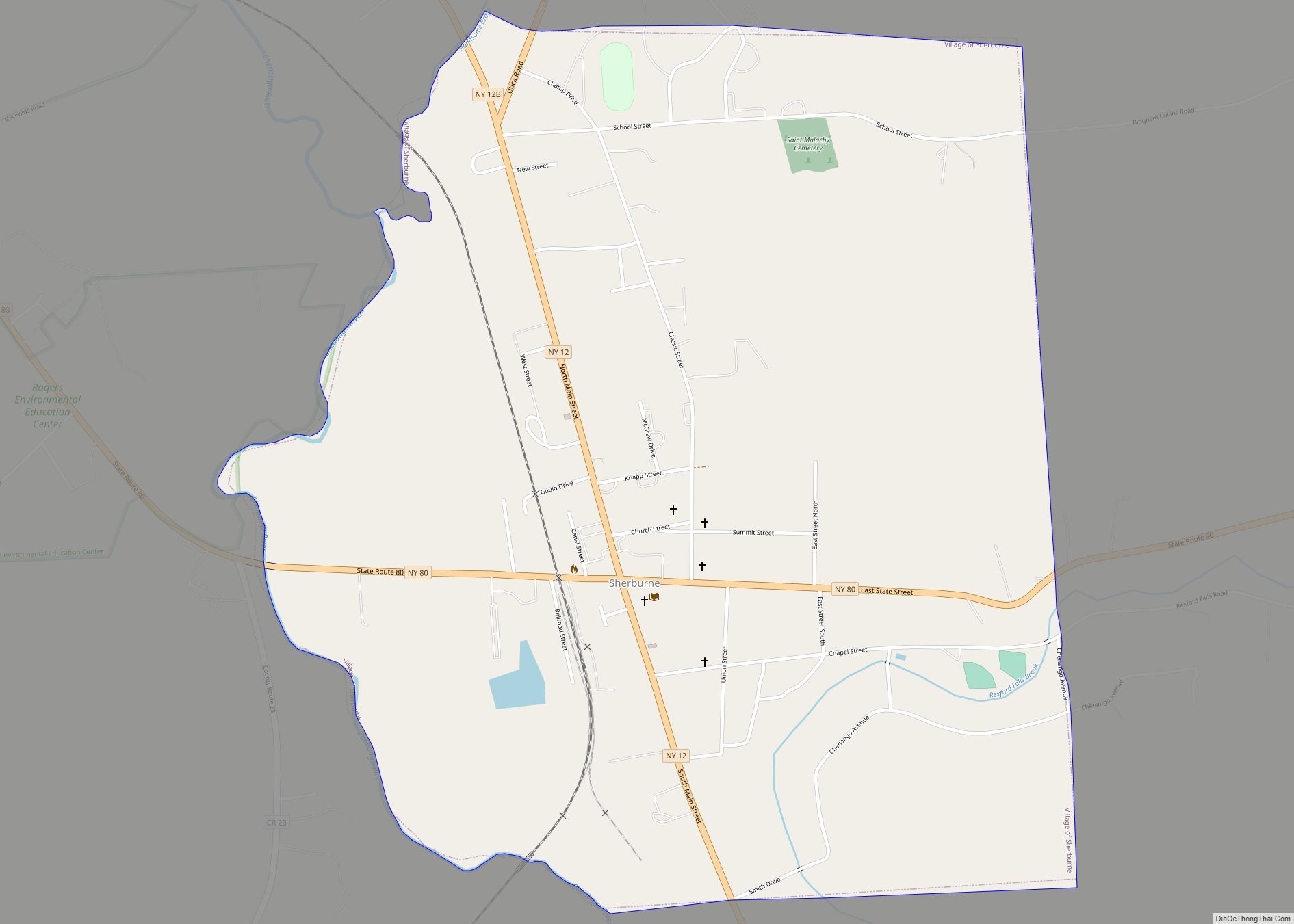
Sherburne is a village in Chenango County, New York, United States. The population was 1,367 at the 2010 census. It is in the town of Sherburne, north of Norwich. Sherburne village overview: Name: Sherburne village LSAD Code: 47 LSAD Description: village (suffix) State: New York County: Chenango County Elevation: 1,047 ft (319 m) Total Area: 1.52 sq mi (3.94 km²) … Read more

Map of Sloan village, New York

Map of Sloan village, New York

Sloan is a village in Erie County, New York, United States. The population was 3,661 at the 2010 census. It is part of the Buffalo–Niagara Falls Metropolitan Statistical Area and is in the town of Cheektowaga. Sloan village overview: Name: Sloan village LSAD Code: 47 LSAD Description: village (suffix) State: New York County: Erie County … Read more

Map of Sleepy Hollow village, New York

Map of Sleepy Hollow village, New York

Sleepy Hollow is a village in the town of Mount Pleasant, in Westchester County, New York, United States. The village is located on the east bank of the Hudson River, about 30 miles (48 km) north of New York City, and is served by the Philipse Manor stop on the Metro-North Hudson Line. To the south … Read more

Map of Skaneateles village

Map of Skaneateles village

Skaneateles (/ˌskæniˈætləs/ SKAN-ee-AT-ləs, locally /ˌskɪn-/ SKIN-) is an affluent village in the town of Skaneateles, in Onondaga County, New York, United States. The village is named after, and located on the shores of, Skaneateles Lake, one of the Finger Lakes. As of the 2020 census, the village had a population of 2,533 residents. Skaneateles village … Read more

Map of Sinclairville village

Map of Sinclairville village

Sinclairville is a village in Chautauqua County, New York, United States. The population was 578 at the 2020 census. The village is named after Major Samuel Sinclear, its founder. Sinclairville is north of Jamestown and is on the border of the towns of Charlotte and Gerry. Sinclairville village overview: Name: Sinclairville village LSAD Code: 47 … Read more

Map of Silver Springs village, New York

Map of Silver Springs village, New York

Silver Springs is a village in Wyoming County, New York, United States. The population was 782 at the 2010 census. The Village of Silver Springs is within the Town of Gainesville, and is located on Route 19A. Silver Springs is home to the world’s largest collection of Beavis and Butt-Head memorabilia. Silver Springs village overview: … Read more

Map of Silver Creek village, New York

Map of Silver Creek village, New York

Silver Creek is a village in the town of Hanover in Chautauqua County, New York, United States. As of the 2020 census, the village had a population of 2,637. Silver Creek is named after a small creek which runs through the village. It is on the shore of Lake Erie. Silver Creek village overview: Name: … Read more

Map of Smithville Flats CDP

Map of Smithville Flats CDP

Smithville Flats is a census-designated place and hamlet in the town of Smithville, Chenango County, New York, United States. The zipcode is 13841. Its population was 351 as of the 2010 census. Smithville Flats CDP overview: Name: Smithville Flats CDP LSAD Code: 57 LSAD Description: CDP (suffix) State: New York County: Chenango County Elevation: 1,024 ft … Read more

Map of Smithtown CDP

Map of Smithtown CDP

Smithtown is a hamlet and census-designated place (CDP) within the Town of Smithtown in Suffolk County, New York. The population was 26,470 at the 2010 census. The hamlet includes the former Village of The Landing, which was dissolved in 1939. Smithtown CDP overview: Name: Smithtown CDP LSAD Code: 57 LSAD Description: CDP (suffix) State: New … Read more

Map of Smallwood CDP

Map of Smallwood CDP

Smallwood is a hamlet (and census-designated place) in Sullivan County, New York, United States. The population was 839 at the 2020 census. Smallwood is in the southeastern section of the Town of Bethel and is a hamlet within the town of Bethel. It was founded in the 1920s as the vacation community “Mountain Lakes”, but … Read more

Map of Sloatsburg village

Map of Sloatsburg village

Sloatsburg is a village in the town of Ramapo in Rockland County, New York, United States. Located east of Orange County, it is at the southern entrance to Harriman State Park. The population was 3,039 at the 2010 census. The village is named after Stephen Sloat, an early European landowner. Sloatsburg village overview: Name: Sloatsburg … Read more

Map of South Farmingdale CDP

Map of South Farmingdale CDP

South Farmingdale is a hamlet and census-designated place (CDP) in the Town of Oyster Bay in Nassau County, on the South Shore of Long Island, in New York, United States. The population of the CDP was 14,486 at the 2010 census. The hamlet is anchored by (and often identified as part of) neighboring Farmingdale, and … Read more