Skaneateles (/ˌskæniˈætləs/ SKAN-ee-AT-ləs, locally /ˌskɪn-/ SKIN-) is an affluent village in the town of Skaneateles, in Onondaga County, New York, United States. The village is named after, and located on the shores of, Skaneateles Lake, one of the Finger Lakes. As of the 2020 census, the village had a population of 2,533 residents.
| Name: | Skaneateles village |
|---|---|
| LSAD Code: | 47 |
| LSAD Description: | village (suffix) |
| State: | New York |
| County: | Onondaga County |
| Incorporated: | 1833 |
| Total Area: | 1.74 sq mi (4.51 km²) |
| Land Area: | 1.42 sq mi (3.69 km²) |
| Water Area: | 0.32 sq mi (0.83 km²) 16.28% |
| Total Population: | 2,533 |
| Population Density: | 1,780.04/sq mi (687.18/km²) |
| ZIP code: | 13152 |
| Area code: | 315 |
| FIPS code: | 3667510 |
| Website: | www.villageofskaneateles.com |
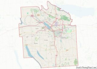
Online Interactive Map
Click on ![]() to view map in "full screen" mode.
to view map in "full screen" mode.
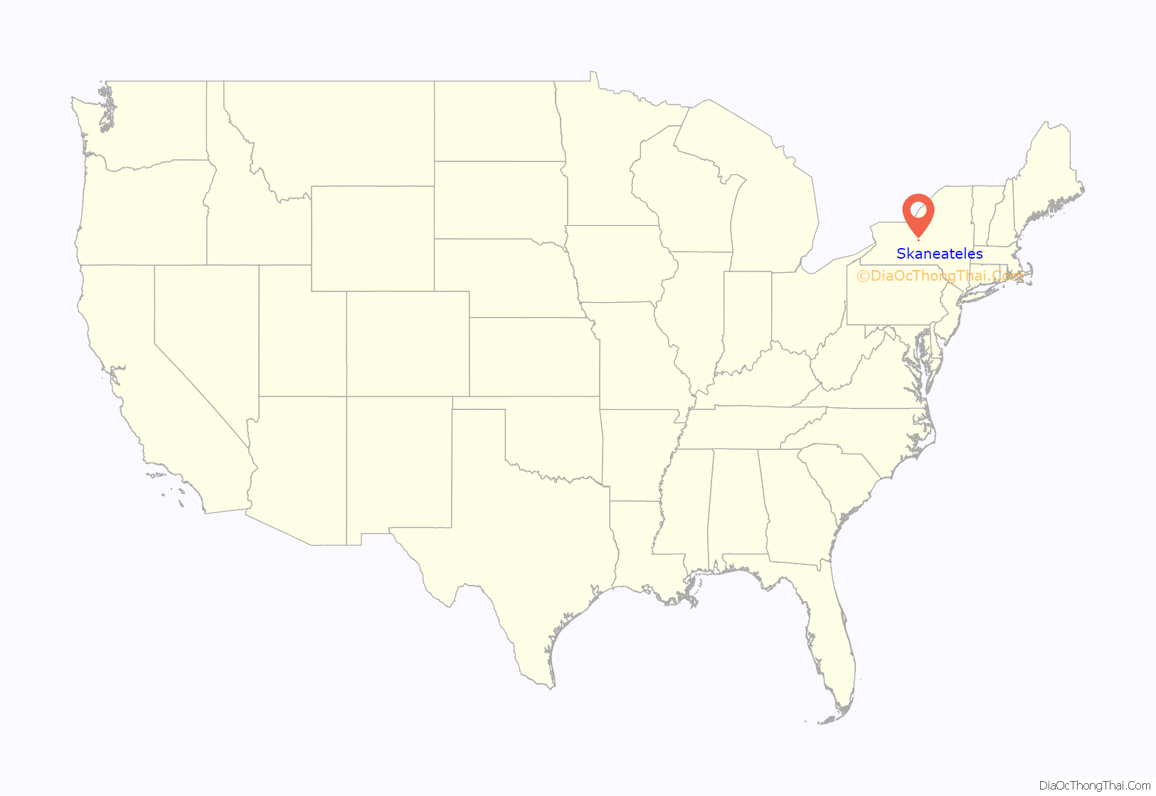
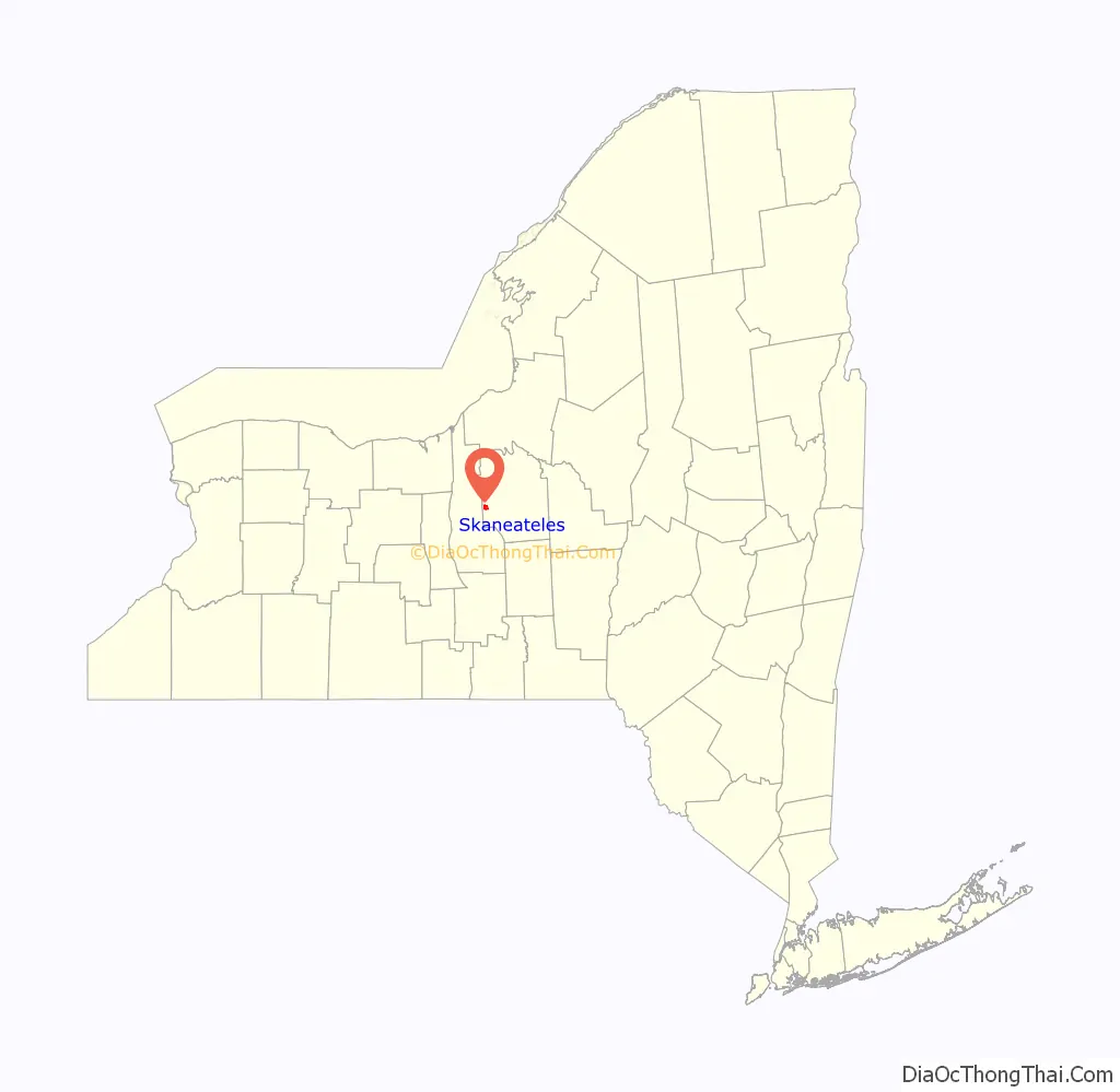
Skaneateles location map. Where is Skaneateles village?
History
Following the Revolutionary War, settlers rapidly populated the eastern Finger Lakes region in the 1790s. Water power from the outlet of Skaneateles Lake made the site of the present village attractive for settlement. Although it had been thought that the first permanent white settler in the area was John Thompson, further research has shown that Abraham A. Cuddeback from Minisink, New York was the first to arrive in 1794.
The old Genesee Road, which connected Utica, Marcellus, Auburn, Geneva and Avon became the Seneca Turnpike in 1800; the first bridge across Skaneateles Creek was built that year. The Seneca Turnpike, together with the Hamilton and Skaneateles Turnpike which opened in 1826, made the new community more accessible. Isaac Sherwood, founder of the Sherwood Inn, developed a stagecoach line through Skaneateles.
The village, which incorporated in 1833 and 1855, attracted prominent residents from an early date. In 1803, a major New York State landowner from New York City, William J. Vredenburgh, erected a sizable mansion. In 1839, Nicholas Roosevelt, “one of the leading industrial entrepreneurs of the period [who] had built the big steam engines for the Philadelphia waterwork,” also from New York City, retired to Skaneateles with his wife, Lydia Latrobe – daughter of the noted architect Benjamin Henry Latrobe.
In the same year, Richard DeZeng, an engineer and canal builder, retired from Oswego, New York to a mansion on the lake. Another Roosevelt family member, Samuel Montgomery Roosevelt, acquired DeZeng’s Greek Revival house which later became known as Roosevelt Hall. It may be the work of Ithiel Town, the partner of Alexander Jackson Davis, who designed the house of Reuel Smith, a wealthy Massachusetts importer who retired to Skaneateles. Built in 1852, the architecturally distinguished house, designed in the Gothic Revival style, has been listed in the National Registry; its plans are in the Library of Congress.
Many early residents such as James Canning Fuller came from Great Britain, largely because of the Quaker community here, giving the early village a cosmopolitan tone. Fuller and his wife Lydia maintained an active Underground Railroad station at their village home (built 1815, extant at 98 Genesee Street.) Fuller was co-founder of the British-American Institute, a Canadian school for fugitive slaves, together with the adjoining settlement of Dawn near Dresden, Ontario.
For more than two centuries, Skaneateles has also attracted visitors and tourists. An excursion boat launched in 1816 was probably the first instance of commercial tourist recreation in the Finger Lakes region.
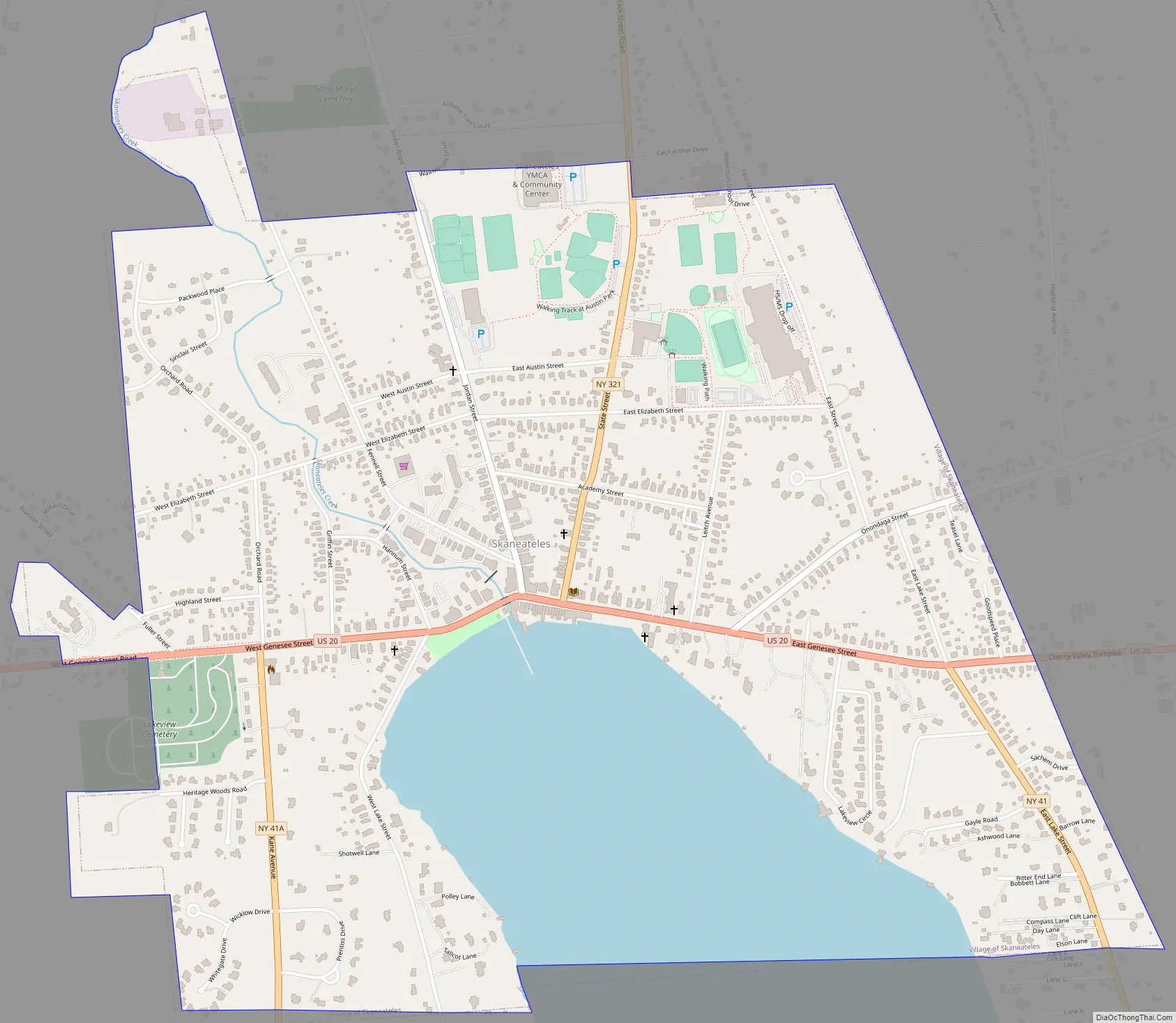
Skaneateles Road Map
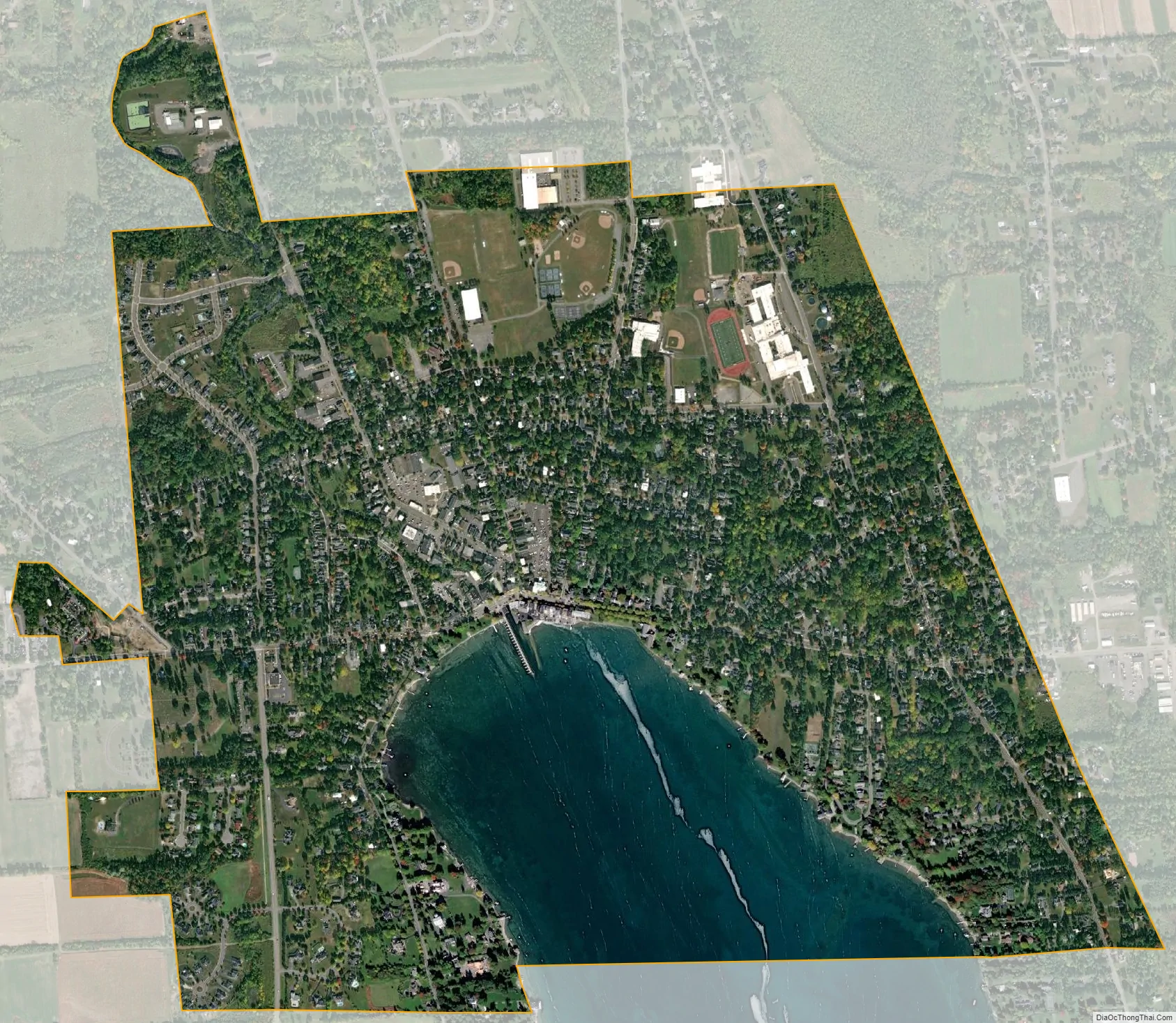
Skaneateles city Satellite Map
Geography
The village is located at the north end of Skaneateles Lake at the eastern end of the Finger Lakes region. According to the United States Census Bureau, the village has a total area of 1.7 sq mi (4.4 km), of which 1.4 sq mi (3.6 km) is land and 0.3 sq mi (0.78 km) is water.
The main highway through the community is U.S. Route 20 (Genesee Street), which heads westward toward Auburn. US 20 and Skaneateles also serve as the northern terminus of NY Route 41 and its suffixed route NY Route 41A. The village is also the southern terminus of NY Route 321.
See also
Map of New York State and its subdivision:- Albany
- Allegany
- Bronx
- Broome
- Cattaraugus
- Cayuga
- Chautauqua
- Chemung
- Chenango
- Clinton
- Columbia
- Cortland
- Delaware
- Dutchess
- Erie
- Essex
- Franklin
- Fulton
- Genesee
- Greene
- Hamilton
- Herkimer
- Jefferson
- Kings
- Lake Ontario
- Lewis
- Livingston
- Madison
- Monroe
- Montgomery
- Nassau
- New York
- Niagara
- Oneida
- Onondaga
- Ontario
- Orange
- Orleans
- Oswego
- Otsego
- Putnam
- Queens
- Rensselaer
- Richmond
- Rockland
- Saint Lawrence
- Saratoga
- Schenectady
- Schoharie
- Schuyler
- Seneca
- Steuben
- Suffolk
- Sullivan
- Tioga
- Tompkins
- Ulster
- Warren
- Washington
- Wayne
- Westchester
- Wyoming
- Yates
- Alabama
- Alaska
- Arizona
- Arkansas
- California
- Colorado
- Connecticut
- Delaware
- District of Columbia
- Florida
- Georgia
- Hawaii
- Idaho
- Illinois
- Indiana
- Iowa
- Kansas
- Kentucky
- Louisiana
- Maine
- Maryland
- Massachusetts
- Michigan
- Minnesota
- Mississippi
- Missouri
- Montana
- Nebraska
- Nevada
- New Hampshire
- New Jersey
- New Mexico
- New York
- North Carolina
- North Dakota
- Ohio
- Oklahoma
- Oregon
- Pennsylvania
- Rhode Island
- South Carolina
- South Dakota
- Tennessee
- Texas
- Utah
- Vermont
- Virginia
- Washington
- West Virginia
- Wisconsin
- Wyoming