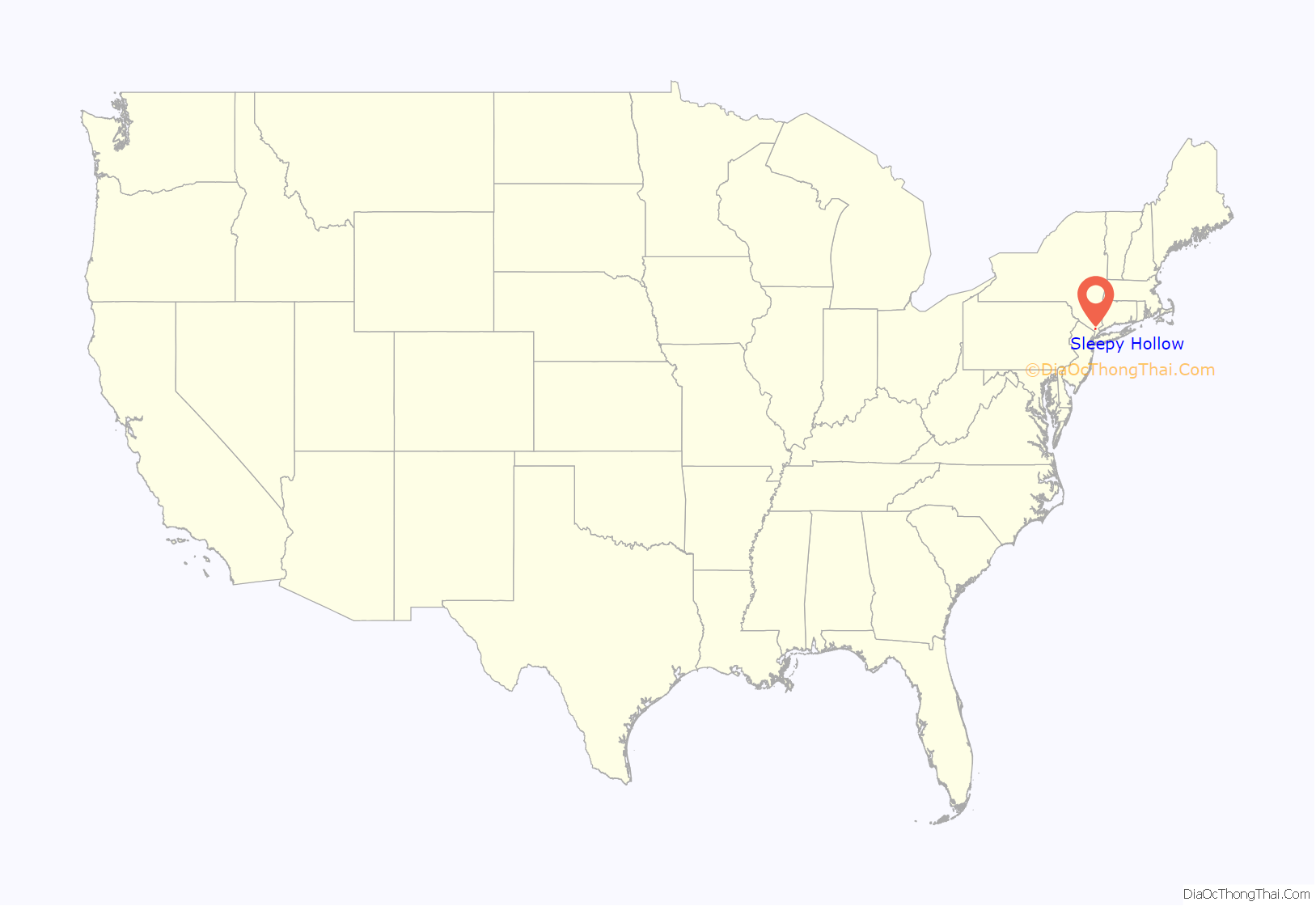
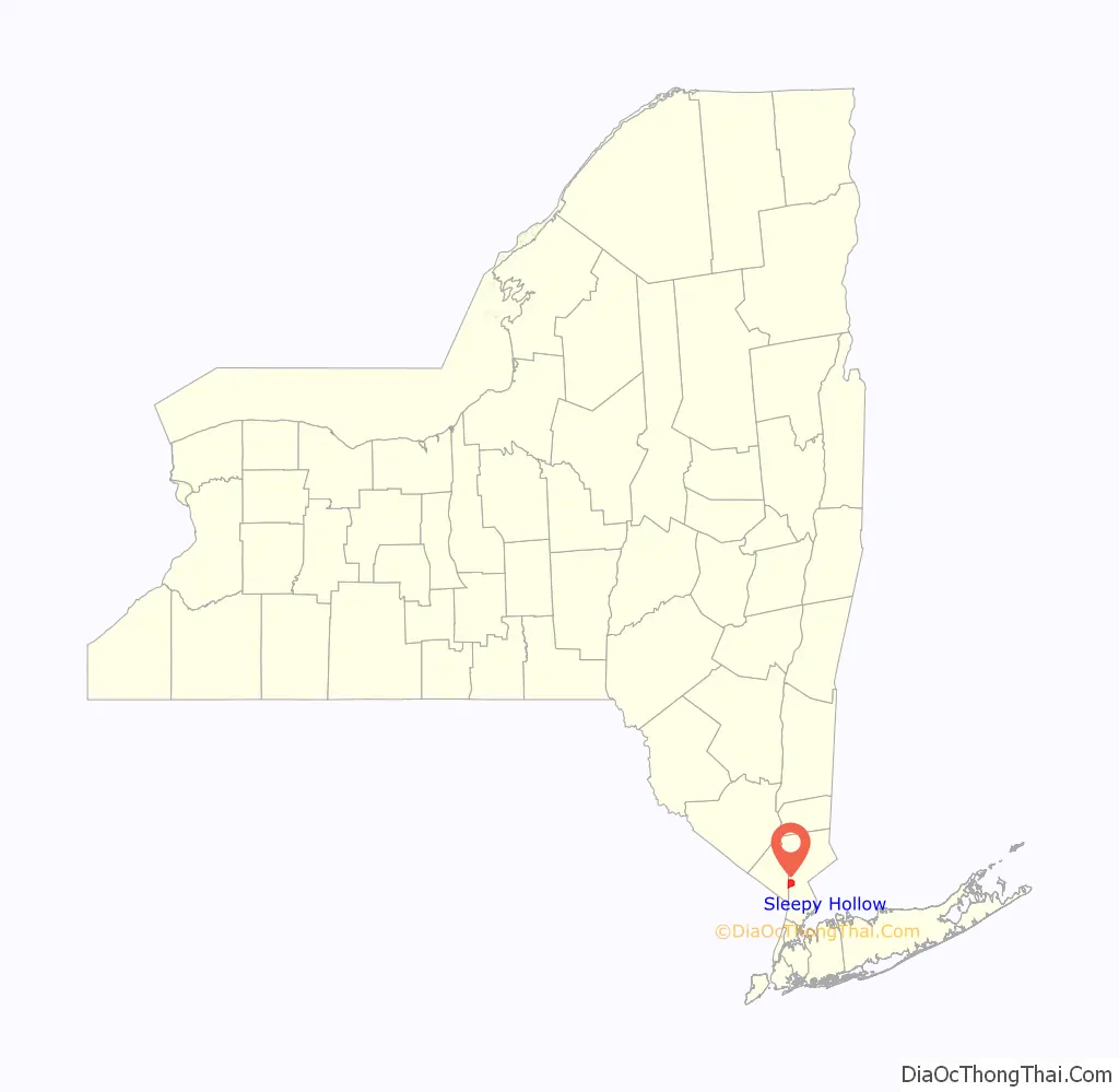
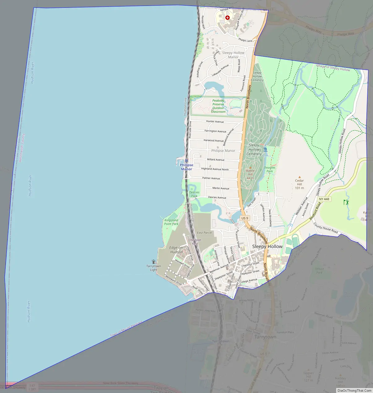
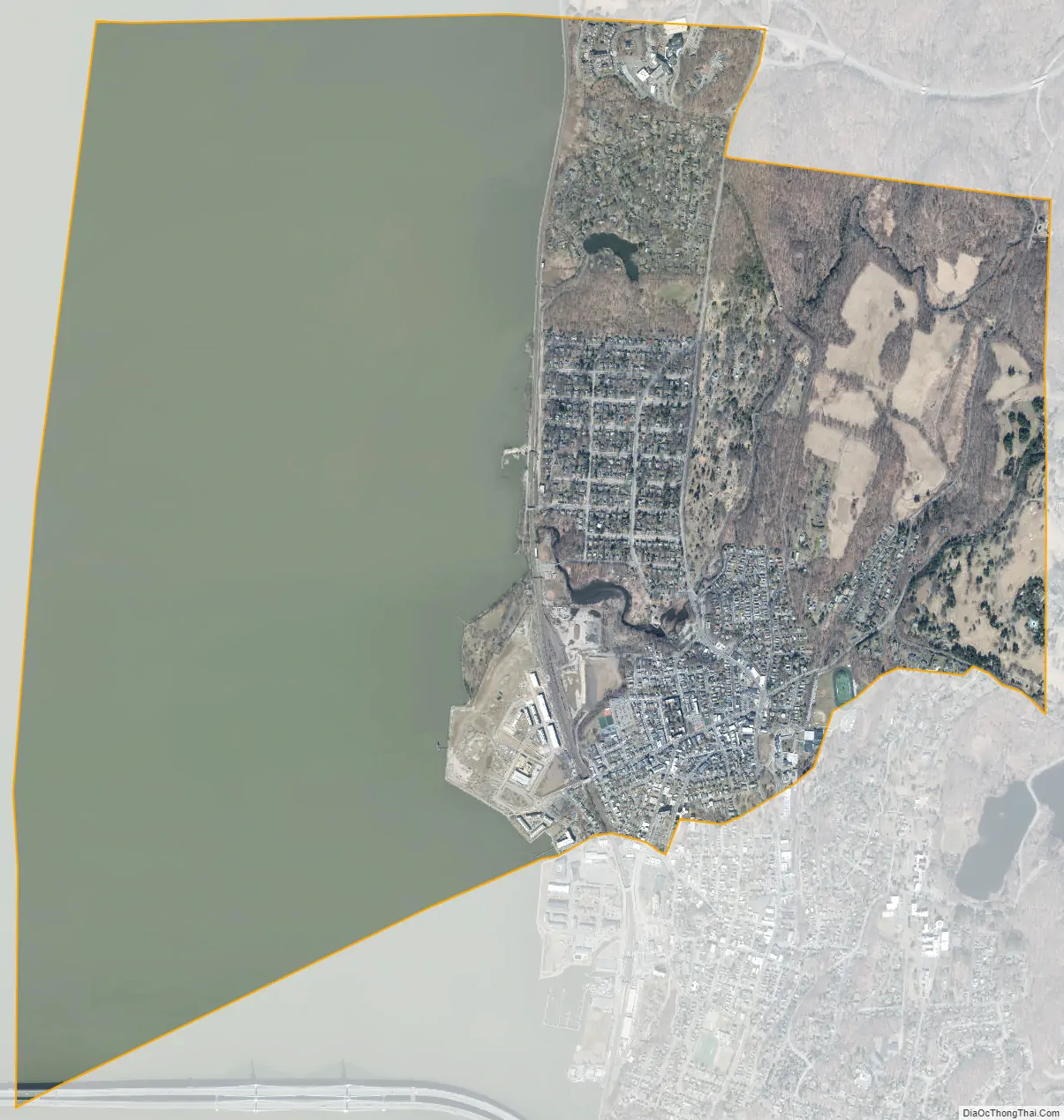
Sleepy Hollow is a village in the town of Mount Pleasant, in Westchester County, New York, United States. The village is located on the east bank of the Hudson River, about 30 miles (48 km) north of New York City, and is served by the Philipse Manor stop on the Metro-North Hudson Line. To the south of Sleepy Hollow is the village of Tarrytown, and to the north and east are unincorporated parts of Mount Pleasant. The population of the village at the 2020 census was 9,986.
Originally incorporated as North Tarrytown in the late 19th century, the village adopted its current name in 1996. The village is known internationally through “The Legend of Sleepy Hollow”, an 1820 short story about the local area and its infamous specter, the Headless Horseman, written by Washington Irving, who lived in Tarrytown and is buried in Sleepy Hollow Cemetery. Owing to this story, as well as the village’s roots in early American history and folklore, Sleepy Hollow is considered by some to be one of the “most haunted places in the world”. Despite this designation, Sleepy Hollow has also been called “the safest small ‘city’ [i.e., under 100,000 residents] in America”.
The village is home to the Philipsburg Manor House and the Old Dutch Church of Sleepy Hollow, as well as the Sleepy Hollow Cemetery, where in addition to Irving, numerous other notable people are buried.
| Name: | Sleepy Hollow village |
|---|---|
| LSAD Code: | 47 |
| LSAD Description: | village (suffix) |
| State: | New York |
| County: | Westchester County |
| Elevation: | 89 ft (27 m) |
| Total Area: | 5.21 sq mi (13.48 km²) |
| Land Area: | 2.24 sq mi (5.81 km²) |
| Water Area: | 2.96 sq mi (7.67 km²) |
| Total Population: | 9,986 |
| Population Density: | 4,452.07/sq mi (1,718.85/km²) |
| ZIP code: | 10591 |
| Area code: | 914 |
| FIPS code: | 3667638 |
| GNISfeature ID: | 0958934 |
| Website: | www.sleepyhollowny.gov |
Online Interactive Map
Click on ![]() to view map in "full screen" mode.
to view map in "full screen" mode.
Sleepy Hollow location map. Where is Sleepy Hollow village?
History
The land that would become Sleepy Hollow was first bought from Adriaen van der Donck, a patroon in New Netherland before the English takeover in 1664. Starting in 1672 Frederick Philipse began acquiring large parcels of land mainly in today’s southern Westchester County. Comprising some 52,000 acres (81 sq mi) of land, it was bounded by the Spuyten Duyvil Creek, the Croton River, the Hudson River, and the Bronx River. Philipse was granted a royal charter in 1693, creating the Manor of Philipsburg and establishing him as first lord.
In today’s Sleepy Hollow, he established an upper mill and shipping depot, today part of the Philipse Manor House historic site. A pious man, he was architect and financier of the town’s Old Dutch Church, and was said to have built the pulpit with his own hands.
When Philipse died in 1702, the manor was divided between his son, Adolphus Philipse, and his grandson, Frederick Philipse II. Adolph received the Upper Mills property, which extended from Dobbs Ferry to the Croton River. Frederick II was given the Lower Mills at the confluence of the Saw Mill and Hudson Rivers, the two parcels being reunited on his uncle’s death. His son, Frederick III, became the third lord of the manor in 1751.
In 1779, Frederick Philipse III, a Loyalist, was attainted for treason. The manor was confiscated and sold at public auction, split between 287 buyers. The largest tract of land (about 750 acres (300 ha)) was at the Upper Mills; it passed to numerous owners until 1951, when it was acquired by Sleepy Hollow Restorations. Thanks to the philanthropy of John D. Rockefeller Jr., about 20 acres (8.1 ha) were restored as today’s historic site.
Sleepy Hollow Road Map
Sleepy Hollow city Satellite Map
Geography
Sleepy Hollow is located at 41°5′31″N 73°51′52″W / 41.09194°N 73.86444°W / 41.09194; -73.86444 (41.091998, −73.864361). According to the United States Census Bureau, the village has a total area of 5.1 square miles (13 km), of which 2.3 square miles (6.0 km) is land and 2.8 square miles (7.3 km), or 55.58%, is water.
See also
Map of New York State and its subdivision:- Albany
- Allegany
- Bronx
- Broome
- Cattaraugus
- Cayuga
- Chautauqua
- Chemung
- Chenango
- Clinton
- Columbia
- Cortland
- Delaware
- Dutchess
- Erie
- Essex
- Franklin
- Fulton
- Genesee
- Greene
- Hamilton
- Herkimer
- Jefferson
- Kings
- Lake Ontario
- Lewis
- Livingston
- Madison
- Monroe
- Montgomery
- Nassau
- New York
- Niagara
- Oneida
- Onondaga
- Ontario
- Orange
- Orleans
- Oswego
- Otsego
- Putnam
- Queens
- Rensselaer
- Richmond
- Rockland
- Saint Lawrence
- Saratoga
- Schenectady
- Schoharie
- Schuyler
- Seneca
- Steuben
- Suffolk
- Sullivan
- Tioga
- Tompkins
- Ulster
- Warren
- Washington
- Wayne
- Westchester
- Wyoming
- Yates
- Alabama
- Alaska
- Arizona
- Arkansas
- California
- Colorado
- Connecticut
- Delaware
- District of Columbia
- Florida
- Georgia
- Hawaii
- Idaho
- Illinois
- Indiana
- Iowa
- Kansas
- Kentucky
- Louisiana
- Maine
- Maryland
- Massachusetts
- Michigan
- Minnesota
- Mississippi
- Missouri
- Montana
- Nebraska
- Nevada
- New Hampshire
- New Jersey
- New Mexico
- New York
- North Carolina
- North Dakota
- Ohio
- Oklahoma
- Oregon
- Pennsylvania
- Rhode Island
- South Carolina
- South Dakota
- Tennessee
- Texas
- Utah
- Vermont
- Virginia
- Washington
- West Virginia
- Wisconsin
- Wyoming


