Map of South Fallsburg CDP
South Fallsburg is a hamlet and census-designated place in Sullivan County, New York, United States. South Fallsburg is located within the Town of Fallsburg at 41°42′59″N 74°37′49″W / 41.71639°N 74.63028°W / 41.71639; -74.63028 (41.716489, -74.630279). South Fallsburg CDP overview: Name: South Fallsburg CDP LSAD Code: 57 LSAD Description: CDP (suffix) State: New York County: Sullivan ... Read more
Map of South Fallsburg CDP
Map of South Dayton village
South Dayton is a village in Cattaraugus County, New York, United States. The population was 564 at the 2020 census. The village lies within the town of Dayton by the southwest corner of the town and less than a mile from the border of Chautauqua County. South Dayton village overview: Name: South Dayton village LSAD ... Read more
Map of South Dayton village
Map of South Corning village
South Corning is a village in Steuben County, New York, United States. The population was 1,145 at the 2010 census. The Village of South Corning is in the Town of Corning. South Corning village overview: Name: South Corning village LSAD Code: 47 LSAD Description: village (suffix) State: New York County: Steuben County Elevation: 951 ft (290 m) ... Read more
Map of South Corning village
Map of South Blooming Grove village
South Blooming Grove is a village inside the Town of Blooming Grove in Orange County, New York, United States. As of the 2020 census the population was 3,973. It is part of the Poughkeepsie–Newburgh–Middletown, NY Metropolitan Statistical Area as well as the larger New York–Newark–Bridgeport, NY-NJ–CT–PA Combined Statistical Area. Robert Jeroloman was the village’s first ... Read more
Map of South Blooming Grove village
Map of Sound Beach CDP
Sound Beach, established in 1929, is a hamlet and census-designated place (CDP) in the north part of the Town of Brookhaven in Suffolk County, New York, United States. The population of the CDP was 7,612 at the 2010 census. Sound Beach CDP overview: Name: Sound Beach CDP LSAD Code: 57 LSAD Description: CDP (suffix) State: ... Read more
Map of Sound Beach CDP
Map of Solvay village
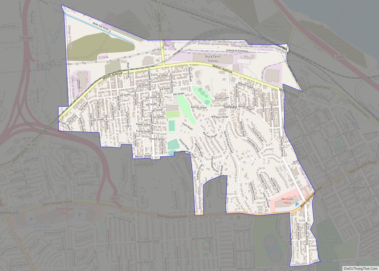
Solvay is a village located in the town of Geddes, Onondaga County, New York, United States, and a suburb of the city of Syracuse. As of the 2020 census, the population was 6,645. The village is named after the Solvay brothers, Belgian inventors of the chemical process employed by the Solvay Process Company, formerly the ... Read more
Map of Solvay village
Map of Sodus village
Sodus is a village in Wayne County, New York, United States. The population was 1,819 at the 2010 census. The Village of Sodus is near the center of the Town of Sodus and lies between Rochester and Syracuse. The village contains the government center for the Town of Sodus. Sodus village overview: Name: Sodus village ... Read more
Map of Sodus village
Map of Sodus Point village
Sodus Point is a village in Wayne County, New York, United States. The population was 900 at the 2010 census. However, the last official US Census in 2020 recorded the population at 822. The name is derived from a nearby body of water, Sodus Bay. It is considered to be within the larger Rochester metropolitan ... Read more
Map of Sodus Point village
Map of Smyrna village, New York
Smyrna is a village in Chenango County, New York, United States. The population was 213 at the 2010 census. The village is located in the town of Smyrna and is near the northern border of Chenango County. Smyrna village overview: Name: Smyrna village LSAD Code: 47 LSAD Description: village (suffix) State: New York County: Chenango ... Read more
Map of Smyrna village, New York
Map of South Hempstead CDP
South Hempstead is a hamlet and census-designated place (CDP) in the Town of Hempstead in Nassau County, on Long Island, in New York, United States. The population was 3,243 at the 2010 census. South Hempstead CDP overview: Name: South Hempstead CDP LSAD Code: 57 LSAD Description: CDP (suffix) State: New York County: Nassau County Elevation: ... Read more
Map of South Hempstead CDP
Map of South Glens Falls village
South Glens Falls is a village in Saratoga County, New York, United States. The population was 3,518 at the 2010 census. The village is in the northern part of the Town of Moreau, south of the City of Glens Falls. Cooper’s Cave, shown on the village seal, is named after the author, James Fenimore Cooper. ... Read more
Map of South Glens Falls village
Map of South Floral Park village
South Floral Park (formerly known as Jamaica Square) is a village in the Town of Hempstead in Nassau County, on Long Island, in New York, United States. The population was 1,741 at the 2020 census. At 0.096 square miles (0.25 km), the Incorporated Village of South Floral Park is the smallest village in the State of ... Read more
Map of South Floral Park village