Map of Spencerport village

Map of Spencerport village

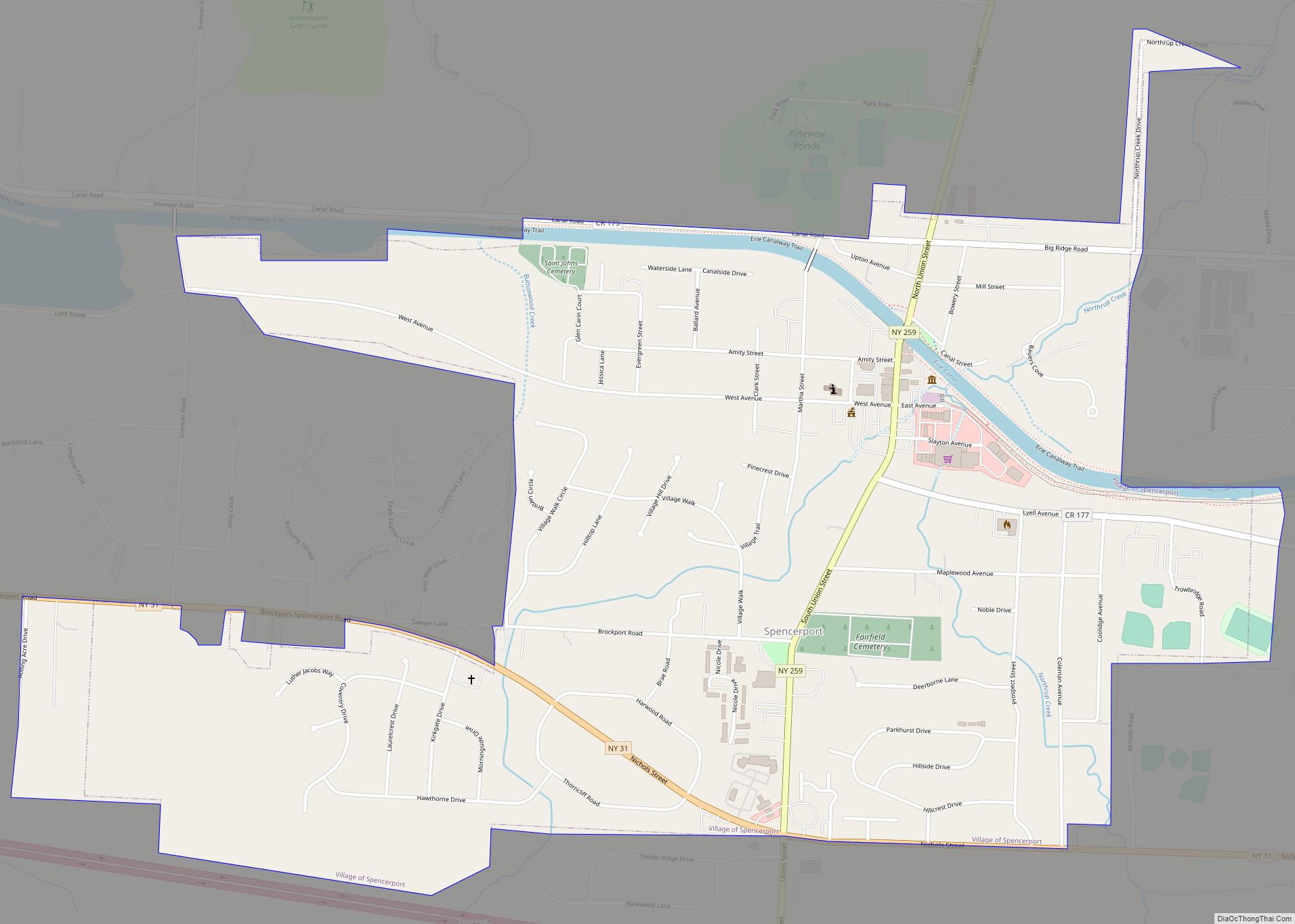
Spencerport is a village in Monroe County, New York, United States, and a suburb of Rochester. The population count was 3,601 at the 2010 census. The Village of Spencerport is within the Town of Ogden and is a village on the Erie Canal. Spencerport Airpark (D91) is a grass strip general aviation airport south of … Read more

Map of Spencer village, New York

Map of Spencer village, New York

Spencer is a village located in the Town of Spencer in Tioga County, New York, United States. The population was 759 at the 2010 census. It is part of the Binghamton Metropolitan Statistical Area. The town and village are named after Judge Ambrose Spencer. The Village of Spencer is located in the center of the … Read more

Map of Speculator village

Map of Speculator village

Speculator is a village in Hamilton County, New York, United States. The population was 406 at the 2020 census. The 2,966-foot (904 m) Speculator Mountain rises just south of the village. Speculator is the only incorporated village within Hamilton County and is within the town of Lake Pleasant. The village includes the northeastern end of a … Read more

Map of Sparkill CDP

Map of Sparkill CDP

Sparkill, formerly known as Tappan Sloat, is a suburban hamlet and census-designated place in the Town of Orangetown, Rockland County, New York, United States located north of Palisades; east of Tappan; south of Piermont and west of the Hudson River. As of the 2010 census, the CDP had a population of 1,565. The hamlet is … Read more

Map of Spackenkill CDP

Map of Spackenkill CDP

Spackenkill (/ˈspækənˌkɪl/) is a hamlet and census-designated place (CDP) in Dutchess County, New York, United States. The population was 4,123 at the 2010 census. It is part of the Poughkeepsie–Newburgh–Middletown, NY Metropolitan Statistical Area as well as the larger New York–Newark–Bridgeport, NY-NJ–CT–PA Combined Statistical Area. Spackenkill is in the town of Poughkeepsie. Children in the … Read more

Map of Stannards CDP

Map of Stannards CDP

Stannards is a hamlet (and census-designated place) located in the towns of Willing and Wellsville in Allegany County, New York, United States. The population was 798 at the 2010 census. The hamlet is named after early resident John Stannard. Stannards CDP overview: Name: Stannards CDP LSAD Code: 57 LSAD Description: CDP (suffix) State: New York … Read more

Map of Stamford village, New York

Map of Stamford village, New York

Stamford is a village in Delaware County, New York, United States. The population was 1,119 at the 2010 census. The village is located partly in the town of Stamford and partly in the town of Harpersfield. The village is on routes 23 and 10. The village has termed itself the “Queen of the Catskills”. Stamford … Read more

Map of Staatsburg CDP

Map of Staatsburg CDP

Staatsburg is a hamlet and census-designated place (CDP) in Hyde Park, a town in Dutchess County, New York, United States. The population was 377 at the 2010 census. It is part of the Poughkeepsie–Newburgh–Middletown, NY Metropolitan Statistical Area as well as the larger New York–Newark–Bridgeport, NY-NJ–CT–PA Combined Statistical Area. Staatsburg is located in the northwestern … Read more

Map of St. Regis Falls CDP

Map of St. Regis Falls CDP

St. Regis Falls is a census-designated place (CDP) in Waverly, Franklin County, New York, United States. The population of the CDP was 464 at the 2010 census. St. Regis Falls CDP overview: Name: St. Regis Falls CDP LSAD Code: 57 LSAD Description: CDP (suffix) State: New York County: Franklin County Elevation: 1,291 ft (393 m) Total Area: … Read more

Map of St. Johnsville village

Map of St. Johnsville village

St. Johnsville is a village in Montgomery County, New York, United States. The population was 1,732 at the 2010 census. Accounts vary as to the etymology of the name, but most of these credit Alexander St. John, an early surveyor and commissioner, while still others credit an early name for the area, St. John’s Church. … Read more

Map of St. James CDP, New York

Map of St. James CDP, New York

St. James is a hamlet and census-designated place (CDP) in Suffolk County, New York, United States. The population of the CDP was 13,487 at the 2020 census. St. James is part of the Town of Smithtown and is located on the North Shore of Long Island. The ZIP code is 11780. St. James CDP overview: … Read more

Map of St. Bonaventure CDP

Map of St. Bonaventure CDP

St. Bonaventure is a hamlet and census-designated place (CDP) in the town of Allegany in Cattaraugus County, New York, United States. The population was 1,963 at the 2020 census. This community, located between the village of Allegany and the city of Olean, is established around St. Bonaventure University. Since the campus comprises the majority of … Read more