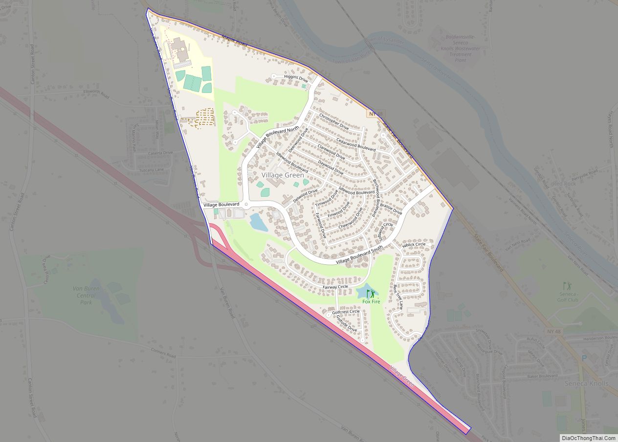
Map of Village of the Branch village

Map of Village of the Branch village

Village of the Branch is a village in the Town of Smithtown in Suffolk County, New York, United States. The population was 1,807 at the 2010 census. The village incorporated in 1927. The village shares its post office and ZIP code with the nearby hamlet of Smithtown, which is also the Town seat of the … Read more

Map of Wantagh CDP

Map of Wantagh CDP

Wantagh (/ˈwɒntɔː/ WAHN-taw) is a hamlet and census-designated place (CDP) in the Town of Hempstead in Nassau County, on Long Island, New York, United States. The population was 18,613 at the time of the 2020 census. Wantagh is known as “The Gateway to Jones Beach”. Wantagh CDP overview: Name: Wantagh CDP LSAD Code: 57 LSAD … Read more

Map of Wanakah CDP

Map of Wanakah CDP

Wanakah is a hamlet (and census-designated place) in the town of Hamburg in Erie County, New York, United States. As of the 2010 census, it had a population of 3,199. Wanakah is part of the Buffalo–Niagara Falls Metropolitan Statistical Area. Wanakah CDP overview: Name: Wanakah CDP LSAD Code: 57 LSAD Description: CDP (suffix) State: New … Read more

Map of Wampsville village

Map of Wampsville village

Wampsville is a village located inside the Town of Lenox in Madison County, New York, United States. The population was 543 as of the 2010 census. It is the county seat of Madison County. The Village of Wampsville is in the northern part of the county and near the eastern town line of Lenox. Wampsville … Read more

Map of Walton village, New York

Map of Walton village, New York

Walton is a village in the town of Walton in Delaware County, New York, United States. As of the 2010 census, the village population was 3,088. Walton is the home of the annual Delaware County Fair, which is typically held in August. There are three primary and secondary schools in Walton: Townsend Elementary School, Mack … Read more

Map of Walton Park CDP

Map of Walton Park CDP

Walton Park is a census-designated place (CDP) in Orange County, New York, United States. As of the 2020 census, the CDP had a total population of 3,907. Walton Park is on the town line separating the towns of Chester and Monroe. Street addresses within Walton Park are usually assigned to Monroe, not Chester. Walton Park … Read more

Map of Wallkill CDP

Map of Wallkill CDP

Wallkill is a hamlet (and census-designated place), generally identified as coterminous with ZIP code 12589, telephone exchange 895 in the 845 area code and most of the Wallkill Central School District located mostly in the eastern half of the town of Shawangunk, Ulster County, New York, United States, but partly spilling over into adjacent regions … Read more

Map of Walker Valley CDP

Map of Walker Valley CDP

Walker Valley is a hamlet (and census-designated place) located in the western part of the Town of Shawangunk in Ulster County, New York, United States, generally thought of as coterminous with the 12588 ZIP code. The population was 1,269 at the 2020 census. Walker Valley is one of the three geographic sections of the town … Read more

Map of Warsaw village, New York

Map of Warsaw village, New York

Warsaw is a village in Wyoming County, New York, United States. It is the county seat of Wyoming County and lies inside the Town of Warsaw. The village of Warsaw is near the center of the town in a valley. The population was 3,473 at the 2010 census. A branch of Genesee Community College is … Read more

Map of Warrensburg CDP, New York

Map of Warrensburg CDP, New York

Warrensburg is a census-designated place (CDP) in Warren County, New York, United States. The population was 3,208 at the 2000 census. It is part of the Glens Falls Metropolitan Statistical Area. Warrensburg is located on U.S. Route 9, on the Schroon River, east of the Hudson River, and west of Interstate 87 (The Northway). The … Read more

Map of Wappingers Falls village

Map of Wappingers Falls village

Wappingers Falls is a village in the towns of Poughkeepsie and Wappinger, in Dutchess County, New York, United States. As of the 2010 census it had a population of 5,522. The community was named for the cascade in Wappinger Creek. The Wappingers Falls post office covers areas in the towns of Wappinger, Poughkeepsie, Fishkill, East … Read more

Map of Waterville village, New York

Map of Waterville village, New York

Waterville (called Ska-na-wis, “long swamp” by the Haudenosaunee) is a village in Oneida County, New York, United States. According to the 2010 census, its population was 1,583. Waterville village overview: Name: Waterville village LSAD Code: 47 LSAD Description: village (suffix) State: New York County: Oneida County Elevation: 1,201 ft (366 m) Total Area: 1.42 sq mi (3.67 km²) Land Area: … Read more