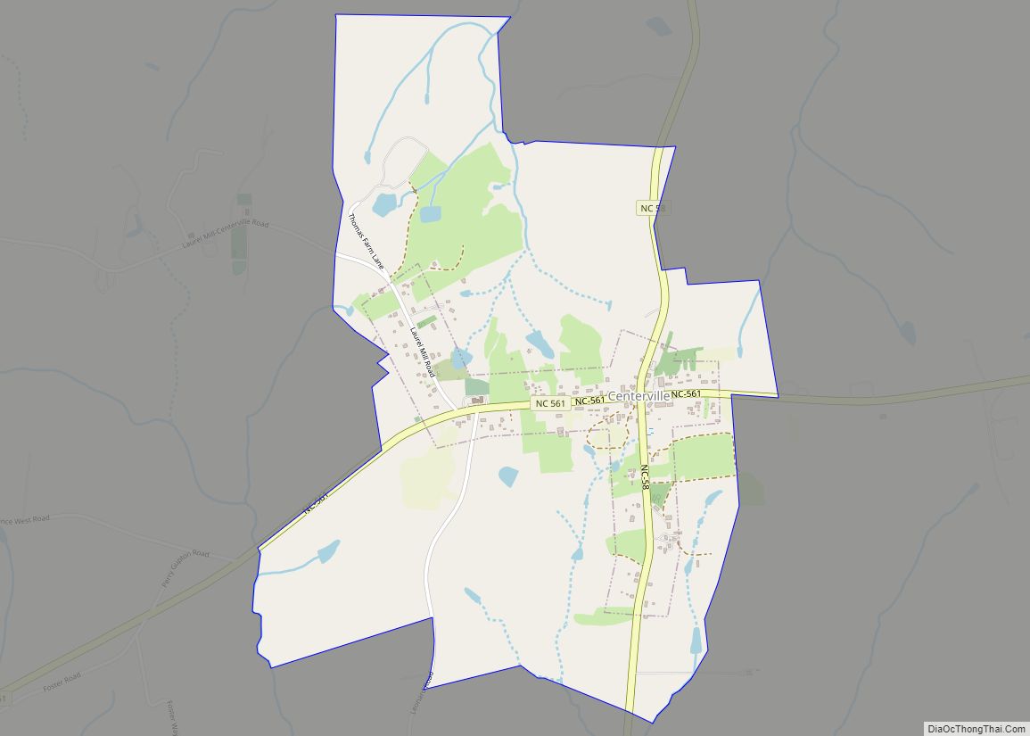
Centerville is a census-designated place (CDP) in the rural northeastern corner of Franklin County, North Carolina, United States. The population was 149 at the 2020 census. It was an incorporated town from 1965 to 2017. There is not a post office in Centerville, and thus no zip code; it simply uses that of Louisburg, which ... Read more
North Carolina Cities and Places
Cedar Rock is a village in Caldwell County, North Carolina, United States. The population was 300 at the 2010 census. Cedar Rock village overview: Name: Cedar Rock village LSAD Code: 47 LSAD Description: village (suffix) State: North Carolina County: Caldwell County Elevation: 1,184 ft (361 m) Total Area: 1.14 sq mi (2.95 km²) Land Area: 1.14 sq mi (2.95 km²) Water Area: 0.00 sq mi ... Read more
Cedar Point is a town in Carteret County, North Carolina, United States. The population was 1,297 in 2010. Cedar Point town overview: Name: Cedar Point town LSAD Code: 43 LSAD Description: town (suffix) State: North Carolina County: Carteret County Elevation: 20 ft (6 m) Total Area: 2.29 sq mi (5.94 km²) Land Area: 2.22 sq mi (5.76 km²) Water Area: 0.07 sq mi (0.18 km²) Total ... Read more
Catawba is a town in Catawba County, North Carolina, United States. The population was 603 at the 2010 census. It is part of the Hickory–Lenoir–Morganton Metropolitan Statistical Area. As with the county, the name recalls the Catawba people, the indigenous people who once inhabited the area. Catawba town overview: Name: Catawba town LSAD Code: 43 ... Read more
Caswell Beach is a small seaside town located on the Atlantic Ocean at the mouth of the Cape Fear River in Southeastern North Carolina, United States. Occupying the eastern part of Oak Island in Brunswick County, its population was listed at 395 in the 2020 census. Prominent features include the Civil War era Fort Caswell, ... Read more
Castle Hayne is a census-designated place (CDP) in New Hanover County, North Carolina, United States. The population was 1,202 at the 2010 census, up from 1,116 in 2000. It is part of the Wilmington Metropolitan Statistical Area. Planters and small farmers used slave labor to make full use of the region’s natural resources. The forest ... Read more
Castalia (pronounced “Cas-tale-yuh”), is a town in Nash County, North Carolina, United States. It is part of the Rocky Mount, North Carolina Metropolitan Statistical Area. The population was 268 at the 2010 census. Castalia town overview: Name: Castalia town LSAD Code: 43 LSAD Description: town (suffix) State: North Carolina County: Nash County Elevation: 308 ft (94 m) ... Read more
Cashiers is a census-designated place (CDP) and unincorporated village located in southern Jackson County, North Carolina, United States. As of the 2020 United States census, the community had a total population of 657, up from 157 at the 2010 census. Cashiers is pronounced KASH-erz locally, and is one of several communities in the area popular ... Read more
China Grove is a town in Rowan County, North Carolina, United States. The population was 4,434 at the 2020 census. The town is located just north of Landis and south of Salisbury. It was one of the first towns in the United States to have Rural Free Mail Delivery. The town was named for a ... Read more
Chimney Rock Village village overview: Name: Chimney Rock Village village LSAD Code: 47 LSAD Description: village (suffix) State: North Carolina County: Rutherford County FIPS code: 3712460 Online Interactive Map Chimney Rock Village online map. Source: Basemap layers from Google Map, Open Street Map (OSM), Arcgisonline, Wmflabs. Boundary Data from Database of Global Administrative Areas. Chimney ... Read more
Cherryville is a small city in northwestern Gaston County, North Carolina, United States. The population was 5,760 at the 2010 census. The New Year’s Shooters celebrate the area’s German heritage by beginning each year with a customary chant and the honorary shooting of muskets. Cherryville is located approximately 38 miles (61 km) west of Charlotte and ... Read more
Cherokee /ˈtʃɛrəkˌiː/ (Cherokee: ᏣᎳᎩ, romanized: Tsalagi) is a census-designated place (CDP) in Swain and Jackson counties in Western North Carolina, United States, within the Qualla Boundary land trust. Cherokee is located in the Oconaluftee River Valley around the intersection of U.S. Routes 19 and 441. As of the 2020 census, the CDP had a population of ... Read more