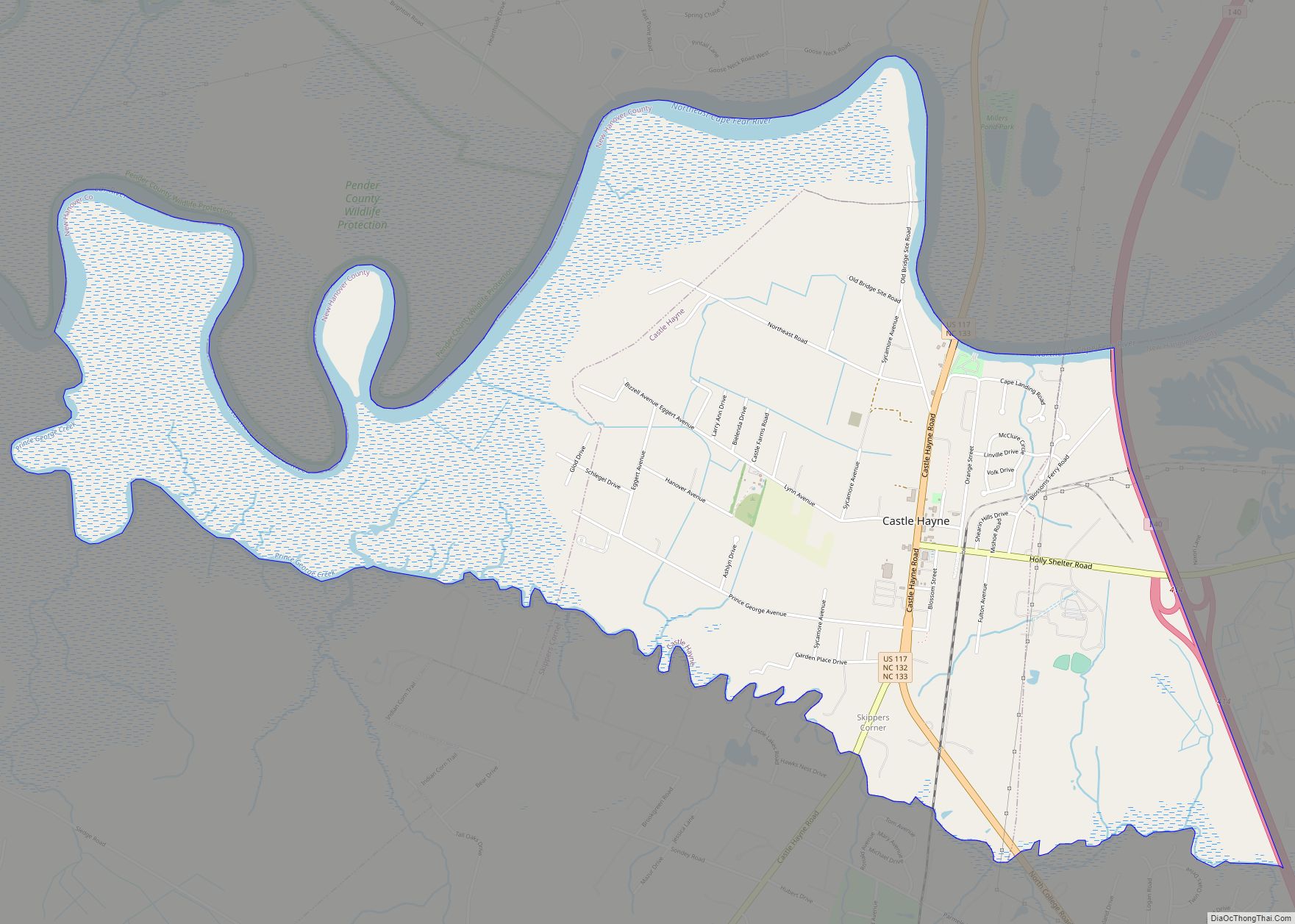
Castle Hayne is a census-designated place (CDP) in New Hanover County, North Carolina, United States. The population was 1,202 at the 2010 census, up from 1,116 in 2000. It is part of the Wilmington Metropolitan Statistical Area.
Planters and small farmers used slave labor to make full use of the region’s natural resources. The forest provided the region’s major industries through the 18th and most of the 19th century: naval stores and lumber fueled the economy both before and after the American Revolution. During the Revolutionary War, the British maintained a garrison at Fort Johnson near Wilmington. After suffering crippling losses at Guilford Court House, the British withdrew all forces back to Fort Johnson and abandoned plans to occupy North Carolina. This prompted the British to attack Yorktown, Virginia instead, which brought an end to the war.
| Name: | Castle Hayne CDP |
|---|---|
| LSAD Code: | 57 |
| LSAD Description: | CDP (suffix) |
| State: | North Carolina |
| County: | New Hanover County |
| Elevation: | 20 ft (6 m) |
| Total Area: | 5.15 sq mi (13.35 km²) |
| Land Area: | 4.76 sq mi (12.34 km²) |
| Water Area: | 0.39 sq mi (1.01 km²) |
| Total Population: | 1,243 |
| Population Density: | 260.92/sq mi (100.73/km²) |
| ZIP code: | 28429 |
| FIPS code: | 3710880 |
| GNISfeature ID: | 1019555 |
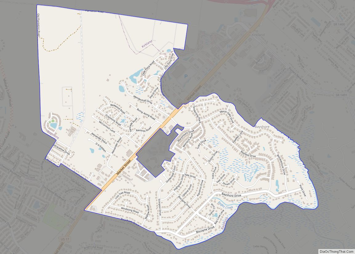
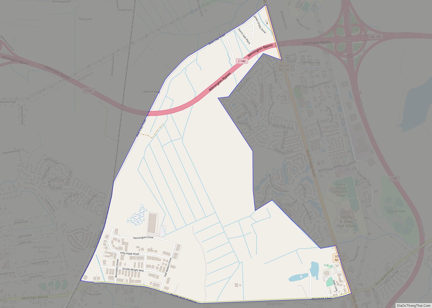
Online Interactive Map
Click on ![]() to view map in "full screen" mode.
to view map in "full screen" mode.
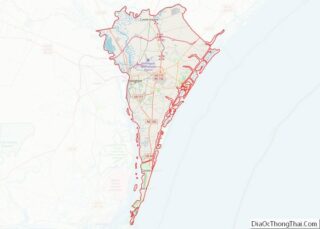
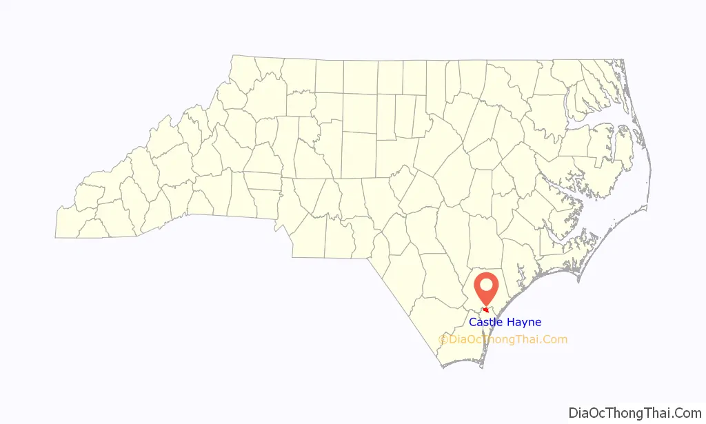
Castle Hayne location map. Where is Castle Hayne CDP?

History
The town took its name from the large house of Captain Roger Haynes.
Leading up to the 2011 election, there was a large movement among the residents to incorporate Castle Hayne to become the “Town of Castle Hayne”. Nearby Wilmington had previously forced an annexation of Monkey Junction in 2010 and proposed a forced annexation of Ogden, both of which had resulted in numerous lawsuits and appeals.
The incorporation referendum failed in November 2011.
Castle Hayne Road Map
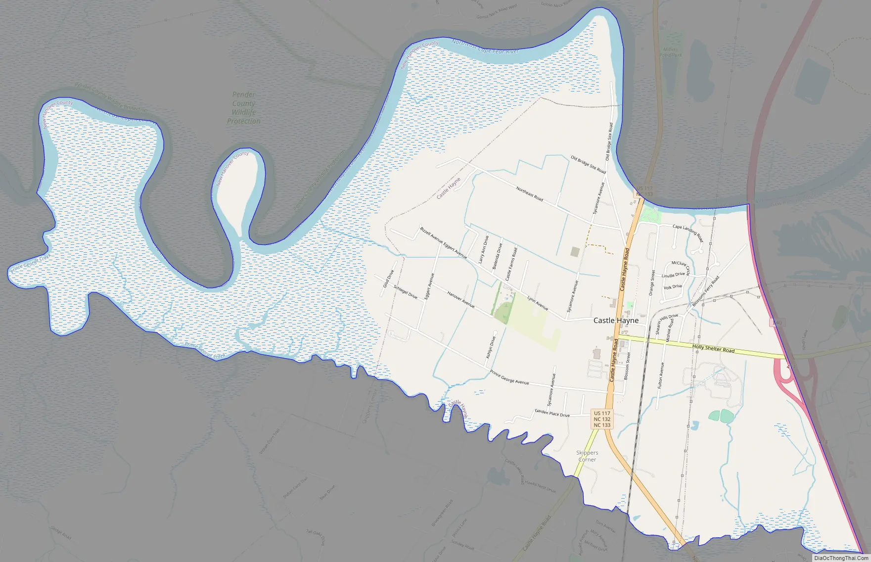
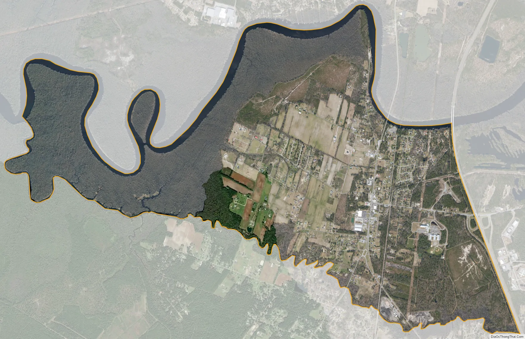
Castle Hayne city Satellite Map
Geography
Castle Hayne is located at 34°21′23″N 77°53′57″W / 34.35639°N 77.89917°W / 34.35639; -77.89917 (34.356353, -77.899126).
According to the United States Census Bureau, the CDP has a total area of 2.3 square miles (6.0 km), of which 2.2 square miles (5.7 km) is land and 0.04 square miles (0.10 km) (1.32%) is water.
See also
Map of North Carolina State and its subdivision:- Alamance
- Alexander
- Alleghany
- Anson
- Ashe
- Avery
- Beaufort
- Bertie
- Bladen
- Brunswick
- Buncombe
- Burke
- Cabarrus
- Caldwell
- Camden
- Carteret
- Caswell
- Catawba
- Chatham
- Cherokee
- Chowan
- Clay
- Cleveland
- Columbus
- Craven
- Cumberland
- Currituck
- Dare
- Davidson
- Davie
- Duplin
- Durham
- Edgecombe
- Forsyth
- Franklin
- Gaston
- Gates
- Graham
- Granville
- Greene
- Guilford
- Halifax
- Harnett
- Haywood
- Henderson
- Hertford
- Hoke
- Hyde
- Iredell
- Jackson
- Johnston
- Jones
- Lee
- Lenoir
- Lincoln
- Macon
- Madison
- Martin
- McDowell
- Mecklenburg
- Mitchell
- Montgomery
- Moore
- Nash
- New Hanover
- Northampton
- Onslow
- Orange
- Pamlico
- Pasquotank
- Pender
- Perquimans
- Person
- Pitt
- Polk
- Randolph
- Richmond
- Robeson
- Rockingham
- Rowan
- Rutherford
- Sampson
- Scotland
- Stanly
- Stokes
- Surry
- Swain
- Transylvania
- Tyrrell
- Union
- Vance
- Wake
- Warren
- Washington
- Watauga
- Wayne
- Wilkes
- Wilson
- Yadkin
- Yancey
- Alabama
- Alaska
- Arizona
- Arkansas
- California
- Colorado
- Connecticut
- Delaware
- District of Columbia
- Florida
- Georgia
- Hawaii
- Idaho
- Illinois
- Indiana
- Iowa
- Kansas
- Kentucky
- Louisiana
- Maine
- Maryland
- Massachusetts
- Michigan
- Minnesota
- Mississippi
- Missouri
- Montana
- Nebraska
- Nevada
- New Hampshire
- New Jersey
- New Mexico
- New York
- North Carolina
- North Dakota
- Ohio
- Oklahoma
- Oregon
- Pennsylvania
- Rhode Island
- South Carolina
- South Dakota
- Tennessee
- Texas
- Utah
- Vermont
- Virginia
- Washington
- West Virginia
- Wisconsin
- Wyoming