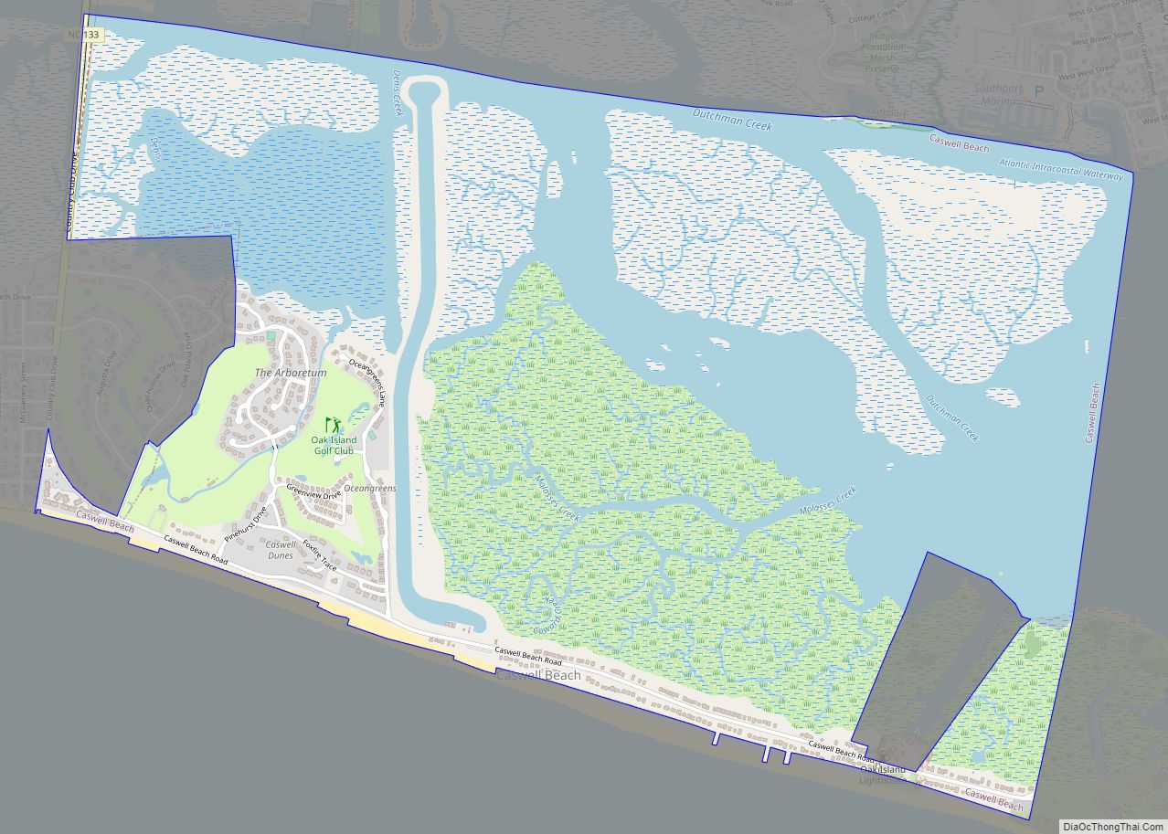
Caswell Beach is a small seaside town located on the Atlantic Ocean at the mouth of the Cape Fear River in Southeastern North Carolina, United States. Occupying the eastern part of Oak Island in Brunswick County, its population was listed at 395 in the 2020 census. Prominent features include the Civil War era Fort Caswell, the Oak Island Lighthouse co-located with the Oak Island Coast Guard Station, and the Oak Island Golf Club, the sole business in town and one of the few eighteen-hole courses located on a North Carolina barrier island. Along with the Town of Oak Island which occupies the central and west parts of the island, Caswell Beach is considered to be in the Myrtle Beach metropolitan area.
| Name: | Caswell Beach town |
|---|---|
| LSAD Code: | 43 |
| LSAD Description: | town (suffix) |
| State: | North Carolina |
| County: | Brunswick County |
| Elevation: | 10 ft (3 m) |
| Total Area: | 4.10 sq mi (10.62 km²) |
| Land Area: | 2.97 sq mi (7.69 km²) |
| Water Area: | 1.13 sq mi (2.93 km²) |
| Total Population: | 395 |
| Population Density: | 133.04/sq mi (51.37/km²) |
| ZIP code: | 28465 |
| FIPS code: | 3710960 |
| GNISfeature ID: | 1004807 |
| Website: | www.caswellbeach.org |
Online Interactive Map
Click on ![]() to view map in "full screen" mode.
to view map in "full screen" mode.
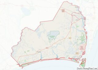
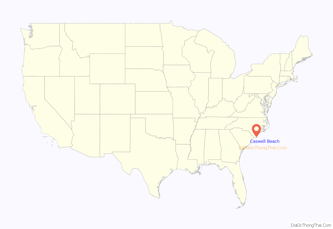
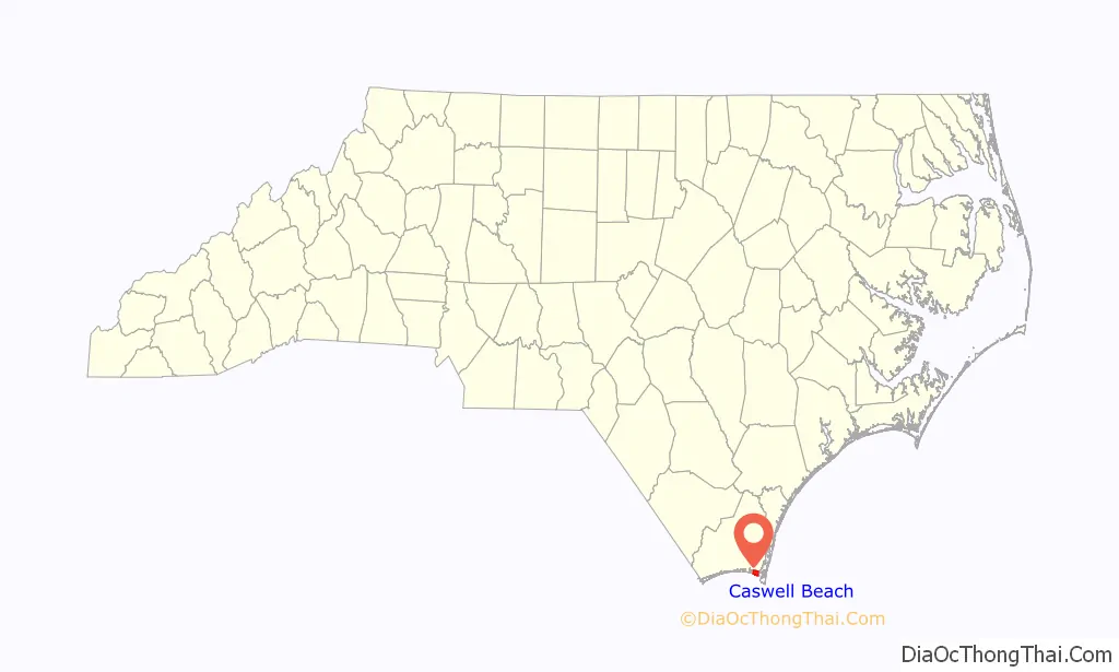
Caswell Beach location map. Where is Caswell Beach town?
History
Contiguous to Fort Caswell which dates from 1825, Caswell Beach was incorporated as a town in 1975; both were named for Richard Caswell, 1st & 5th Governor of North Carolina. The fort which is located on the extreme eastern end of Oak Island now houses the North Carolina Baptist Assembly, a Christian retreat and conference center and in 2013 it was designated a National Historic District. Also on the east end of town, the Oak Island Lighthouse which became operational in 1958 was acquired by the town in 2004 after extensive negotiations with the National Park Service. In 1975, the same year the town was incorporated, all 18 holes of the Oak Island Golf Club on the west end of town were first opened for play.
Caswell Beach slowly developed into a vacation resort community, but was plagued over the years by the incessant erosion of beach sand due to hurricanes and nor-easters. This erosion threatened the town’s main thoroughfare (Caswell Beach Rd) and made uninhabitable many ocean front houses. Installation of roadside sandbags provided temporary relief and its success prompted the town to set in motion an intensive restoration and preservation effort focused on installing sand fences and planting sea oats/beach grass. This work was abetted by the Wilmington Harbor Channel Project, which dumped huge amounts of sand on the beach as a least cost disposal option. This effort was very successful and widely recognized as the town received a national award in 2002 for Best Restored Beach.
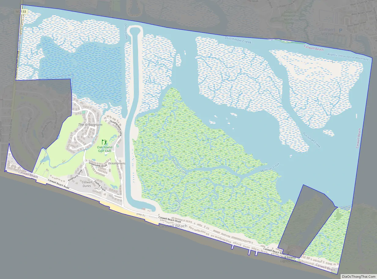
Caswell Beach Road Map
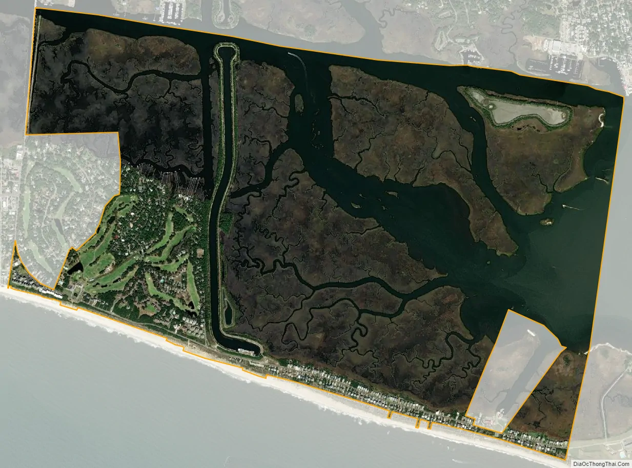
Caswell Beach city Satellite Map
Geography
Roughly halfway distant from Wilmington, North Carolina and Myrtle Beach, South Carolina, Caswell Beach is located on the east end of Oak Island at 33°54′13″N 78°3′38″W / 33.90361°N 78.06056°W / 33.90361; -78.06056 (33.903609, -78.060637). This island is the easternmost of the South Brunswick Islands which were formed in the late 1930s by the construction of the Intracoastal Waterway (ICW) which was dredged from Southport, NC at the mouth of the Cape Fear River through coastal sounds and marshes to the Little River in South Carolina. Elevations in the town range from sea level to approximately 25’while the town has a total area of 4.1 square miles (10.5 km), of which 2.9 square miles (7.6 km) is land.
See also
Map of North Carolina State and its subdivision:- Alamance
- Alexander
- Alleghany
- Anson
- Ashe
- Avery
- Beaufort
- Bertie
- Bladen
- Brunswick
- Buncombe
- Burke
- Cabarrus
- Caldwell
- Camden
- Carteret
- Caswell
- Catawba
- Chatham
- Cherokee
- Chowan
- Clay
- Cleveland
- Columbus
- Craven
- Cumberland
- Currituck
- Dare
- Davidson
- Davie
- Duplin
- Durham
- Edgecombe
- Forsyth
- Franklin
- Gaston
- Gates
- Graham
- Granville
- Greene
- Guilford
- Halifax
- Harnett
- Haywood
- Henderson
- Hertford
- Hoke
- Hyde
- Iredell
- Jackson
- Johnston
- Jones
- Lee
- Lenoir
- Lincoln
- Macon
- Madison
- Martin
- McDowell
- Mecklenburg
- Mitchell
- Montgomery
- Moore
- Nash
- New Hanover
- Northampton
- Onslow
- Orange
- Pamlico
- Pasquotank
- Pender
- Perquimans
- Person
- Pitt
- Polk
- Randolph
- Richmond
- Robeson
- Rockingham
- Rowan
- Rutherford
- Sampson
- Scotland
- Stanly
- Stokes
- Surry
- Swain
- Transylvania
- Tyrrell
- Union
- Vance
- Wake
- Warren
- Washington
- Watauga
- Wayne
- Wilkes
- Wilson
- Yadkin
- Yancey
- Alabama
- Alaska
- Arizona
- Arkansas
- California
- Colorado
- Connecticut
- Delaware
- District of Columbia
- Florida
- Georgia
- Hawaii
- Idaho
- Illinois
- Indiana
- Iowa
- Kansas
- Kentucky
- Louisiana
- Maine
- Maryland
- Massachusetts
- Michigan
- Minnesota
- Mississippi
- Missouri
- Montana
- Nebraska
- Nevada
- New Hampshire
- New Jersey
- New Mexico
- New York
- North Carolina
- North Dakota
- Ohio
- Oklahoma
- Oregon
- Pennsylvania
- Rhode Island
- South Carolina
- South Dakota
- Tennessee
- Texas
- Utah
- Vermont
- Virginia
- Washington
- West Virginia
- Wisconsin
- Wyoming