Map of Hillsborough town, North Carolina
The town of Hillsborough is the county seat of Orange County, North Carolina, United States and is located along the Eno River. The population was 6,087 in 2010, but it grew rapidly to 9,660 by 2020. Its name was unofficially shortened to “Hillsboro” during the 19th century. In the late 1960s, residents voted to change ... Read more
Map of Hillsborough town, North Carolina
Map of Hildebran town
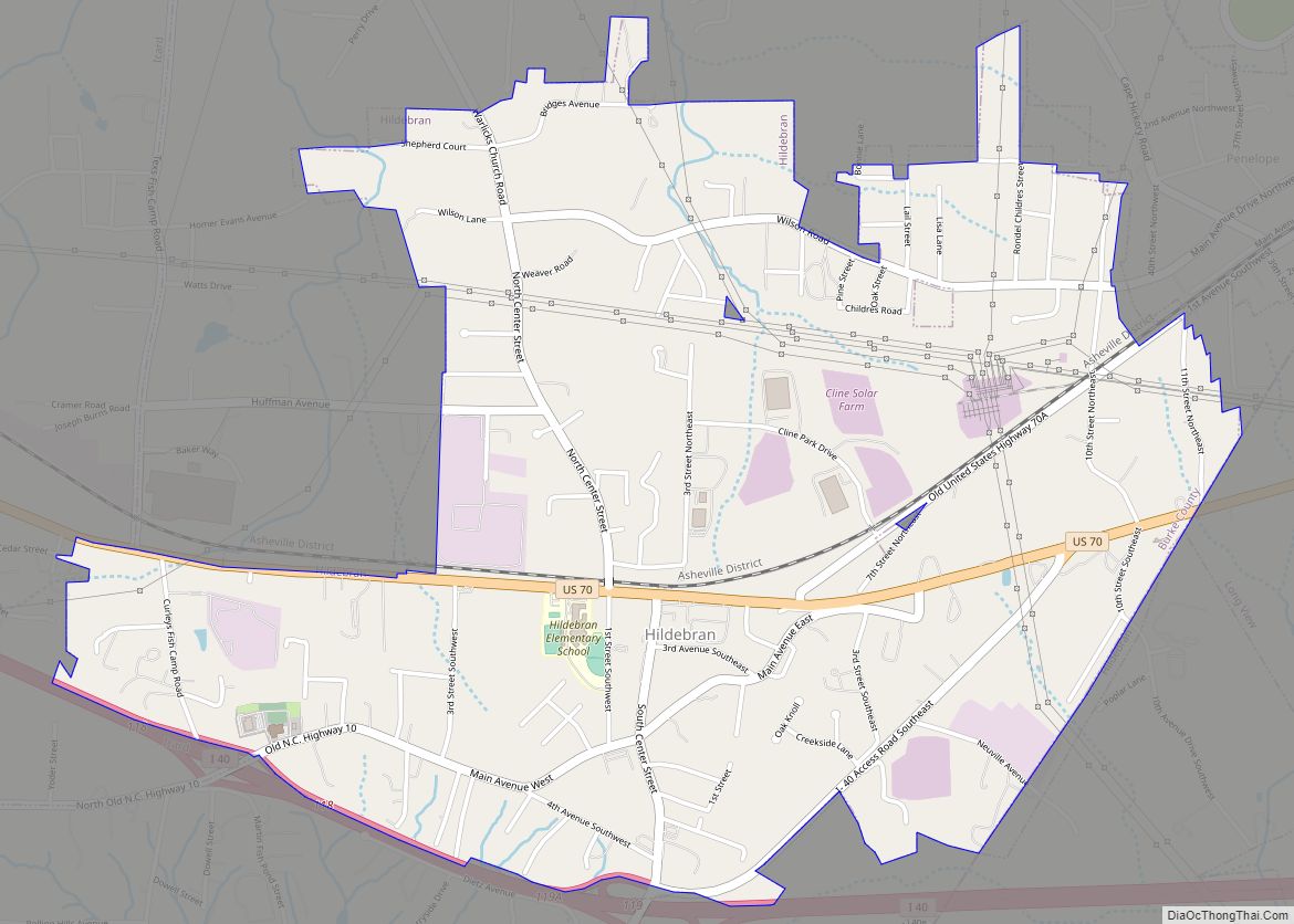
Hildebran is a town in Burke County, North Carolina, United States. The population was 2,023 at the 2010 census. It is part of the Hickory–Lenoir–Morganton Metropolitan Statistical Area. Hildebran town overview: Name: Hildebran town LSAD Code: 43 LSAD Description: town (suffix) State: North Carolina County: Burke County Incorporated: 1899 Elevation: 1,188 ft (362 m) Total Area: 2.83 sq mi ... Read more
Map of Hildebran town
Map of Hightsville CDP
Hightsville is a census-designated place (CDP) in New Hanover County, North Carolina, United States. The population was 739 at the 2010 census. It is part of the Wilmington Metropolitan Statistical Area. Hightsville CDP overview: Name: Hightsville CDP LSAD Code: 57 LSAD Description: CDP (suffix) State: North Carolina County: New Hanover County Elevation: 20 ft (6 m) Total ... Read more
Map of Hightsville CDP
Map of Highlands town, North Carolina
Highlands is an incorporated town in Macon County in the U.S. state of North Carolina. Located on a plateau in the southern Appalachian Mountains, within the Nantahala National Forest, it lies mostly in southeastern Macon County and slightly in southwestern Jackson County, in the Highlands and Cashiers Townships, respectively. The permanent population was 1,014 at ... Read more
Map of Highlands town, North Carolina
Map of High Shoals city
High Shoals is a city in Gaston County, North Carolina, United States, named for the high rocky shoal across the Catawba River. The population was 696 at the 2010 census. High Shoals city overview: Name: High Shoals city LSAD Code: 25 LSAD Description: city (suffix) State: North Carolina County: Gaston County Incorporated: November 6, 1973 ... Read more
Map of High Shoals city
Map of Hiddenite CDP
Hiddenite CDP overview: Name: Hiddenite CDP LSAD Code: 57 LSAD Description: CDP (suffix) State: North Carolina County: Alexander County FIPS code: 3731260 Online Interactive Map Hiddenite online map. Source: Basemap layers from Google Map, Open Street Map (OSM), Arcgisonline, Wmflabs. Boundary Data from Database of Global Administrative Areas. Hiddenite location map. Where is Hiddenite CDP? ... Read more
Map of Hiddenite CDP
Map of Hickory city, North Carolina
Hickory is a North Carolina city located approximately 60 miles (97 km) northwest of Charlotte. Its population in the 2020 census was 43,490. Primarily located in Catawba County, its formal boundaries extend into Burke and Caldwell counties. Hickory is the principal city of the Hickory–Lenoir–Morganton Metropolitan Statistical Area, which had a population of 365,276 in the ... Read more
Map of Hickory city, North Carolina
Map of Hertford town
Hertford is a town and the county seat of Perquimans County, North Carolina, United States. The current population of Hertford, North Carolina is 1,912 based on the 2020 census. The US Census estimates the 2021 population at 1,925. The last official US Census in 2010 recorded the population at 2,143. Hertford is located in North ... Read more
Map of Hertford town
Map of Hookerton town
Hookerton is a town in Greene County, North Carolina, United States. The population was 409 at the 2010 census. It is geographically located southeast of Snow Hill on North Carolina Highway 123. The town is part of the Greenville Metropolitan Area. Hookerton town overview: Name: Hookerton town LSAD Code: 43 LSAD Description: town (suffix) State: ... Read more
Map of Hookerton town
Map of Holly Springs town, North Carolina
Holly Springs is a town in Wake County, North Carolina, United States. As of the 2020 census, the town population was 41,239, a 67% increase from 2010. Holly Springs town overview: Name: Holly Springs town LSAD Code: 43 LSAD Description: town (suffix) State: North Carolina County: Wake County Elevation: 440 ft (130 m) Total Area: 18.69 sq mi (48.39 km²) ... Read more
Map of Holly Springs town, North Carolina
Map of Holly Ridge town
Holly Ridge is a town in Onslow County, North Carolina, United States. The 2010 population was 1,268. It is part of the Jacksonville, North Carolina Metropolitan Statistical Area. It is considered the gateway to Topsail Island. Population Boom: In 1940, the town had 28 residents. Just three years later in 1943, the town had ballooned ... Read more
Map of Holly Ridge town
Map of Hollister CDP, North Carolina
Hollister is a census-designated place and unincorporated community in Halifax County in northeastern North Carolina, United States. As of the 2010 census it had a population of 674. Hollister’s ZIP code is 27844. Hollister CDP overview: Name: Hollister CDP LSAD Code: 57 LSAD Description: CDP (suffix) State: North Carolina County: Halifax County Elevation: 246 ft (75 m) ... Read more
Map of Hollister CDP, North Carolina