The town of Hillsborough is the county seat of Orange County, North Carolina, United States and is located along the Eno River. The population was 6,087 in 2010, but it grew rapidly to 9,660 by 2020.
Its name was unofficially shortened to “Hillsboro” during the 19th century. In the late 1960s, residents voted to change the name back to its original, historic spelling.
| Name: | Hillsborough town |
|---|---|
| LSAD Code: | 43 |
| LSAD Description: | town (suffix) |
| State: | North Carolina |
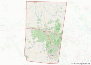
| County: | Orange County |
| Total Area: | 5.67 sq mi (14.67 km²) |
| Land Area: | 5.59 sq mi (14.49 km²) |
| Water Area: | 0.07 sq mi (0.19 km²) |
| Total Population: | 9,660 |
| Population Density: | 1,726.85/sq mi (666.76/km²) |
| ZIP code: | 27278 |
| Area code: | 919 |
| FIPS code: | 3731620 |
| Website: | www.ci.hillsborough.nc.us |
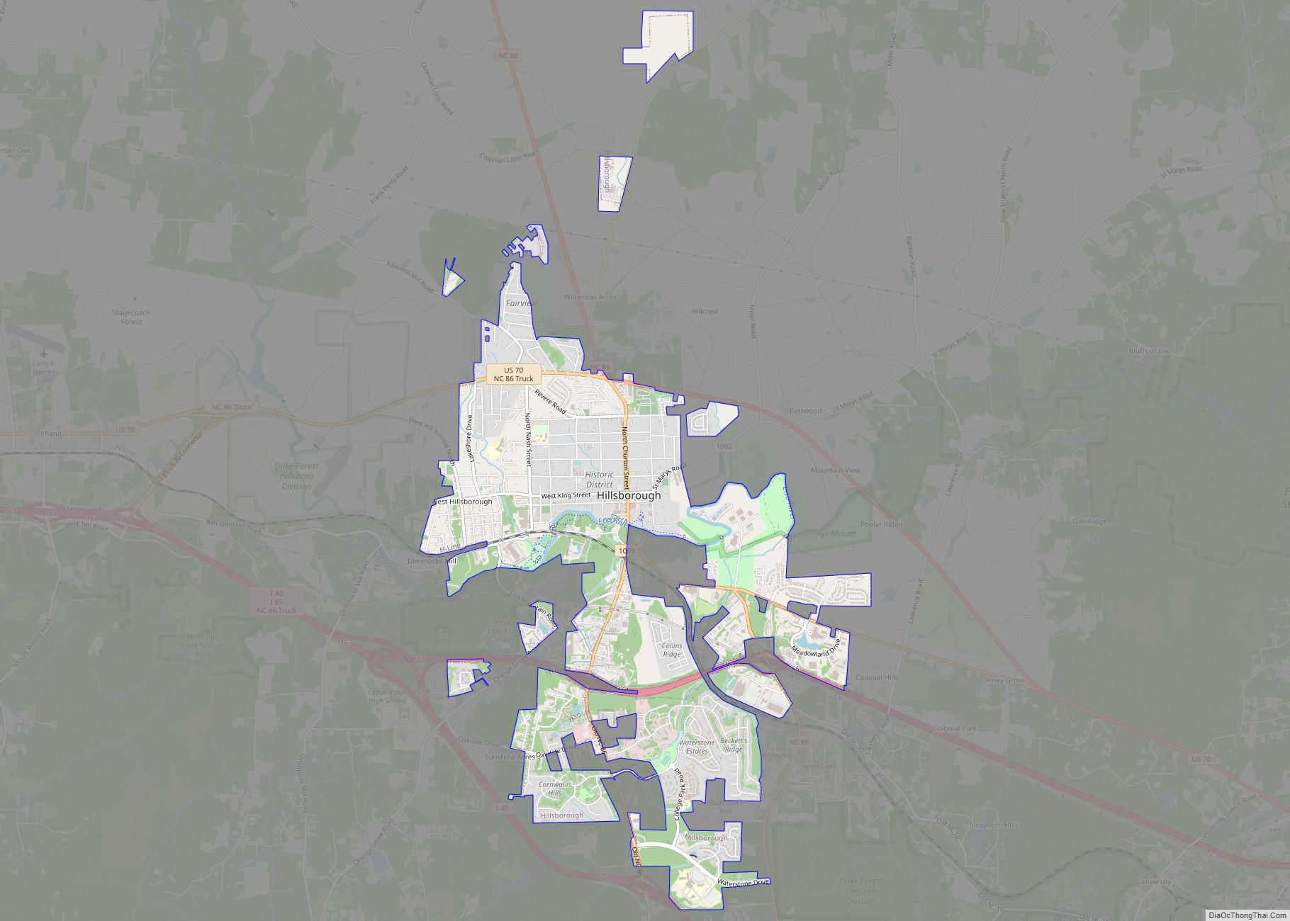
Online Interactive Map
Click on ![]() to view map in "full screen" mode.
to view map in "full screen" mode.
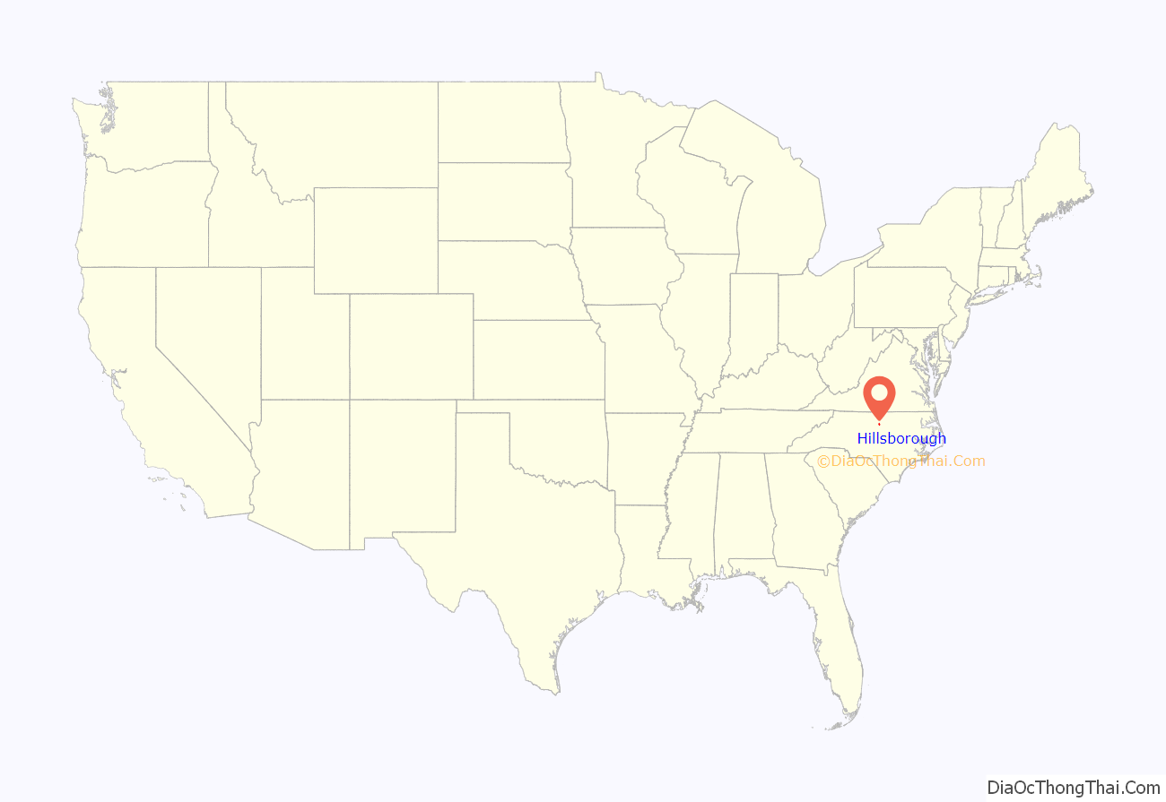
Hillsborough location map. Where is Hillsborough town?
History
Native American history
Local Native American groups had lived in the Hillsborough area for thousands of years by the time Spanish explorers entered the region. The Great Indian Trading Path, used by generations of Native Americans, crossed the Eno River in this area. Historic Siouan-language tribes such as the Occaneechi and the Eno were living in the Hillsborough area at the time of European contact. The English explorer John Lawson recorded visiting “Occaneechi Town” here when he traveled through North Carolina in 1701. The tribes suffered high losses due to new infectious diseases and conflicts with settlers; most of the survivors were eventually pushed out of their territory by British and other European settlers.
English settlers developed Hillsborough at the site of the former Occaneechi village along the Eno River. In the early 18th century, the Occaneechi left Hillsborough for Virginia, though they returned to the area around 1780.
In the 1980s, an archaeological team from UNC-Chapel Hill excavated an historic Occaneechi farming village in this area. A replica of an Occaneechi village was built close to their original site of settlement near the Eno River.
Colonial period and Revolutionary War
Hillsborough was founded in 1754 and was first owned, surveyed, and mapped by William Churton (a surveyor for Earl Granville). Originally to be named Orange, it was first named Corbin Town (for Francis Corbin, a member of the governor’s council and one of Granville’s land agents). It was renamed in 1759 as Childsburgh (in honor of Thomas Child, the attorney general for North Carolina from 1751 to 1760 and another of Granville’s land agents). It was not until 1766 that it was named Hillsborough, after Wills Hill, then the Earl of Hillsborough, the British secretary of state for the colonies, and a relative of royal Governor William Tryon.
Hillsborough was an early Piedmont colonial town where court was held, and was the scene of some pre-Revolutionary War tensions. In the late 1760s, tensions between Piedmont farmers and county officers arose in the Regulator movement, which had its strongest support in Hillsborough. With specie scarce, many inland farmers found themselves unable to pay their taxes and resented the consequent seizure of their property. Local sheriffs sometimes kept taxes for their own gain and sometimes charged twice for the same tax. Governor William Tryon’s conspicuous consumption in the construction of a new governor’s mansion at New Bern exacerbated the movement’s resentment.
As the western districts were under-represented in the colonial legislature, farmers had difficulty gaining redress from the legislature. Ultimately, the frustrated farmers took to arms and closed the court in Hillsborough, dragging those they considered corrupt officials through the streets. Tryon and North Carolina militia troops marched to the region and defeated the Regulators at the Battle of Alamance in May 1771. Several trials were held after the war, resulting in the hanging of six Regulators at Hillsborough on June 19, 1771.
The North Carolina Provincial Congress met in Hillsborough from August 20–September 10, 1775, at the outset of the American Revolution. The North Carolina General Assembly met here in 1778, 1782, and 1783. The town was also the site of the first North Carolina ratifying convention, which met July 21–August 2, 1788, to deliberate and determine whether or not to ratify the Constitution recommended to the states by the Constitutional Convention held in Philadelphia the previous summer. With the hope of effecting the incorporation of a Bill of Rights into the frame of government, delegates voted (184–84) to neither ratify nor reject the Constitution. During the bicentennial celebration of the writing and ratification of the Constitution, a historical marker was placed at the site (now the Hillsborough Presbyterian Church) commemorating the convention.
William Hooper, a signer of the Declaration of Independence, was buried in the Presbyterian Church cemetery in October 1790. However, his remains were later reinterred at Guilford Court House Military Battlefield. His original gravestone remains in the town cemetery.
Antebellum period and American Civil War
Robert and Margaret Anna (née Robertson) Burwell ran a girl’s academy called the Burwell School from 1837 to 1857 in their home on Churton Street.
When the Civil War began, Hillsborough residents were reluctant to support secession, but many men went off to fight for the Confederacy. In March 1865, Confederate General Joseph E. Johnston wintered just outside Hillsborough at the large Dickson home. In the early 1980s this house was moved downtown in order to preserve it from commercial development; it now serves as the Hillsborough Welcome Center. The main portion of the Confederate Army of Tennessee was encamped around Greensboro.
After sweeping through the South on his March to the Sea, Union General William T. Sherman camped in Raleigh. He offered an armistice to Johnston, who agreed to meet to discuss terms of surrender. Johnston, traveling east from Hillsborough, and Sherman, traveling west from Raleigh along the Hillsborough-Raleigh Road, met approximately halfway near present-day Durham (then Durham Station) at the home of James and Nancy Bennett. This farmhouse is now known as Bennett Place. The two generals met three times on April 17, 18, and finally on April 26, when they agreed on the final terms of surrender. Johnston surrendered 89,270 Southern troops who were still active in North Carolina, South Carolina, Georgia, and Florida. This was the largest surrender of troops during the war, and effectively ended the conflict.
Historic sites
There are numerous historical sites to visit in Hillsborough, including some dating to the late eighteenth century. More than 100 surviving late eighteenth and nineteenth-century structures help illustrate its history of prominence in the early period of the state.
In addition, numerous secondary buildings, bridges, mill sites and dams along the Eno River document the local history. Native American relics have been recovered from the sites of ancient villages thousands of years old.
The Hillsborough Visitors Center operates from this late-18th century Quaker-plan house. It was moved from its original location 1 mi (1.6 km) southeast of Hillsborough to its present location in the historic district. The site includes an office used by Confederate Gen. Joseph E. Johnston.
The Old Orange County Courthouse is an 1844 Greek-revival building designed and built by local builder John Berry. The courthouse is still used for county judicial business.
Ayr Mount is an 1815 Federal-era plantation house, restored and furnished with period antiques and fine art. The estate includes the 1 mi (1.6 km)-long Poet’s Walk.
Green Hill is a 1750 Federal-style plantation house.
The name comes from the teardrop-shaped glass on the front doors and the molding around the eaves of the house. It was owned by Edmund Fanning until 1768, when he sold it to Thomas King, an inn keeper.
The main body of the present structure is probably King’s old inn. Notable eighteenth-century owners include General Thomas Person, Peter Malett, William Duffy, and John Taylor, who was clerk of the Superior Court from 1800 to 1845.
In 1938, the J.W. Richmond family bought the property and renovated the house as a private residence. After additional renovations, Richmond adapted it as ‘The Inn at Teardrops’, a bed and breakfast.
Margaret Lane Cemetery, sometimes called the Old Slave Cemetery, first appears in written records in 1885. It is believed that Peter Brown Ruffin, a landowner and employer to the west of Hillsborough, bought the two 1-acre (0.40 ha) lots that comprise the cemetery from the town in 1854 to use as a burial ground.
Occoneechee Speedway, just outside Hillsborough, was one of the first two NASCAR tracks to open in 1949. The track was made up of dirt. It is one of two tracks remaining from that inaugural season, Martinsville Speedway being the other. Today, the site has been preserved as a trail.
The Historic Occoneechee Speedway Trail (HOST) is a 3 mi (4.8 km)-trail located on 44 acres (180,000 m) at the site of the former Speedway. Bill France and the early founders of NASCAR bought land to build a 1 mi (1.6 km) oval track at Hillsborough, but opposition from local religious leaders prevented the track from being built in the town. Instead, NASCAR officials moved their project to Alabama, where they built the large Talladega Superspeedway in Talladega.
A former plantation house once owned by Julian Carr named Poplar Hill is located in the town’s historic district.
Numerous other properties in Hillsborough are listed on the National Register of Historic Places.
They include the Bellevue Manufacturing Company, Burwell School, Cabe-Pratt-Harris House, Commandant’s House, Eagle Lodge, Eno Cotton Mill, Faucett Mill and House, Hazel-Nash House, Heartsease, Holden-Roberts Farm, Jacob Jackson Farm, Montrose, Moorefields, Murphey School, Nash Law Office, Nash-Hooper House, Rigsbee’s Rock House, Ruffin-Roulhac House, Sans Souci, St. Mary’s Chapel, and St. Matthew’s Episcopal Church and Churchyard. The Hillsborough Historic District is also listed on the NRHP.
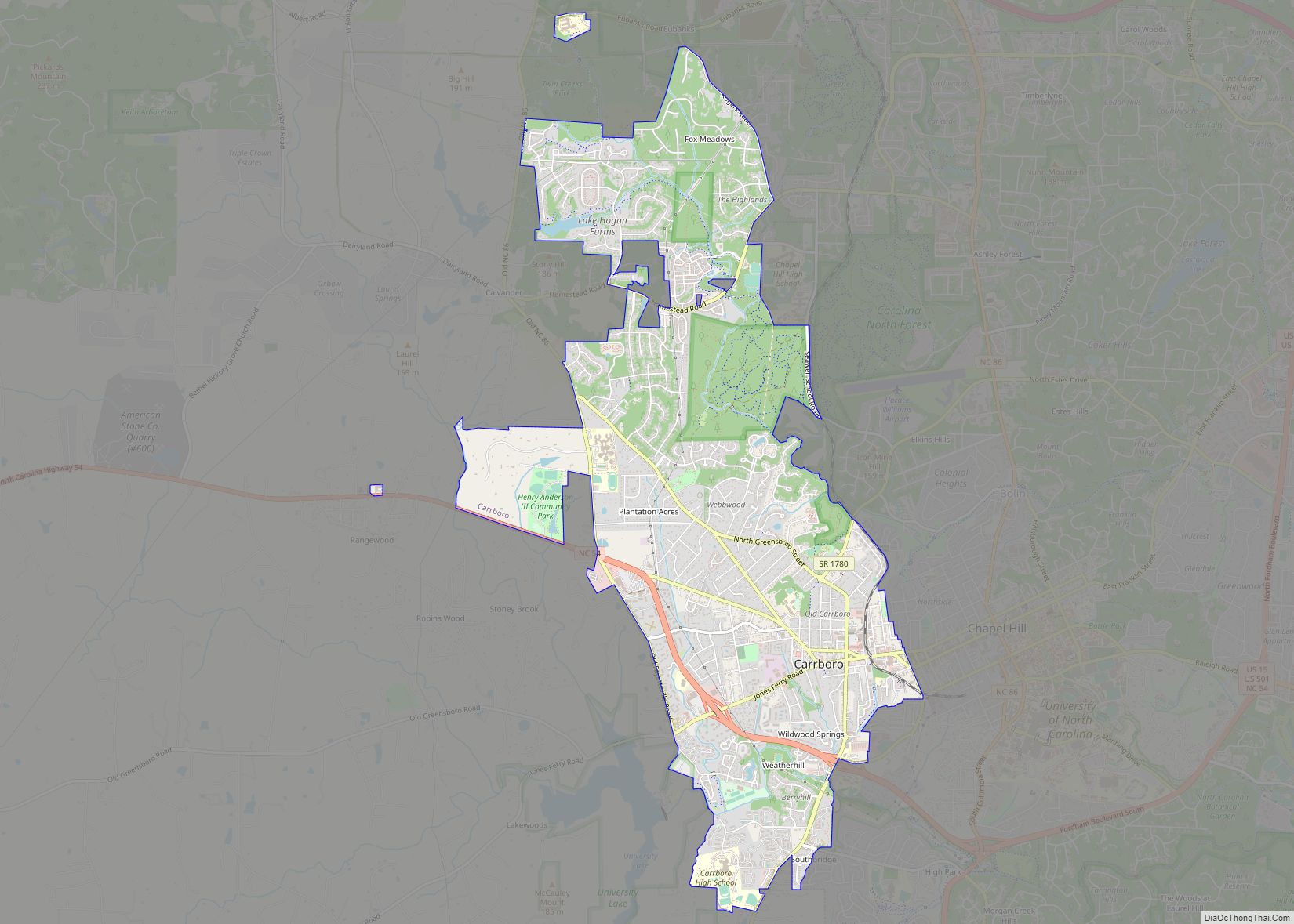
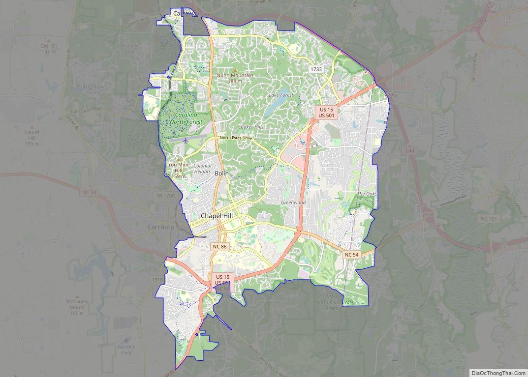
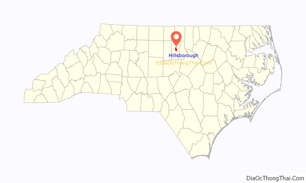
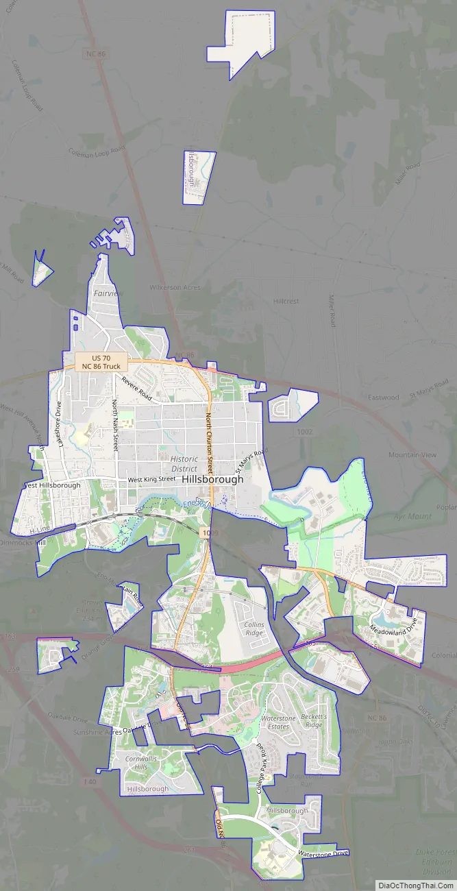
Hillsborough Road Map
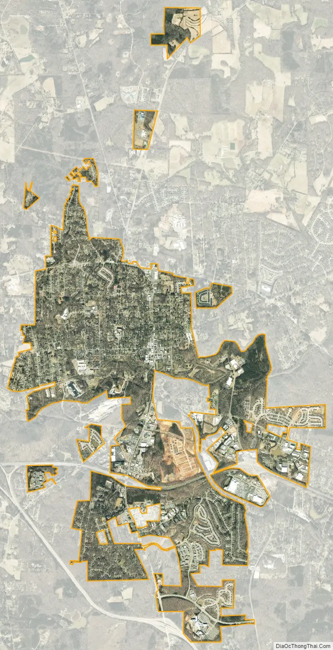
Hillsborough city Satellite Map
Geography
Hillsborough is located along the Eno River. The town government has constructed the Riverwalk along the river—a paved, accessible, urban greenway that stretches approximately two miles, connecting the trail system in the Occoneechee Mountain State Natural Area to trails on the Ayr Mount property and the Occoneechee Speedway trail. The Riverwalk is part of the Mountains-to-Sea Trail.
According to the United States Census Bureau, the town has a total area of 4.6 square miles (12 km), of which 4.6 square miles (12 km) is land and 0.22% is water.
The architecture of nearby Duke University incorporates the stone from the local Hillsborough Quarry. Now sometimes referred to as the Duke Stone, it is included in the design of almost every building on Duke University West Campus which was originally designed by architect Julian Abele.
See also
Map of North Carolina State and its subdivision:- Alamance
- Alexander
- Alleghany
- Anson
- Ashe
- Avery
- Beaufort
- Bertie
- Bladen
- Brunswick
- Buncombe
- Burke
- Cabarrus
- Caldwell
- Camden
- Carteret
- Caswell
- Catawba
- Chatham
- Cherokee
- Chowan
- Clay
- Cleveland
- Columbus
- Craven
- Cumberland
- Currituck
- Dare
- Davidson
- Davie
- Duplin
- Durham
- Edgecombe
- Forsyth
- Franklin
- Gaston
- Gates
- Graham
- Granville
- Greene
- Guilford
- Halifax
- Harnett
- Haywood
- Henderson
- Hertford
- Hoke
- Hyde
- Iredell
- Jackson
- Johnston
- Jones
- Lee
- Lenoir
- Lincoln
- Macon
- Madison
- Martin
- McDowell
- Mecklenburg
- Mitchell
- Montgomery
- Moore
- Nash
- New Hanover
- Northampton
- Onslow
- Orange
- Pamlico
- Pasquotank
- Pender
- Perquimans
- Person
- Pitt
- Polk
- Randolph
- Richmond
- Robeson
- Rockingham
- Rowan
- Rutherford
- Sampson
- Scotland
- Stanly
- Stokes
- Surry
- Swain
- Transylvania
- Tyrrell
- Union
- Vance
- Wake
- Warren
- Washington
- Watauga
- Wayne
- Wilkes
- Wilson
- Yadkin
- Yancey
- Alabama
- Alaska
- Arizona
- Arkansas
- California
- Colorado
- Connecticut
- Delaware
- District of Columbia
- Florida
- Georgia
- Hawaii
- Idaho
- Illinois
- Indiana
- Iowa
- Kansas
- Kentucky
- Louisiana
- Maine
- Maryland
- Massachusetts
- Michigan
- Minnesota
- Mississippi
- Missouri
- Montana
- Nebraska
- Nevada
- New Hampshire
- New Jersey
- New Mexico
- New York
- North Carolina
- North Dakota
- Ohio
- Oklahoma
- Oregon
- Pennsylvania
- Rhode Island
- South Carolina
- South Dakota
- Tennessee
- Texas
- Utah
- Vermont
- Virginia
- Washington
- West Virginia
- Wisconsin
- Wyoming