Hope Mills is a town in Cumberland County, North Carolina, United States. Its population was 15,176 at the 2010 census.
| Name: | Hope Mills town |
|---|---|
| LSAD Code: | 43 |
| LSAD Description: | town (suffix) |
| State: | North Carolina |
| County: | Cumberland County |
| Elevation: | 108 ft (33 m) |
| Total Area: | 8.64 sq mi (22.38 km²) |
| Land Area: | 8.48 sq mi (21.96 km²) |
| Water Area: | 0.16 sq mi (0.42 km²) |
| Total Population: | 17,808 |
| Population Density: | 2,100.25/sq mi (810.90/km²) |
| ZIP code: | 28348 |
| FIPS code: | 3732640 |
| GNISfeature ID: | 0987040 |
| Website: | www.townofhopemills.com |
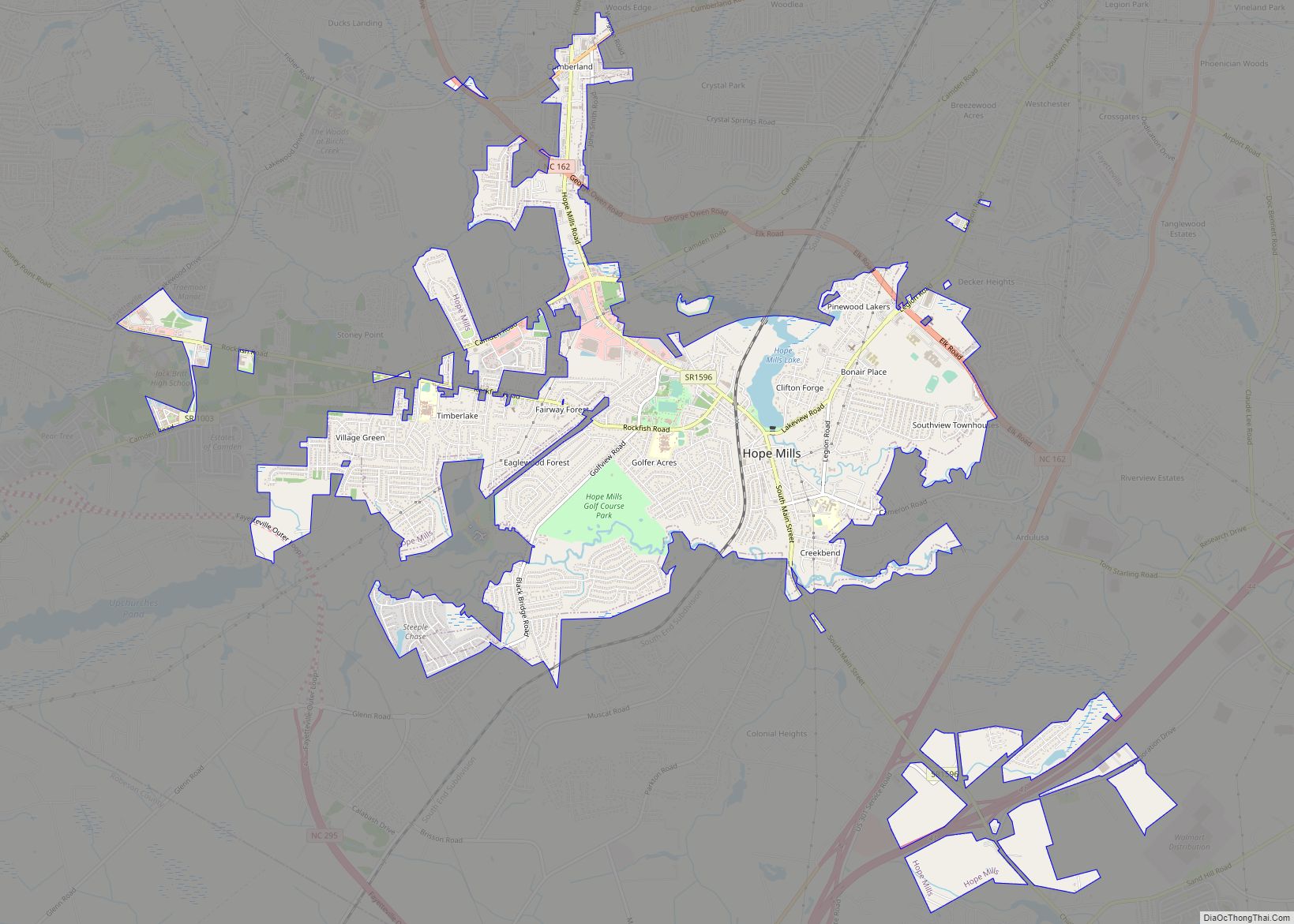
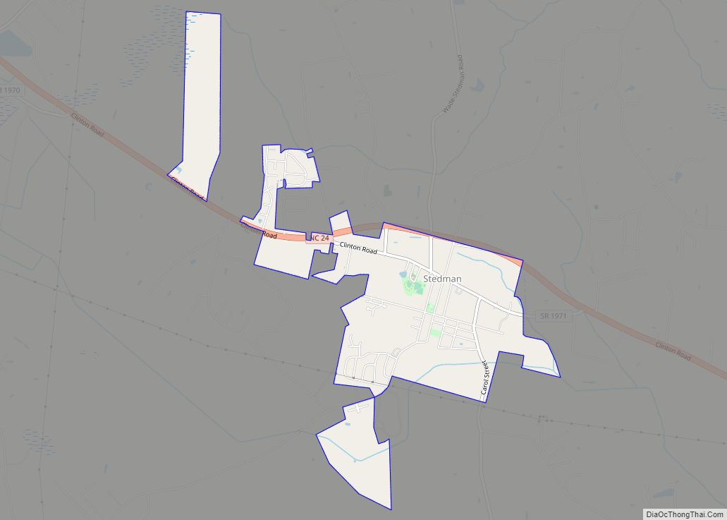
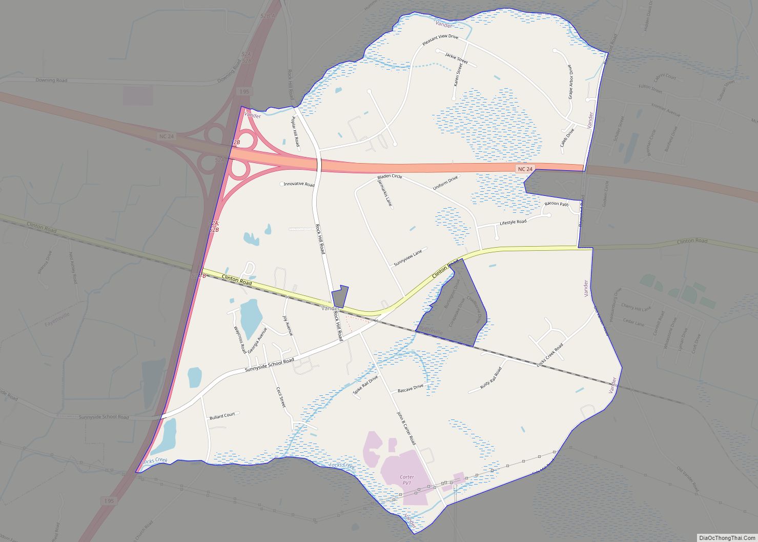
Online Interactive Map
Click on ![]() to view map in "full screen" mode.
to view map in "full screen" mode.
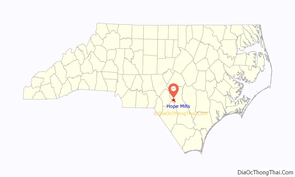
Hope Mills location map. Where is Hope Mills town?

History
Chartered in 1891, Hope Mills can trace its beginning back to 1766, when due to the wealth of natural water power and the abundance of timber, a lumber camp, saw mill, grist mill, and pottery business were established. In 1839, construction of the first cotton mill powered by the Hope Mills Dam was completed and was the beginning of a new era for the town. Much of the heritage and the town’s name itself can be attributed to the cotton-milling industry that followed.
Before it was known as Hope Mills, the area was known as Little Rockfish Village and as Hope Mills Number One.
The local cotton mill and many other buildings were burned by General Sherman’s troops during the Civil War.
The Big Rockfish Presbyterian Church and Hope Mills Historic District are listed on the National Register of Historic Places.
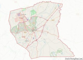
Hope Mills Road Map

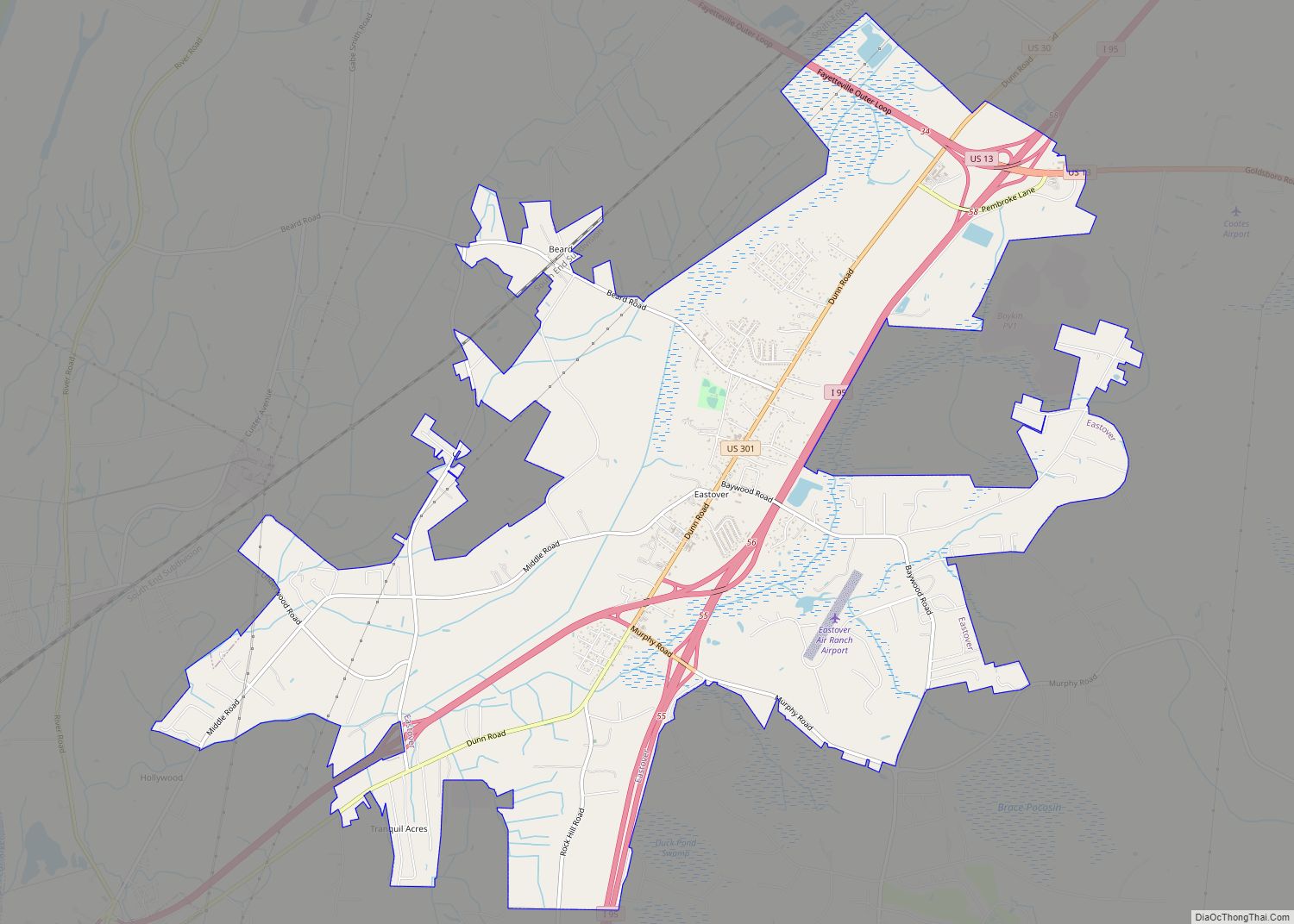
Hope Mills city Satellite Map

Geography
Hope Mills is located in western Cumberland County at 34°58′14″N 78°57′24″W / 34.97056°N 78.95667°W / 34.97056; -78.95667 (34.970679, −78.956603), south of Fayetteville, the county seat. The town center is next to a dam on Little Rockfish Creek, forming Hope Mills Lake. Little Rockfish Creek flows southeast to Rockfish Creek, a tributary of the Cape Fear River.
North Carolina Highway 59 (Main Street) runs through the center of the town, leading north 5 miles (8 km) to U.S. Route 401 in western Fayetteville, and south 2.5 miles (4.0 km) to Interstate 95 at Exit 41. Several pieces of land around Exit 41 are within the town limits, although not connected to the town center.
According to the United States Census Bureau, the town has a total area of 7.0 square miles (18.2 km), of which 6.9 square miles (18.0 km) are land and 0.08 square miles (0.2 km), or 1.40%, is covered by water, including Hope Mills Lake.
See also
Map of North Carolina State and its subdivision:- Alamance
- Alexander
- Alleghany
- Anson
- Ashe
- Avery
- Beaufort
- Bertie
- Bladen
- Brunswick
- Buncombe
- Burke
- Cabarrus
- Caldwell
- Camden
- Carteret
- Caswell
- Catawba
- Chatham
- Cherokee
- Chowan
- Clay
- Cleveland
- Columbus
- Craven
- Cumberland
- Currituck
- Dare
- Davidson
- Davie
- Duplin
- Durham
- Edgecombe
- Forsyth
- Franklin
- Gaston
- Gates
- Graham
- Granville
- Greene
- Guilford
- Halifax
- Harnett
- Haywood
- Henderson
- Hertford
- Hoke
- Hyde
- Iredell
- Jackson
- Johnston
- Jones
- Lee
- Lenoir
- Lincoln
- Macon
- Madison
- Martin
- McDowell
- Mecklenburg
- Mitchell
- Montgomery
- Moore
- Nash
- New Hanover
- Northampton
- Onslow
- Orange
- Pamlico
- Pasquotank
- Pender
- Perquimans
- Person
- Pitt
- Polk
- Randolph
- Richmond
- Robeson
- Rockingham
- Rowan
- Rutherford
- Sampson
- Scotland
- Stanly
- Stokes
- Surry
- Swain
- Transylvania
- Tyrrell
- Union
- Vance
- Wake
- Warren
- Washington
- Watauga
- Wayne
- Wilkes
- Wilson
- Yadkin
- Yancey
- Alabama
- Alaska
- Arizona
- Arkansas
- California
- Colorado
- Connecticut
- Delaware
- District of Columbia
- Florida
- Georgia
- Hawaii
- Idaho
- Illinois
- Indiana
- Iowa
- Kansas
- Kentucky
- Louisiana
- Maine
- Maryland
- Massachusetts
- Michigan
- Minnesota
- Mississippi
- Missouri
- Montana
- Nebraska
- Nevada
- New Hampshire
- New Jersey
- New Mexico
- New York
- North Carolina
- North Dakota
- Ohio
- Oklahoma
- Oregon
- Pennsylvania
- Rhode Island
- South Carolina
- South Dakota
- Tennessee
- Texas
- Utah
- Vermont
- Virginia
- Washington
- West Virginia
- Wisconsin
- Wyoming