Map of Lake Park village, North Carolina

Map of Lake Park village, North Carolina

Lake Park is a village in Union County, North Carolina, United States. The population was 3,422 at the 2010 census. Lake Park village overview: Name: Lake Park village LSAD Code: 47 LSAD Description: village (suffix) State: North Carolina County: Union County Elevation: 686 ft (209 m) Total Area: 0.76 sq mi (1.97 km²) Land Area: 0.73 sq mi (1.90 km²) Water Area: 0.03 sq mi … Read more

Map of Lake Norman of Catawba CDP

Map of Lake Norman of Catawba CDP

Lake Norman of Catawba CDP overview: Name: Lake Norman of Catawba CDP LSAD Code: 57 LSAD Description: CDP (suffix) State: North Carolina County: Catawba County FIPS code: 3736511 Online Interactive Map Lake Norman of Catawba online map. Source: Basemap layers from Google Map, Open Street Map (OSM), Arcgisonline, Wmflabs. Boundary Data from Database of Global … Read more

Map of Lake Lure town

Map of Lake Lure town

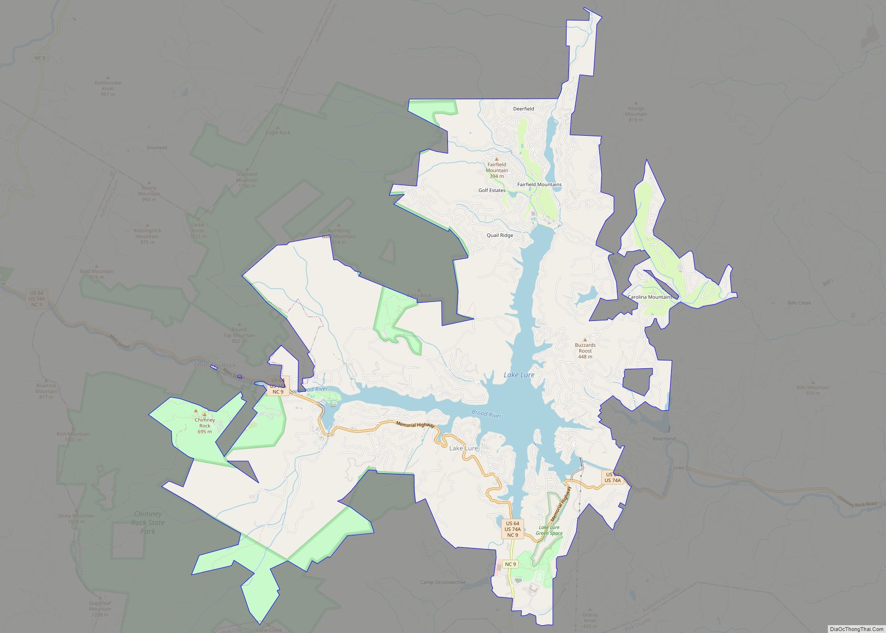
Lake Lure is a town in Rutherford County, North Carolina, United States. In 2020 the town population was 1,634. Lake Lure was incorporated in 1927, and acquired the lake after which it is named in 1965. Lake Lure town overview: Name: Lake Lure town LSAD Code: 43 LSAD Description: town (suffix) State: North Carolina County: … Read more

Map of Lake Junaluska CDP

Map of Lake Junaluska CDP

Lake Junaluska CDP overview: Name: Lake Junaluska CDP LSAD Code: 57 LSAD Description: CDP (suffix) State: North Carolina County: Haywood County FIPS code: 3736480 Online Interactive Map Lake Junaluska online map. Source: Basemap layers from Google Map, Open Street Map (OSM), Arcgisonline, Wmflabs. Boundary Data from Database of Global Administrative Areas. Lake Junaluska location map. … Read more

Map of La Grange town, North Carolina

Map of La Grange town, North Carolina

La Grange is a town in Lenoir County, North Carolina, United States. The population was 2,873 based on the 2010 census. La Grange is located in North Carolina’s Inner Banks region. La Grange town overview: Name: La Grange town LSAD Code: 43 LSAD Description: town (suffix) State: North Carolina County: Lenoir County Elevation: 108 ft (33 m) … Read more

Map of Kure Beach town

Map of Kure Beach town

Kure Beach (/ˈkjʊəri/ KURE-ee) is a town in New Hanover County, North Carolina, United States, approximately 15 miles south of Wilmington. It is part of the Wilmington Metropolitan Statistical Area. The population was 2,012 at the 2010 census. It is found on Pleasure Island directly south of the Wilmington Beach annex of Carolina Beach and just … Read more

Map of Knightdale town

Map of Knightdale town

Knightdale is a town in Wake County, North Carolina, United States. As of the 2020 census, Knightdale has a population of 19,435. That’s up from 11,401 in 2010 . The U.S. Census Bureau estimates the town’s population to be 17,843 as of July 1, 2019. Knightdale’s population grew 10.4% from 2010-2013, making it the second … Read more

Map of Kitty Hawk town

Map of Kitty Hawk town

Kitty Hawk is a town in Dare County, North Carolina, on Bodie Island, part of what is known as the state’s Outer Banks. The population was 3,708 at the 2020 census. It was established in the early 18th century as Chickahawk. Kitty Hawk town overview: Name: Kitty Hawk town LSAD Code: 43 LSAD Description: town … Read more

Map of Kittrell town

Map of Kittrell town

Kittrell is a town in Vance County, North Carolina, United States. Kittrell town overview: Name: Kittrell town LSAD Code: 43 LSAD Description: town (suffix) State: North Carolina County: Vance County Elevation: 440 ft (130 m) Total Area: 0.21 sq mi (0.54 km²) Land Area: 0.21 sq mi (0.54 km²) Water Area: 0.00 sq mi (0.00 km²) Total Population: 132 Population Density: 634.62/sq mi (245.23/km²) ZIP code: 27544 … Read more

Map of Kinston city, North Carolina

Map of Kinston city, North Carolina

Kinston is a city in Lenoir County, North Carolina, United States, with a population of 19,900 as of the 2020 census. It has been the county seat of Lenoir County since its formation in 1791. Kinston is located in the coastal plains region of eastern North Carolina. In 2009, Kinston won the All-America City Award. … Read more

Map of Lake Royale CDP

Map of Lake Royale CDP

Lake Royale is a census-designated place (CDP) in southeastern Franklin County, North Carolina, United States. The population was 3,392 at the 2020 census. It is a gated resort community which surrounds a man-made lake with the same name. The main entrance to Lake Royale is off Sledge Road (SR 1611), 3 miles (5 km) east of … Read more

Map of Laurinburg city

Map of Laurinburg city

Laurinburg is a city in and the county seat of Scotland County, North Carolina, United States. Located in southern North Carolina near the South Carolina border, Laurinburg is southwest of Fayetteville and is home to St. Andrews University. The population at the 2010 Census was 15,962 people. Laurinburg city overview: Name: Laurinburg city LSAD Code: … Read more