Lake Lure is a town in Rutherford County, North Carolina, United States. In 2020 the town population was 1,634. Lake Lure was incorporated in 1927, and acquired the lake after which it is named in 1965.
| Name: | Lake Lure town |
|---|---|
| LSAD Code: | 43 |
| LSAD Description: | town (suffix) |
| State: | North Carolina |
| County: | Rutherford County |
| Elevation: | 1,125 ft (343 m) |
| Total Area: | 14.37 sq mi (37.22 km²) |
| Land Area: | 13.17 sq mi (34.10 km²) |
| Water Area: | 1.21 sq mi (3.12 km²) |
| Total Population: | 1,365 |
| Population Density: | 103.67/sq mi (40.03/km²) |
| ZIP code: | 28746 |
| Area code: | 828 |
| FIPS code: | 3736500 |
| GNISfeature ID: | 1021079 |
| Website: | www.townoflakelure.com |
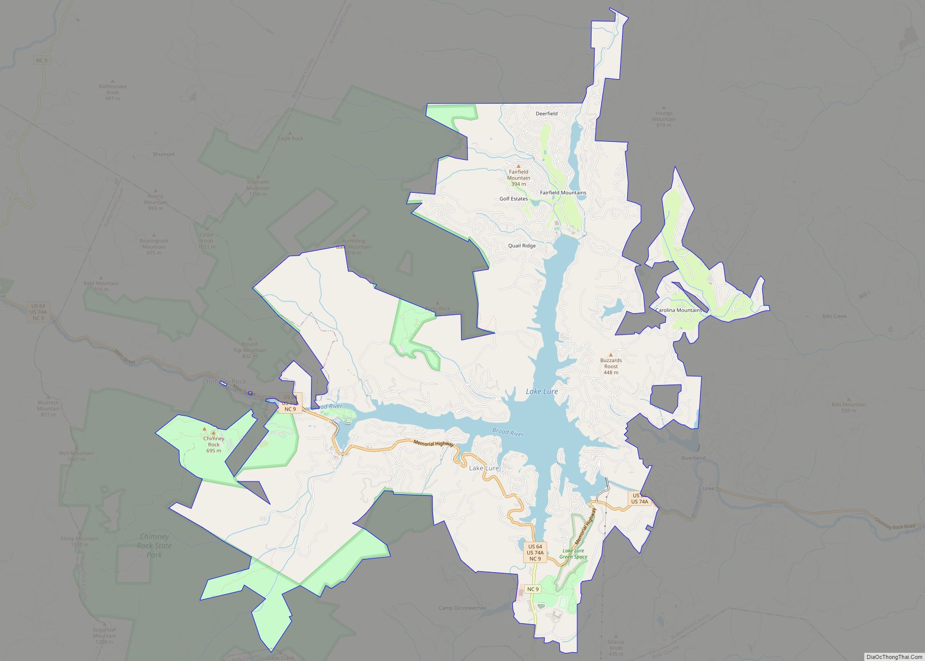
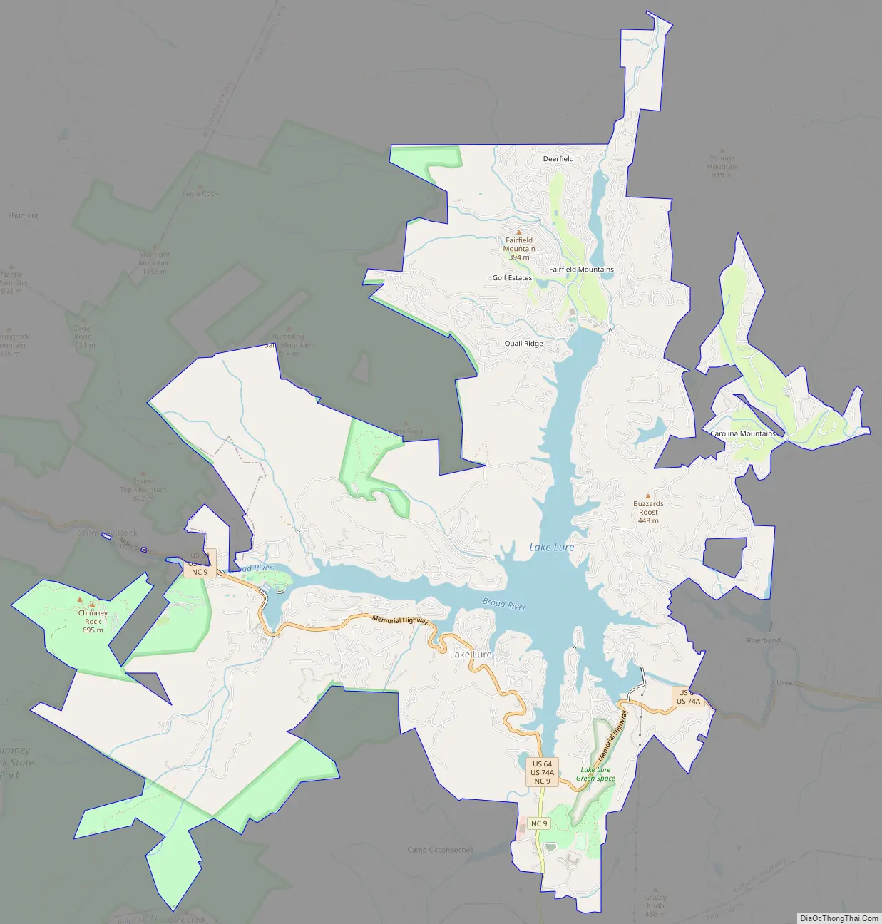
Online Interactive Map
Click on ![]() to view map in "full screen" mode.
to view map in "full screen" mode.
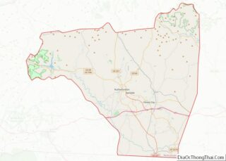
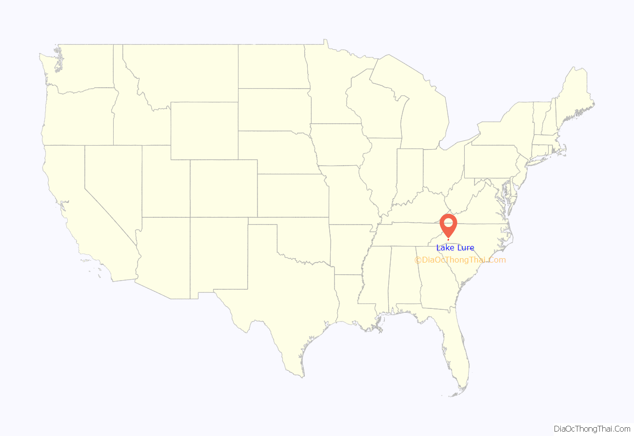
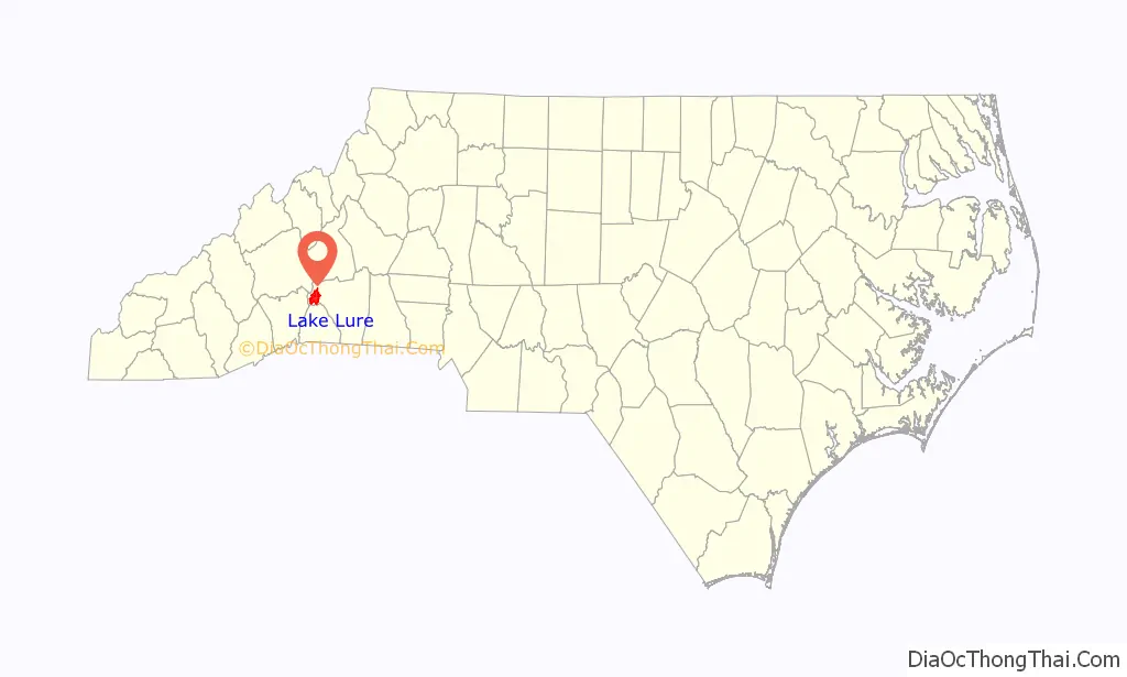
Lake Lure location map. Where is Lake Lure town?
History
In 1902, Dr. Lucius B. Morse and his brothers Hiram and Asahel purchased 64 acres (0.26 km) around Chimney Rock (within present-day Chimney Rock State Park) for $5,000. They later acquired enough land in the area to bring the total to 8,000 acres (32 km). Lucius Morse’s wife Elizabeth is credited with naming the lake (and the town). Included in the area that became the lake, according to a blog entry by Russ Meade, was the town of Buffalo, believed to have been named for a nearby mountain that resembled a buffalo.
In 1925, the Morse family created Carolina Mountain Power Company and funded the construction of a dam on the Broad River (through a mortgage) which produced the lake after which the town is named. The full impoundment of Lake Lure was completed in 1927. At ordinary water levels, Lake Lure covers approximately 720 acres (2.9 km) and has a shoreline of approximately 27 miles (43 km). The dam’s power plant began operations in 1928 with the sale of electricity under a 10-year contract to Blue Ridge Power Co., a local predecessor of Duke Power. In modern times, the town continues to sell electricity to Duke Energy, although profits from the dam now come second to maintaining a fixed water level year-round.
In 1929, the plans for development came to a halt with the advent of the Great Depression. A mortgage-holder, Stroud & Company of Philadelphia, foreclosed on the lake and the dam. Stroud owned them and the power the dam generated until 1965. In 1963, the North Carolina General Assembly enacted the legislation that authorized the Town of Lake Lure to issue revenue bonds for the purpose of acquiring the assets from Stroud. The dam, power company, and real estate of Lake Lure were acquired by the Town of Lake Lure in 1965.
Tourism
Recreation and tourism have become crucial to the town’s economy; challenges to this industry have included the Party Rock wildfire and the COVID-19 pandemic.
In 1999, Pine Gables was added to the National Register of Historic Places.
Lake Lure was a primary filming location for Dirty Dancing, and hosts an annual festival event honoring the movie.
Located on Memorial Highway, The Right Track Toy Train Museum, opened in 2011, features a large display of toy train memorabilia previously belonging to Larry Keyes. Larry’s widow, Peggy, opened the museum to honor her late husband, and 100% of the museum’s proceeds are donated to pancreatic cancer research.
The Rocky Broad River Bridge, built in 1925 and closed to traffic in 2011, re-opened as the Lake Lure Flowering Bridge in 2013, with gardens spanning the 155-foot span of the bridge and expanding. Prior to the grand opening, the tourist attraction had already been visited by tourists from 36 states and 14 countries. Today referred to as “The Gateway to Somewhere Beautiful”, the Flowering Bridge features garden beds, a mobile phone tour, and a Sensory Tour for visually-impaired guests. It has been recognized by the National Wildlife Federation as a Certified Wildlife Habitat and has met the criteria to be designated as a Monarch Waystation by Monarch Watch. The bridge was briefly closed due to the COVID-19 pandemic.
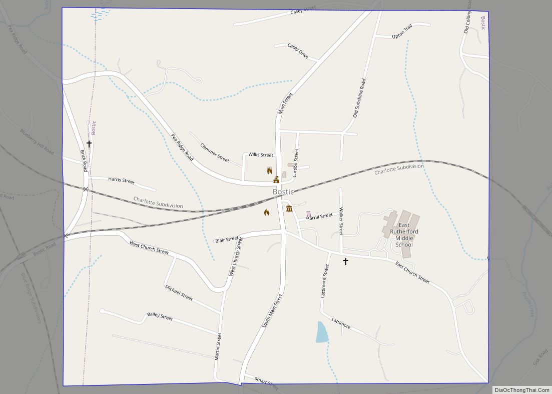
Lake Lure Road Map
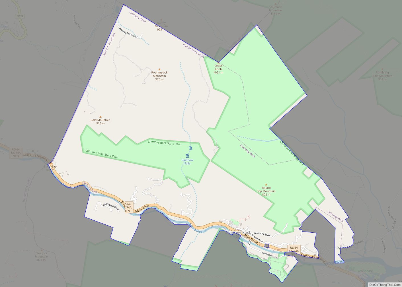
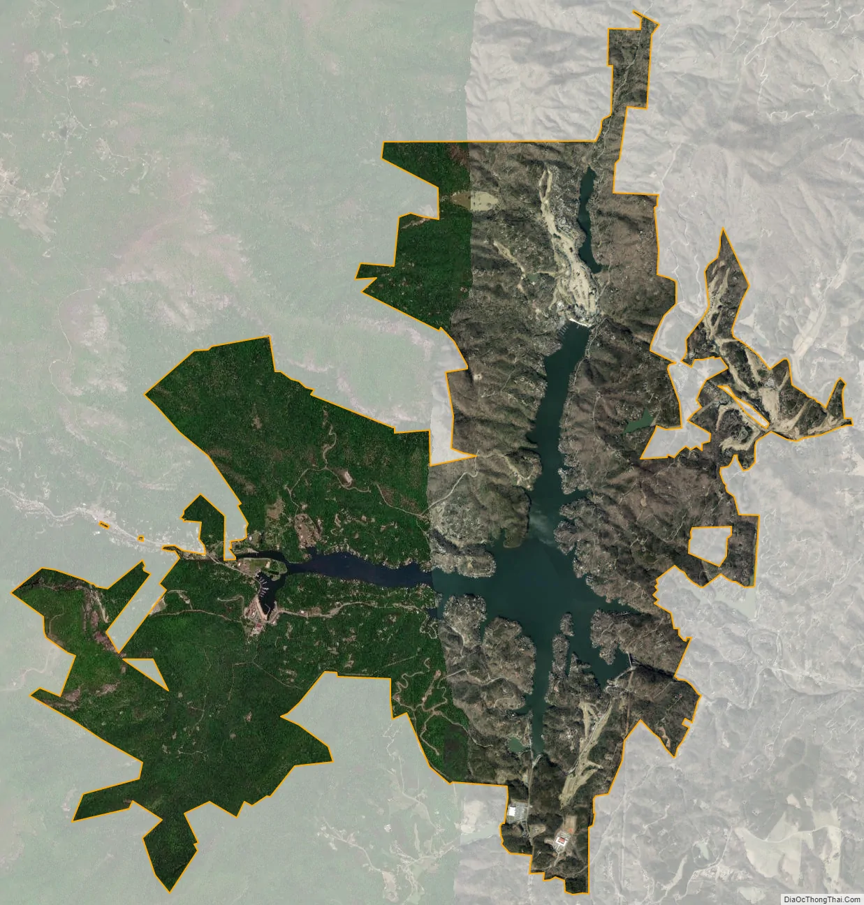
Lake Lure city Satellite Map
Geography
Lake Lure is located at 35°26′41″N 82°11′28″W / 35.444668°N 82.191243°W / 35.444668; -82.191243. According to the United States Census Bureau, the town has a total area of 14.8 square miles (38 km), of which, 13.6 square miles (35 km) of it is land and 1.2 square miles (3.1 km) of it (8.11%) is water.
See also
Map of North Carolina State and its subdivision:- Alamance
- Alexander
- Alleghany
- Anson
- Ashe
- Avery
- Beaufort
- Bertie
- Bladen
- Brunswick
- Buncombe
- Burke
- Cabarrus
- Caldwell
- Camden
- Carteret
- Caswell
- Catawba
- Chatham
- Cherokee
- Chowan
- Clay
- Cleveland
- Columbus
- Craven
- Cumberland
- Currituck
- Dare
- Davidson
- Davie
- Duplin
- Durham
- Edgecombe
- Forsyth
- Franklin
- Gaston
- Gates
- Graham
- Granville
- Greene
- Guilford
- Halifax
- Harnett
- Haywood
- Henderson
- Hertford
- Hoke
- Hyde
- Iredell
- Jackson
- Johnston
- Jones
- Lee
- Lenoir
- Lincoln
- Macon
- Madison
- Martin
- McDowell
- Mecklenburg
- Mitchell
- Montgomery
- Moore
- Nash
- New Hanover
- Northampton
- Onslow
- Orange
- Pamlico
- Pasquotank
- Pender
- Perquimans
- Person
- Pitt
- Polk
- Randolph
- Richmond
- Robeson
- Rockingham
- Rowan
- Rutherford
- Sampson
- Scotland
- Stanly
- Stokes
- Surry
- Swain
- Transylvania
- Tyrrell
- Union
- Vance
- Wake
- Warren
- Washington
- Watauga
- Wayne
- Wilkes
- Wilson
- Yadkin
- Yancey
- Alabama
- Alaska
- Arizona
- Arkansas
- California
- Colorado
- Connecticut
- Delaware
- District of Columbia
- Florida
- Georgia
- Hawaii
- Idaho
- Illinois
- Indiana
- Iowa
- Kansas
- Kentucky
- Louisiana
- Maine
- Maryland
- Massachusetts
- Michigan
- Minnesota
- Mississippi
- Missouri
- Montana
- Nebraska
- Nevada
- New Hampshire
- New Jersey
- New Mexico
- New York
- North Carolina
- North Dakota
- Ohio
- Oklahoma
- Oregon
- Pennsylvania
- Rhode Island
- South Carolina
- South Dakota
- Tennessee
- Texas
- Utah
- Vermont
- Virginia
- Washington
- West Virginia
- Wisconsin
- Wyoming