Knightdale is a town in Wake County, North Carolina, United States. As of the 2020 census, Knightdale has a population of 19,435. That’s up from 11,401 in 2010 . The U.S. Census Bureau estimates the town’s population to be 17,843 as of July 1, 2019. Knightdale’s population grew 10.4% from 2010-2013, making it the second fastest-growing community in the Research Triangle region for that time period.
Named for Henry Haywood Knight, a local Wake County landowner who donated land to found a railroad depot, the town was incorporated in 1927. By the 1960s, the economic center of town migrated from the area around the rail depot to U.S. Highway 64, which ran north of downtown Knightdale. Since 1990, the community has experienced a significant population boom, getting its own high school in 2004, and a new freeway bypass in 2006. Since 2010, several new shopping centers have sprung up along Business U.S. 64 (Knightdale Boulevard), the main thoroughfare through town. A large destination park, Knightdale Station Park, opened in 2013 just to the east of the old downtown area as part of a revitalization effort, the park was expanded in 2018 to add an amphitheater. Interstate 540 passes directly through the town before its eastern terminus at Interstate 87, while Interstate 87 (in concurrency with US 64) travels along a southern freeway bypass.
| Name: | Knightdale town |
|---|---|
| LSAD Code: | 43 |
| LSAD Description: | town (suffix) |
| State: | North Carolina |
| County: | Wake County |
| Incorporated: | 1927 |
| Elevation: | 315 ft (96 m) |
| Total Area: | 8.50 sq mi (22.01 km²) |
| Land Area: | 8.49 sq mi (22.00 km²) |
| Water Area: | 0.01 sq mi (0.02 km²) |
| Total Population: | 19,435 |
| Population Density: | 2,288.36/sq mi (883.50/km²) |
| ZIP code: | 27545 |
| Area code: | 919 |
| FIPS code: | 3736080 |
| GNISfeature ID: | 1021061 |
| Website: | www.knightdalenc.gov |
Online Interactive Map
Click on ![]() to view map in "full screen" mode.
to view map in "full screen" mode.
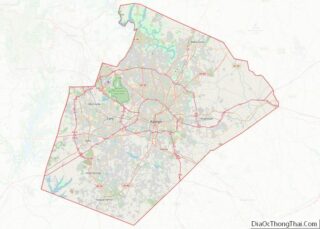
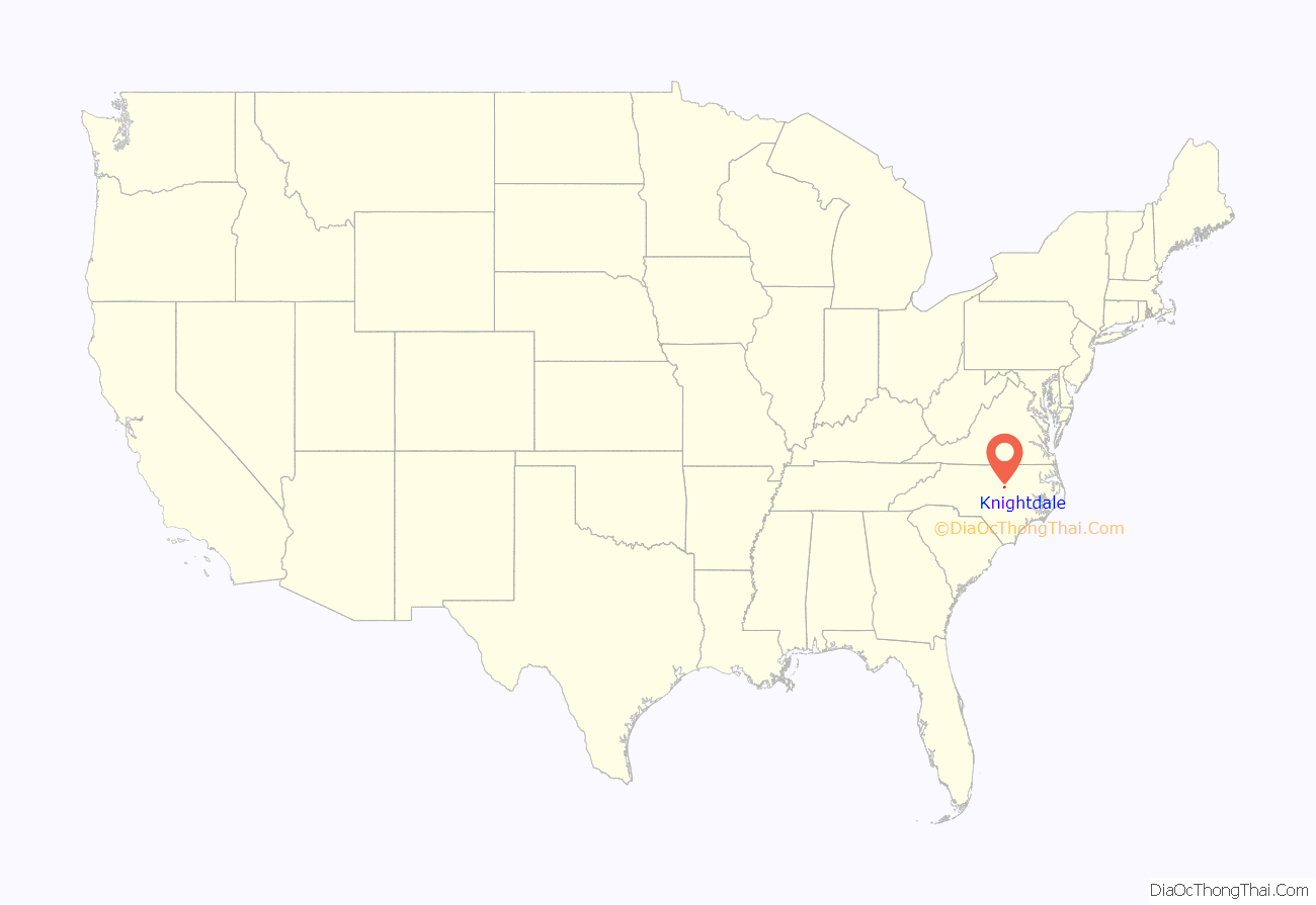
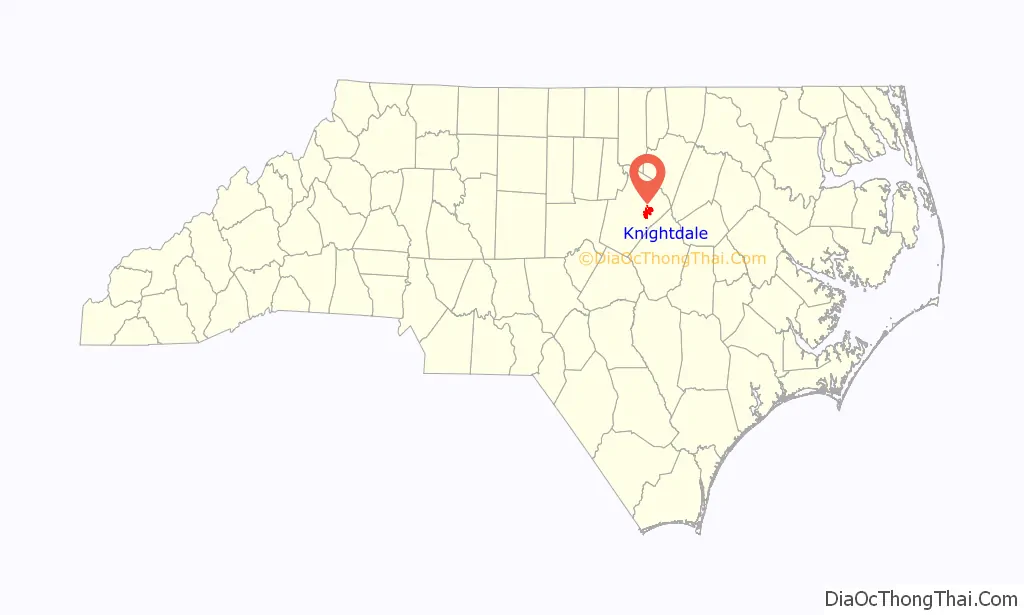
Knightdale location map. Where is Knightdale town?
History
Early history
In 1700, the Lords Proprietor of the Carolina Colony hired John Lawson to explore the area. He began his 1,000-mile (1,600 km) trek near present-day Charleston, South Carolina, and according to his diary, passed through the area sometime in February 1701. He wrote about a meeting with the Tuscarora Native American tribe on the banks of the Neuse River, and with the help of an interpreter, Lawson made peace with the Tuscarora.
After receiving the report from Lawson, the King of England began to apportion these lands to willing settlers. In 1730, John Hinton settled in what would one day be called Knightdale in an area near the Neuse River, not far from where Hodge Road and Old Faison Road now intersect.
As more settlers arrived, the colonial government appointed Hinton to be the Justice of the Peace for Craven County. Eventually, Johnston County was carved out of Craven County in the 1750s and Wake County carved out of Johnston County in 1771.
When the American Revolution began, Hinton switched his allegiance to the colonials. He became a military leader and played a key role in the first battle of the American Revolution fought on North Carolina soil, the Battle of Moore’s Creek Bridge. Hinton owned seven plantations in the Knightdale area, of which three are still intact: The Oaks, Midway, and Beaver Dam.
19th century
After independence, the population of the area began to increase, with farmers growing products such as tobacco and cotton. Although slavery was not prominent in Knightdale like locations in the Deep South, it was still visible in the area. There are unmarked grave plots for slaves throughout Knightdale. Although documentation of grave sites has been lost, the burials remain a significant part of the local landscape.
During the Civil War, the Confederate and Union armies were present in the area. The Clay Hill and Midway plantations saw the greatest damage, and after the war had ended, the residents began to rebuild. During this time, nearby Raleigh experienced a population boom. As a result, local leaders redrew the map of Wake County and divided it into townships. The area that became Knightdale was located in St. Matthew’s Township, where it still is today.
For many years the Knightdale area was a crossroads served only by a post office. By the end of the 19th century, locals decided there was a need to establish a town. Henry Haywood Knight donated some of his land holdings in the area to the Norfolk and Southern Railroad Company in order to entice the company to build a railroad that would provide freight and passenger service. Although Knight did not live to see the railroad arrive in Knightdale, not long after his death in 1904, the railroad finally came to the community that would bear his name.
20th century
After the railroad and depot were built, the area began to develop quickly. Norfolk and Southern moved families into the community to take care of the railroad, and many of the older homes that exist today in Knightdale were built specifically for the use of railroad workers and their families. The first railroad stationmaster’s house can still be seen along the tracks on Railroad Street.
As the community continued to grow, Knightdale received its articles of official incorporation from the North Carolina Legislature on March 9, 1927, with the first mayor being Bennett L. Wall.
On February 7, 1940, a fire broke out in the center of town. The townspeople turned out to help extinguish the fire, but the fire was not brought under control until firefighters arrived from Raleigh with an adequate water supply. Several businesses and homes were destroyed and the townspeople rebuilt the historic downtown area.
After World War II, the population of Knightdale grew at a steady pace, thanks to the Baby Boom. The corner drugstore, the bank, and the barber shop located on First Avenue served as places of business, as well as places for social gatherings. Movies were often shown on the wall of the old bank building, which is located at the intersection of First Avenue and Main Street. In 1952 a municipal water system was installed.
Beginning in the 1960s the majority of new businesses in Knightdale began locating along US 64. With the addition of the Mingo Creek sewer outfall in the late 1980s, development on the south side of US 64 began. Subdivisions such as Parkside, Planter’s Walk and Mingo Creek subdivisions were built, rapidly increasing the town’s population. Between 1990 and 2000 Knightdale’s population increased from 1,700 to more than 6,000 residents, making it the seventh fastest-growing town in North Carolina.
Frankie Muniz, a popular television and film actor, grew up in Knightdale. He started his acting career performing the role of Tiny Tim in “A Christmas Carol” for three years. Nominations for his performances include the Hollywood Reporter Young Star Award and the Young Artist of Hollywood Award. He currently resides in Scottsdale, Arizona.
Beaver Dam, Henry H. and Bettie S. Knight Farm, and Midway Plantation House and Outbuildings are listed on the National Register of Historic Places.
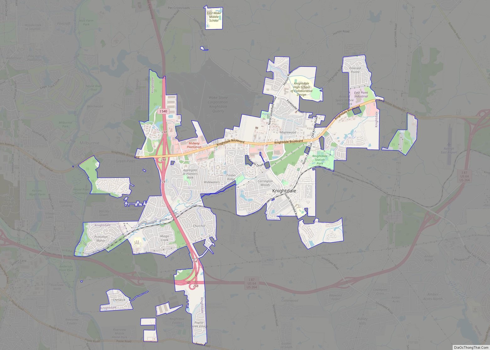
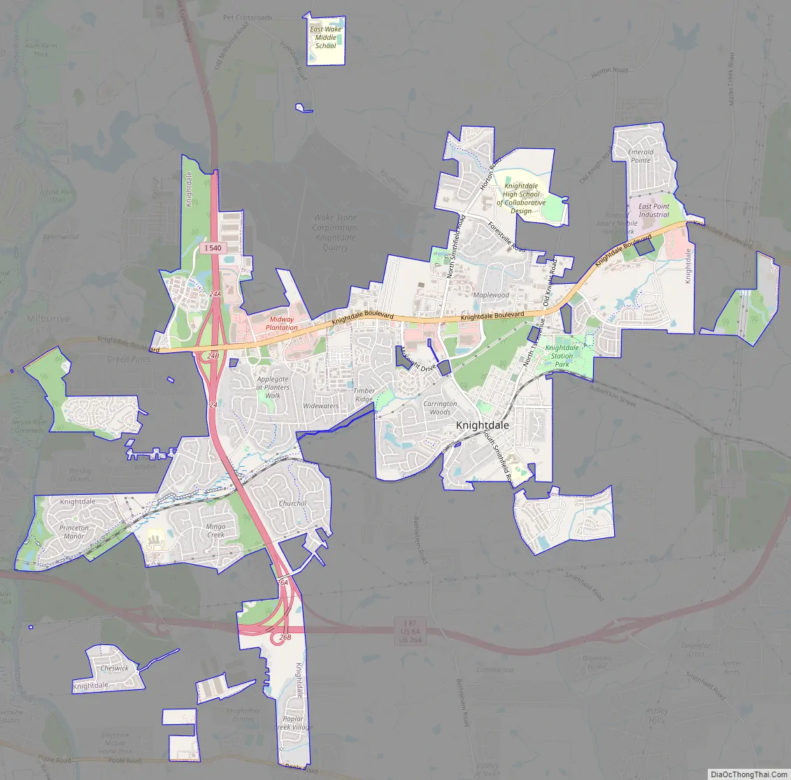
Knightdale Road Map
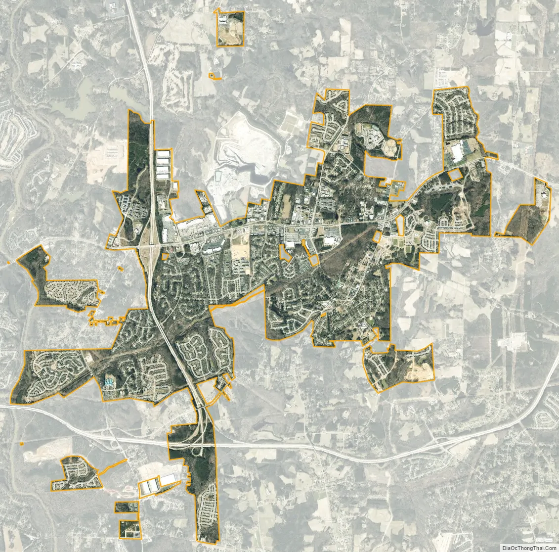
Knightdale city Satellite Map
Geography
Knightdale is located at 35°47′26″N 78°29′31″W / 35.79056°N 78.49194°W / 35.79056; -78.49194 (35.790549, -78.491982).
According to the United States Census Bureau, the town has a total area of 6.2 square miles (16.1 km), all land.
Knightdale is located in the northeast central region of North Carolina, where the North American Piedmont and Atlantic Coastal Plain regions meet. This area is known as the “Fall Line” because it marks the elevation inland at which waterfalls begin to appear in creeks and rivers. Its central Piedmont location and access to large highways places Knightdale a little over two hours northwest of Wrightsville Beach, NC by car and four hours east of the Great Smoky Mountains.
Climate
Knightdale has a moderate subtropical climate, with moderate temperatures in the spring, fall, and winter. Summers are typically hot with high humidity. Winter highs generally range in the low 50s°F (10 to 13 °C) with lows in the low-to-mid 30s°F (-2 to 2 °C), although an occasional 60 °F (15 °C) or warmer winter day is not uncommon. Spring and fall days usually reach the low-to-mid 70s°F (low 20s°C), with lows at night in the lower 50s°F (10 to 14 °C). Summer daytime highs often reach the upper 80s to low 90s°F (29 to 35 °C). The rainiest months are July and August.
See also
Map of North Carolina State and its subdivision:- Alamance
- Alexander
- Alleghany
- Anson
- Ashe
- Avery
- Beaufort
- Bertie
- Bladen
- Brunswick
- Buncombe
- Burke
- Cabarrus
- Caldwell
- Camden
- Carteret
- Caswell
- Catawba
- Chatham
- Cherokee
- Chowan
- Clay
- Cleveland
- Columbus
- Craven
- Cumberland
- Currituck
- Dare
- Davidson
- Davie
- Duplin
- Durham
- Edgecombe
- Forsyth
- Franklin
- Gaston
- Gates
- Graham
- Granville
- Greene
- Guilford
- Halifax
- Harnett
- Haywood
- Henderson
- Hertford
- Hoke
- Hyde
- Iredell
- Jackson
- Johnston
- Jones
- Lee
- Lenoir
- Lincoln
- Macon
- Madison
- Martin
- McDowell
- Mecklenburg
- Mitchell
- Montgomery
- Moore
- Nash
- New Hanover
- Northampton
- Onslow
- Orange
- Pamlico
- Pasquotank
- Pender
- Perquimans
- Person
- Pitt
- Polk
- Randolph
- Richmond
- Robeson
- Rockingham
- Rowan
- Rutherford
- Sampson
- Scotland
- Stanly
- Stokes
- Surry
- Swain
- Transylvania
- Tyrrell
- Union
- Vance
- Wake
- Warren
- Washington
- Watauga
- Wayne
- Wilkes
- Wilson
- Yadkin
- Yancey
- Alabama
- Alaska
- Arizona
- Arkansas
- California
- Colorado
- Connecticut
- Delaware
- District of Columbia
- Florida
- Georgia
- Hawaii
- Idaho
- Illinois
- Indiana
- Iowa
- Kansas
- Kentucky
- Louisiana
- Maine
- Maryland
- Massachusetts
- Michigan
- Minnesota
- Mississippi
- Missouri
- Montana
- Nebraska
- Nevada
- New Hampshire
- New Jersey
- New Mexico
- New York
- North Carolina
- North Dakota
- Ohio
- Oklahoma
- Oregon
- Pennsylvania
- Rhode Island
- South Carolina
- South Dakota
- Tennessee
- Texas
- Utah
- Vermont
- Virginia
- Washington
- West Virginia
- Wisconsin
- Wyoming