Map of McDonald town, North Carolina

Map of McDonald town, North Carolina

McDonald is a town in Robeson County, North Carolina, United States. The population was 113 at the 2010 census. McDonald town overview: Name: McDonald town LSAD Code: 43 LSAD Description: town (suffix) State: North Carolina County: Robeson County Elevation: 141 ft (43 m) Total Area: 0.26 sq mi (0.66 km²) Land Area: 0.26 sq mi (0.66 km²) Water Area: 0.00 sq mi (0.00 km²) Total Population: … Read more

Map of McAdenville town

Map of McAdenville town

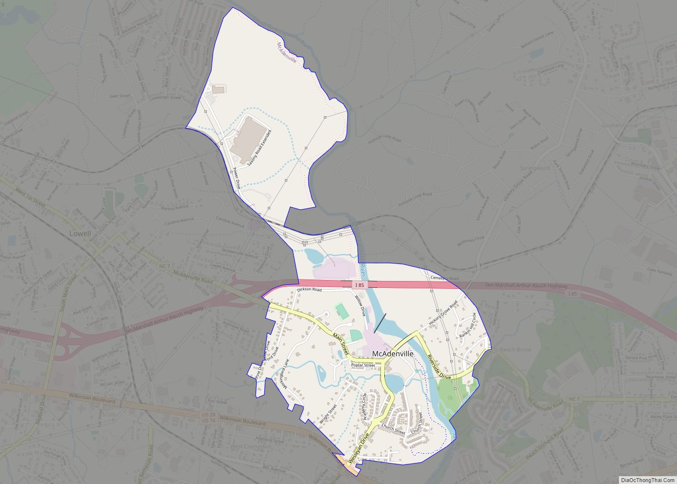
McAdenville is a small town in Gaston County, North Carolina, United States. It is a suburb of Charlotte and located east of Gastonia. The population was 890 at the 2020 census. McAdenville town overview: Name: McAdenville town LSAD Code: 43 LSAD Description: town (suffix) State: North Carolina County: Gaston County Elevation: 571 ft (174 m) Total Area: … Read more

Map of Maysville town, North Carolina

Map of Maysville town, North Carolina

Maysville is a town in Jones County, North Carolina, United States. The population was 818 at the 2020 census. It is part of the New Bern, North Carolina Metropolitan Statistical Area. This town was home to former MLB left fielder Louie Meadows. Maysville town overview: Name: Maysville town LSAD Code: 43 LSAD Description: town (suffix) … Read more

Map of Mayodan town

Map of Mayodan town

Mayodan is a town in Rockingham County, North Carolina, in the United States. It is a manufacturing site for Sturm, Ruger & Co., Bridgestone Aircraft Tire, and formerly General Tobacco (ceased operations 2010). Washington Mills Company, later Tultex, operated a textile mill in Mayodan until 1999. The town is named for two rivers that converge … Read more

Map of Maxton town

Map of Maxton town

Maxton is a town in Robeson and Scotland counties, North Carolina, United States. The population was 2,426 at the time of the 2010 U.S. Census. Maxton town overview: Name: Maxton town LSAD Code: 43 LSAD Description: town (suffix) State: North Carolina County: Robeson County, Scotland County Incorporated: 1874 Elevation: 194 ft (59 m) Total Area: 2.70 sq mi (6.99 km²) … Read more

Map of Maury CDP

Map of Maury CDP

Maury is an unincorporated community and census-designated place (CDP) in Greene County, North Carolina, United States. Its population was 1,685 as of the 2010 census. Maury has a post office with ZIP code 28554. North Carolina Highway 123 and North Carolina Highway 903 intersect in the community. Maury CDP overview: Name: Maury CDP LSAD Code: … Read more

Map of Matthews town, North Carolina

Map of Matthews town, North Carolina

Matthews is a town in southeastern Mecklenburg County, North Carolina, United States. It is a suburb of Charlotte. The population was 27,198 according to the 2010 Census. Matthews town overview: Name: Matthews town LSAD Code: 43 LSAD Description: town (suffix) State: North Carolina County: Mecklenburg County Elevation: 745 ft (227 m) Total Area: 17.19 sq mi (44.53 km²) Land Area: … Read more

Map of Marvin village

Map of Marvin village, North Carolina

Marvin is a village in Union County, North Carolina, United States. The population was 5,579 at the 2010 census. It is a more rural suburb of Charlotte. Marvin village overview: Name: Marvin village LSAD Code: 47 LSAD Description: village (suffix) State: North Carolina County: Union County Elevation: 696 ft (212 m) Total Area: 6.03 sq mi (15.63 km²) Land Area: … Read more

Map of Marshville town

Map of Marshville town

Marshville is a town in Union County, North Carolina, United States. Its population was 2,402 at the 2010 census. Marshville is known as the birthplace of country music singer Randy Travis. Marshville town overview: Name: Marshville town LSAD Code: 43 LSAD Description: town (suffix) State: North Carolina County: Union County Elevation: 584 ft (178 m) Total Area: … Read more

Map of McFarlan town

Map of McFarlan town

McFarlan is a town in Anson County, North Carolina, United States. The population was 95 at the 2020 census. The town was named after Alan McFarland, a railroad official. McFarlan town overview: Name: McFarlan town LSAD Code: 43 LSAD Description: town (suffix) State: North Carolina County: Anson County Founded: 1883 Incorporated: 1885 Elevation: 305 ft (93 m) … Read more

Map of Millingport CDP

Map of Millingport CDP

Millingport is an unincorporated community and census-designated place in Stanly County, North Carolina, United States. Its population was 599 as of the 2010 census. North Carolina Highway 73 passes through the community. Millingport CDP overview: Name: Millingport CDP LSAD Code: 57 LSAD Description: CDP (suffix) State: North Carolina County: Stanly County Elevation: 653 ft (199 m) Total … Read more

Map of Millers Creek CDP

Map of Millers Creek CDP

Millers Creek is a census-designated place (CDP) in Wilkes County, North Carolina, United States. The population was 2,112 at the 2010 census. West Wilkes High School, one of the four public high schools in Wilkes County, is located in Millers Creek. Millers Creek CDP overview: Name: Millers Creek CDP LSAD Code: 57 LSAD Description: CDP … Read more