Maysville is a town in Jones County, North Carolina, United States. The population was 818 at the 2020 census. It is part of the New Bern, North Carolina Metropolitan Statistical Area. This town was home to former MLB left fielder Louie Meadows.
| Name: | Maysville town |
|---|---|
| LSAD Code: | 43 |
| LSAD Description: | town (suffix) |
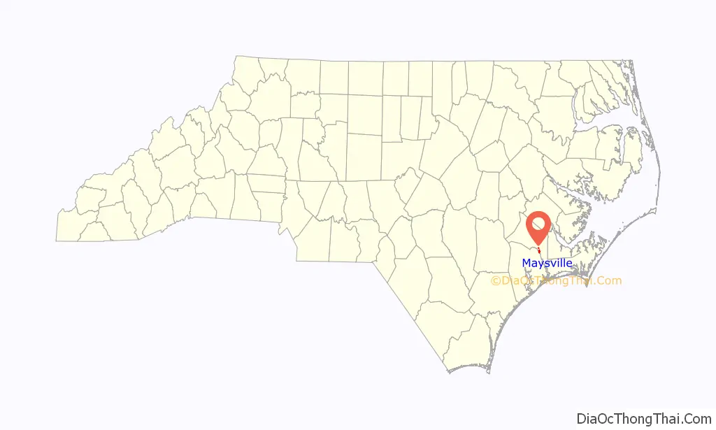
| State: | North Carolina |
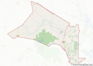
| County: | Jones County |
| Elevation: | 39 ft (12 m) |
| Total Area: | 0.86 sq mi (2.22 km²) |
| Land Area: | 0.86 sq mi (2.22 km²) |
| Water Area: | 0.00 sq mi (0.00 km²) |
| Total Population: | 818 |
| Population Density: | 955.61/sq mi (368.83/km²) |
| ZIP code: | 28555 |
| FIPS code: | 3742100 |
| GNISfeature ID: | 1013382 |
| Website: | www.townofmaysville.org |
Online Interactive Map
Click on ![]() to view map in "full screen" mode.
to view map in "full screen" mode.
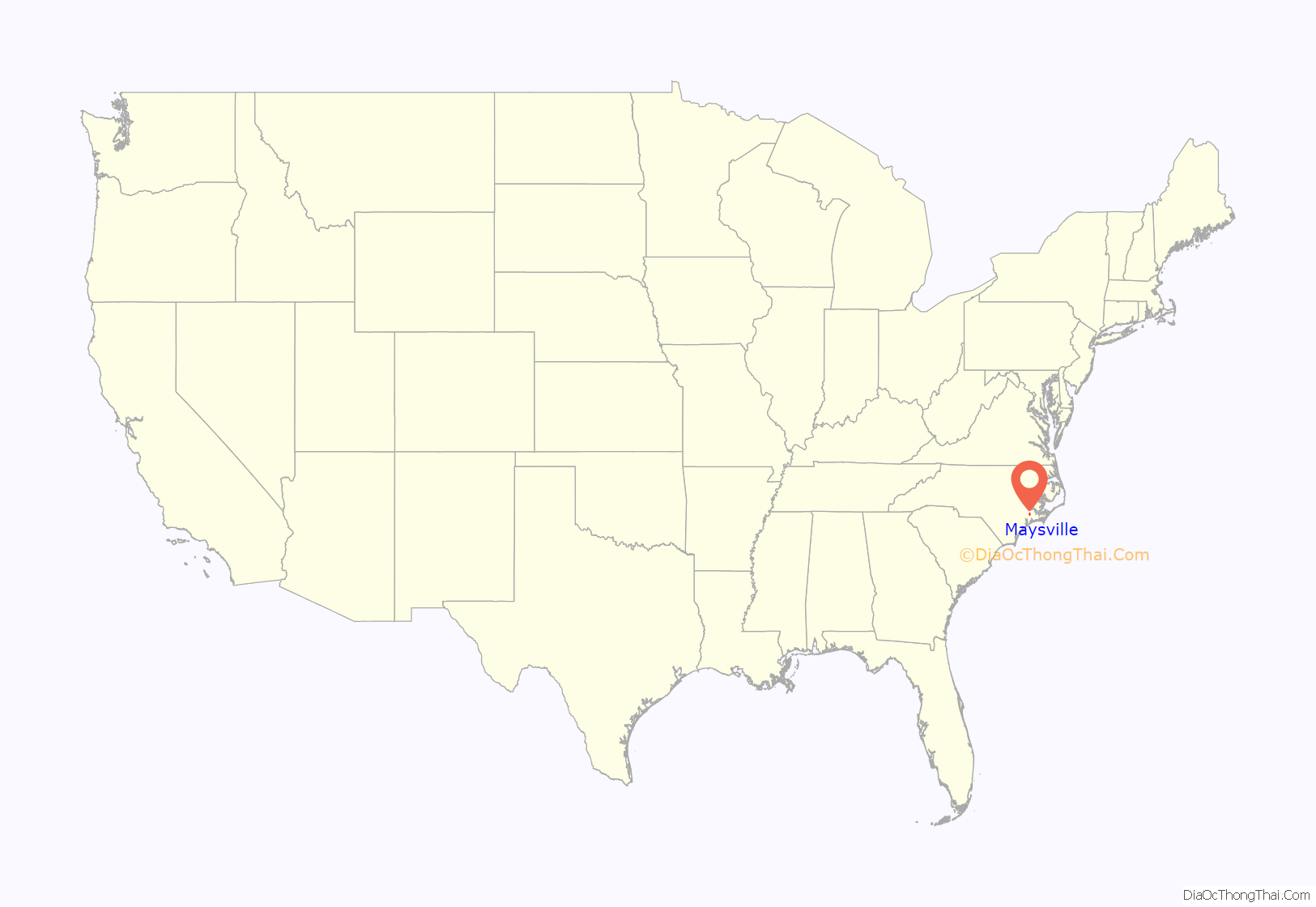
Maysville location map. Where is Maysville town?
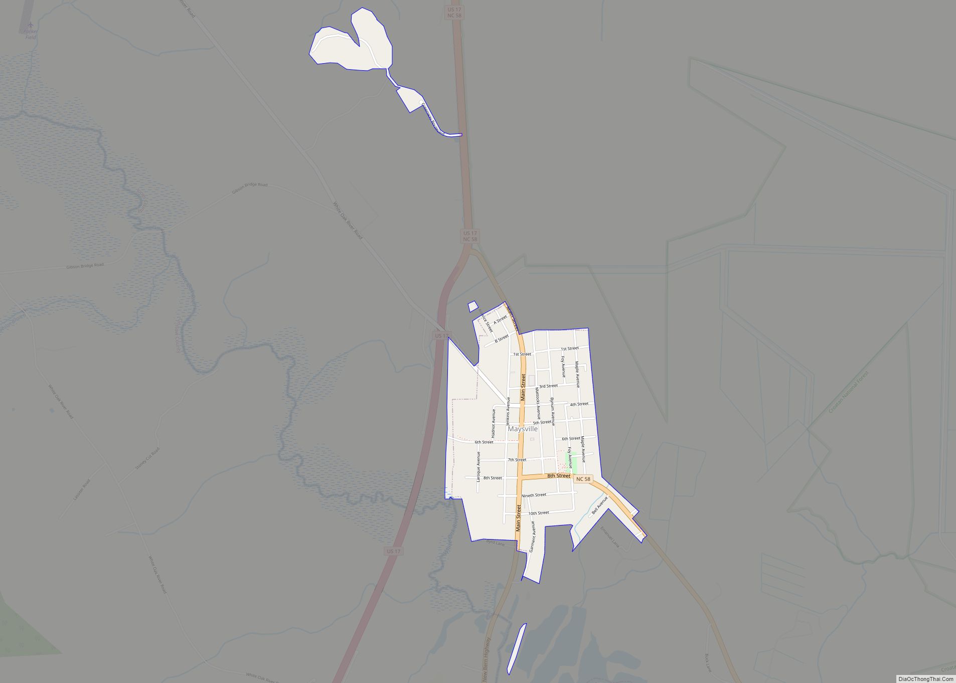
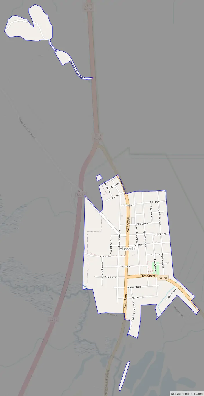
Maysville Road Map
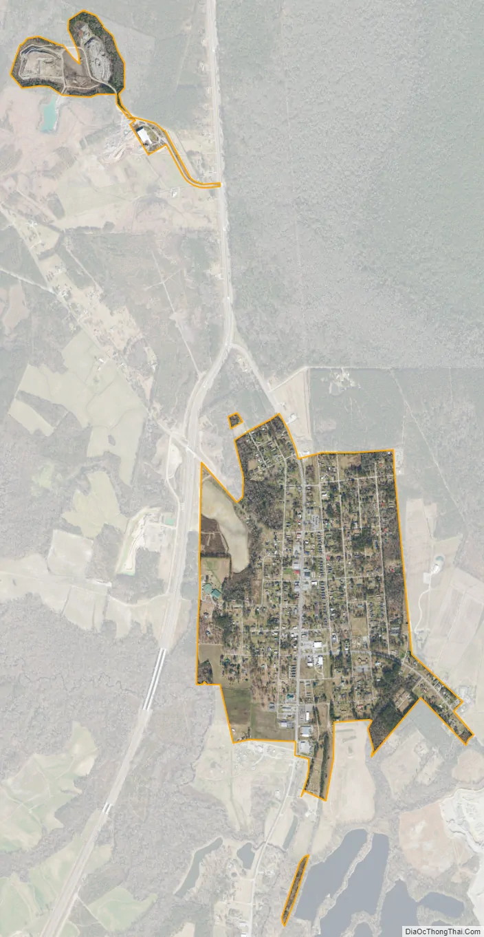
Maysville city Satellite Map
Geography
Maysville is located in southeastern Jones County at 34°54′16″N 77°13′44″W / 34.90444°N 77.22889°W / 34.90444; -77.22889 (34.904581, -77.228969). U.S. Route 17 passes through the center of town, leading north 21 miles (34 km) to New Bern and southwest 15 miles (24 km) to Jacksonville. North Carolina Highway 58 leads southeast from Maysville 20 miles (32 km) to Emerald Isle on the Atlantic coast.
According to the United States Census Bureau, the town has a total area of 0.69 square miles (1.8 km), all land. It is bordered to the east by Croatan National Forest. The White Oak River runs past the southern end of town.
See also
Map of North Carolina State and its subdivision:- Alamance
- Alexander
- Alleghany
- Anson
- Ashe
- Avery
- Beaufort
- Bertie
- Bladen
- Brunswick
- Buncombe
- Burke
- Cabarrus
- Caldwell
- Camden
- Carteret
- Caswell
- Catawba
- Chatham
- Cherokee
- Chowan
- Clay
- Cleveland
- Columbus
- Craven
- Cumberland
- Currituck
- Dare
- Davidson
- Davie
- Duplin
- Durham
- Edgecombe
- Forsyth
- Franklin
- Gaston
- Gates
- Graham
- Granville
- Greene
- Guilford
- Halifax
- Harnett
- Haywood
- Henderson
- Hertford
- Hoke
- Hyde
- Iredell
- Jackson
- Johnston
- Jones
- Lee
- Lenoir
- Lincoln
- Macon
- Madison
- Martin
- McDowell
- Mecklenburg
- Mitchell
- Montgomery
- Moore
- Nash
- New Hanover
- Northampton
- Onslow
- Orange
- Pamlico
- Pasquotank
- Pender
- Perquimans
- Person
- Pitt
- Polk
- Randolph
- Richmond
- Robeson
- Rockingham
- Rowan
- Rutherford
- Sampson
- Scotland
- Stanly
- Stokes
- Surry
- Swain
- Transylvania
- Tyrrell
- Union
- Vance
- Wake
- Warren
- Washington
- Watauga
- Wayne
- Wilkes
- Wilson
- Yadkin
- Yancey
- Alabama
- Alaska
- Arizona
- Arkansas
- California
- Colorado
- Connecticut
- Delaware
- District of Columbia
- Florida
- Georgia
- Hawaii
- Idaho
- Illinois
- Indiana
- Iowa
- Kansas
- Kentucky
- Louisiana
- Maine
- Maryland
- Massachusetts
- Michigan
- Minnesota
- Mississippi
- Missouri
- Montana
- Nebraska
- Nevada
- New Hampshire
- New Jersey
- New Mexico
- New York
- North Carolina
- North Dakota
- Ohio
- Oklahoma
- Oregon
- Pennsylvania
- Rhode Island
- South Carolina
- South Dakota
- Tennessee
- Texas
- Utah
- Vermont
- Virginia
- Washington
- West Virginia
- Wisconsin
- Wyoming