Map of Midway town, North Carolina
Midway is an incorporated town in Davidson County, North Carolina, United States. It is located within the township of the same name. Midway is situated approximately 275 metres (902 ft) above sea level, and as of 2010 had a population of 4,679. Midway is part of the Piedmont Triad region and is neighbored by the communities ... Read more
Map of Midway town, North Carolina
Map of Midland town, North Carolina
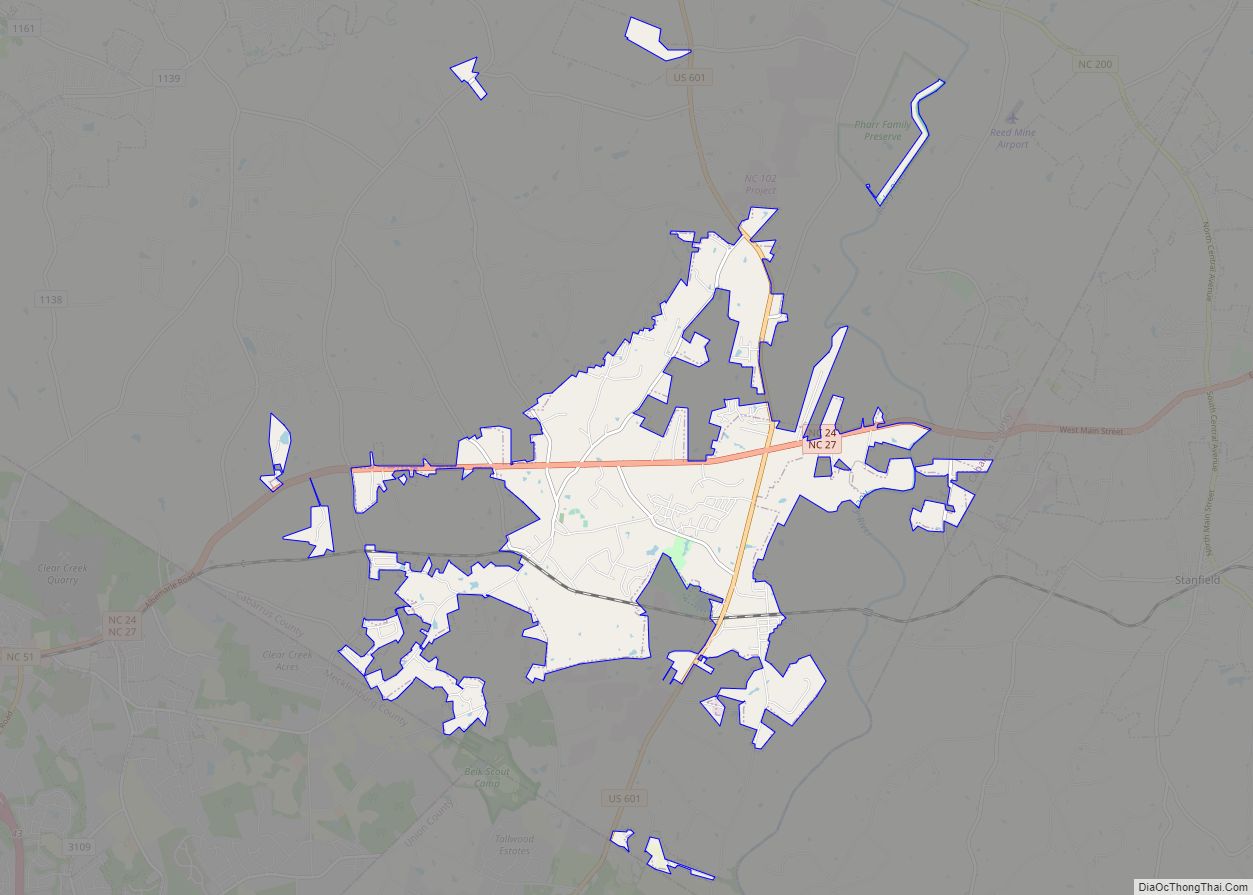
Midland is a town in southern Cabarrus County in the U.S. state of North Carolina. Located in the Charlotte region of North Carolina, Midland is a 30-minute commute to uptown Charlotte. The name of the town is derived from its location approximately halfway between Charlotte and Oakboro on the railroad line. The population was 3,073 ... Read more
Map of Midland town, North Carolina
Map of Middlesex town, North Carolina
Middlesex is a town in Nash County, North Carolina, United States. It is part of the Rocky Mount, North Carolina Metropolitan Statistical Area. Middlesex is about 25 miles east of Raleigh, North Carolina. The population was 822 at the 2010 census. Middlesex town overview: Name: Middlesex town LSAD Code: 43 LSAD Description: town (suffix) State: ... Read more
Map of Middlesex town, North Carolina
Map of Middleburg town, North Carolina
Middleburg is a town in Vance County, North Carolina, United States. The population was 133 at the 2010 census. It was in Warren County and known as Middleburgh prior to the establishment of Vance County in 1881. Middleburg town overview: Name: Middleburg town LSAD Code: 43 LSAD Description: town (suffix) State: North Carolina County: Vance ... Read more
Map of Middleburg town, North Carolina
Map of Micro town
Micro is a town in Johnston County, North Carolina, United States. The 2010 population was 441. Micro town overview: Name: Micro town LSAD Code: 43 LSAD Description: town (suffix) State: North Carolina County: Johnston County Elevation: 187 ft (57 m) Total Area: 0.42 sq mi (1.09 km²) Land Area: 0.42 sq mi (1.09 km²) Water Area: 0.00 sq mi (0.00 km²) Total Population: 458 Population Density: ... Read more
Map of Micro town
Map of Mesic town
Mesic is a town in Pamlico County, North Carolina, United States. The population was 220 at the 2010 census. It is part of the New Bern, North Carolina Micropolitan Statistical Area. Mesic town overview: Name: Mesic town LSAD Code: 43 LSAD Description: town (suffix) State: North Carolina County: Pamlico County Elevation: 7 ft (2 m) Total Area: ... Read more
Map of Mesic town
Map of Mebane city
Mebane /ˈmɛbən/ is a city located mostly in Alamance County, North Carolina, United States, and partly in Orange County. The town was named for Alexander Mebane, an American Revolutionary War general and member of the U.S. Congress. It was incorporated as “Mebanesville” in 1881, and in 1883 the name was changed to “Mebane”. It was ... Read more
Map of Mebane city
Map of McLeansville CDP
McLeansville is an unincorporated community and census-designated place (CDP) in Guilford County, North Carolina, United States. The population was 1,021 at the 2010 census. McLeansville CDP overview: Name: McLeansville CDP LSAD Code: 57 LSAD Description: CDP (suffix) State: North Carolina County: Guilford County Elevation: 748 ft (228 m) Total Area: 6.21 sq mi (16.08 km²) Land Area: 6.13 sq mi (15.89 km²) Water ... Read more
Map of McLeansville CDP
Map of Mineral Springs town, North Carolina
Mineral Springs is a town in Union County, North Carolina, United States. The population was 2,639 at the 2010 census. Mineral Springs town overview: Name: Mineral Springs town LSAD Code: 43 LSAD Description: town (suffix) State: North Carolina County: Union County Elevation: 640 ft (195 m) Total Area: 8.28 sq mi (21.44 km²) Land Area: 8.21 sq mi (21.26 km²) Water Area: 0.07 sq mi ... Read more
Map of Mineral Springs town, North Carolina
Map of Milton town, North Carolina
Milton is a town in Caswell County, North Carolina, United States. The population was 166 at the 2010 census. It is adjacent to the Virginia International Raceway, just across the state line in Virginia. The town’s name was derived from its beginnings as Mill Town. A mill was established prior to the incorporation of the ... Read more
Map of Milton town, North Carolina
Map of Mills River town
Mills River is a town in Henderson County, North Carolina, United States. The population was 6,802 at the 2010 census, and was estimated to be 7,406 in 2019. The town took its name from the nearby confluence of the Mills River and French Broad River. It is part of the Asheville Metropolitan Statistical Area. It ... Read more
Map of Mills River town
Map of Monroe city, North Carolina
Monroe is a city in and the county seat of Union County, North Carolina, United States. The population increased from 32,797 in 2010 to 34,551 in 2020. It is within the rapidly growing Charlotte metropolitan area. Monroe has a council-manager form of government. Monroe city overview: Name: Monroe city LSAD Code: 25 LSAD Description: city ... Read more
Map of Monroe city, North Carolina