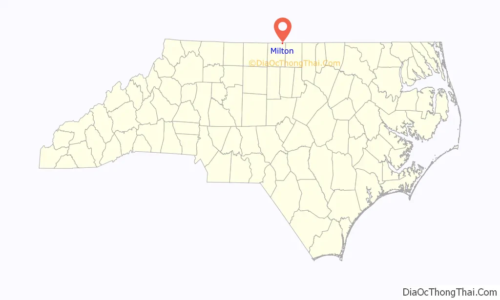
Milton is a town in Caswell County, North Carolina, United States. The population was 166 at the 2010 census. It is adjacent to the Virginia International Raceway, just across the state line in Virginia.
The town’s name was derived from its beginnings as Mill Town. A mill was established prior to the incorporation of the town.
| Name: | Milton town |
|---|---|
| LSAD Code: | 43 |
| LSAD Description: | town (suffix) |
| State: | North Carolina |
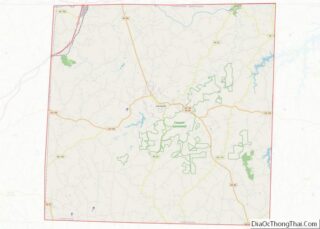
| County: | Caswell County |
| Elevation: | 482 ft (147 m) |
| Total Area: | 0.39 sq mi (1.01 km²) |
| Land Area: | 0.39 sq mi (1.01 km²) |
| Water Area: | 0.00 sq mi (0.00 km²) |
| Total Population: | 155 |
| Population Density: | 398.46/sq mi (153.86/km²) |
| ZIP code: | 27305 |
| Area code: | 336 |
| FIPS code: | 3743300 |
| GNISfeature ID: | 0990036 |
Online Interactive Map
Click on ![]() to view map in "full screen" mode.
to view map in "full screen" mode.
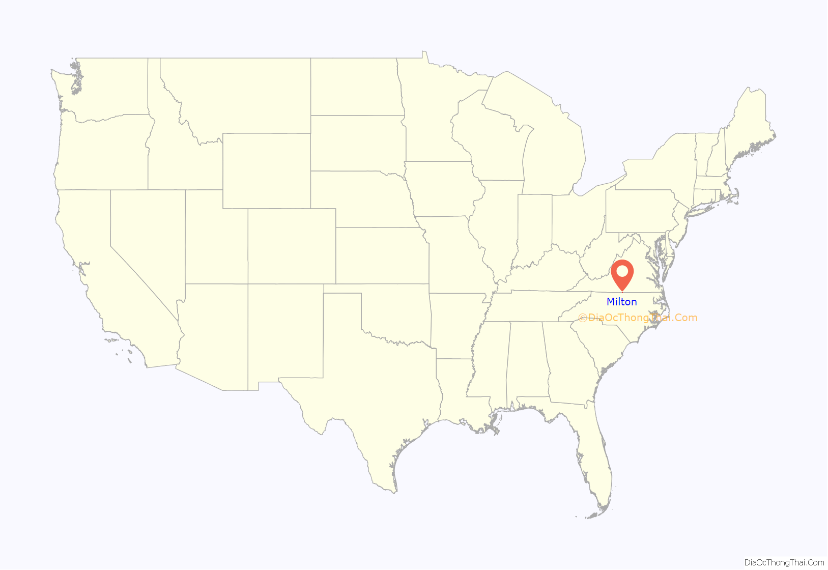
Milton location map. Where is Milton town?
History
Woodside, a historic plantation home, is located 2 miles (3 km) southeast of town along Highway 57. It was the home of Caleb Hazard and Mary Dodson Richmond during the mid-19th century. General Stephen Dodson Ramseur, a distinguished American Civil War hero, was a nephew of Caleb Hazard and Mary Dodson Richmond and stayed with them while recuperating from injuries received in the Battle of Malvern Hill. While there he fell in love with their daughter, Ellen, and they were married in the parlor. Ramseur was killed almost a year later at the Battle of Cedar Creek. Three days after his death, their only daughter was born at Woodside. A historic marker stands at the front of the yard to honor Ramseur. Inside the house is the book about him, titled Lee’s Gallant General. The parlor where the marriage took place is named the Ramseur Parlor, and the portraits of General and Mrs. Ramseur are highlighted in two recessed alcoves in remembrance of their story.
Milton is the northernmost point of the Colonial Heritage Byway. Founded in 1796, Milton is also notable for being the home of Thomas Day, a free Black man who was a renowned cabinetmaker. Day had a workshop and residence in the historic Union Tavern building that is in the process of being restored through an ongoing restoration campaign. Fire damaged the building in 1989.
In addition to Woodside, Longwood, Milton Historic District, Milton State Bank, and Union Tavern are listed on the National Register of Historic Places.
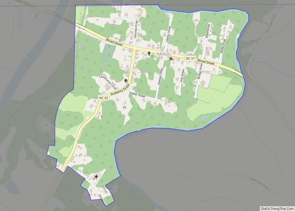
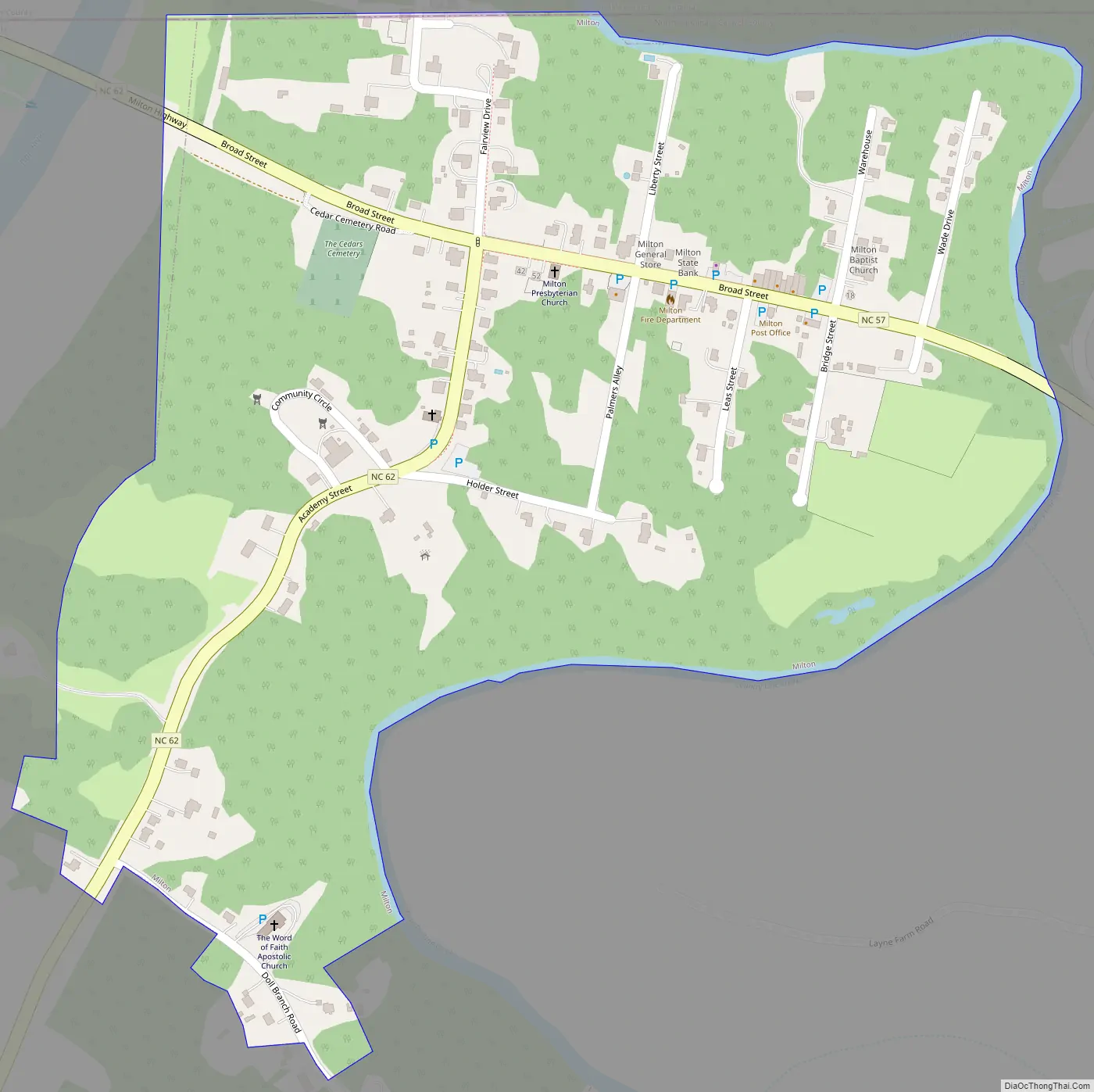
Milton Road Map
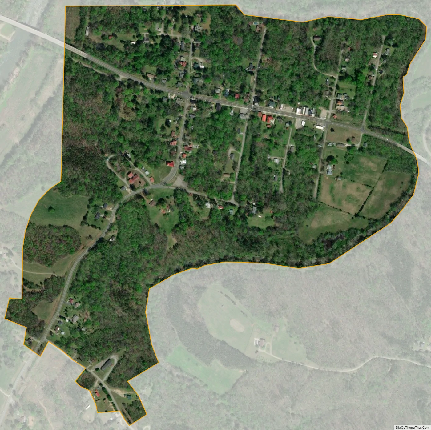
Milton city Satellite Map
Geography
Milton is located in northeastern Caswell County at 36°32′12″N 79°12′29″W / 36.53667°N 79.20806°W / 36.53667; -79.20806 (36.536679, -79.208166), just to the east of the Dan River. The town is bordered to the north by the state line, with Halifax County, Virginia, to the north.
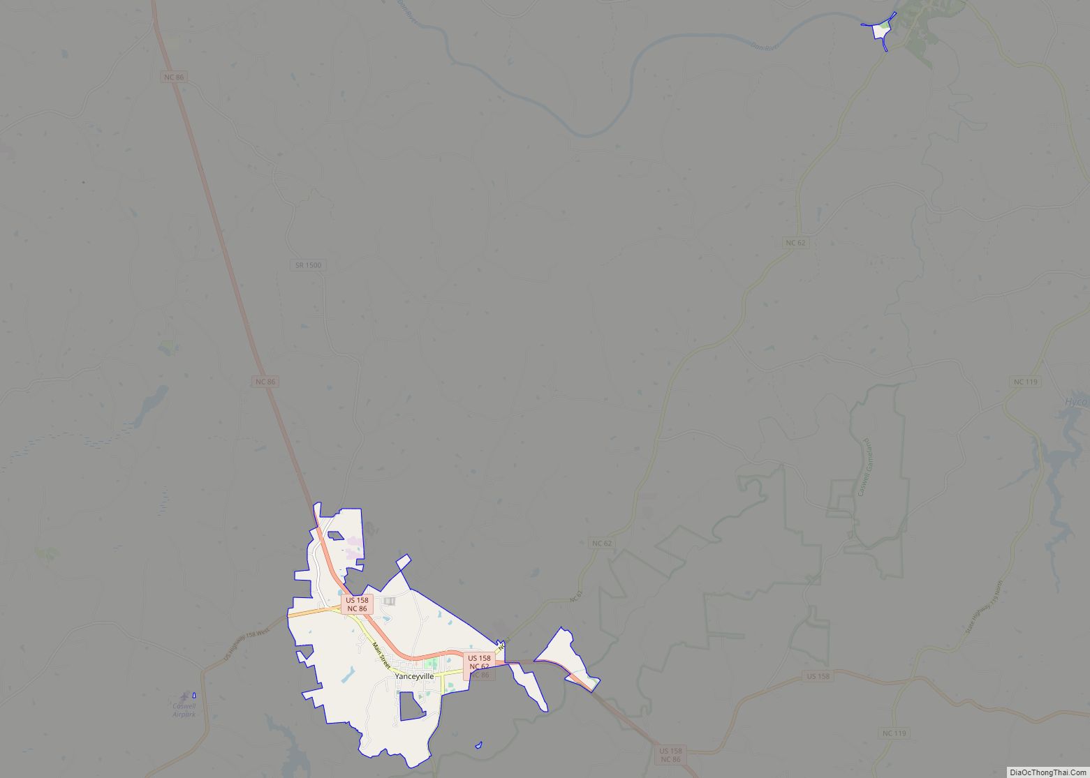
North Carolina Highways 57 and 62 intersect in the center of town. NC 57 leads southeast 18 miles (29 km) to Roxboro, while NC 62 leads southwest 13 miles (21 km) to Yanceyville, the Caswell County seat. NC 62 turns northwest in Milton, crosses the Dan River, and becomes Virginia State Route 62, which leads northwest to U.S. Route 58. By this route it is 12 miles (19 km) from Milton to Danville, Virginia.
According to the United States Census Bureau, Milton has a total area of 0.4 square miles (1.0 km), all land.
See also
Map of North Carolina State and its subdivision:- Alamance
- Alexander
- Alleghany
- Anson
- Ashe
- Avery
- Beaufort
- Bertie
- Bladen
- Brunswick
- Buncombe
- Burke
- Cabarrus
- Caldwell
- Camden
- Carteret
- Caswell
- Catawba
- Chatham
- Cherokee
- Chowan
- Clay
- Cleveland
- Columbus
- Craven
- Cumberland
- Currituck
- Dare
- Davidson
- Davie
- Duplin
- Durham
- Edgecombe
- Forsyth
- Franklin
- Gaston
- Gates
- Graham
- Granville
- Greene
- Guilford
- Halifax
- Harnett
- Haywood
- Henderson
- Hertford
- Hoke
- Hyde
- Iredell
- Jackson
- Johnston
- Jones
- Lee
- Lenoir
- Lincoln
- Macon
- Madison
- Martin
- McDowell
- Mecklenburg
- Mitchell
- Montgomery
- Moore
- Nash
- New Hanover
- Northampton
- Onslow
- Orange
- Pamlico
- Pasquotank
- Pender
- Perquimans
- Person
- Pitt
- Polk
- Randolph
- Richmond
- Robeson
- Rockingham
- Rowan
- Rutherford
- Sampson
- Scotland
- Stanly
- Stokes
- Surry
- Swain
- Transylvania
- Tyrrell
- Union
- Vance
- Wake
- Warren
- Washington
- Watauga
- Wayne
- Wilkes
- Wilson
- Yadkin
- Yancey
- Alabama
- Alaska
- Arizona
- Arkansas
- California
- Colorado
- Connecticut
- Delaware
- District of Columbia
- Florida
- Georgia
- Hawaii
- Idaho
- Illinois
- Indiana
- Iowa
- Kansas
- Kentucky
- Louisiana
- Maine
- Maryland
- Massachusetts
- Michigan
- Minnesota
- Mississippi
- Missouri
- Montana
- Nebraska
- Nevada
- New Hampshire
- New Jersey
- New Mexico
- New York
- North Carolina
- North Dakota
- Ohio
- Oklahoma
- Oregon
- Pennsylvania
- Rhode Island
- South Carolina
- South Dakota
- Tennessee
- Texas
- Utah
- Vermont
- Virginia
- Washington
- West Virginia
- Wisconsin
- Wyoming