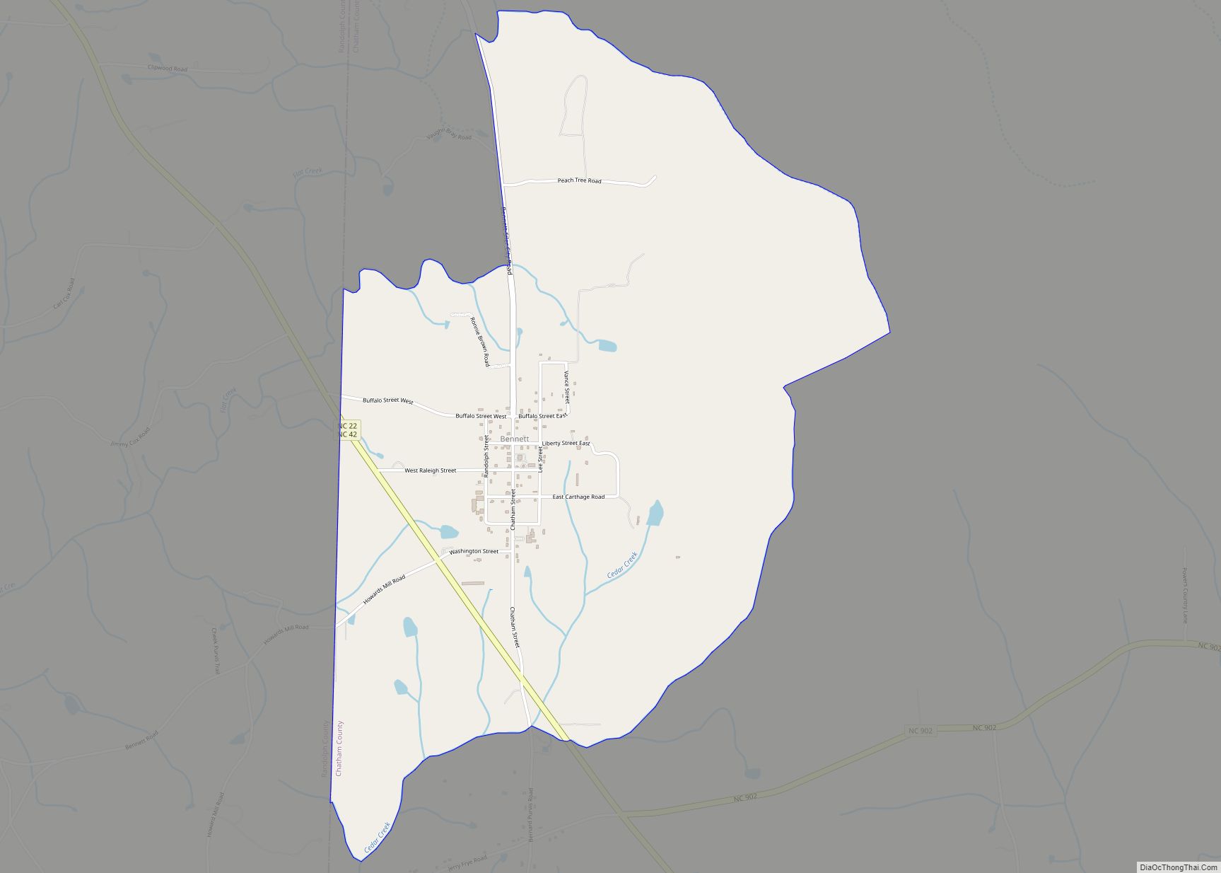
Moncure, founded in 1881, is a small rural unincorporated community in southeastern Chatham County, North Carolina, United States. Moncure and the neighboring community of Haywood form the Moncure census-designated place (CDP), which had a population of 711 at the 2010 census. The community is located near the confluence of the Deep and Haw rivers, which form the Cape Fear River. Moncure once served as the westernmost inland port in the state, linked to the Atlantic Ocean by steamships.
| Name: | Moncure CDP |
|---|---|
| LSAD Code: | 57 |
| LSAD Description: | CDP (suffix) |
| State: | North Carolina |
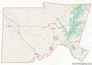
| County: | Chatham County |
| Elevation: | 217 ft (66 m) |
| Total Area: | 4.91 sq mi (12.72 km²) |
| Land Area: | 4.73 sq mi (12.25 km²) |
| Water Area: | 0.18 sq mi (0.47 km²) |
| Total Population: | 780 |
| Population Density: | 164.90/sq mi (63.67/km²) |
| ZIP code: | 27559 |
| FIPS code: | 3743880 |
| GNISfeature ID: | 1021511 |
Online Interactive Map
Click on ![]() to view map in "full screen" mode.
to view map in "full screen" mode.
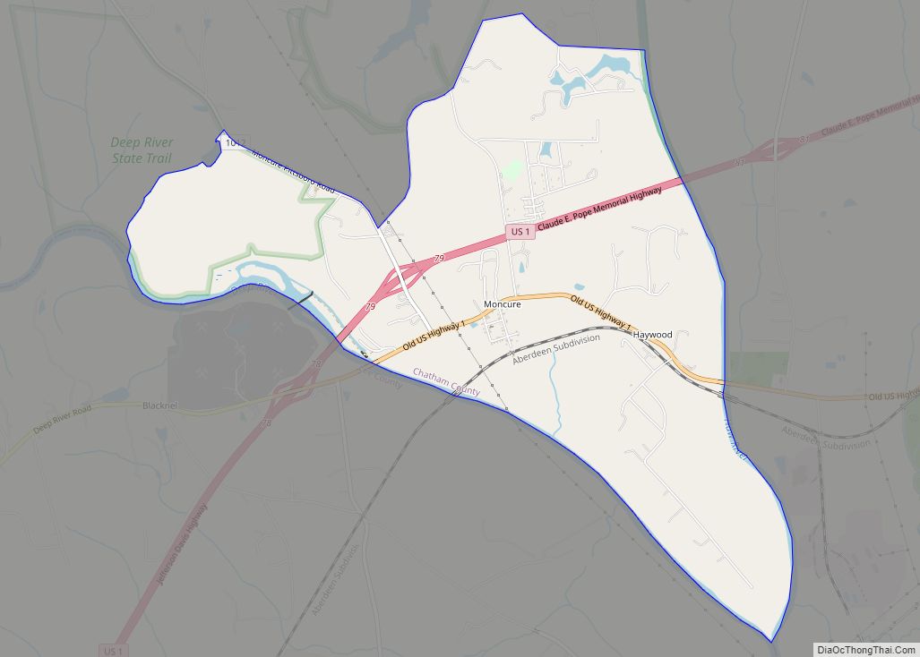
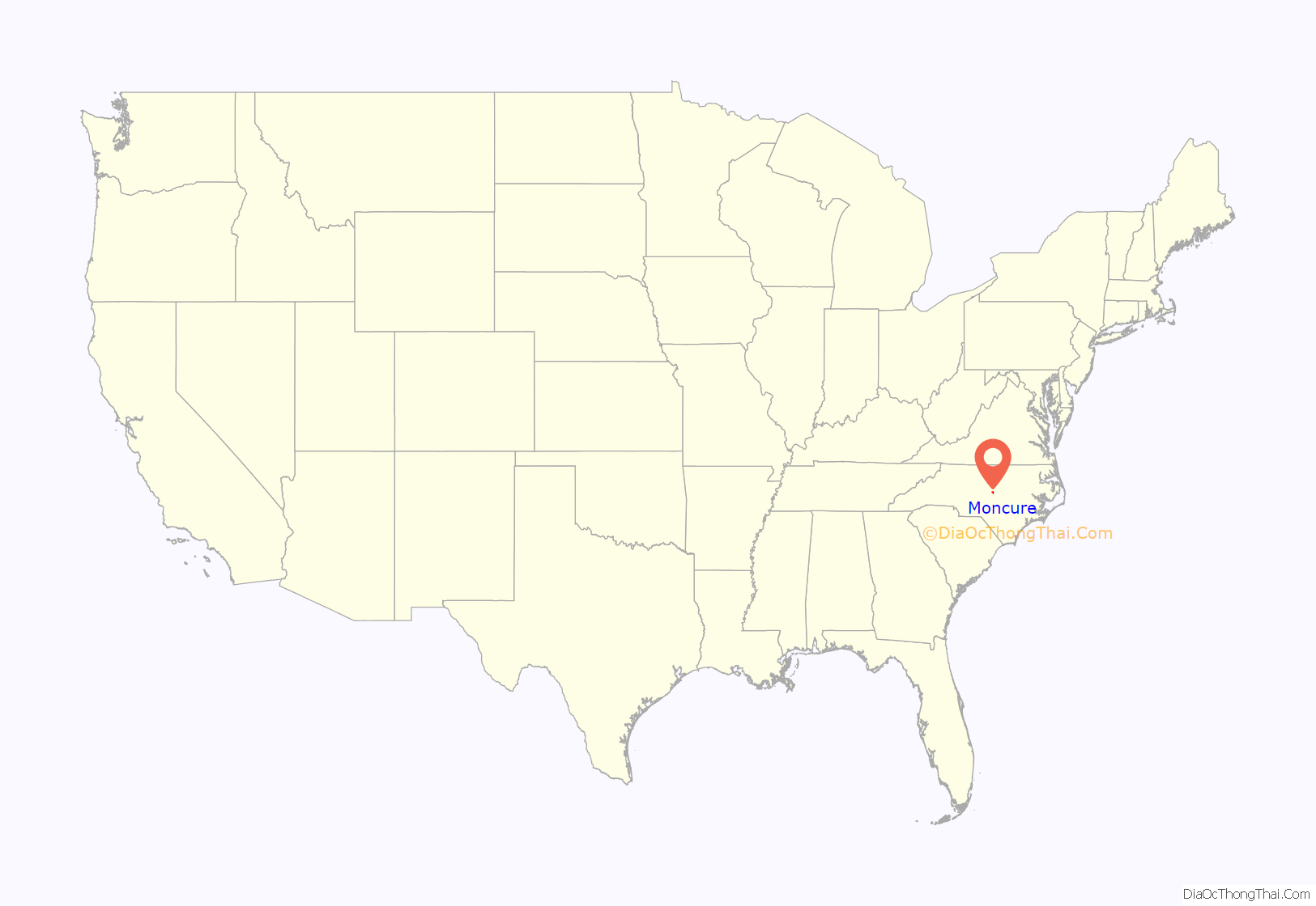
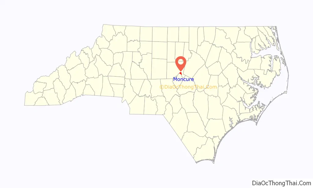
Moncure location map. Where is Moncure CDP?
History
Moncure was founded in 1881 by Thomas Jefferson Moncure, Benjamin Gunter Womble (February 17, 1841 – February 15, 1916), Jake Wisseler, and James Everett Bryan. Thomas Moncure was an engineer for what became the Seaboard Air Line Railroad. Benjamin Womble was a Confederate veteran, owner of the Womble Hotel, and first postmaster of Moncure for 30 years. The old post office now resides on the Womble property that has been continuously owned by his family.
The Newkirk State (Site 3lCH366) and Lockville Dam, Canal and Powerhouse are listed on the National Register of Historic Places.
Moncure Road Map
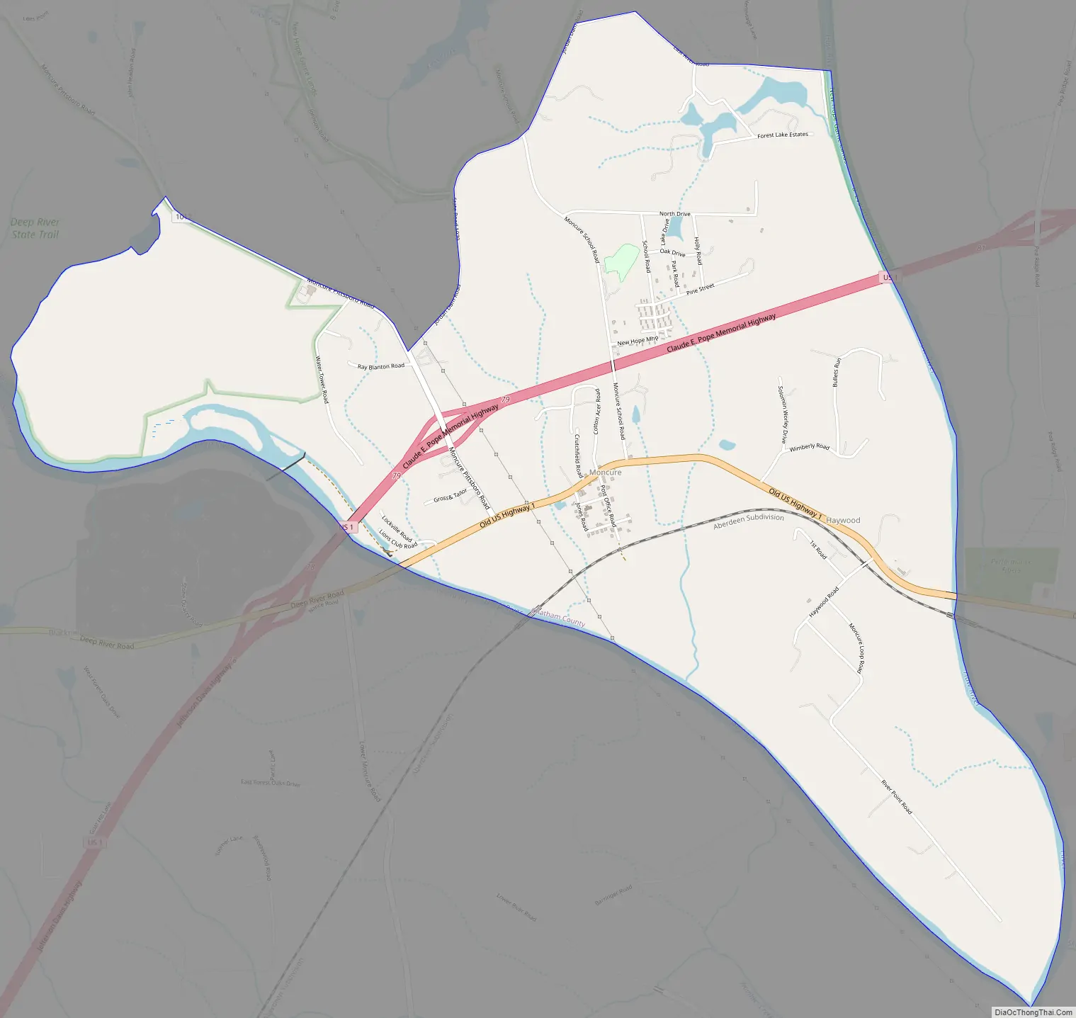
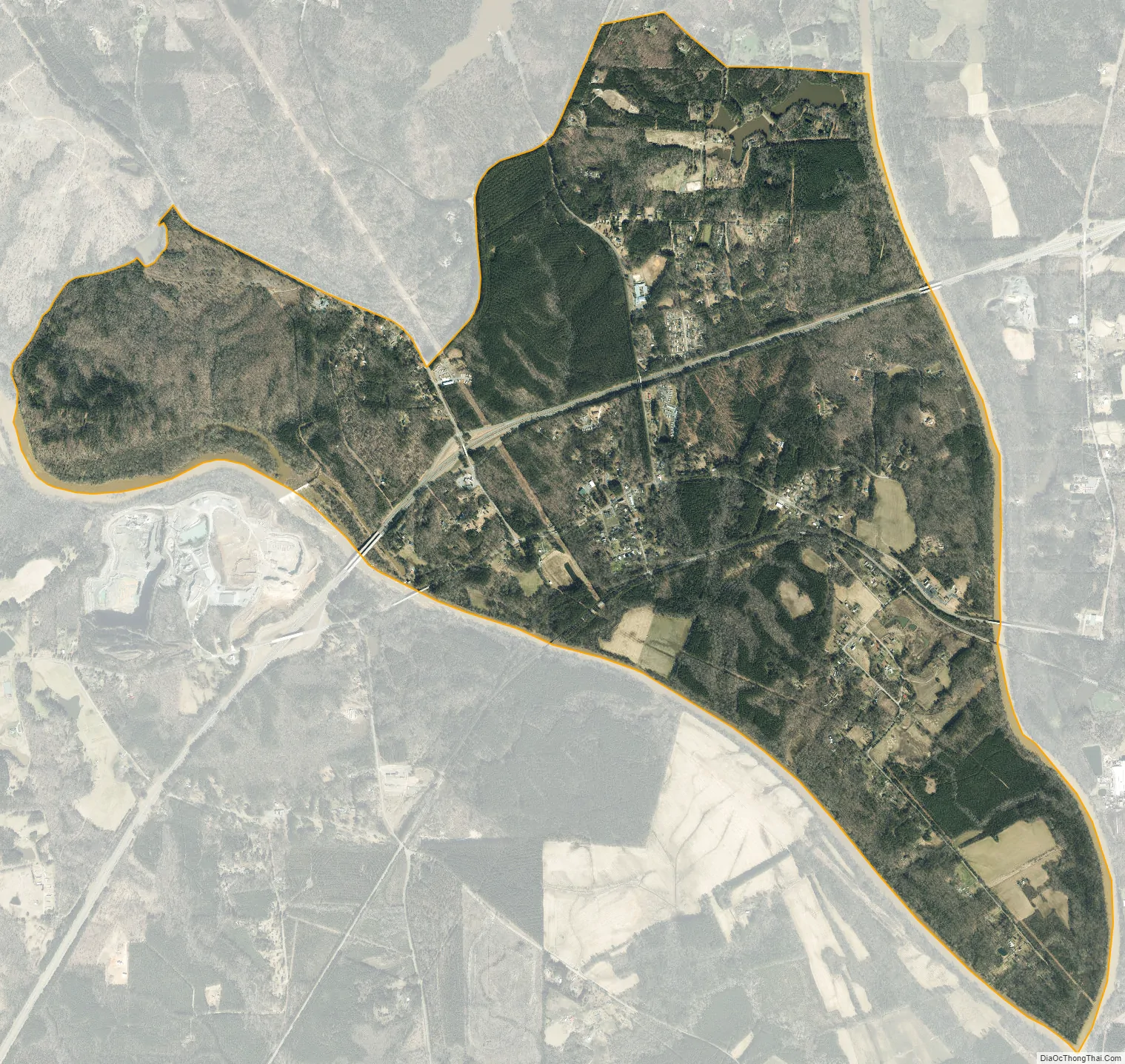
Moncure city Satellite Map
Geography
Moncure is located in southeastern Chatham County, at 35.622N latitude and -79.078W longitude, and at an elevation of approximately 213 feet (65 m). It is bordered on the south by the Deep River, which forms the boundary with Lee County to the south. The Moncure CDP includes the village of Moncure, plus the smaller community of Haywood to the east; both are located along Old US Highway 1. The CDP extends as far east as the Haw River and as far south as the junction of the Haw with the Deep River to form the Cape Fear River. U.S. Route 1, a four-lane expressway, passes through Moncure north of the village center, with access from Exit 79. US 1 leads northeast 28 miles (45 km) to Raleigh, the state capital, and southwest 12 miles (19 km) to Sanford. The area forms a salient or panhandle of Chatham County, lying between Wake and Lee Counties.
According to the United States Census Bureau, the Moncure CDP has a total area of 4.9 square miles (12.8 km), of which 4.7 square miles (12.2 km) is land and 0.23 square miles (0.6 km), or 4.61%, is water.
The B. Everett Jordan Lake Dam is located just north of Moncure, and the area is home to much of Chatham County’s heavy industry, including Shearon Harris Nuclear Power Plant 8 miles (13 km) to the east, and several plywood and lumber plants.
See also
Map of North Carolina State and its subdivision:- Alamance
- Alexander
- Alleghany
- Anson
- Ashe
- Avery
- Beaufort
- Bertie
- Bladen
- Brunswick
- Buncombe
- Burke
- Cabarrus
- Caldwell
- Camden
- Carteret
- Caswell
- Catawba
- Chatham
- Cherokee
- Chowan
- Clay
- Cleveland
- Columbus
- Craven
- Cumberland
- Currituck
- Dare
- Davidson
- Davie
- Duplin
- Durham
- Edgecombe
- Forsyth
- Franklin
- Gaston
- Gates
- Graham
- Granville
- Greene
- Guilford
- Halifax
- Harnett
- Haywood
- Henderson
- Hertford
- Hoke
- Hyde
- Iredell
- Jackson
- Johnston
- Jones
- Lee
- Lenoir
- Lincoln
- Macon
- Madison
- Martin
- McDowell
- Mecklenburg
- Mitchell
- Montgomery
- Moore
- Nash
- New Hanover
- Northampton
- Onslow
- Orange
- Pamlico
- Pasquotank
- Pender
- Perquimans
- Person
- Pitt
- Polk
- Randolph
- Richmond
- Robeson
- Rockingham
- Rowan
- Rutherford
- Sampson
- Scotland
- Stanly
- Stokes
- Surry
- Swain
- Transylvania
- Tyrrell
- Union
- Vance
- Wake
- Warren
- Washington
- Watauga
- Wayne
- Wilkes
- Wilson
- Yadkin
- Yancey
- Alabama
- Alaska
- Arizona
- Arkansas
- California
- Colorado
- Connecticut
- Delaware
- District of Columbia
- Florida
- Georgia
- Hawaii
- Idaho
- Illinois
- Indiana
- Iowa
- Kansas
- Kentucky
- Louisiana
- Maine
- Maryland
- Massachusetts
- Michigan
- Minnesota
- Mississippi
- Missouri
- Montana
- Nebraska
- Nevada
- New Hampshire
- New Jersey
- New Mexico
- New York
- North Carolina
- North Dakota
- Ohio
- Oklahoma
- Oregon
- Pennsylvania
- Rhode Island
- South Carolina
- South Dakota
- Tennessee
- Texas
- Utah
- Vermont
- Virginia
- Washington
- West Virginia
- Wisconsin
- Wyoming