Map of Sparta town, North Carolina

Map of Sparta town, North Carolina

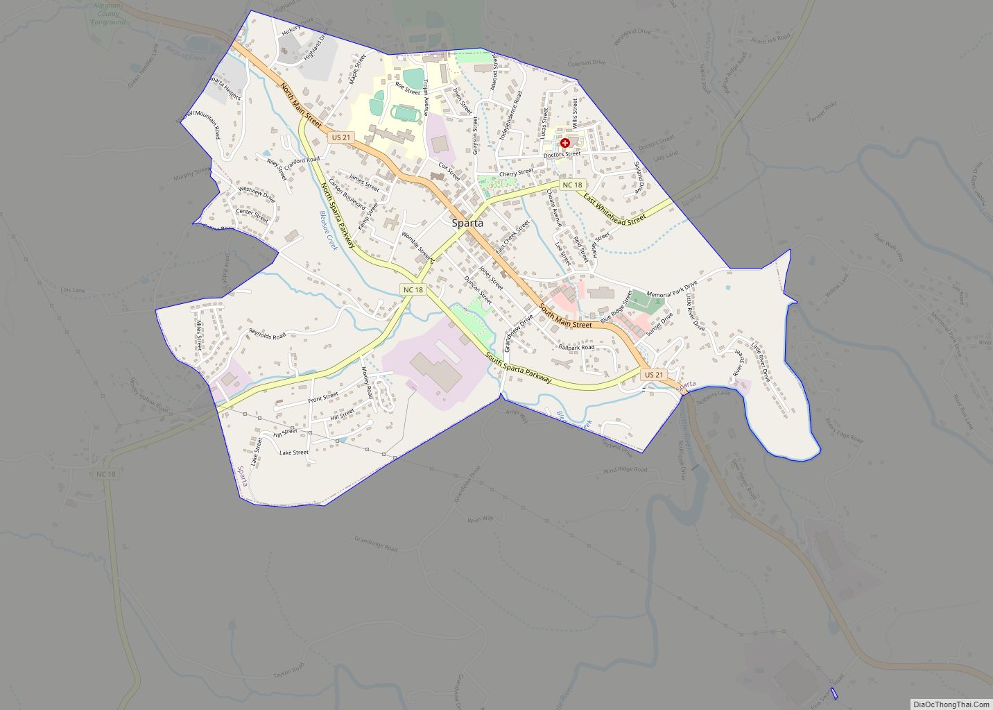
Sparta is a town in Alleghany County, North Carolina, United States. At the last 2010 census, the population was 1,770 people. It is the county seat of Alleghany County. Sparta town overview: Name: Sparta town LSAD Code: 43 LSAD Description: town (suffix) State: North Carolina County: Alleghany County Elevation: 2,927 ft (892 m) Total Area: 2.36 sq mi (6.11 km²) … Read more

Map of Southport city, North Carolina

Map of Southport city, North Carolina

Southport is a city in Brunswick County, North Carolina, United States, near the mouth of the Cape Fear River. Its population was 3,828 as of the 2018 census. The mayor is Joseph P. Hatem. Southport is the location of the North Carolina Fourth of July Festival, which attracts 40,000 to 50,000 visitors annually. Southport city … Read more

Map of Southmont CDP

Map of Southmont CDP, North Carolina

Southmont is an unincorporated community and census-designated place (CDP) in Davidson County, North Carolina, United States. As of the 2010 census it had a population of 1,470. It is located along North Carolina State Highway 8 on the northern shores of High Rock Lake. There is an organized effort underway to incorporate the community as … Read more

Map of Southern Shores town

Map of Southern Shores town

Southern Shores is a town in Dare County, North Carolina, United States. It is located on the Outer Banks and the population was 3,107 at the 2020 census. Southern Shores town overview: Name: Southern Shores town LSAD Code: 43 LSAD Description: town (suffix) State: North Carolina County: Dare County Incorporated: 1969 Elevation: 20 ft (6 m) Total … Read more

Map of Southern Pines town

Map of Southern Pines town

Southern Pines is a town in Moore County, North Carolina, United States. The population was 12,334 as of the 2010 United States Census. Southern Pines town overview: Name: Southern Pines town LSAD Code: 43 LSAD Description: town (suffix) State: North Carolina County: Moore County Elevation: 535 ft (163 m) Land Area: 17.57 sq mi (45.50 km²) Water Area: 0.19 sq mi (0.49 km²) … Read more

Map of South Weldon CDP

Map of South Weldon CDP

South Weldon is an unincorporated community and census-designated place (CDP) in Halifax County, North Carolina, United States. As of the 2010 census, the CDP population was 705. It is part of the Roanoke Rapids, North Carolina Micropolitan Statistical Area. South Weldon CDP overview: Name: South Weldon CDP LSAD Code: 57 LSAD Description: CDP (suffix) State: … Read more

Map of St. James town, North Carolina

Map of St. James town, North Carolina

St. James town overview: Name: St. James town LSAD Code: 43 LSAD Description: town (suffix) State: North Carolina County: Brunswick County FIPS code: 3758630 Online Interactive Map St. James online map. Source: Basemap layers from Google Map, Open Street Map (OSM), Arcgisonline, Wmflabs. Boundary Data from Database of Global Administrative Areas. St. James location map. … Read more

Map of St. Helena village, North Carolina

Map of St. Helena village, North Carolina

St. Helena village overview: Name: St. Helena village LSAD Code: 47 LSAD Description: village (suffix) State: North Carolina County: Pender County FIPS code: 3758620 Online Interactive Map St. Helena online map. Source: Basemap layers from Google Map, Open Street Map (OSM), Arcgisonline, Wmflabs. Boundary Data from Database of Global Administrative Areas. St. Helena location map. … Read more

Map of Spruce Pine town, North Carolina

Map of Spruce Pine town, North Carolina

Spruce Pine is a town in Mitchell County, North Carolina, United States. The population was 2,175 at the 2010 census. Spruce Pine town overview: Name: Spruce Pine town LSAD Code: 43 LSAD Description: town (suffix) State: North Carolina County: Mitchell County Incorporated: 1907 Elevation: 2,559 ft (780 m) Total Area: 4.68 sq mi (12.13 km²) Land Area: 4.68 sq mi (12.13 km²) Water … Read more

Map of Spring Lake town, North Carolina

Map of Spring Lake town, North Carolina

Spring Lake is a town in Cumberland County, North Carolina, United States. The 2010 census recorded the population at 11,964 people, with an estimated population in 2019 of 12,005. Spring Lake town overview: Name: Spring Lake town LSAD Code: 43 LSAD Description: town (suffix) State: North Carolina County: Cumberland County Elevation: 276 ft (84 m) Total Area: … Read more

Map of Spring Hope town

Map of Spring Hope town

Spring Hope is a town in Nash County, North Carolina, United States. It is part of the Rocky Mount, North Carolina Metropolitan Statistical Area. The population was 1,320 at the 2010 census. Spring Hope town overview: Name: Spring Hope town LSAD Code: 43 LSAD Description: town (suffix) State: North Carolina County: Nash County Elevation: 262 ft … Read more

Map of Spivey's Corner CDP

Map of Spivey’s Corner CDP

Spivey’s Corner is a census-designated place located in Sampson County, North Carolina, United States, at the intersection of U.S. Highway 13 and U.S. Highway 421. As of the 2020 census, the CDP had a total population of 576. From 1969 to 2016, Spivey’s Corner was the home of the National Hollerin’ Contest. Contestants from the … Read more