Southern Pines is a town in Moore County, North Carolina, United States. The population was 12,334 as of the 2010 United States Census.
| Name: | Southern Pines town |
|---|---|
| LSAD Code: | 43 |
| LSAD Description: | town (suffix) |
| State: | North Carolina |
| County: | Moore County |
| Elevation: | 535 ft (163 m) |
| Land Area: | 17.57 sq mi (45.50 km²) |
| Water Area: | 0.19 sq mi (0.49 km²) |
| Population Density: | 884.95/sq mi (341.69/km²) |
| ZIP code: | 28387-28388 |
| FIPS code: | 3763120 |
| GNISfeature ID: | 0995240 |
| Website: | www.southernpines.net |
Online Interactive Map
Click on ![]() to view map in "full screen" mode.
to view map in "full screen" mode.
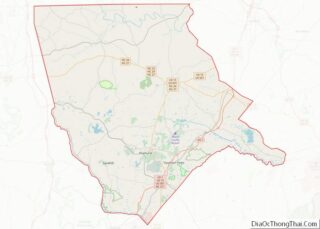
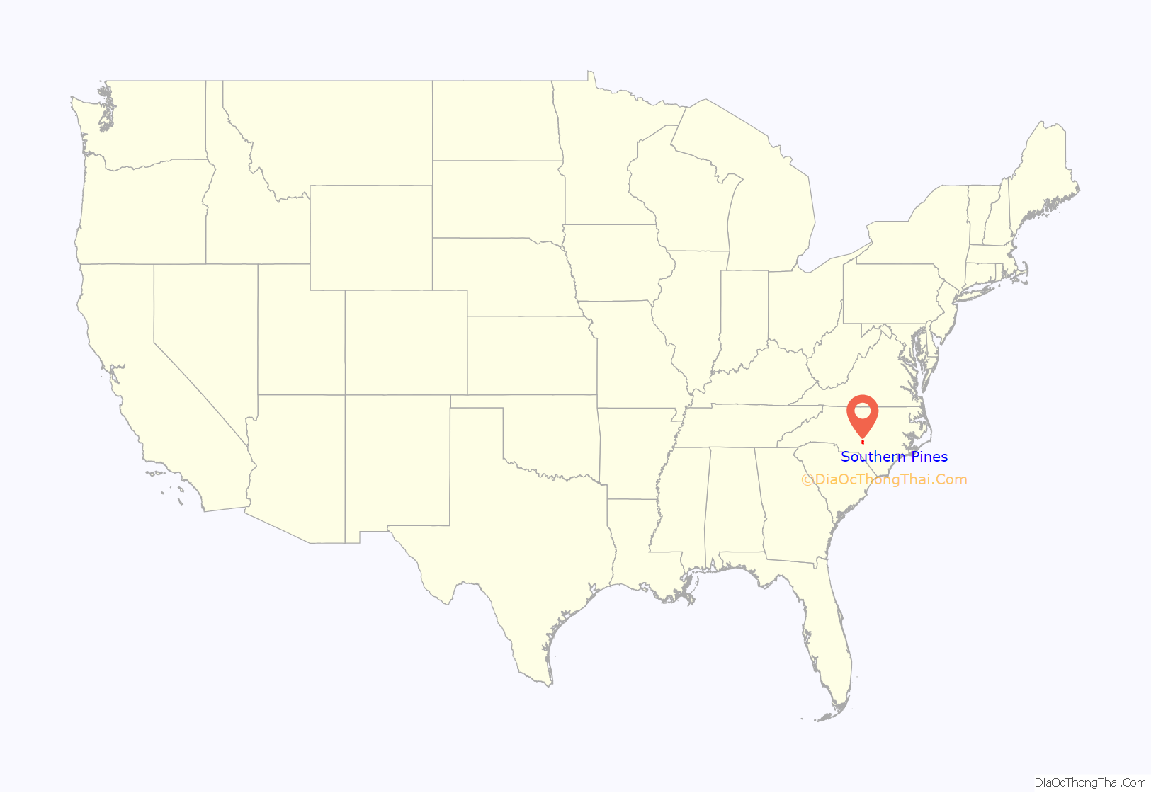
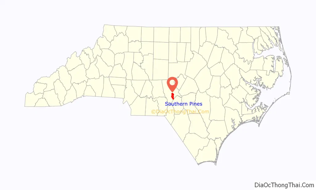
Southern Pines location map. Where is Southern Pines town?
History
Southern Pines was founded as a winter health resort for Northerners.
Southern Pines was incorporated on March 7, 1887.
As of 1898, it was a sundown town where African Americans were not allowed to reside or conduct business.
The James Boyd House, Shaw House, Southern Pines Historic District, Firleigh Farms, and Moore County Hunt Lands and Mile-Away Farms are listed on the National Register of Historic Places. The Southern Pines Golf Club was founded in 1906.
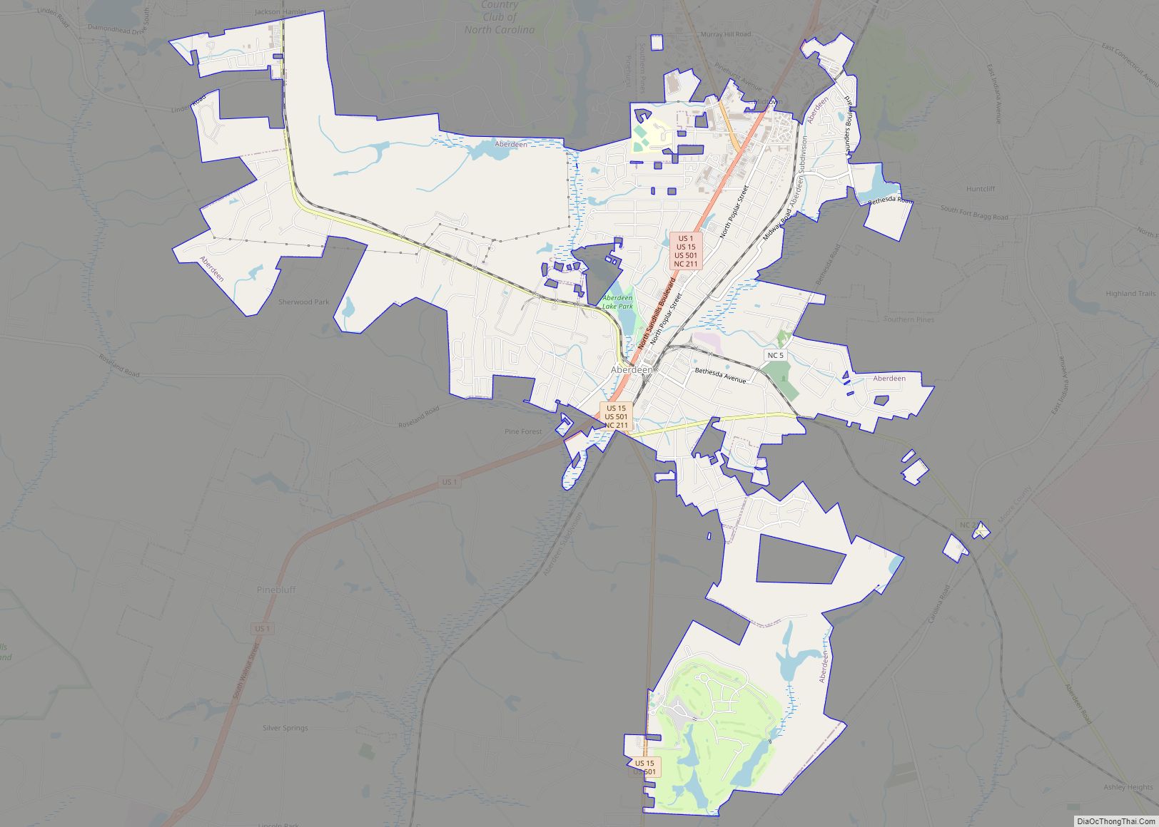
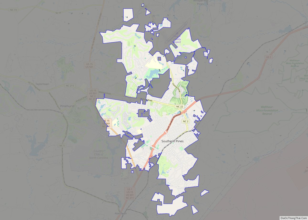
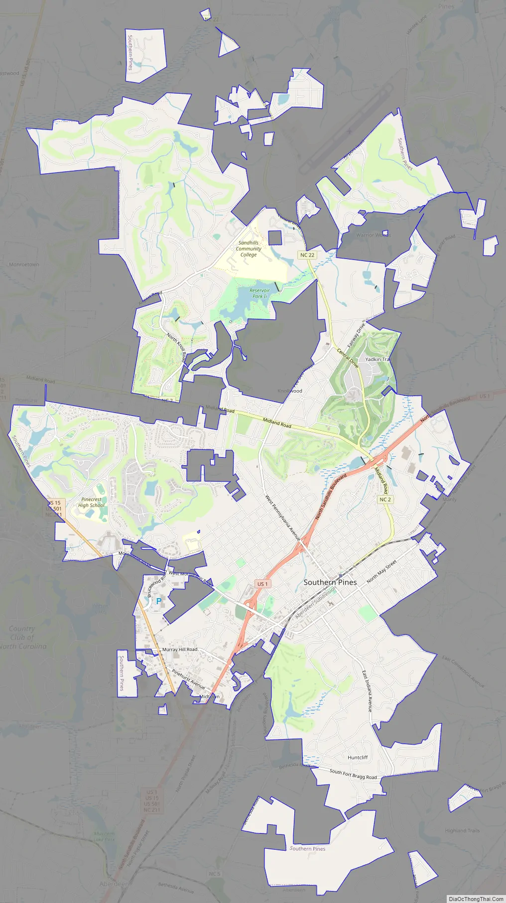
Southern Pines Road Map
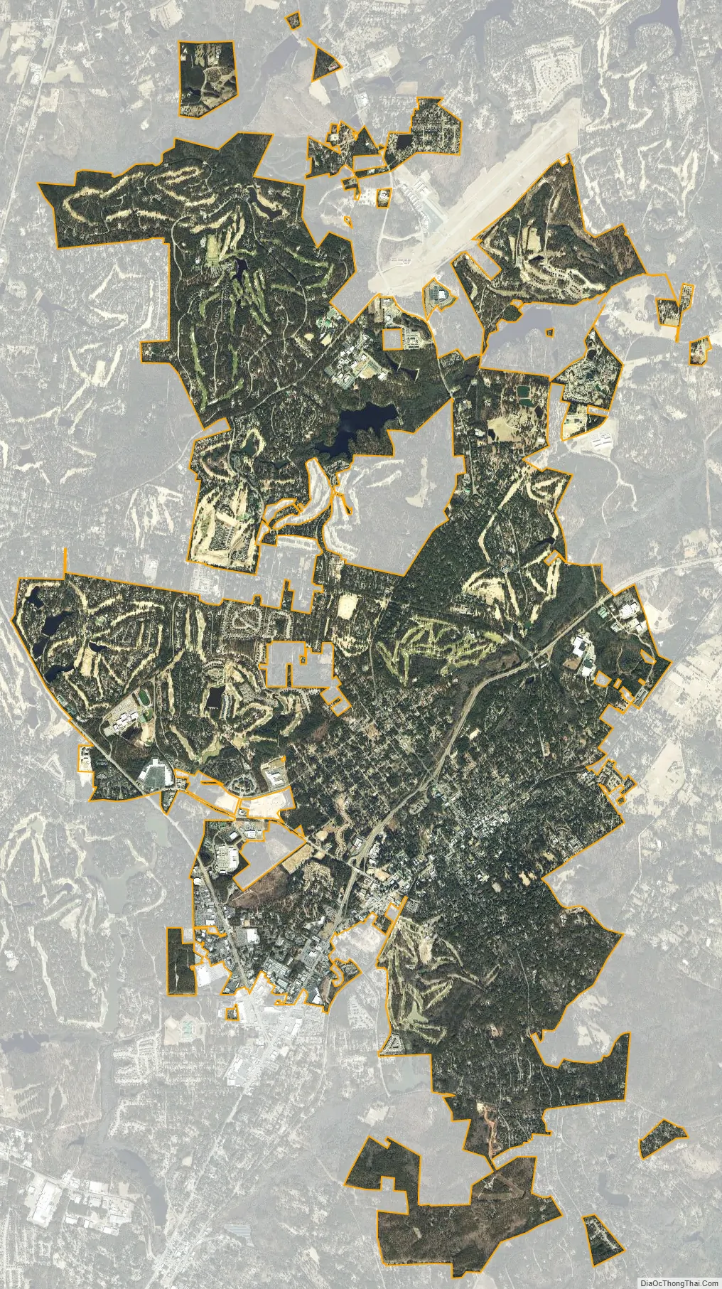
Southern Pines city Satellite Map
Geography
According to the United States Census Bureau, the town has a total area of 15.5 square miles (40.2 km), of which 15.4 square miles (39.8 km) is land and 0.2 square mile (0.5 km) (1.16%) is water.
See also
Map of North Carolina State and its subdivision:- Alamance
- Alexander
- Alleghany
- Anson
- Ashe
- Avery
- Beaufort
- Bertie
- Bladen
- Brunswick
- Buncombe
- Burke
- Cabarrus
- Caldwell
- Camden
- Carteret
- Caswell
- Catawba
- Chatham
- Cherokee
- Chowan
- Clay
- Cleveland
- Columbus
- Craven
- Cumberland
- Currituck
- Dare
- Davidson
- Davie
- Duplin
- Durham
- Edgecombe
- Forsyth
- Franklin
- Gaston
- Gates
- Graham
- Granville
- Greene
- Guilford
- Halifax
- Harnett
- Haywood
- Henderson
- Hertford
- Hoke
- Hyde
- Iredell
- Jackson
- Johnston
- Jones
- Lee
- Lenoir
- Lincoln
- Macon
- Madison
- Martin
- McDowell
- Mecklenburg
- Mitchell
- Montgomery
- Moore
- Nash
- New Hanover
- Northampton
- Onslow
- Orange
- Pamlico
- Pasquotank
- Pender
- Perquimans
- Person
- Pitt
- Polk
- Randolph
- Richmond
- Robeson
- Rockingham
- Rowan
- Rutherford
- Sampson
- Scotland
- Stanly
- Stokes
- Surry
- Swain
- Transylvania
- Tyrrell
- Union
- Vance
- Wake
- Warren
- Washington
- Watauga
- Wayne
- Wilkes
- Wilson
- Yadkin
- Yancey
- Alabama
- Alaska
- Arizona
- Arkansas
- California
- Colorado
- Connecticut
- Delaware
- District of Columbia
- Florida
- Georgia
- Hawaii
- Idaho
- Illinois
- Indiana
- Iowa
- Kansas
- Kentucky
- Louisiana
- Maine
- Maryland
- Massachusetts
- Michigan
- Minnesota
- Mississippi
- Missouri
- Montana
- Nebraska
- Nevada
- New Hampshire
- New Jersey
- New Mexico
- New York
- North Carolina
- North Dakota
- Ohio
- Oklahoma
- Oregon
- Pennsylvania
- Rhode Island
- South Carolina
- South Dakota
- Tennessee
- Texas
- Utah
- Vermont
- Virginia
- Washington
- West Virginia
- Wisconsin
- Wyoming