Map of Bonnetsville CDP
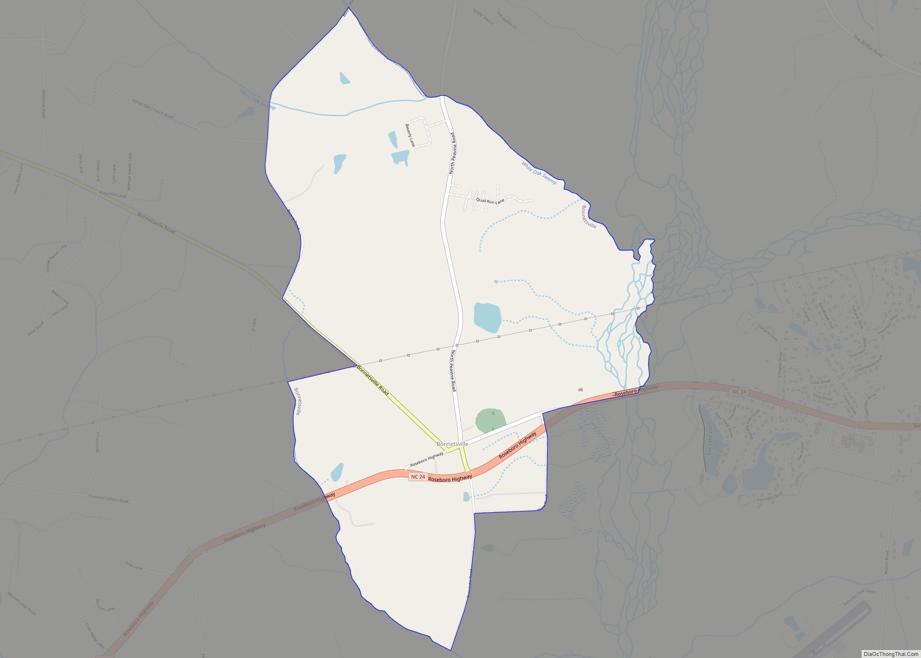
Bonnetsville is a census-designated place (CDP) in Sampson County, North Carolina, United States. The population was 390 at the 2000 census. Bonnetsville CDP overview: Name: Bonnetsville CDP LSAD Code: 57 LSAD Description: CDP (suffix) State: North Carolina County: Sampson County Elevation: 164 ft (50 m) Total Area: 3.31 sq mi (8.58 km²) Land Area: 3.31 sq mi (8.56 km²) Water Area: 0.01 sq mi (0.01 km²) ... Read more
Map of Bonnetsville CDP
Map of Bolton town, North Carolina
Bolton is a town in Columbus County, North Carolina, United States. The population was 691 at the 2010 census. Bolton town overview: Name: Bolton town LSAD Code: 43 LSAD Description: town (suffix) State: North Carolina County: Columbus County Elevation: 64 ft (19 m) Total Area: 3.60 sq mi (9.33 km²) Land Area: 3.60 sq mi (9.33 km²) Water Area: 0.00 sq mi (0.00 km²) Total Population: ... Read more
Map of Bolton town, North Carolina
Map of Bolivia town
Bolivia is a town in Brunswick County, North Carolina, United States. The population was 143 at the 2010 census. It is the county seat of Brunswick County. Bolivia town overview: Name: Bolivia town LSAD Code: 43 LSAD Description: town (suffix) State: North Carolina County: Brunswick County Elevation: 43 ft (13 m) Total Area: 0.64 sq mi (1.65 km²) Land Area: ... Read more
Map of Bolivia town
Map of Boiling Springs town, North Carolina
Boiling Springs is a town in Cleveland County, North Carolina, United States and is located in the westernmost part of the Charlotte metropolitan area, located approximately 50 miles away from the city. As of the 2010 census, the town’s population was 4,647. It is home to Gardner–Webb University. The town is named after the natural ... Read more
Map of Boiling Springs town, North Carolina
Map of Broadway town, North Carolina
Broadway is a town in Lee County, North Carolina, United States. According to the 2010 Census, the population was 1,229. Broadway town overview: Name: Broadway town LSAD Code: 43 LSAD Description: town (suffix) State: North Carolina County: Harnett County, Lee County Elevation: 492 ft (150 m) Total Area: 1.33 sq mi (3.44 km²) Land Area: 1.29 sq mi (3.35 km²) Water Area: 0.03 sq mi ... Read more
Map of Broadway town, North Carolina
Map of Broad Creek CDP
Broad Creek is an unincorporated area and census-designated place (CDP) in Carteret County, North Carolina, United States. As of the 2010 census it had a population of 2,334. It is part of the greater Newport area and currently shares the Newport zip code of 28570. Broad Creek CDP overview: Name: Broad Creek CDP LSAD Code: ... Read more
Map of Broad Creek CDP
Map of Bridgeton town, North Carolina
Bridgeton is a town in Craven County, North Carolina, United States. The population was 454 at the 2010 census. It is part of the New Bern, North Carolina Micropolitan Statistical Area. Bridgeton town overview: Name: Bridgeton town LSAD Code: 43 LSAD Description: town (suffix) State: North Carolina County: Craven County Elevation: 7 ft (2 m) Total Area: ... Read more
Map of Bridgeton town, North Carolina
Map of Bunnlevel CDP
Bunnlevel is an unincorporated community and census-designated place (CDP) along U.S. Highway 401 in Stewarts Creek Township, Harnett County, North Carolina, United States. The population was 552 at the 2010 census. It is a part of the Dunn Micropolitan Area, which is also a part of the greater Raleigh–Durham–Cary Combined Statistical Area (CSA) as defined ... Read more
Map of Bunnlevel CDP
Map of Bunn town
Bunn is a town in Franklin County, North Carolina, United States. The population was 327 at the 2020 census. Bunn town overview: Name: Bunn town LSAD Code: 43 LSAD Description: town (suffix) State: North Carolina County: Franklin County Incorporated: March 3, 1913 Elevation: 279 ft (85 m) Total Area: 0.54 sq mi (1.40 km²) Land Area: 0.54 sq mi (1.40 km²) Water Area: ... Read more
Map of Bunn town
Map of Buies Creek CDP
Buies Creek (/ˈbuːiːz/ BOO-EEZ) is a census-designated place (CDP) located in the Neills Creek Township of Harnett County, North Carolina, United States. It is the home of Campbell University. The population was 3,253 at the 2020 census, up from 2,942 in 2010. Buies Creek is a part of the Dunn Micropolitan Area, which is also ... Read more
Map of Buies Creek CDP
Map of Bryson City town
Bryson City is a town in and the county seat of Swain County, North Carolina, United States. The population was 1,558 as of the 2020 census. Located in what was historically the land of the Cherokee, Bryson City was founded as the Charleston to serve as the county seat of Swain County when it was ... Read more
Map of Bryson City town
Map of Brunswick town, North Carolina
Brunswick is a town in Columbus County, North Carolina, United States. The population was 1,119 at the 2010 census. Brunswick town overview: Name: Brunswick town LSAD Code: 43 LSAD Description: town (suffix) State: North Carolina County: Columbus County Elevation: 79 ft (24 m) Total Area: 0.60 sq mi (1.55 km²) Land Area: 0.60 sq mi (1.55 km²) Water Area: 0.00 sq mi (0.00 km²) Total Population: ... Read more
Map of Brunswick town, North Carolina