Map of Orrin CDP
Orrin is a census-designated place and unincorporated community in Pierce County, North Dakota, United States. Its population was 22 as of the 2010 census. Old Saint John Nepomocene Cemetery, Wrought-Iron Cross Site and St. Mathias Cemetery, Wrought-Iron Cross Site, both in or near Orrin, are listed on the National Register of Historic Places. Orrin CDP ... Read more
Map of Orrin CDP
Map of Oriska city
Oriska is a city in Barnes County, North Dakota, United States. The population was 114 at the 2020 census. Oriska city overview: Name: Oriska city LSAD Code: 25 LSAD Description: city (suffix) State: North Dakota County: Barnes County Founded: 1872 Elevation: 1,270 ft (387 m) Total Area: 0.27 sq mi (0.69 km²) Land Area: 0.27 sq mi (0.69 km²) Water Area: 0.00 sq mi (0.00 km²) ... Read more
Map of Oriska city
Map of Oberon city
Oberon is a city in Benson County, North Dakota, United States. The population was 101 at the 2020 census. Oberon was founded in 1886. Oberon city overview: Name: Oberon city LSAD Code: 25 LSAD Description: city (suffix) State: North Dakota County: Benson County Elevation: 1,578 ft (481 m) Total Area: 0.35 sq mi (0.91 km²) Land Area: 0.35 sq mi (0.91 km²) Water ... Read more
Map of Oberon city
Map of Oakes city
Oakes is the most populous city in Dickey County, North Dakota, United States. The population was 1,798 at the 2020 census. Oakes was founded in 1886. Oakes city overview: Name: Oakes city LSAD Code: 25 LSAD Description: city (suffix) State: North Dakota County: Dickey County Founded: 1886 Elevation: 1,312 ft (400 m) Total Area: 1.56 sq mi (4.05 km²) Land ... Read more
Map of Oakes city
Map of Northwood city, North Dakota
Northwood is a city in Grand Forks County, North Dakota, United States. It is part of the “Grand Forks, ND–MN Metropolitan Statistical Area” or “Greater Grand Forks.” The population was 982 at the 2020 census. Northwood city overview: Name: Northwood city LSAD Code: 25 LSAD Description: city (suffix) State: North Dakota County: Grand Forks County ... Read more
Map of Northwood city, North Dakota
Map of North River city
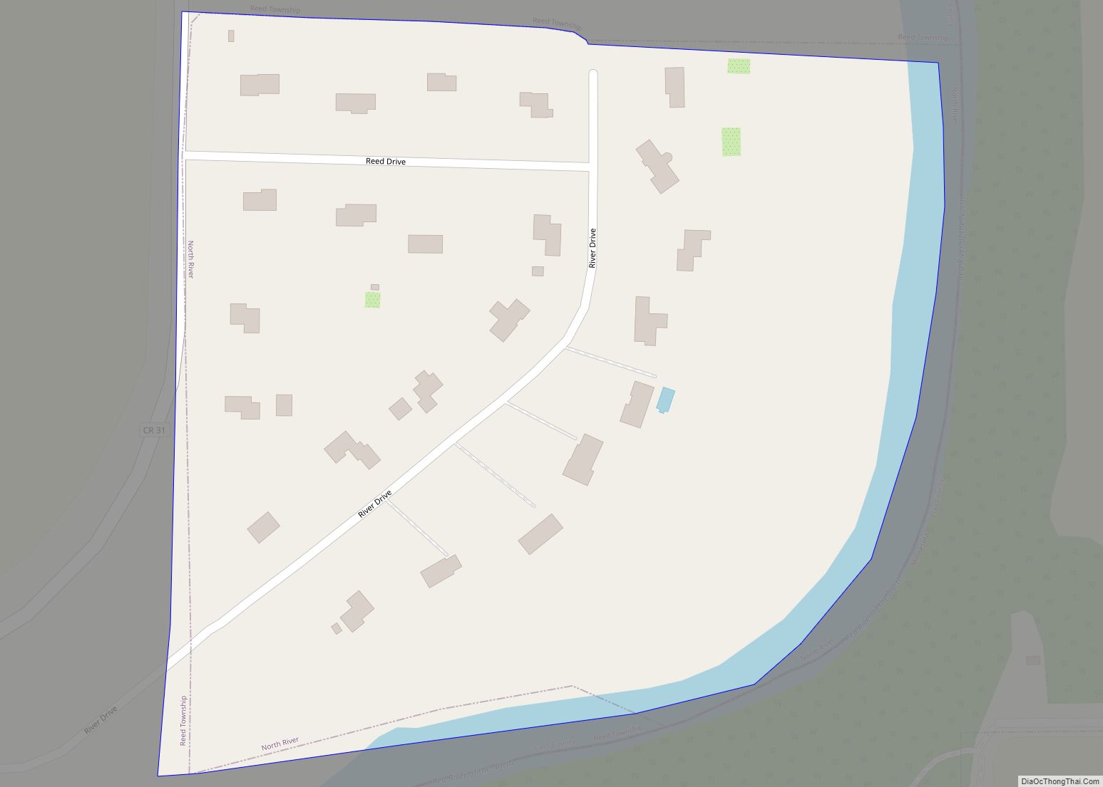
North River is a city in Cass County, North Dakota, United States. The population was 55 at the 2020 census. North River was founded in 1973. It is a suburb/bedroom community directly adjacent to the city of Fargo. North River city overview: Name: North River city LSAD Code: 25 LSAD Description: city (suffix) State: North ... Read more
Map of North River city
Map of Noonan city
Noonan is a city in Divide County, North Dakota, United States. The population was 137 at the 2020 census. Noonan was founded in 1907 and named after a family that had business, farm, and coal interests in the area. It was once known as “The White City” because of an ordinance requiring all buildings to ... Read more
Map of Noonan city
Map of Nome city, North Dakota
Nome is a city in Barnes County, North Dakota, United States. The population was 51 at the 2020 census. Nome was founded in 1901. Nome city overview: Name: Nome city LSAD Code: 25 LSAD Description: city (suffix) State: North Dakota County: Barnes County Founded: 1901 Elevation: 1,339 ft (408 m) Total Area: 0.41 sq mi (1.07 km²) Land Area: 0.41 sq mi ... Read more
Map of Nome city, North Dakota
Map of Niagara city, North Dakota
Niagara is a city in Grand Forks County, North Dakota, United States. It is part of the “Grand Forks, ND–MN Metropolitan Statistical Area” or “Greater Grand Forks”. The population was 46 at the 2020 census. Niagara was founded in 1883. Niagara city overview: Name: Niagara city LSAD Code: 25 LSAD Description: city (suffix) State: North ... Read more
Map of Niagara city, North Dakota
Map of Newburg city, North Dakota
Newburg is a city in Bottineau County, North Dakota, United States. The population was 96 at the 2020 census. Newburg was founded in 1906. Newburg city overview: Name: Newburg city LSAD Code: 25 LSAD Description: city (suffix) State: North Dakota County: Bottineau County Founded: 1906 Elevation: 1,467 ft (447 m) Total Area: 0.14 sq mi (0.36 km²) Land Area: 0.14 sq mi ... Read more
Map of Newburg city, North Dakota
Map of Perth city
Perth is a city in Towner County, North Dakota, United States. The population was 6 at the 2020 census. Perth was founded in 1897. It is not to be confused with Perth, Scotland or Perth, Western Australia. Perth had a newspaper, the Perth Journal, from 1898 to 1904. Perth is assigned ZIP Code 58363. Perth ... Read more
Map of Perth city
Map of Pembina city
Pembina (/ˈpɛmbɪnə/ (listen)) is a city in Pembina County, North Dakota, United States. The population was 512 at the 2020 census. Pembina is located 2 miles (3.2 km) south of the Canada–US border. Interstate 29 passes on the west side of Pembina, leading north to the Canada–US border at Emerson, Manitoba and south to the cities ... Read more
Map of Pembina city