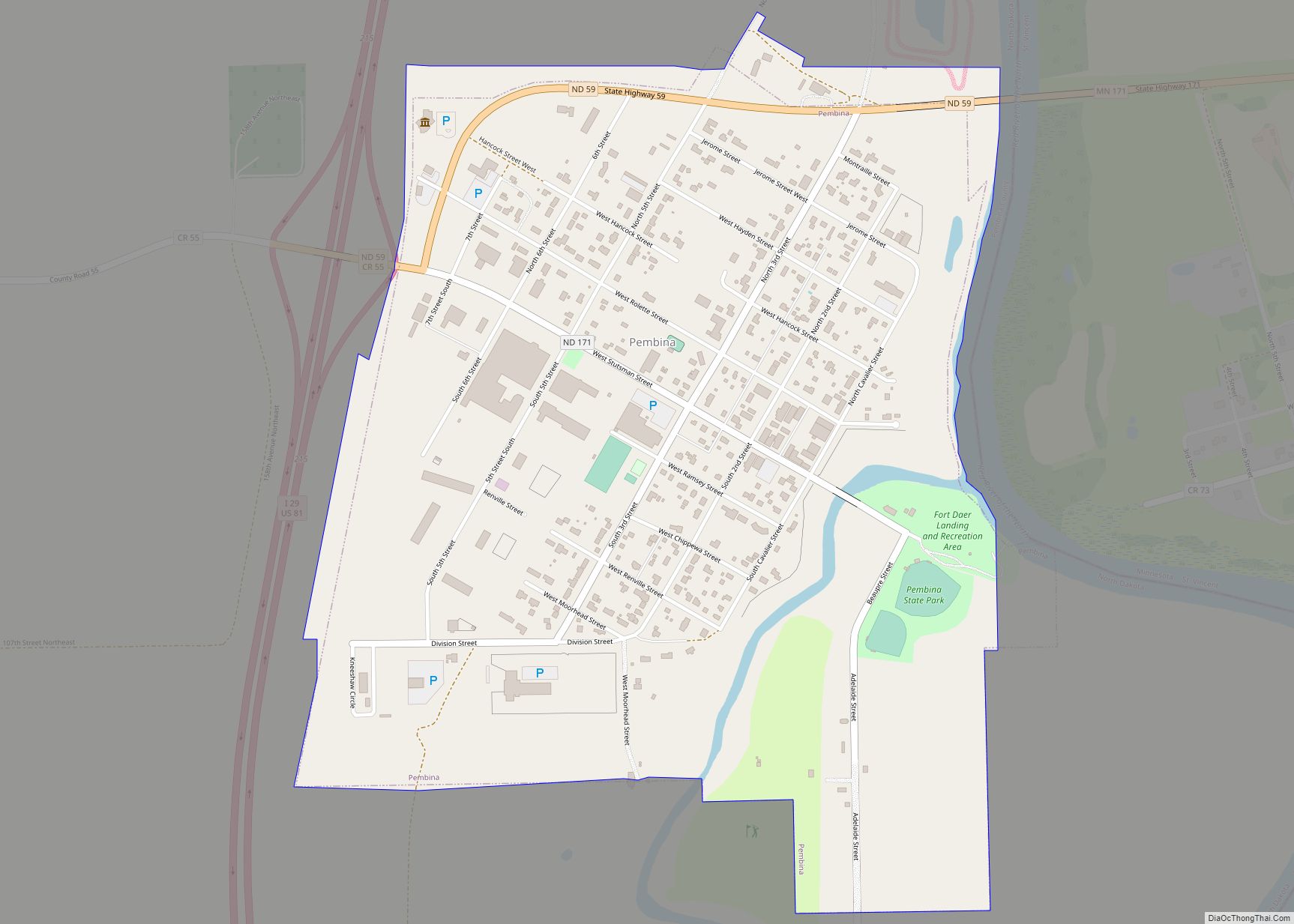
Pembina (/ˈpɛmbɪnə/ (listen)) is a city in Pembina County, North Dakota, United States. The population was 512 at the 2020 census. Pembina is located 2 miles (3.2 km) south of the Canada–US border. Interstate 29 passes on the west side of Pembina, leading north to the Canada–US border at Emerson, Manitoba and south to the cities of Grand Forks and Fargo. The Pembina-Emerson Border Crossing is the busiest between Blaine, Washington and Detroit, Michigan and the fifth busiest along the Canada-United States border. It is one of three 24-hour ports of entry in North Dakota, the others being Portal and Dunseith. The Noyes–Emerson Border Crossing, located 2 miles (3.2 km) to the east on the Minnesota side of the Red River, also processed cross border traffic until its closure in 2006.
The area of Pembina was long inhabited by various indigenous peoples. At the time of 16th century French exploration and fur trading, historical Native American tribes included the Lakota (Sioux, as the French called them), the Chippewa (Ojibwe), and the Assiniboine. The British/Canadian Hudson’s Bay Company (HBC) established a fur-trading post on the site of present-day Pembina in 1797, and it is the oldest European-American community in the Dakotas. The first permanent HBC-sponsored settlement in Pembina started in 1812. Prior to the Treaty of 1818, Pembina was located in Rupert’s Land, the HBC’s trading territory. The treaty transferred the Red River Valley south of the 49th parallel to the United States, but until 1823, both the United States and the British authorities believed Pembina was north of the 49th and therefore in Rupert’s Land. That year United States Army Major Stephen H. Long’s survey of the 49th parallel revealed Pembina’s location to be just south of the Rupert’s Land – United States border. Pembina was officially founded in 1843. In 1851, the US established its first post office in present-day North Dakota in Pembina. Pembina was the most populous place in North Dakota according to the 1860 census. Pembina served as county seat from 1867 to 1911, being designated as a town in 1885.
Pembina is home to the U.S. satellite plant of Motor Coach Industries, which completes assembly of intercity buses. Its major clients include Greyhound Lines.
| Name: | Pembina city |
|---|---|
| LSAD Code: | 25 |
| LSAD Description: | city (suffix) |
| State: | North Dakota |
| County: | Pembina County |
| Founded: | 1797 (Officially 1843) |
| Elevation: | 778 ft (237 m) |
| Total Area: | 0.81 sq mi (2.11 km²) |
| Land Area: | 0.81 sq mi (2.09 km²) |
| Water Area: | 0.01 sq mi (0.02 km²) |
| Total Population: | 512 |
| Population Density: | 634.45/sq mi (245.03/km²) |
| ZIP code: | 58271 |
| Area code: | 701 |
| FIPS code: | 3861580 |
| GNISfeature ID: | 1030666 |
| Website: | cityofpembina.org |
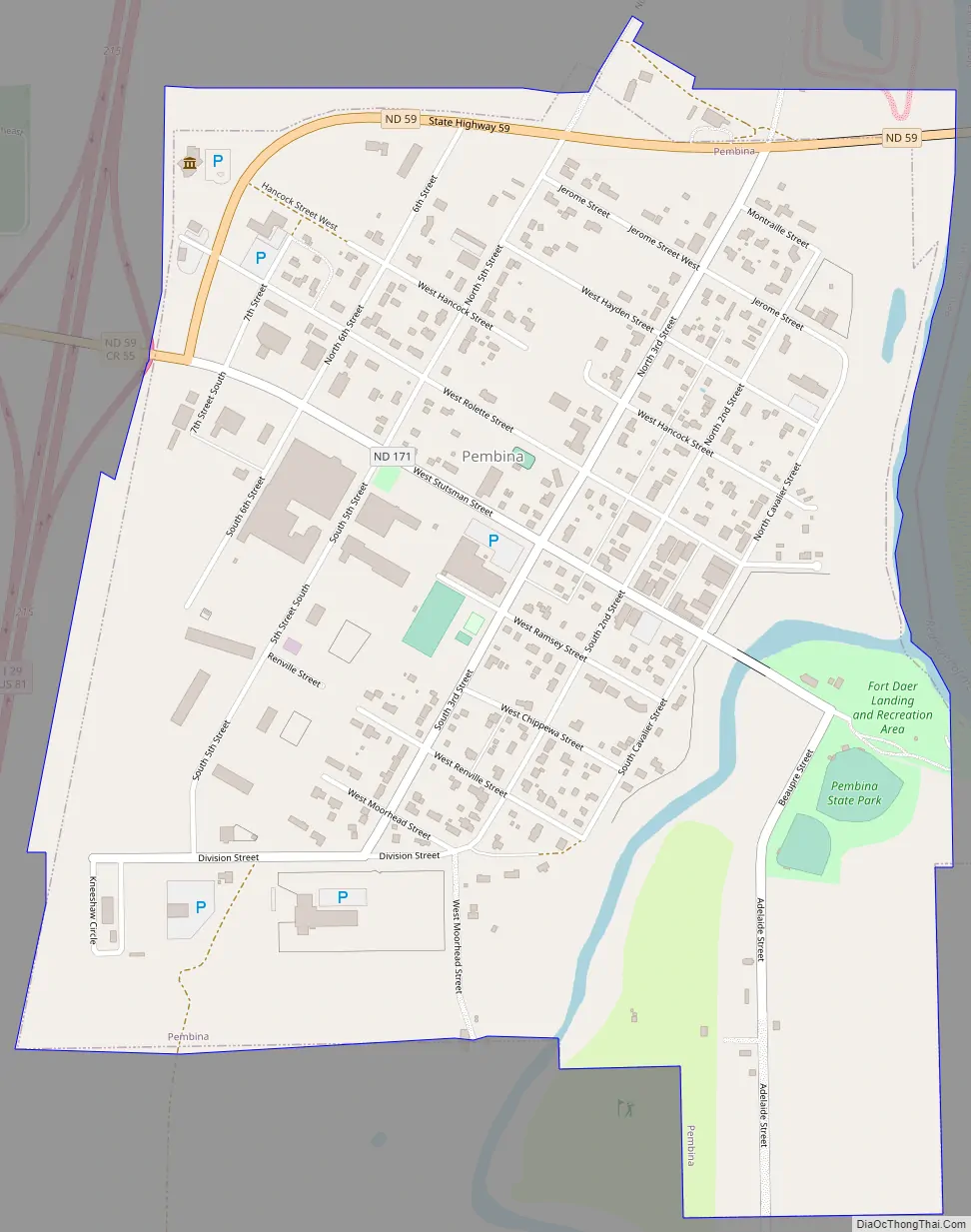
Online Interactive Map
Click on ![]() to view map in "full screen" mode.
to view map in "full screen" mode.
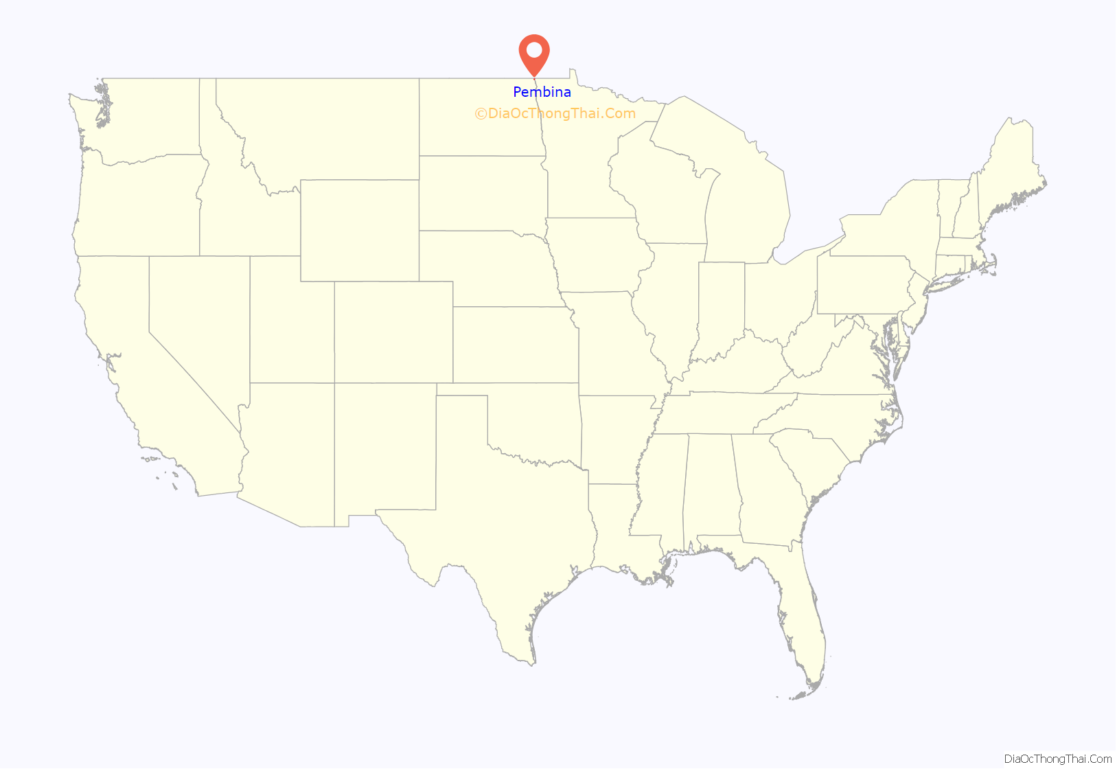
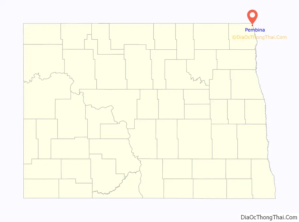
Pembina location map. Where is Pembina city?
History
The Pembina area was historically at the borders of the territories of the Lakota, the Chippewa, and the Assiniboine, American Indian tribes, who competed for hegemony. Their conflict increased beginning with the French introduction of firearms in the late 17th century as part of their goods traded for furs. The first known European] visitors to the Pembina region were the French La Vérendrye family in the early 18th century.
Pembina’s recorded history of European encounter extended for more than 200 years. Started by the French as a fur trading post for commerce with Native Americans, it was also tied to trade for plains bison. European trappers who hunted in the Red River of the North area frequently married Native women and often lived with local tribes at least part of the year. Their descendants became part of their hunting and trapping culture, and formed the ethnic group recognized in Canada as Métis people.
The settlement was associated with the histories of French Canada, the North West Company (NWC), the Hudson’s Bay Company (HBC), the Red River Colony, Battle of Seven Oaks, the Red River Rebellion, Assiniboia, and Manitoba. Through much of the nineteenth century, Métis families used the two-wheeled Red River ox cart trains to travel into the Great Plains, where the men would hunt bison and women would process the meat, skins, and bones. All parts were used for clothing, tepees, etc. Their regular trade routes became known as the Red River Trails. This area was part of the United States’ Dakota and Minnesota territories; and Canada–US border politics.
Fort Pembina trading posts
- Peter Grant of the North West Company, between 1784 and 1789, built a post on the east side of the Red River. It had disappeared by 1801.
- In 1797, Jean Baptiste Chaboillez of the North West Company built a post on the south bank of the Pembina in what is now Pembina State Park.
- From 1800 to 1805, the XY Company had a post within sight of the two following posts. It was absorbed by the North West Company.
- In 1801, Alexander Henry the younger, also of the North West Company, built a post on the north bank across from Chaboillez’s post. He remained in charge until 1808. It was absorbed by the Hudson’s Bay Company in 1821.
- By 1793, the Hudson’s Bay Company had a small post (seemingly called Fort Skene) on the east side on the Red River. It was rebuilt in 1801. By 1805, most of the local beaver had been exterminated. Pembina was the traditional rendezvous for the Métis buffalo hunt. It was also a center for illicit trade with the United States. The HBC post operated until at least 1870, even though it was known to be south of the border.
- In 1812, Selkirk settlers from the Red River Colony built Fort Daer on the Chaboillez site.
- In the 1820s, David Thompson determined that Pembina was south of the 49th parallel, and therefore had been transferred to the United States from British Rupert’s Land by the Treaty of 1818.
- In the 1840s, Norman Kittson of the American Fur Company had an establishment.
- In September 1872, a joint Canadian and American boundary survey commission met in Pembina where they over-wintered before setting off in the spring of 1873 to survey and mark the Canada-U.S. border along the 49th parallel.
Fort Pembina
Due to the unrest among Native Americans of the Red River Valley after the American Civil War, the Minnesota Legislature petitioned Congress to build a fort, especially to defend against incursions by the Lakota (Sioux), some of whom had migrated to Rupert’s Land to evade the US Army.
As a result, Major General Winfield Scott Hancock recommended the establishment of the post on December 8, 1869; Fort Pembina was completed on July 8, 1870. Located 1+1⁄2 miles (2.4 km) south of the settlement, it was just above the mouth of the Pembina River. It was originally called Fort Thomas, for Major General George Henry Thomas, who died on March 28, 1870. The post was designated as Fort Pembina on September 6, 1870. Seriously damaged by fire on May 27, 1895, it was abandoned on August 16, 1895. It was later sold at public auction.
Métis in Pembina
The Métis had a very strong connection with Pembina during the 19th century. Individual and groups of bison hunters and goods traders were based in Pembina. In 1818, with the help of Father Dumoulin, the Roman Catholic Church created a mission in Pembina with the goal of converting buffalo hunters and other Native Americans to Catholicism. The records show a clear engagement among the Métis with Catholicism; Father Dumoulin baptised 394 people before the closure of the mission in 1823, and Assomption Catholic Church recorded 166 burials between 1848 and 1892 (with 147 being either French or English/Scottish Métis.)
Recent history
Pembina was officially designated as a city in 1967.
The noted American author Louise Erdrich has represented the Pembina River and the Pembina Band of the Ojibwe Indians on the Turtle Mountain Reservation in numerous works of fiction. In the past several books, the Pembina have celebrated their unique heritage.
Despite its small size, Pembina maintained a television station, KCND-TV channel 12, from 1960 to 1975. The station was a border blaster primarily targeting Winnipeg from as close to the border as possible; when simultaneous substitution rules took effect in the early 1970s, Canadian interests bought the intellectual property of the station and relocated it to Winnipeg, where it was relicensed by the Canadian government as CKND-TV channel 9, and has operated there ever since. Channel 12 in Pembina was rechristened in 1986 as KNRR, a satellite of KVRR Fargo.
Its population in federal censuses has never exceeded 1,000. In 2022, author Sophia Wilkie wrote a book named “Rose’s Faith-Testing Adventure”, which features Pembina as the main character’s destination.
Pembina Road Map
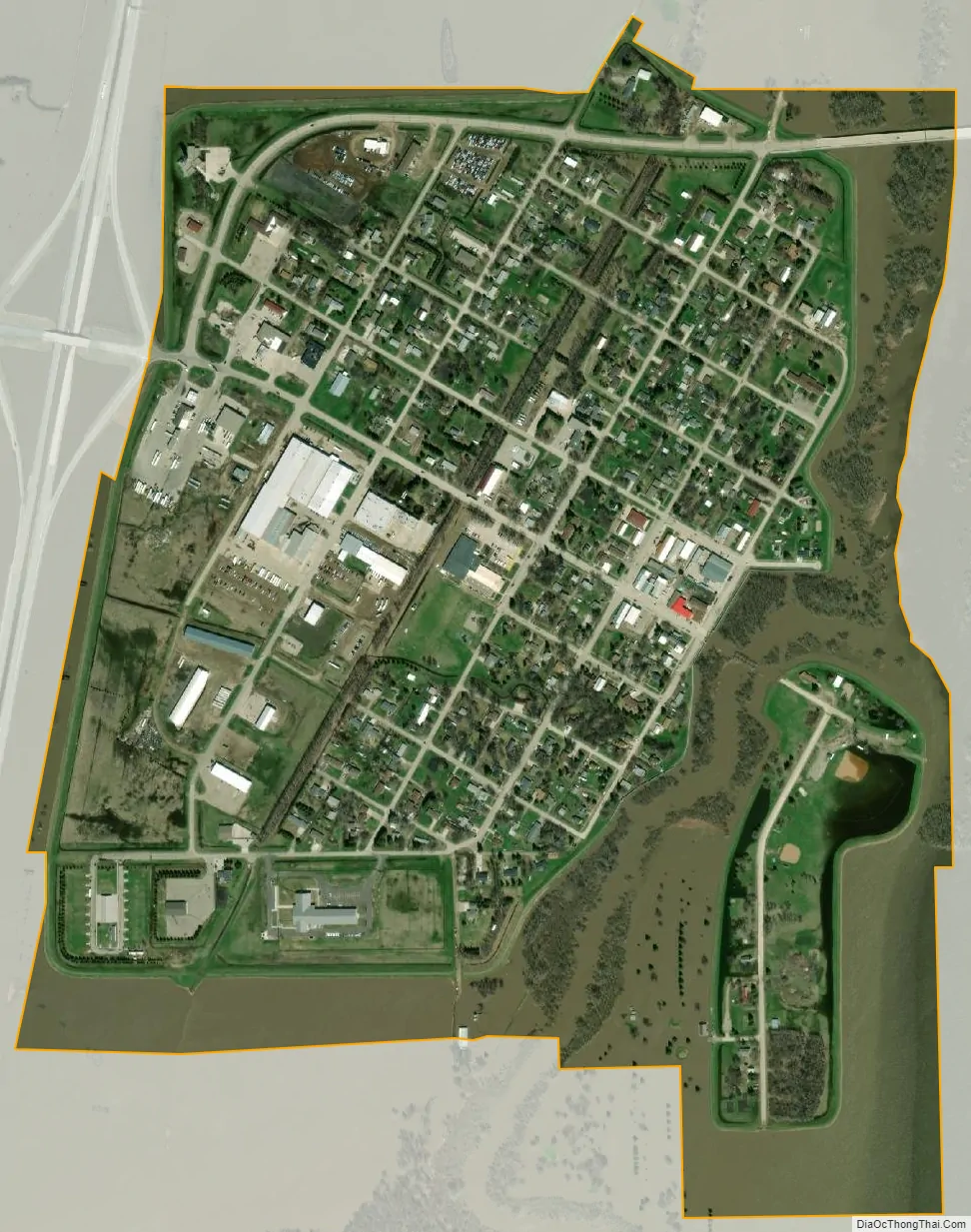
Pembina city Satellite Map
Geography
Pembina is located at 48°57′59″N 97°14′43″W / 48.96639°N 97.24528°W / 48.96639; -97.24528 (48.966423, -97.245142), in the far northeast corner of the North Dakota, at the confluence of the Red River of the North and the Pembina River. The city of St. Vincent, Minnesota lies adjacent to the east, across the Red River. The town of Emerson, Manitoba lies just north of the city on the other side of the international border.
According to the United States Census Bureau, the city has a total area of 0.77 square miles (1.99 km), all land.
Pembina experiences a dry winter humid continental climate (Köppen Dwb).
See also
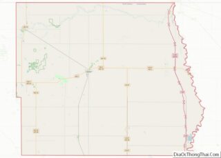
Map of North Dakota State and its subdivision:- Adams
- Barnes
- Benson
- Billings
- Bottineau
- Bowman
- Burke
- Burleigh
- Cass
- Cavalier
- Dickey
- Divide
- Dunn
- Eddy
- Emmons
- Foster
- Golden Valley
- Grand Forks
- Grant
- Griggs
- Hettinger
- Kidder
- Lamoure
- Logan
- McHenry
- McIntosh
- McKenzie
- McLean
- Mercer
- Morton
- Mountrail
- Nelson
- Oliver
- Pembina
- Pierce
- Ramsey
- Ransom
- Renville
- Richland
- Rolette
- Sargent
- Sheridan
- Sioux
- Slope
- Stark
- Steele
- Stutsman
- Towner
- Traill
- Walsh
- Ward
- Wells
- Williams
- Alabama
- Alaska
- Arizona
- Arkansas
- California
- Colorado
- Connecticut
- Delaware
- District of Columbia
- Florida
- Georgia
- Hawaii
- Idaho
- Illinois
- Indiana
- Iowa
- Kansas
- Kentucky
- Louisiana
- Maine
- Maryland
- Massachusetts
- Michigan
- Minnesota
- Mississippi
- Missouri
- Montana
- Nebraska
- Nevada
- New Hampshire
- New Jersey
- New Mexico
- New York
- North Carolina
- North Dakota
- Ohio
- Oklahoma
- Oregon
- Pennsylvania
- Rhode Island
- South Carolina
- South Dakota
- Tennessee
- Texas
- Utah
- Vermont
- Virginia
- Washington
- West Virginia
- Wisconsin
- Wyoming