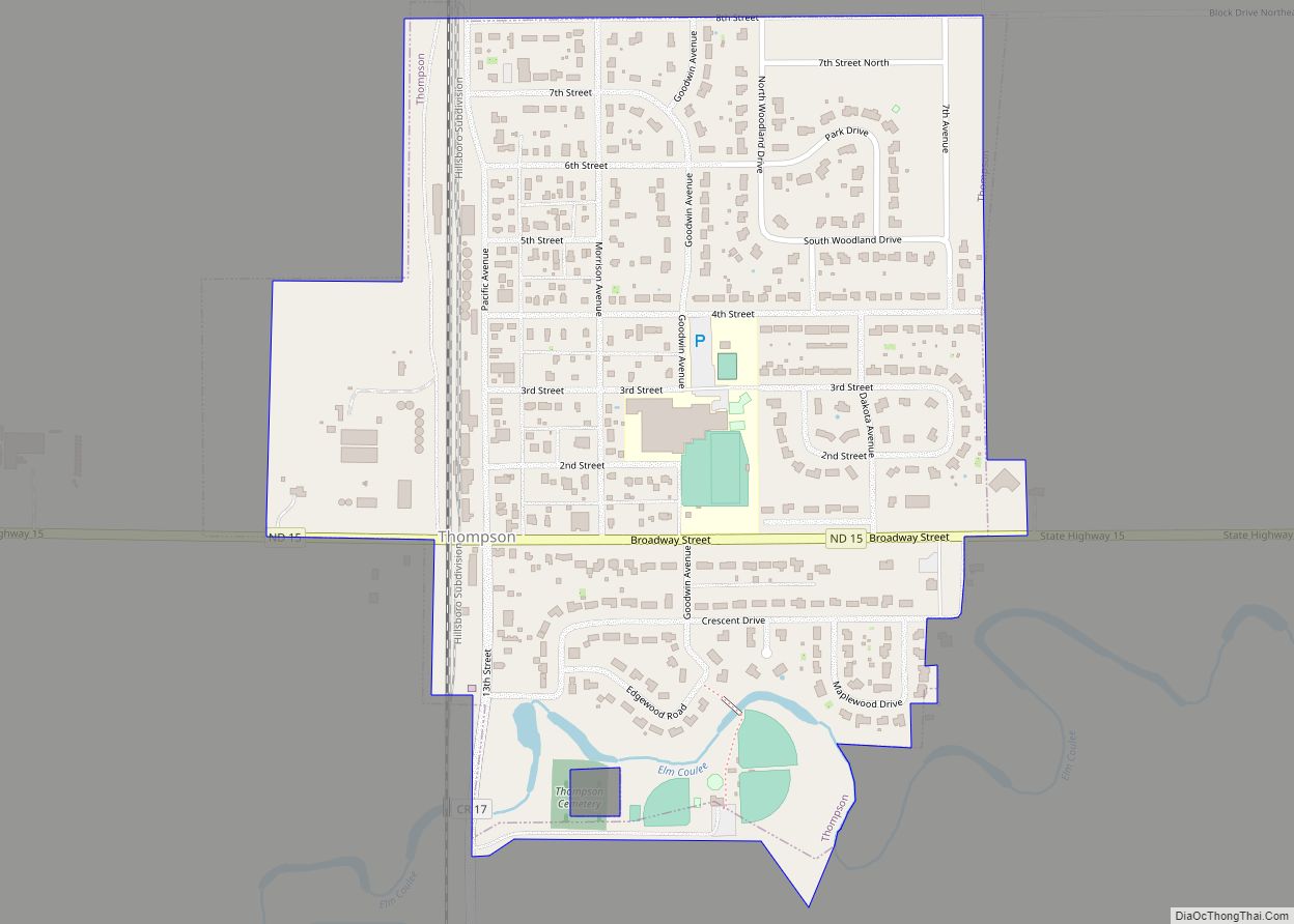
Map of Tappen city
Tappen is a city in Kidder County, North Dakota, United States. The population was 217 at the 2020 census. Tappen city overview: Name: Tappen city LSAD Code: 25 LSAD Description: city (suffix) State: North Dakota County: Kidder County Elevation: 1,772 ft (540 m) Total Area: 1.05 sq mi (2.72 km²) Land Area: 1.05 sq mi (2.72 km²) Water Area: 0.00 sq mi (0.00 km²) Total Population: ... Read more
Map of Tappen city
Map of Sykeston city
Sykeston is a city in Wells County, North Dakota, United States. The population was 105 at the 2020 census. Sykeston was founded in 1883 by Richard Sykes, a prominent landowner and founder of several other cities in the state. The city was the county seat of Wells County from 1884 to 1894, when Fessenden took ... Read more
Map of Sykeston city
Map of Sutton CDP, North Dakota
Sutton is a census-designated place in western Griggs County, North Dakota, United States. An unincorporated community, it was designated as part of the U.S. Census Bureau’s Participant Statistical Areas Program on March 31, 2010. It was not counted separately during the 2000 Census, but was included in the 2010 Census, where a population of 17 ... Read more
Map of Sutton CDP, North Dakota
Map of Surrey city
Surrey is a town in Ward County, North Dakota, United States. The population was 1,357 at the 2020 census. Official incorporation of Surrey occurred in 1951. The city is part of the Minot Micropolitan Statistical Area. Surrey city overview: Name: Surrey city LSAD Code: 25 LSAD Description: city (suffix) State: North Dakota County: Ward County ... Read more
Map of Surrey city
Map of Tower City, North Dakota
Tower City is a city in Barnes and Cass counties in the State of North Dakota. The population was 268 at the 2020 census. Tower City city overview: Name: Tower City city LSAD Code: 25 LSAD Description: city (suffix) State: North Dakota County: Barnes County, Cass County Elevation: 1,171 ft (357 m) Total Area: 2.05 sq mi (5.31 km²) Land ... Read more
Map of Tower City, North Dakota
Map of Tolna city
Tolna is a city in Nelson County, North Dakota, United States. The population was 136 at the 2020 census. Tolna was founded in 1906. In February 2019, resident Brian Nelson, who is an antique collector, was featured on “American Pickers” on the History Channel. Tolna city overview: Name: Tolna city LSAD Code: 25 LSAD Description: ... Read more
Map of Tolna city
Map of Voltaire city
Voltaire is a city in McHenry County, North Dakota, United States. The population was 46 at the 2020 census. It is part of the Minot Micropolitan Statistical Area. Voltaire city overview: Name: Voltaire city LSAD Code: 25 LSAD Description: city (suffix) State: North Dakota County: McHenry County Founded: 1901 Elevation: 1,588 ft (484 m) Total Area: 0.49 sq mi ... Read more
Map of Voltaire city
Map of Verona city, North Dakota
Verona is a city in LaMoure County, North Dakota, United States. The population was 59 at the 2020 census. Verona was founded in 1886. Verona city overview: Name: Verona city LSAD Code: 25 LSAD Description: city (suffix) State: North Dakota County: LaMoure County Founded: 1886 Elevation: 1,388 ft (423 m) Total Area: 0.57 sq mi (1.49 km²) Land Area: 0.57 sq mi ... Read more
Map of Verona city, North Dakota
Map of Venturia city
Venturia is a city in McIntosh County, North Dakota, United States. The population was 21 at the 2020 census. Venturia was founded in 1901. Venturia city overview: Name: Venturia city LSAD Code: 25 LSAD Description: city (suffix) State: North Dakota County: McIntosh County Founded: 1901 Elevation: 2,073 ft (632 m) Total Area: 0.11 sq mi (0.29 km²) Land Area: 0.11 sq mi ... Read more
Map of Venturia city
Map of Velva city
Velva is a city in McHenry County, North Dakota, United States. Part of the Minot Micropolitan Statistical Area, it was founded in 1897 and the population was 1,086 at the 2020 census. Southeast of Minot, Velva is at the southernmost point of the Souris River. Velva city overview: Name: Velva city LSAD Code: 25 LSAD Description: ... Read more
Map of Velva city
Map of Valley City, North Dakota
Valley City is a city in Barnes County, North Dakota, United States. It is the county seat of Barnes County. The population was 6,575 during the 2020 census, making it the 12th largest city in North Dakota. Valley City was founded in 1874. Valley City is known for its many bridges over the Sheyenne River, ... Read more
Map of Valley City, North Dakota
Map of Upham city
Upham is a city in McHenry County, North Dakota, United States. The population was 135 at the 2020 census. It is part of the Minot Micropolitan Statistical Area. Upham was founded in 1905. Upham city overview: Name: Upham city LSAD Code: 25 LSAD Description: city (suffix) State: North Dakota County: McHenry County Founded: 1905 Elevation: ... Read more
Map of Upham city