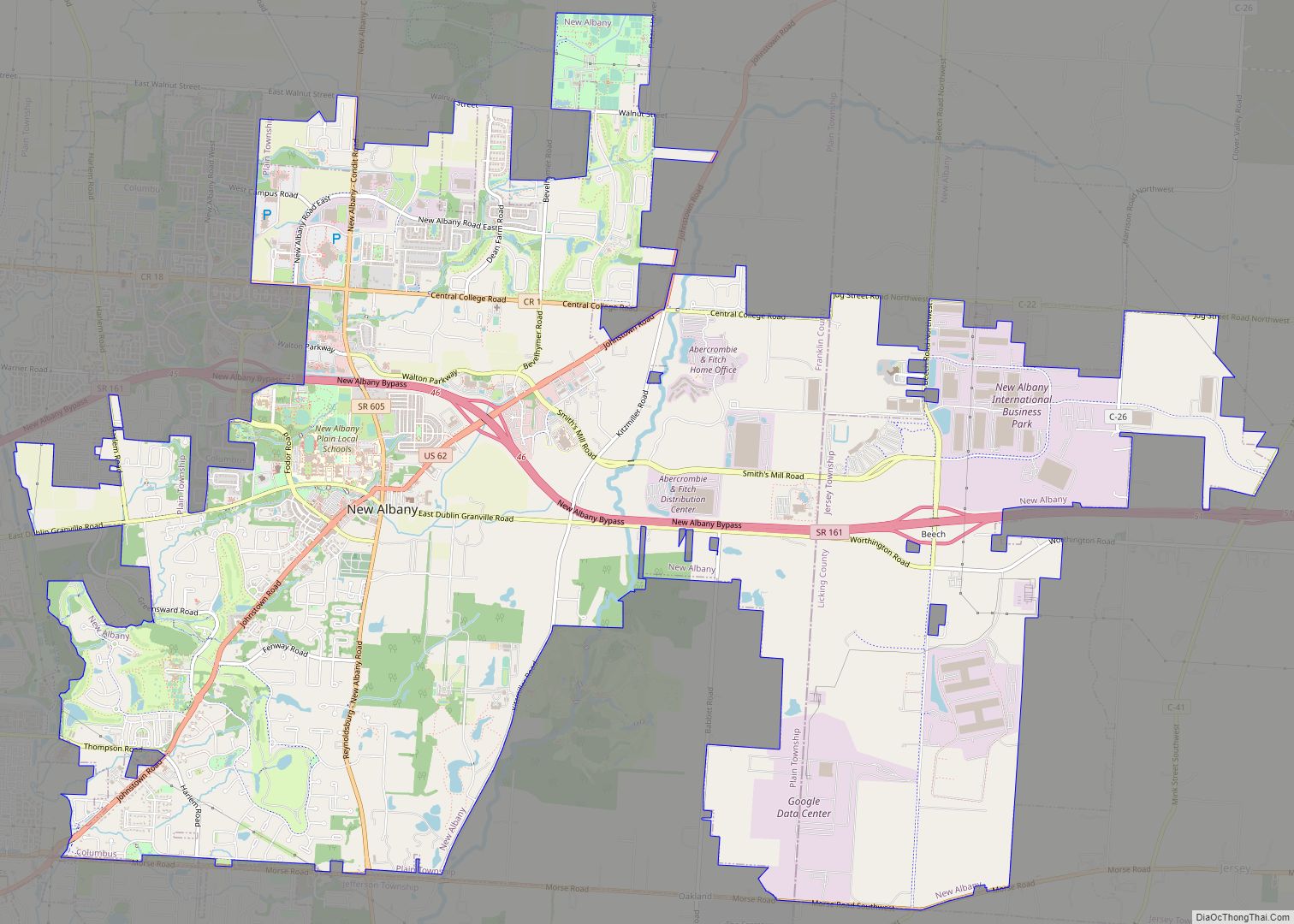
Map of New Alexandria village

Map of New Alexandria village, Ohio

New Alexandria is a village in eastern Jefferson County, Ohio, United States. The population was 232 at the 2020 census. It is part of the Weirton–Steubenville metropolitan area. New Alexandria village overview: Name: New Alexandria village LSAD Code: 47 LSAD Description: village (suffix) State: Ohio County: Jefferson County Elevation: 1,224 ft (373 m) Total Area: 0.37 sq mi (0.95 km²) … Read more

Map of New Knoxville village

Map of New Knoxville village

New Knoxville is a village in Auglaize County, Ohio, United States. It was established in 1836. The population was 946 at the 2020 census. It is included in the Wapakoneta, Ohio Micropolitan Statistical Area. New Knoxville village overview: Name: New Knoxville village LSAD Code: 47 LSAD Description: village (suffix) State: Ohio County: Auglaize County Elevation: … Read more

Map of New Holland village, Ohio

Map of New Holland village, Ohio

New Holland is a village in Fayette and Pickaway counties in Ohio, United States. The population was 801 at the 2010 census. The Pickaway County portion of New Holland is part of the Columbus Metropolitan Statistical Area, while the Fayette County portion is part of the Washington Court House Micropolitan Statistical Area. New Holland village … Read more

Map of New Haven CDP, Ohio

Map of New Haven CDP, Ohio

New Haven is an unincorporated community and census-designated place (CDP) in central New Haven Township, Huron County, Ohio, United States. As of the 2010 census the population was 399. It has a post office with the ZIP code 44850. It lies at the intersection of U.S. Route 224 with State Routes 61 and 598. New … Read more

Map of New Hampshire CDP

Map of New Hampshire CDP

New Hampshire is a census-designated place in central Goshen Township, Auglaize County, Ohio, United States. As of the 2010 census, it had a population of 174. Located between Wapakoneta and Lakeview at the intersection of U.S. Route 33 with State Routes 196 and 385, the village maintains a small post office (Zip Code: 45870) and … Read more

Map of New Franklin city, Ohio

Map of New Franklin city, Ohio

New Franklin is a city in southwestern Summit County, Ohio, United States, in the northeastern part of the state. The population was 13,877 according to the 2020 census. It is part of the Akron metropolitan area. New Franklin city overview: Name: New Franklin city LSAD Code: 25 LSAD Description: city (suffix) State: Ohio County: Summit … Read more

Map of New Concord village

Map of New Concord village

New Concord is a village in Muskingum County, Ohio, United States. The population was 2,361 as of the 2020 census. It is part of the Zanesville micropolitan area. New Concord is the home of Muskingum University and is served by a branch of the Muskingum County Library System. New Concord village overview: Name: New Concord … Read more

Map of New Carlisle city, Ohio

Map of New Carlisle city, Ohio

New Carlisle is a city in Clark County, Ohio, United States. The population was 5,785 at the 2010 census. It is part of the Springfield, Ohio Metropolitan Statistical Area. New Carlisle city overview: Name: New Carlisle city LSAD Code: 25 LSAD Description: city (suffix) State: Ohio County: Clark County Elevation: 899 ft (274 m) Total Area: 2.71 sq mi … Read more

Map of New London village, Ohio

Map of New London village, Ohio

New London is a village in Huron County, Ohio, United States. The population was 2,461 at the 2010 census. The village motto, “The Right Place at the Right Time”, was chosen in the late twentieth century by former Mayor Dorothy Sholes. New London has been designated Tree City USA by the Arbor Day Foundation. New … Read more

Map of New Lexington village

Map of New Lexington village

New Lexington is a village in and the county seat of Perry County, Ohio, United States, 21 miles (34 km) southwest of Zanesville and 45 miles (72 km) miles southeast of Columbus. The population was 4,435 at the 2020 census. New Lexington village overview: Name: New Lexington village LSAD Code: 47 LSAD Description: village (suffix) State: Ohio … Read more

Map of New Lebanon village

Map of New Lebanon village, Ohio

New Lebanon is a village in Montgomery County, Ohio, United States. The population was 3,796 at the 2020 census. It is part of the Dayton Metropolitan Statistical Area. New Lebanon village overview: Name: New Lebanon village LSAD Code: 47 LSAD Description: village (suffix) State: Ohio County: Montgomery County Elevation: 906 ft (276 m) Total Area: 2.04 sq mi (5.30 km²) … Read more

Map of New Straitsville village

Map of New Straitsville village

New Straitsville is a village in Perry County, Ohio, United States. The population was 652 at the 2020 census. New Straitsville village overview: Name: New Straitsville village LSAD Code: 47 LSAD Description: village (suffix) State: Ohio County: Perry County Elevation: 787 ft (240 m) Total Area: 1.30 sq mi (3.37 km²) Land Area: 1.30 sq mi (3.37 km²) Water Area: 0.00 sq mi (0.00 km²) Total … Read more