New Albany is a city in the U.S. state of Ohio, located 15 miles (24 km) northeast of the state capital of Columbus. Most of the city is located in Franklin County and a small portion extends into adjacent Licking County. New Albany had a population of 10,825 at the 2020 census. Founded in 1837, it is a growing suburb in the Columbus metropolitan area.
| Name: | New Albany city |
|---|---|
| LSAD Code: | 25 |
| LSAD Description: | city (suffix) |
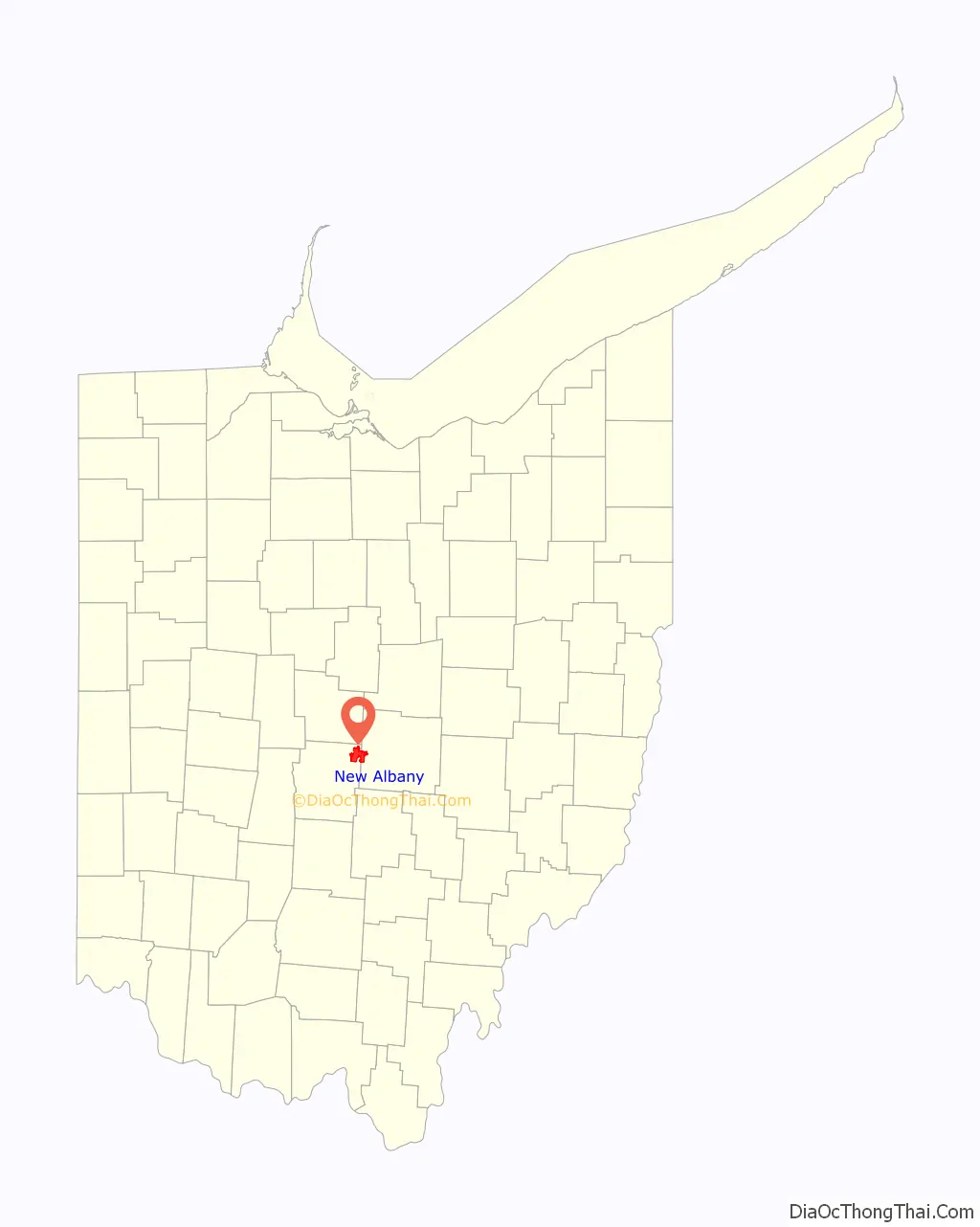
| State: | Ohio |
| County: | Franklin County, Licking County |
| Elevation: | 1,024 ft (312 m) |
| Total Area: | 16.82 sq mi (43.57 km²) |
| Land Area: | 16.65 sq mi (43.13 km²) |
| Water Area: | 0.17 sq mi (0.44 km²) |
| Total Population: | 10,825 |
| Population Density: | 650.03/sq mi (250.98/km²) |
| ZIP code: | 43054 |
| Area code: | 614, 380 |
| FIPS code: | 3953970 |
| GNISfeature ID: | 1065106 |
| Website: | www.newalbanyohio.org |
Online Interactive Map
Click on ![]() to view map in "full screen" mode.
to view map in "full screen" mode.
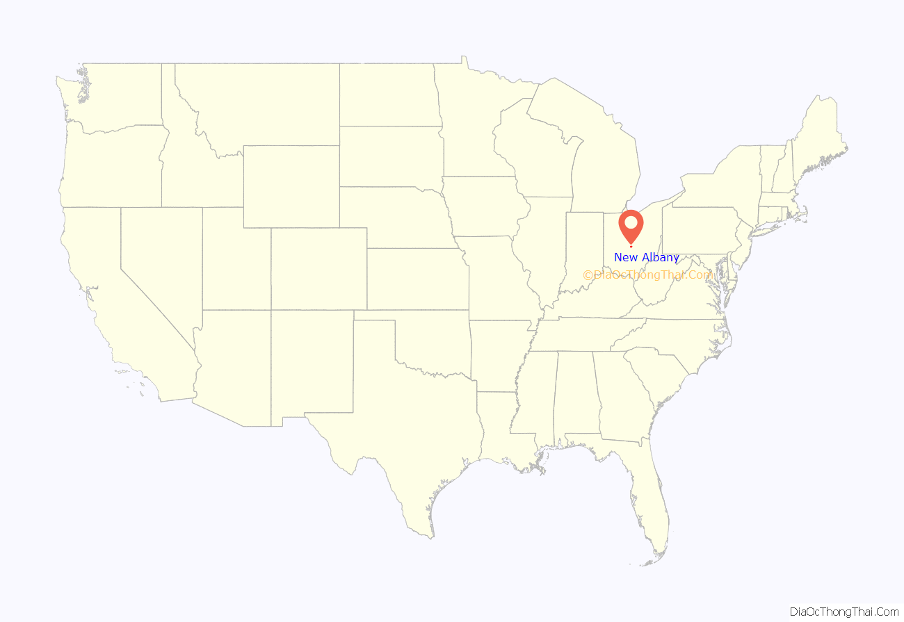
New Albany location map. Where is New Albany city?
History
The land that was to become the city was founded in the center of Plain Township in 1837 by Nobel Landon and William Yantis. Land was split into lots measuring 50 ft (15 m) by 100 ft (30 m) and sold to new settlers. One theory about the name “New Albany” is that some of the original settlers migrated from the Albany, New York, area. Albany, Ohio was laid out in about 1832, which was prior to the founding of New Albany. During its history, the community has also been known by the name of “Hope”.
In 1856, New Albany was incorporated with a population of 50, and the first mayor (S. Ogden) was elected. The Wilkins Lumber Mill, later renamed the New Albany Mill, opened in 1881. In 1922, Mrs. Edward Babbitt was elected the first female mayor of New Albany.
In 1970, New Albany was much smaller than it is today, only consisting of a small part of Plain Township that did not touch Columbus. The first annual New Albany Founders Day Celebration was held in 1976. As late as 1980, the census only listed 414 residents in the village.
Rapid growth in New Albany began in the 1990s, partly due to the expansion of the Les Wexner clothing empire and Wexner’s construction of his mansion (the second largest in central Ohio behind the Longaberger mansion off Kitzmiller Road in the village). State Route 161 and access to 161 from I-270 was reconfigured around this time, allowing freeway access into and out of town.
In 2008, the New Albany Mill closed 119 years after its downtown opening. The original sawmill had been converted to a hardware store and was a staple in the lives of many of the residents of New Albany.
The 2009 Fathima Rifqa Bary controversy occurred in New Albany and made national headlines. New Albany teen Bary (raised Muslim but a convert to Christianity) ran away from home to Florida, claiming that as a convert she feared that she would be killed by her family, a claim her parents called untrue.
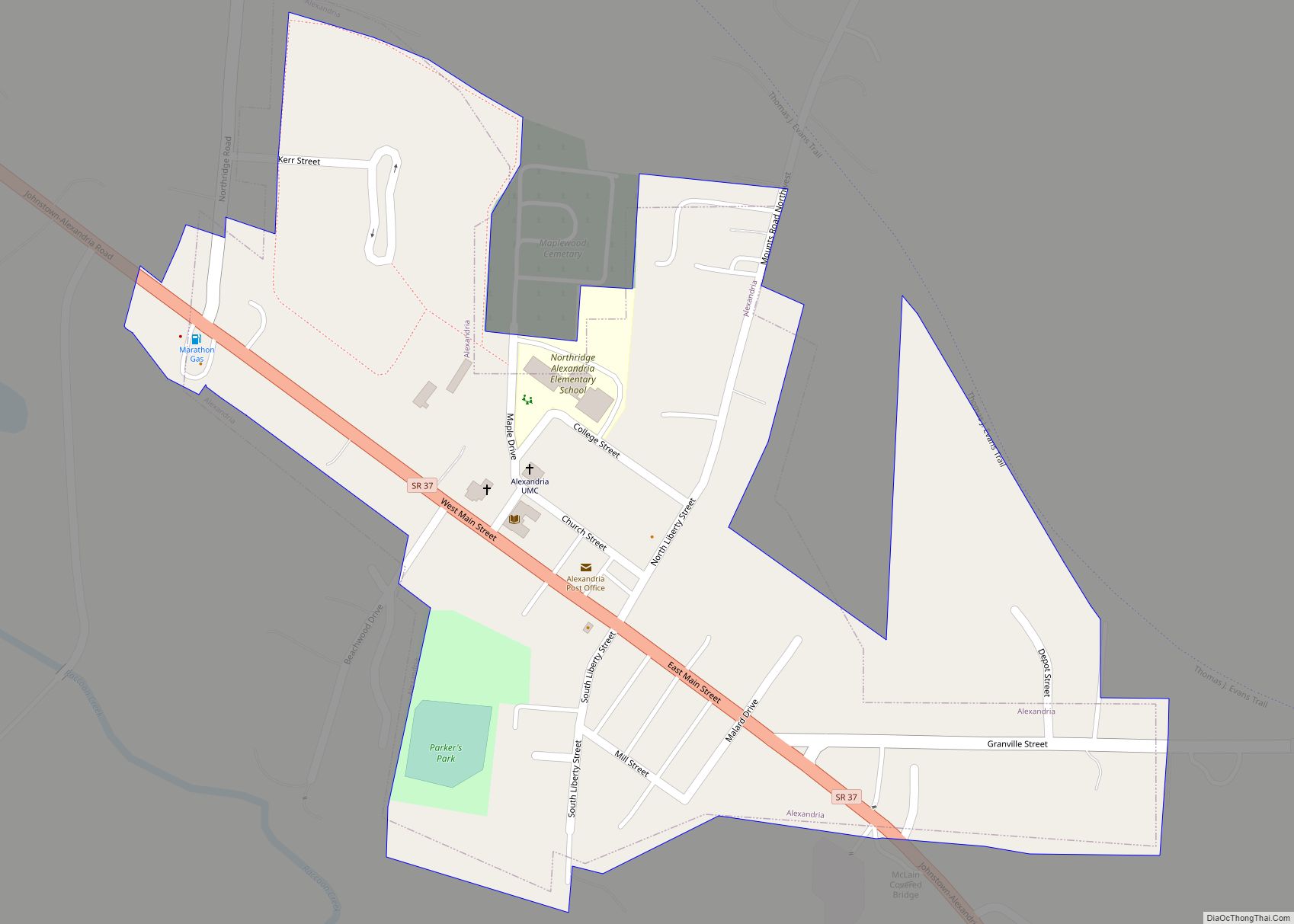
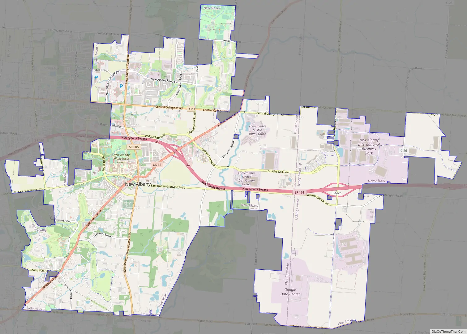
New Albany Road Map
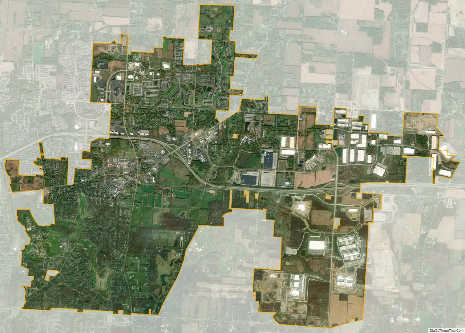
New Albany city Satellite Map
Geography
New Albany is located in northeastern Franklin County at 40°4′43″N 82°49′14″W / 40.07861°N 82.82056°W / 40.07861; -82.82056 (40.078643, −82.820618), with a portion extending east into Licking County. It is northeast of Columbus at an elevation of 1,024 feet (312 m).
According to the United States Census Bureau, the village has a total area of 15.4 square miles (39.8 km), of which 15.2 square miles (39.4 km) are land and 0.15 square miles (0.4 km), or 1.09%, are water.
New Albany is situated in the headwaters of the Rocky Fork, a tributary of Big Walnut Creek. Rose Run and Sugar Run, tributaries of the Rocky Fork, flow northeast to southwest throughout the city. Blacklick Creek runs through the eastern end of the city.
Neighborhoods
In the center of the city, three main roads cross: Dublin-Granville, U.S. Route 62/Johnstown Road, and New Albany-Reynoldsburg/Ohio Route 605/New Albany-Condit. These three roads divide the city into six roughly equal sections. In the southwest section is the New Albany Country Club, much of the club’s golf course (designed by Jack Nicklaus), and Market Square. The south-central section contains the remainder of the golf course, with the rest mostly residential. The northwest section houses New Albany Schools and the performing arts center. The New Albany Links golf course (designed by Barry Serafin) and the surrounding neighborhoods are in the north-central section, along with Bevelhymer Park and the headquarters of Justice. Lastly, the northeast section contains the Mt. Carmel New Albany Surgical Hospital and the new headquarters of Bob Evans Farms, Inc.
The city is divided into many subdivisions. North of Dublin-Granville Road are: Asbury Ridge, Cedarbrook, Hampstead Green, Hampstead Heath, New Albany Links, Tidewater, Upper Clarenton, and Windsor. South are the neighborhoods of: Alban Mews, Ashberry Ridge, Brandon, Clivdon, Crescent, Edge of Woods, The Farms, Fenway, Hawksmoor, Keswick, Lambton Park, Lansdowne, North Of Woods, Planter’s Grove, the Reserve, Tensweep, Upper Brandon, Waterston, and Wiveliscombe.
See also
Map of Ohio State and its subdivision:- Adams
- Allen
- Ashland
- Ashtabula
- Athens
- Auglaize
- Belmont
- Brown
- Butler
- Carroll
- Champaign
- Clark
- Clermont
- Clinton
- Columbiana
- Coshocton
- Crawford
- Cuyahoga
- Darke
- Defiance
- Delaware
- Erie
- Fairfield
- Fayette
- Franklin
- Fulton
- Gallia
- Geauga
- Greene
- Guernsey
- Hamilton
- Hancock
- Hardin
- Harrison
- Henry
- Highland
- Hocking
- Holmes
- Huron
- Jackson
- Jefferson
- Knox
- Lake
- Lake Erie
- Lawrence
- Licking
- Logan
- Lorain
- Lucas
- Madison
- Mahoning
- Marion
- Medina
- Meigs
- Mercer
- Miami
- Monroe
- Montgomery
- Morgan
- Morrow
- Muskingum
- Noble
- Ottawa
- Paulding
- Perry
- Pickaway
- Pike
- Portage
- Preble
- Putnam
- Richland
- Ross
- Sandusky
- Scioto
- Seneca
- Shelby
- Stark
- Summit
- Trumbull
- Tuscarawas
- Union
- Van Wert
- Vinton
- Warren
- Washington
- Wayne
- Williams
- Wood
- Wyandot
- Alabama
- Alaska
- Arizona
- Arkansas
- California
- Colorado
- Connecticut
- Delaware
- District of Columbia
- Florida
- Georgia
- Hawaii
- Idaho
- Illinois
- Indiana
- Iowa
- Kansas
- Kentucky
- Louisiana
- Maine
- Maryland
- Massachusetts
- Michigan
- Minnesota
- Mississippi
- Missouri
- Montana
- Nebraska
- Nevada
- New Hampshire
- New Jersey
- New Mexico
- New York
- North Carolina
- North Dakota
- Ohio
- Oklahoma
- Oregon
- Pennsylvania
- Rhode Island
- South Carolina
- South Dakota
- Tennessee
- Texas
- Utah
- Vermont
- Virginia
- Washington
- West Virginia
- Wisconsin
- Wyoming