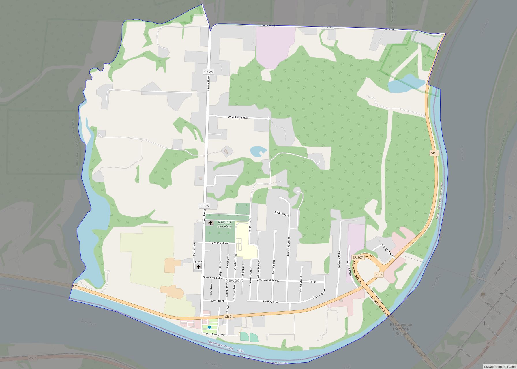
Map of Newcomerstown village

Map of Newcomerstown village

Newcomerstown is a village in Tuscarawas County, Ohio, United States, 85 miles (137 km) east-northeast of Columbus. In the late 1770s, this was the largest Delaware Indian village on the Tuscarawas River, with 700 residents. Chief Newcomer (Netawatwes) was the leader of the western Delawares here, and they called the village Gekelmukpechunk. Early French traders and … Read more

Map of Newburgh Heights village

Map of Newburgh Heights village

Newburgh Heights is a village in Cuyahoga County, Ohio, United States. The population was 2,167 at the 2010 census. Newburgh Heights village overview: Name: Newburgh Heights village LSAD Code: 47 LSAD Description: village (suffix) State: Ohio County: Cuyahoga County Elevation: 692 ft (211 m) Total Area: 0.58 sq mi (1.51 km²) Land Area: 0.58 sq mi (1.51 km²) Water Area: 0.00 sq mi (0.00 km²) Total … Read more

Map of Newark city, Ohio

Map of Newark city, Ohio

Newark (/ˈnʊərk/ Noork) is a city in and the county seat of Licking County, Ohio, United States, located 40 miles (64 km) east of Columbus at the junction of the forks of the Licking River. The population was 49,934 at the 2020 census, making it the 18th-largest city in Ohio. It is part of the Columbus … Read more

Map of New Weston village

Map of New Weston village

New Weston is a village in Darke County, Ohio, United States. The population was 136 at the 2010 census. New Weston is home to the Eldora Speedway, a half-mile clay oval race track. New Weston village overview: Name: New Weston village LSAD Code: 47 LSAD Description: village (suffix) State: Ohio County: Darke County Elevation: 1,010 ft … Read more

Map of New Waterford village

Map of New Waterford village

New Waterford is a village in northeastern Columbiana County, Ohio, United States. The population was 1,194 at the 2020 census. It is part of the Salem micropolitan area, about 18 miles (29 km) south of Youngstown. New Waterford village overview: Name: New Waterford village LSAD Code: 47 LSAD Description: village (suffix) State: Ohio County: Columbiana County … Read more

Map of New Washington village, Ohio

Map of New Washington village, Ohio

New Washington is a village in Cranberry Township in Crawford County, Ohio, United States. The population was 967 at the 2010 census. New Washington village overview: Name: New Washington village LSAD Code: 47 LSAD Description: village (suffix) State: Ohio County: Crawford County Elevation: 991 ft (302 m) Total Area: 1.34 sq mi (3.47 km²) Land Area: 1.34 sq mi (3.47 km²) Water Area: … Read more

Map of New Vienna village, Ohio

Map of New Vienna village, Ohio

New Vienna is a village in Clinton County, Ohio, United States. The population was 1,224 at the 2010 census. New Vienna village overview: Name: New Vienna village LSAD Code: 47 LSAD Description: village (suffix) State: Ohio County: Clinton County Elevation: 1,122 ft (342 m) Total Area: 0.82 sq mi (2.13 km²) Land Area: 0.80 sq mi (2.08 km²) Water Area: 0.02 sq mi (0.05 km²) Total … Read more

Map of Niles city, Ohio

Map of Niles city, Ohio

Niles is a city in southern Trumbull County, Ohio, United States, situated at the confluence of the Mahoning River and Mosquito Creek. The city’s population was 18,443 at the 2020 census. It is a suburb of the Youngstown–Warren metropolitan area. Located in the nation’s former industrial belt, the city’s economy focused initially on iron manufacturing … Read more

Map of Ney village

Map of Ney village

Ney is a village in Defiance County, Ohio, United States. The population was 354 at the 2010 census. Ney has been noted for having one of the shortest place names in Ohio. Ney village overview: Name: Ney village LSAD Code: 47 LSAD Description: village (suffix) State: Ohio County: Defiance County Elevation: 709 ft (216 m) Total Area: … Read more

Map of Newtown village, Ohio

Map of Newtown village, Ohio

Newtown is a village in southeastern Hamilton County, Ohio, United States, near Cincinnati. The population was 2,702 at the 2020 census. Newtown was settled in 1792 and incorporated as a village in 1901. Newtown village overview: Name: Newtown village LSAD Code: 47 LSAD Description: village (suffix) State: Ohio County: Hamilton County Elevation: 499 ft (152 m) Total … Read more

Map of North Kingsville village

Map of North Kingsville village

North Kingsville is a village in Ashtabula County, Ohio, United States. The population was 2,742 at the 2020 census. North Kingsville village overview: Name: North Kingsville village LSAD Code: 47 LSAD Description: village (suffix) State: Ohio County: Ashtabula County Elevation: 712 ft (217 m) Total Area: 8.87 sq mi (22.98 km²) Land Area: 8.86 sq mi (22.93 km²) Water Area: 0.02 sq mi (0.05 km²) Total … Read more

Map of North Hampton village

Map of North Hampton village

North Hampton is a village in Clark County, Ohio, United States. The population was 478 at the 2010 census. It is part of the Springfield, Ohio Metropolitan Statistical Area. North Hampton village overview: Name: North Hampton village LSAD Code: 47 LSAD Description: village (suffix) State: Ohio County: Clark County Elevation: 1,093 ft (333 m) Total Area: 0.39 sq mi … Read more