North Bend is a village in Miami Township, Hamilton County, Ohio, United States, along the Ohio River. It is a part of the Greater Cincinnati area. The population was 835 at the 2020 census.
| Name: | North Bend village |
|---|---|
| LSAD Code: | 47 |
| LSAD Description: | village (suffix) |
| State: | Ohio |
| County: | Hamilton County |
| Elevation: | 574 ft (175 m) |
| Total Area: | 1.15 sq mi (2.98 km²) |
| Land Area: | 1.09 sq mi (2.83 km²) |
| Water Area: | 0.06 sq mi (0.15 km²) |
| Total Population: | 835 |
| Population Density: | 763.95/sq mi (294.97/km²) |
| ZIP code: | 45052 |
| Area code: | 513 |
| FIPS code: | 3956182 |
| GNISfeature ID: | 1065159 |
| Website: | www.northbendohio.org |
Online Interactive Map
Click on ![]() to view map in "full screen" mode.
to view map in "full screen" mode.
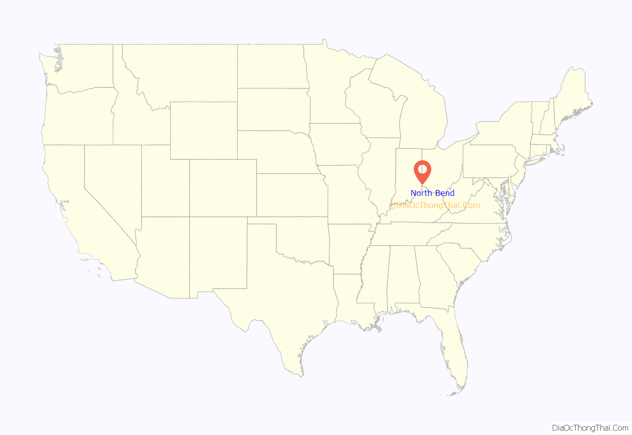
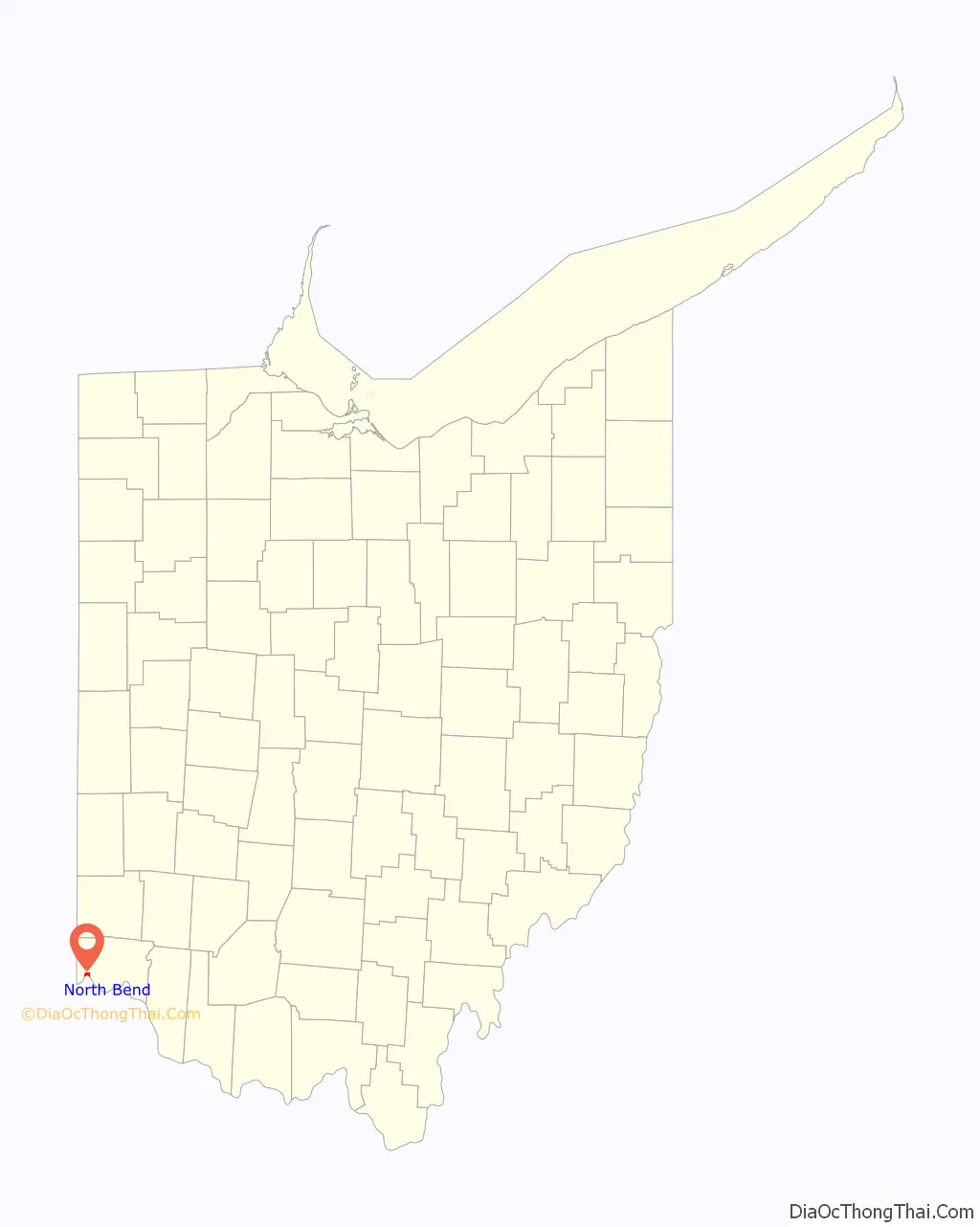
North Bend location map. Where is North Bend village?
History
North Bend was founded in 1789. It was platted as Symmes City but ultimately never took that name. Instead, it was incorporated as the village of North Bend in 1845. It is named for its location, where the Ohio River meanders to the north.
President Benjamin Harrison was born in North Bend. It was the home of his grandfather, President William Henry Harrison. North Bend is the location of the grave of John Cleves Symmes at Congress Green Cemetery and of the William Henry Harrison Tomb State Memorial, the grave of William Henry Harrison. John Scott Harrison, the only man in U.S. history to be the son of a president and the father of a president, was born in North Bend and is buried in his father’s vault in North Bend. Eliza Hendricks, wife of U.S. Vice President Thomas A. Hendricks, also was born in North Bend.
On May 5, 1865, North Bend was the site of an early hold-up of a railway train.
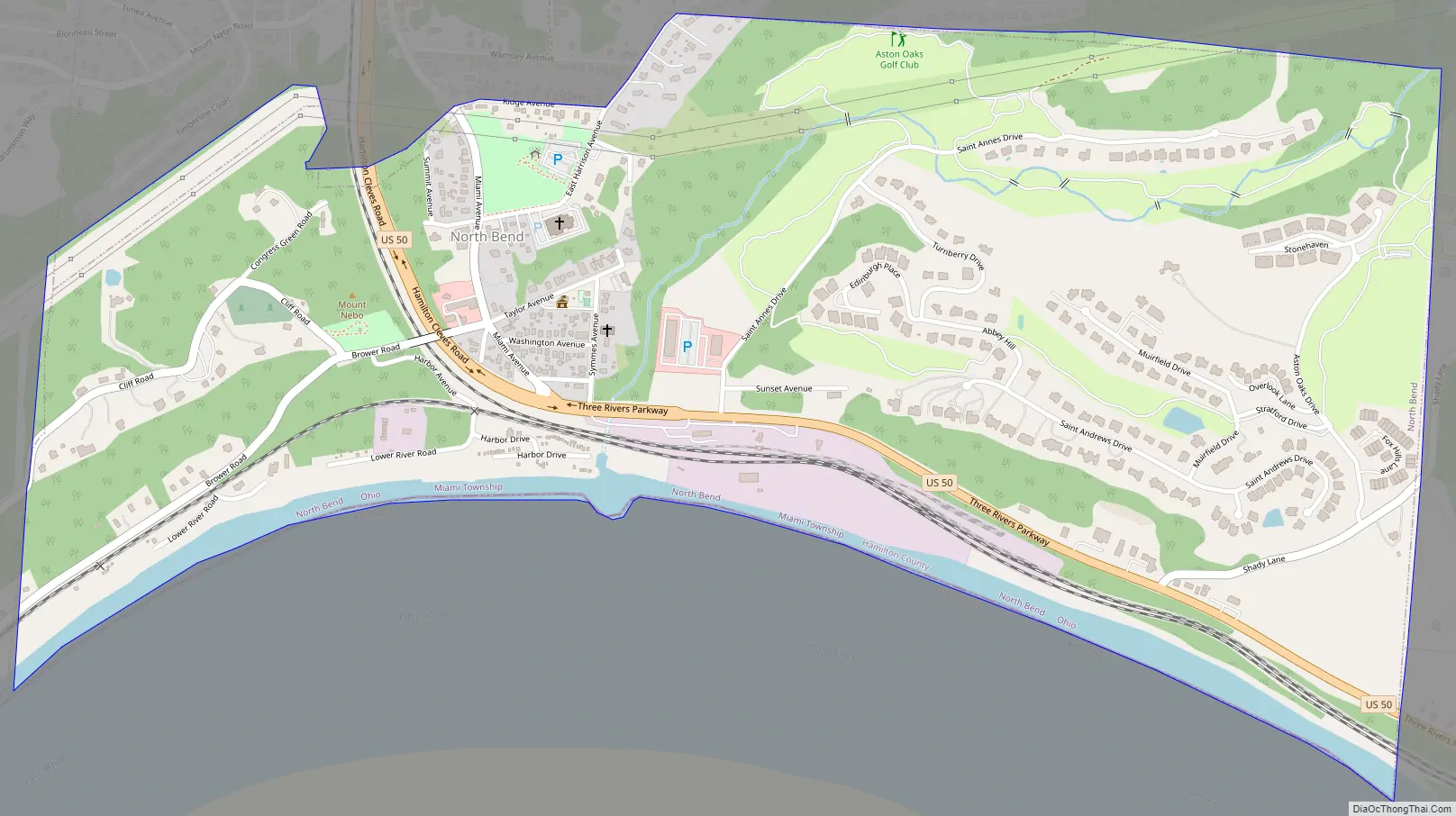
North Bend Road Map
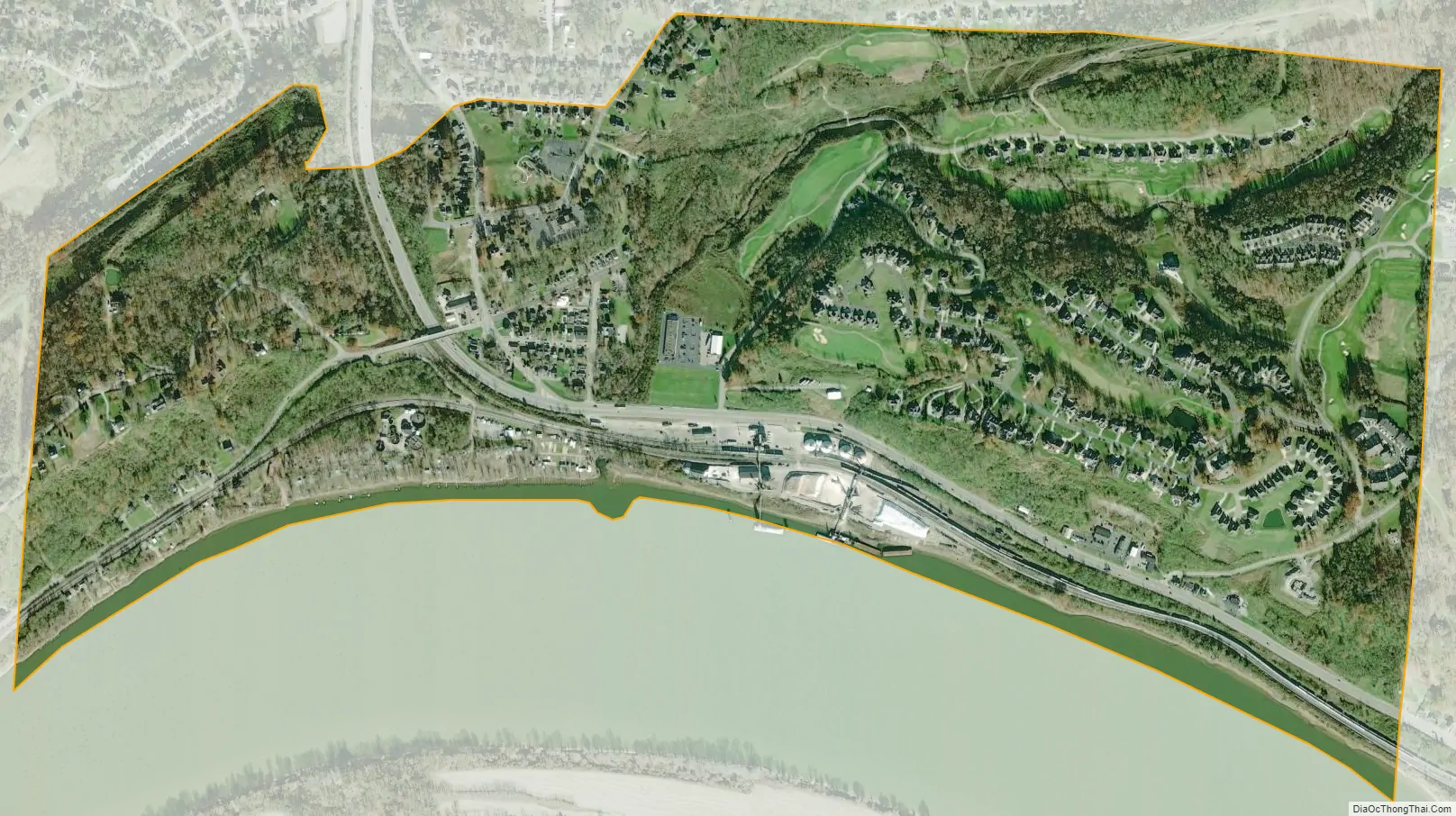
North Bend city Satellite Map
Geography
North Bend is located at 39°8′59″N 84°44′45″W / 39.14972°N 84.74583°W / 39.14972; -84.74583 (39.149658, -84.745828).
According to the United States Census Bureau, the village has a total area of 1.15 square miles (2.98 km), of which 1.07 square miles (2.77 km) is land and 0.08 square miles (0.21 km) is water.
See also
Map of Ohio State and its subdivision:- Adams
- Allen
- Ashland
- Ashtabula
- Athens
- Auglaize
- Belmont
- Brown
- Butler
- Carroll
- Champaign
- Clark
- Clermont
- Clinton
- Columbiana
- Coshocton
- Crawford
- Cuyahoga
- Darke
- Defiance
- Delaware
- Erie
- Fairfield
- Fayette
- Franklin
- Fulton
- Gallia
- Geauga
- Greene
- Guernsey
- Hamilton
- Hancock
- Hardin
- Harrison
- Henry
- Highland
- Hocking
- Holmes
- Huron
- Jackson
- Jefferson
- Knox
- Lake
- Lake Erie
- Lawrence
- Licking
- Logan
- Lorain
- Lucas
- Madison
- Mahoning
- Marion
- Medina
- Meigs
- Mercer
- Miami
- Monroe
- Montgomery
- Morgan
- Morrow
- Muskingum
- Noble
- Ottawa
- Paulding
- Perry
- Pickaway
- Pike
- Portage
- Preble
- Putnam
- Richland
- Ross
- Sandusky
- Scioto
- Seneca
- Shelby
- Stark
- Summit
- Trumbull
- Tuscarawas
- Union
- Van Wert
- Vinton
- Warren
- Washington
- Wayne
- Williams
- Wood
- Wyandot
- Alabama
- Alaska
- Arizona
- Arkansas
- California
- Colorado
- Connecticut
- Delaware
- District of Columbia
- Florida
- Georgia
- Hawaii
- Idaho
- Illinois
- Indiana
- Iowa
- Kansas
- Kentucky
- Louisiana
- Maine
- Maryland
- Massachusetts
- Michigan
- Minnesota
- Mississippi
- Missouri
- Montana
- Nebraska
- Nevada
- New Hampshire
- New Jersey
- New Mexico
- New York
- North Carolina
- North Dakota
- Ohio
- Oklahoma
- Oregon
- Pennsylvania
- Rhode Island
- South Carolina
- South Dakota
- Tennessee
- Texas
- Utah
- Vermont
- Virginia
- Washington
- West Virginia
- Wisconsin
- Wyoming


