Map of Kinta town

Map of Kinta town

Kinta is a town in Haskell County, Oklahoma, United States. The population was 297 at the 2010 census, an increase of 22.2 percent over the figure of 243 recorded in 2000. Kinta town overview: Name: Kinta town LSAD Code: 43 LSAD Description: town (suffix) State: Oklahoma County: Haskell County Elevation: 548 ft (167 m) Total Area: 0.64 sq mi … Read more

Map of Kingston town, Oklahoma

Map of Kingston town, Oklahoma

Kingston is a town in Marshall County, Oklahoma, United States, in the central southern portion of the state close to the border. The population was 1,601 at the 2010 census. Kingston town overview: Name: Kingston town LSAD Code: 43 LSAD Description: town (suffix) State: Oklahoma County: Marshall County Elevation: 810 ft (247 m) Total Area: 2.19 sq mi (5.68 km²) … Read more

Map of Kingfisher city

Map of Kingfisher city

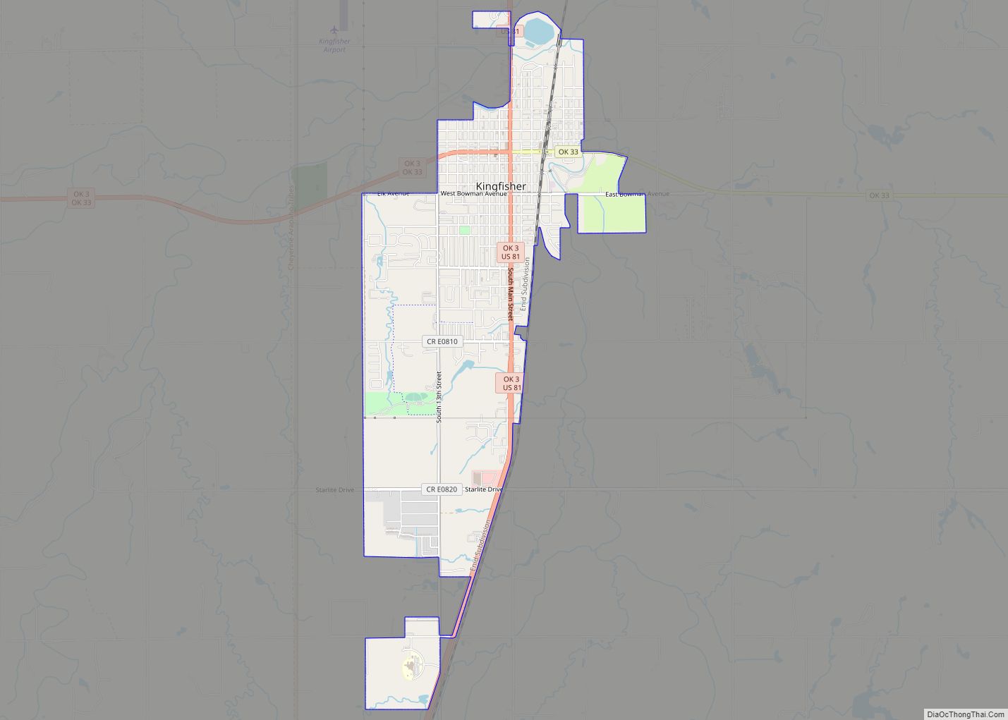
Kingfisher is a city in and the county seat of Kingfisher County, Oklahoma,. The population was 4,903 at the time of the 2020 census. It is the former home and namesake of Kingfisher College. According to the Encyclopedia of Oklahoma History and Culture, Kingfisher is now primarily a bedroom community for people employed in Enid … Read more

Map of Kildare town

Map of Kildare town

Kildare is a town in Kay County, Oklahoma, United States. The population was 100 at the 2010 census, an 8.7 percent increase from the figure of 92 in 2000. Kildare town overview: Name: Kildare town LSAD Code: 43 LSAD Description: town (suffix) State: Oklahoma County: Kay County Elevation: 1,125 ft (343 m) Total Area: 0.14 sq mi (0.35 km²) Land … Read more

Map of Kiefer town

Map of Kiefer town

Kiefer is a town in Creek County, Oklahoma, United States. The population was 1,685 at the 2010 census, an increase of 64.2 percent over the figure of 1,026 recorded in 2000. Kiefer town overview: Name: Kiefer town LSAD Code: 43 LSAD Description: town (suffix) State: Oklahoma County: Creek County Elevation: 702 ft (214 m) Total Area: 2.40 sq mi … Read more

Map of Keys CDP

Map of Keys CDP

Keys is an unincorporated community and census-designated place (CDP) in Cherokee County, Oklahoma, United States. The population was 565 at the 2010 census. Keys CDP overview: Name: Keys CDP LSAD Code: 57 LSAD Description: CDP (suffix) State: Oklahoma County: Cherokee County Total Area: 9.77 sq mi (25.29 km²) Land Area: 9.75 sq mi (25.24 km²) Water Area: 0.02 sq mi (0.05 km²) Total Population: … Read more

Map of Latta CDP

Map of Latta CDP, Oklahoma

Latta CDP overview: Name: Latta CDP LSAD Code: 57 LSAD Description: CDP (suffix) State: Oklahoma FIPS code: 4041680 Online Interactive Map Latta online map. Source: Basemap layers from Google Map, Open Street Map (OSM), Arcgisonline, Wmflabs. Boundary Data from Database of Global Administrative Areas. Latta location map. Where is Latta CDP? Latta Road Map Latta … Read more

Map of Langston town, Oklahoma

Map of Langston town, Oklahoma

Langston is a town in Logan County, Oklahoma, United States, and is part of the Oklahoma City Metropolitan Statistical Area. The population was 1,724 at the 2010 census, an increase of 3.2 percent from the figure of 1,670 in 2000. Langston is home to Langston University, the only historically black college in Oklahoma. Langston town … Read more

Map of Langley town

Map of Langley town, Oklahoma

Langley is a town in Mayes County, Oklahoma, United States. The population was 819 at the 2010 census. Langley town overview: Name: Langley town LSAD Code: 43 LSAD Description: town (suffix) State: Oklahoma County: Craig County, Mayes County Elevation: 764 ft (233 m) Total Area: 1.43 sq mi (3.69 km²) Land Area: 1.43 sq mi (3.69 km²) Water Area: 0.00 sq mi (0.00 km²) Total Population: … Read more

Map of Lane CDP, Oklahoma

Map of Lane CDP, Oklahoma

Lane is an unincorporated community and census-designated place in Atoka County, Oklahoma, United States. A post office was established at Lane, Indian Territory on October 6, 1902. Its name reflects the fact the new post office was located in a building which was at the end of lane bounded by rail fencing. At the time … Read more

Map of Lamont town, Oklahoma

Map of Lamont town, Oklahoma

Lamont is a town in Grant County, Oklahoma, United States, situated along the Salt Fork Arkansas River. The population was 417 at the 2010 census, a decline of 10.3 percent from the figure of 465 in 2000. Lamont town overview: Name: Lamont town LSAD Code: 43 LSAD Description: town (suffix) State: Oklahoma County: Grant County … Read more

Map of Lambert town, Oklahoma

Map of Lambert town, Oklahoma

Lambert is a town in Alfalfa County, Oklahoma, United States. The population was six at the 2010 census. Lambert town overview: Name: Lambert town LSAD Code: 43 LSAD Description: town (suffix) State: Oklahoma County: Alfalfa County Elevation: 1,276 ft (389 m) Total Area: 0.11 sq mi (0.29 km²) Land Area: 0.11 sq mi (0.29 km²) Water Area: 0.00 sq mi (0.00 km²) Total Population: 5 Population … Read more