Map of Lamar town, Oklahoma

Map of Lamar town, Oklahoma

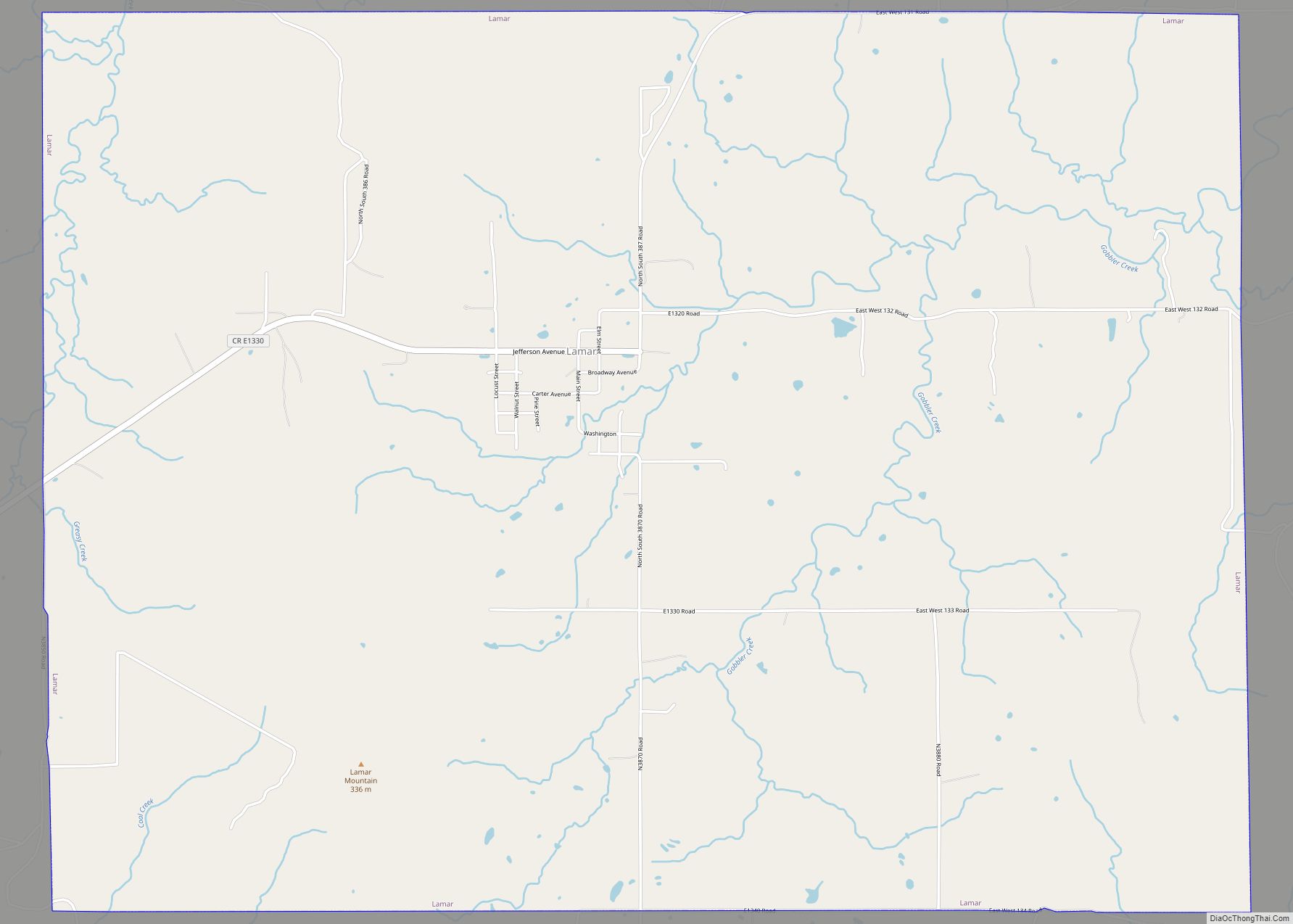
Lamar is a town in Hughes County, Oklahoma, United States. The population was 158 at the 2010 census. Lamar town overview: Name: Lamar town LSAD Code: 43 LSAD Description: town (suffix) State: Oklahoma County: Hughes County Elevation: 764 ft (233 m) Total Area: 11.99 sq mi (31.07 km²) Land Area: 11.99 sq mi (31.06 km²) Water Area: 0.00 sq mi (0.00 km²) Total Population: 118 Population … Read more

Map of Lake Aluma town

Map of Lake Aluma town

Lake Aluma is a town in Oklahoma County, Oklahoma, United States, and a part of the Oklahoma City Metropolitan Area. The population was 88 at the 2010 census. Lake Aluma town overview: Name: Lake Aluma town LSAD Code: 43 LSAD Description: town (suffix) State: Oklahoma County: Oklahoma County Elevation: 1,142 ft (348 m) Total Area: 0.28 sq mi (0.72 km²) … Read more

Map of Lahoma town

Map of Lahoma town

Lahoma is a town in Garfield County, Oklahoma, United States. The population was 611 at the 2010 census, a 5.9 percent gain over the figure of 577 in 2000. Its name was formed from the last three syllables of Oklahoma. Until the 1960s, Lahoma was a farm town. Later, it became primarily a bedroom community … Read more

Map of Kremlin town, Oklahoma

Map of Kremlin town, Oklahoma

Kremlin is a town in Garfield County, Oklahoma, United States. The population was 255 at the 2010 census, a 6.25 percent increase from the figure of 240 in 2000. Kremlin town overview: Name: Kremlin town LSAD Code: 43 LSAD Description: town (suffix) State: Oklahoma County: Garfield County Elevation: 1,119 ft (341 m) Total Area: 0.25 sq mi (0.66 km²) Land … Read more

Map of Lawrence Creek town

Map of Lawrence Creek town

Lawrence Creek is a town in Creek County, Oklahoma, United States. Incorporated March 15, 1983, it is primarily a bedroom community whose employed residents work in Sapulpa and Tulsa. The population was 149 at the 2010 census, a gain of 25.2 percent over the figure of 119 recorded in 2000. Lawrence Creek town overview: Name: … Read more

Map of Laverne town

Map of Laverne town

Laverne is a town in Harper County, Oklahoma, United States. The population was 1,223 at the 2020 census. Laverne town overview: Name: Laverne town LSAD Code: 43 LSAD Description: town (suffix) State: Oklahoma County: Harper County Elevation: 2,110 ft (640 m) Total Area: 0.75 sq mi (1.94 km²) Land Area: 0.75 sq mi (1.94 km²) Water Area: 0.00 sq mi (0.00 km²) Total Population: 1,223 Population … Read more

Map of Leon town, Oklahoma

Map of Leon town, Oklahoma

Leon is a town in Love County, Oklahoma, United States. The population was 91 at the 2010 census. It is part of the Ardmore Micropolitan Statistical Area. Leon town overview: Name: Leon town LSAD Code: 43 LSAD Description: town (suffix) State: Oklahoma County: Love County Elevation: 817 ft (249 m) Total Area: 0.27 sq mi (0.70 km²) Land Area: 0.27 sq mi … Read more

Map of Lenapah town

Map of Lenapah town

Lenapah is a town in north central Nowata County, Oklahoma, United States, eleven miles north of Nowata and sixty two miles northeast of Tulsa. Its name is an adaptation of Lenape, the name of a Delaware Tribe of Indians. The population was 293 at the 2010 census, a 1.7 percent decrease from the figure of … Read more

Map of Lehigh city, Oklahoma

Map of Lehigh city, Oklahoma

Lehigh is a city in Coal County, Oklahoma, United States. Its population was 356 at the 2010 census. Lehigh city overview: Name: Lehigh city LSAD Code: 25 LSAD Description: city (suffix) State: Oklahoma County: Coal County Elevation: 620 ft (189 m) Total Area: 1.62 sq mi (4.20 km²) Land Area: 1.57 sq mi (4.07 km²) Water Area: 0.05 sq mi (0.14 km²) Total Population: 272 Population … Read more

Map of Leedey town

Map of Leedey town

Leedey is a town in Dewey County, Oklahoma, United States. The population was 415 at the 2020 census. Leedey Public School’s mascot is the Bison. Leedey town overview: Name: Leedey town LSAD Code: 43 LSAD Description: town (suffix) State: Oklahoma County: Dewey County Elevation: 2,070 ft (631 m) Total Area: 0.45 sq mi (1.17 km²) Land Area: 0.45 sq mi (1.17 km²) Water … Read more

Map of Lebanon CDP, Oklahoma

Map of Lebanon CDP, Oklahoma

Lebanon is census-designated place (CDP) and unincorporated community in Marshall County, Oklahoma, United States. It has a post office with the ZIP code 73440. Lebanon CDP overview: Name: Lebanon CDP LSAD Code: 57 LSAD Description: CDP (suffix) State: Oklahoma County: Marshall County Elevation: 676 ft (206 m) Total Area: 4.07 sq mi (10.55 km²) Land Area: 3.09 sq mi (8.01 km²) Water Area: … Read more

Map of Leach CDP

Map of Leach CDP

Leach is an unincorporated community and census-designated place (CDP) in southwestern Delaware County, Oklahoma, United States, along U.S. Route 412 and 412 Alternate. The population was 237 at the 2010 census. Leach CDP overview: Name: Leach CDP LSAD Code: 57 LSAD Description: CDP (suffix) State: Oklahoma County: Delaware County Elevation: 1,106 ft (337 m) Total Area: 5.75 sq mi … Read more