Lehigh is a city in Coal County, Oklahoma, United States. Its population was 356 at the 2010 census.
| Name: | Lehigh city |
|---|---|
| LSAD Code: | 25 |
| LSAD Description: | city (suffix) |
| State: | Oklahoma |
| County: | Coal County |
| Elevation: | 620 ft (189 m) |
| Total Area: | 1.62 sq mi (4.20 km²) |
| Land Area: | 1.57 sq mi (4.07 km²) |
| Water Area: | 0.05 sq mi (0.14 km²) |
| Total Population: | 272 |
| Population Density: | 173.14/sq mi (66.84/km²) |
| ZIP code: | 74556 |
| Area code: | 580 |
| FIPS code: | 4042200 |
| GNISfeature ID: | 1094575 |
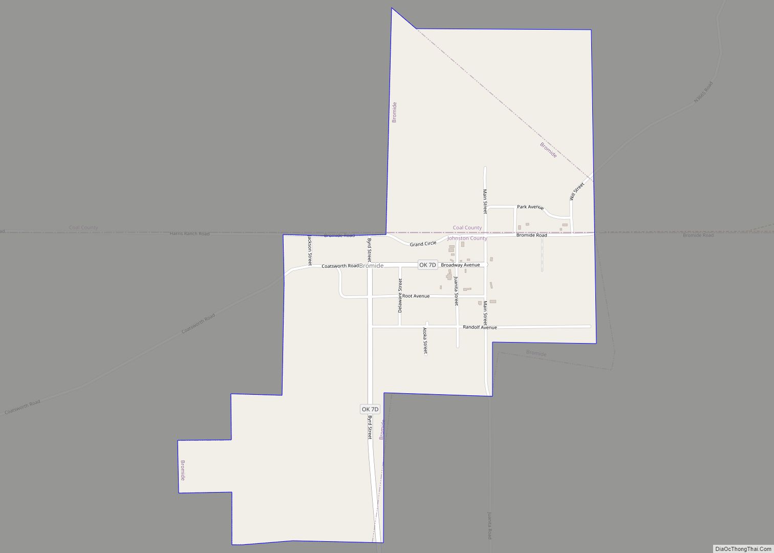
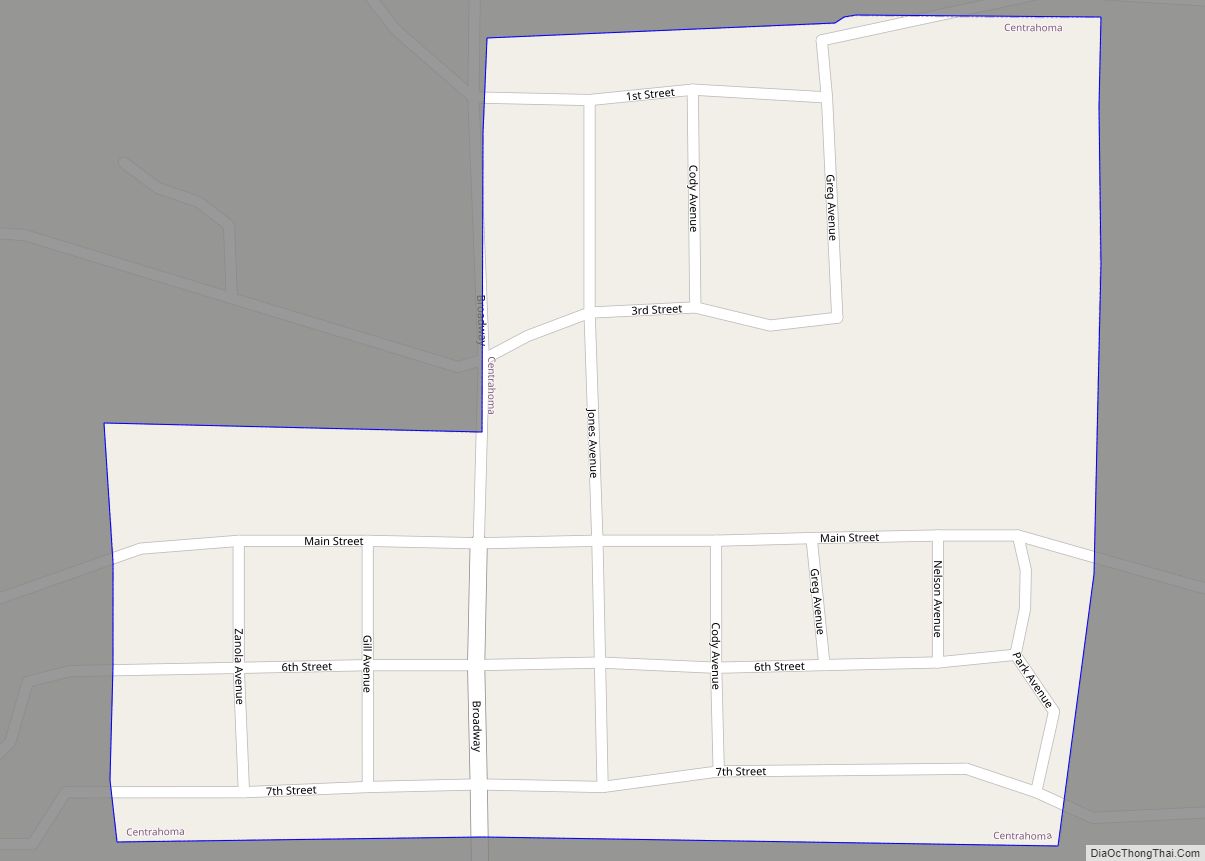
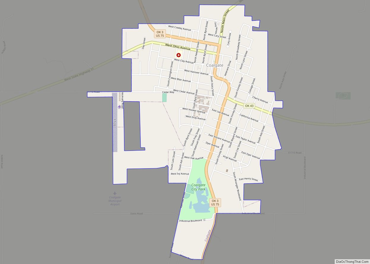
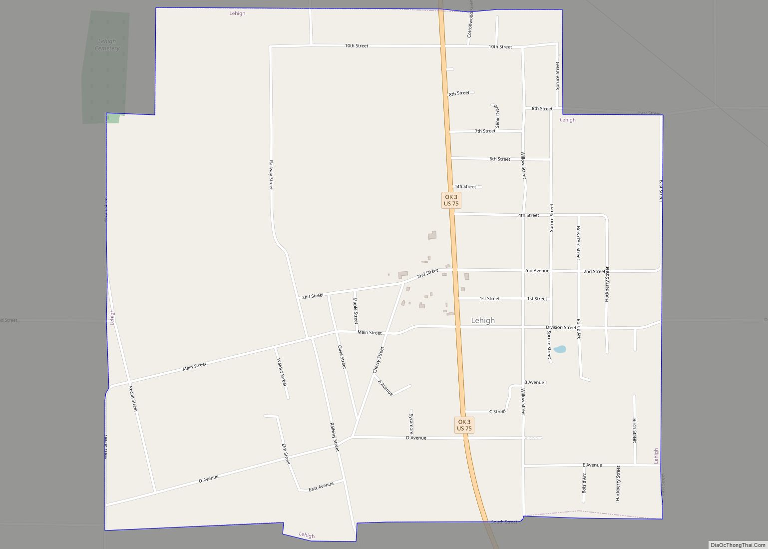
Online Interactive Map
Click on ![]() to view map in "full screen" mode.
to view map in "full screen" mode.
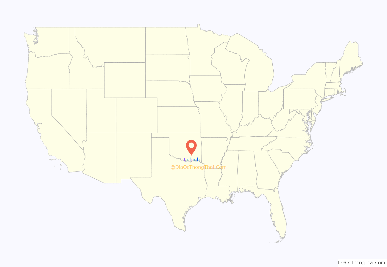
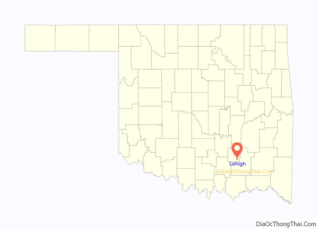
Lehigh location map. Where is Lehigh city?
History
Lehigh began as the first mining camp in what is now Coal County, Oklahoma. At the time of its founding, Lehigh was located in Atoka County, Choctaw Nation. It was originally named Boone, but the name was changed to Lehigh. The new name was taken from Lehigh County, Pennsylvania, a coal-mining region.
A post office opened in Lehigh, Indian Territory, on April 4, 1882, and several railroads built lines to Lehigh, including the Missouri–Kansas–Texas Railroad, the Chicago, Rock Island and Pacific Railway, and the Gulf, Colorado and Santa Fe Railway. During the late 19th and early 20th centuries, Lehigh was a growing settlement that greatly profited from the coal mines surrounding it. During the 1910s and 1920s, the demand for coal lessened as railroads switched to oil-powered trains. The mines eventually closed, and in the early 1920s, boll weevils destroyed the cotton crops in the area. Many businesses closed, and people left the town. The Merchants National Bank Building in Lehigh is the only structure that remains from the once-prosperous downtown area.
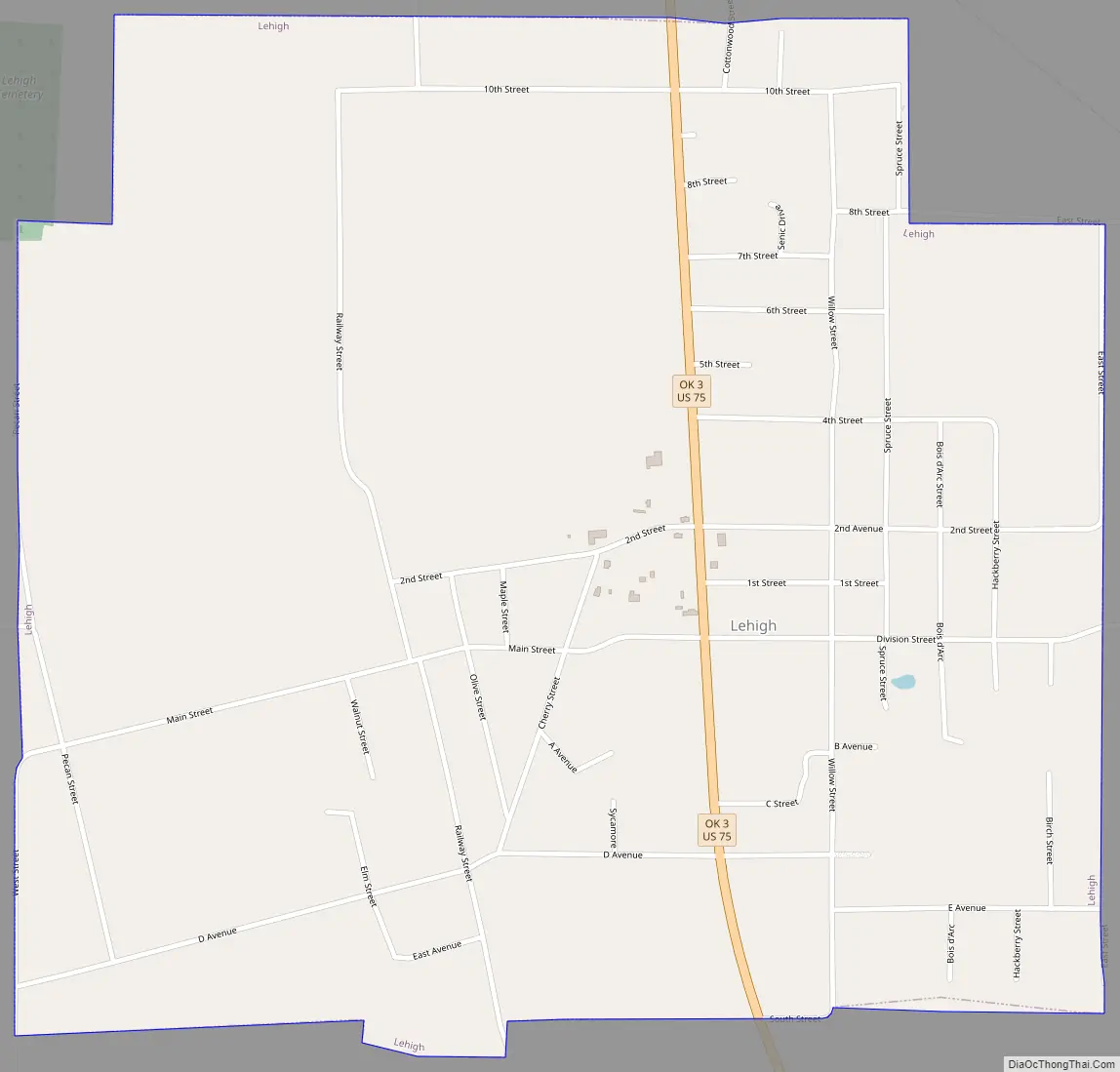
Lehigh Road Map
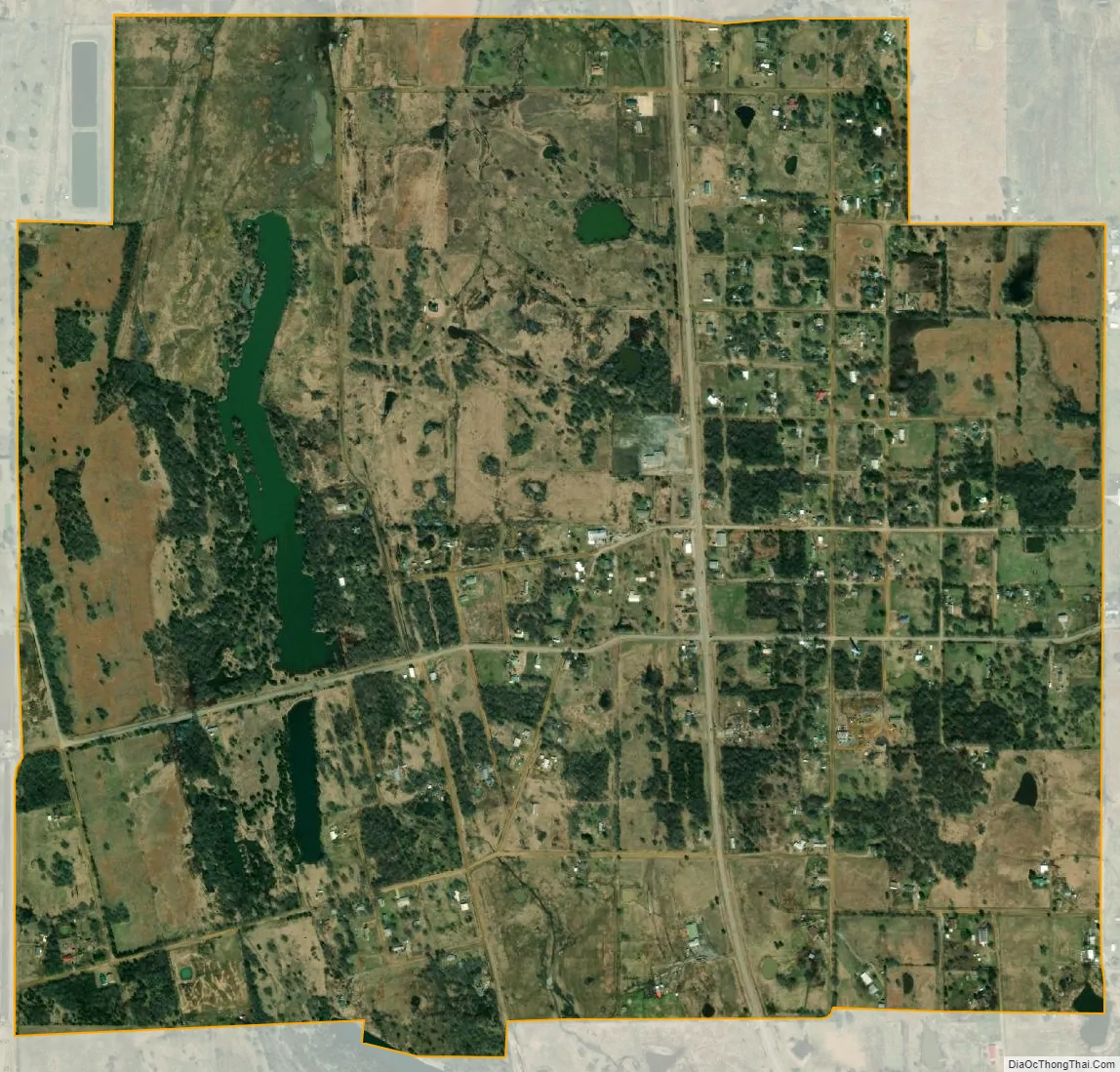
Lehigh city Satellite Map
Geography
Lehigh is located in southeastern Coal County at 34°28′12″N 96°13′7″W / 34.47000°N 96.21861°W / 34.47000; -96.21861 (34.470084, -96.218578). U.S. Route 75 passes through the city, leading north 5 miles (8 km) to Coalgate, the county seat, and southeast 9 miles (14 km) to Atoka.
According to the United States Census Bureau, the city has a total area of 1.6 square miles (4.1 km), of which 0.04 square miles (0.10 km) (2.47%) is covered by water.
See also
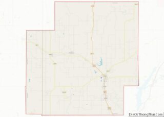
Map of Oklahoma State and its subdivision:- Adair
- Alfalfa
- Atoka
- Beaver
- Beckham
- Blaine
- Bryan
- Caddo
- Canadian
- Carter
- Cherokee
- Choctaw
- Cimarron
- Cleveland
- Coal
- Comanche
- Cotton
- Craig
- Creek
- Custer
- Delaware
- Dewey
- Ellis
- Garfield
- Garvin
- Grady
- Grant
- Greer
- Harmon
- Harper
- Haskell
- Hughes
- Jackson
- Jefferson
- Johnston
- Kay
- Kingfisher
- Kiowa
- Latimer
- Le Flore
- Lincoln
- Logan
- Love
- Major
- Marshall
- Mayes
- McClain
- McCurtain
- McIntosh
- Murray
- Muskogee
- Noble
- Nowata
- Okfuskee
- Oklahoma
- Okmulgee
- Osage
- Ottawa
- Pawnee
- Payne
- Pittsburg
- Pontotoc
- Pottawatomie
- Pushmataha
- Roger Mills
- Rogers
- Seminole
- Sequoyah
- Stephens
- Texas
- Tillman
- Tulsa
- Wagoner
- Washington
- Washita
- Woods
- Woodward
- Alabama
- Alaska
- Arizona
- Arkansas
- California
- Colorado
- Connecticut
- Delaware
- District of Columbia
- Florida
- Georgia
- Hawaii
- Idaho
- Illinois
- Indiana
- Iowa
- Kansas
- Kentucky
- Louisiana
- Maine
- Maryland
- Massachusetts
- Michigan
- Minnesota
- Mississippi
- Missouri
- Montana
- Nebraska
- Nevada
- New Hampshire
- New Jersey
- New Mexico
- New York
- North Carolina
- North Dakota
- Ohio
- Oklahoma
- Oregon
- Pennsylvania
- Rhode Island
- South Carolina
- South Dakota
- Tennessee
- Texas
- Utah
- Vermont
- Virginia
- Washington
- West Virginia
- Wisconsin
- Wyoming