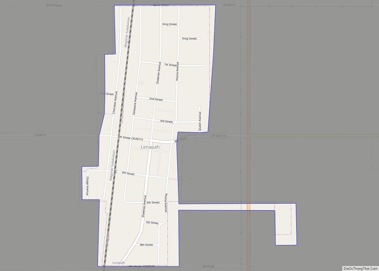
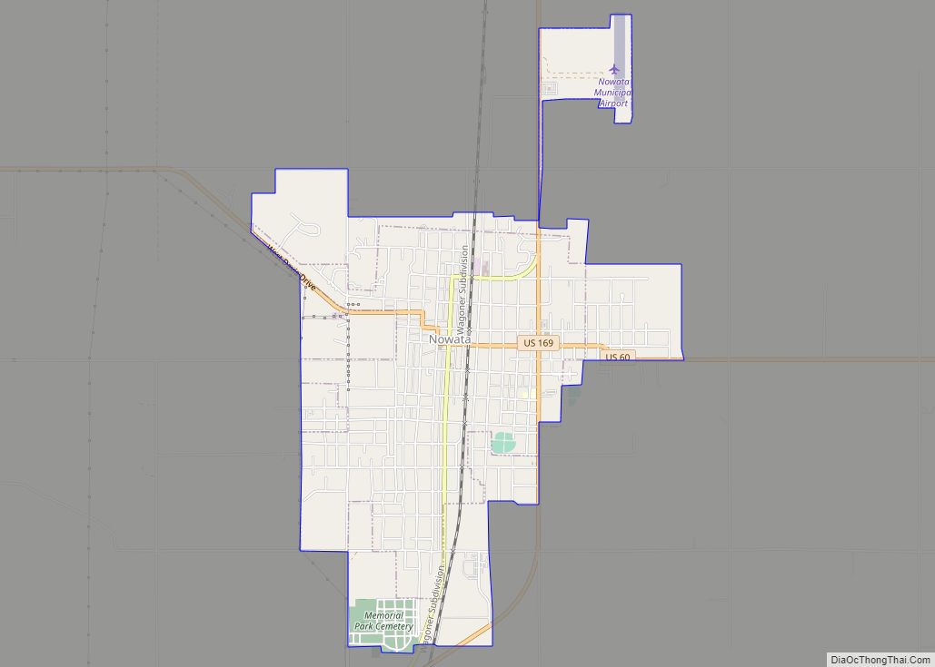
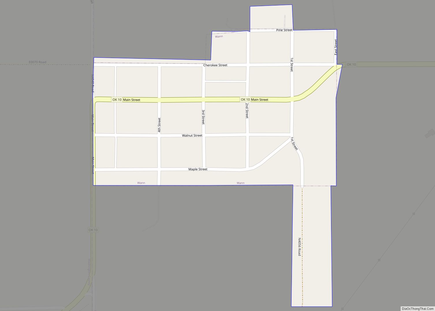
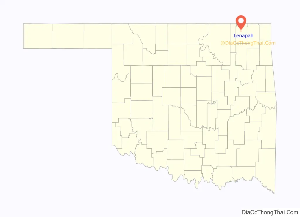
Lenapah is a town in north central Nowata County, Oklahoma, United States, eleven miles north of Nowata and sixty two miles northeast of Tulsa. Its name is an adaptation of Lenape, the name of a Delaware Tribe of Indians. The population was 293 at the 2010 census, a 1.7 percent decrease from the figure of 298 recorded in 2000.
| Name: | Lenapah town |
|---|---|
| LSAD Code: | 43 |
| LSAD Description: | town (suffix) |
| State: | Oklahoma |
| County: | Nowata County |
| Elevation: | 750 ft (230 m) |
| Total Area: | 0.41 sq mi (1.07 km²) |
| Land Area: | 0.41 sq mi (1.07 km²) |
| Water Area: | 0.00 sq mi (0.00 km²) |
| Total Population: | 272 |
| Population Density: | 660.19/sq mi (255.10/km²) |
| ZIP code: | 74042 |
| Area code: | 539/918 |
| FIPS code: | 4042300 |
| GNISfeature ID: | 1094580 |
Online Interactive Map
Click on ![]() to view map in "full screen" mode.
to view map in "full screen" mode.
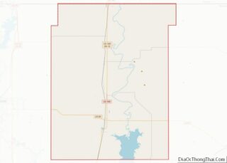
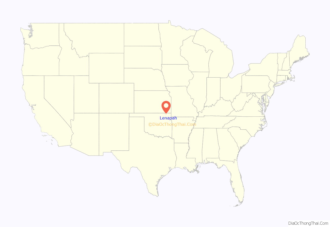
Lenapah location map. Where is Lenapah town?
History
The town is primarily an agricultural community. The Kansas and Arkansas Valley Railway, now part of the Union Pacific Railroad system, established a depot at Lenapah in 1889, and a post office opened in the following year. There were 154 residents in the 1900 census, and 331 at statehood in 1907. The highest population was 434 at the 1920 census.
Oil and natural gas were discovered nearby after the start of the 20th century. Although this activity did not contribute much to the town’s growth, it resulted in piping gas to Lenapah’s homes and businesses.
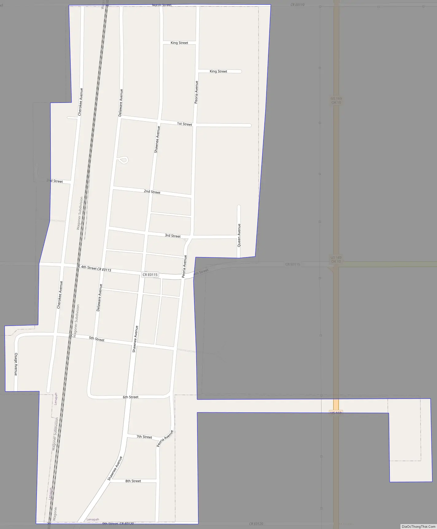
Lenapah Road Map
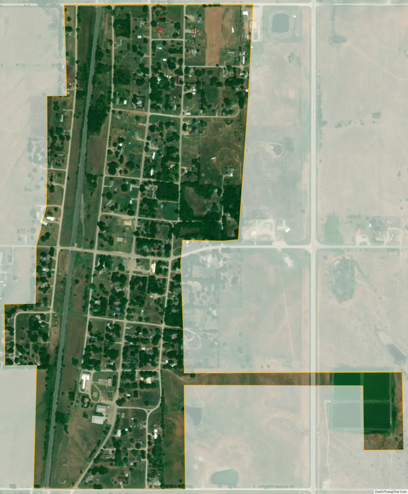
Lenapah city Satellite Map
Geography
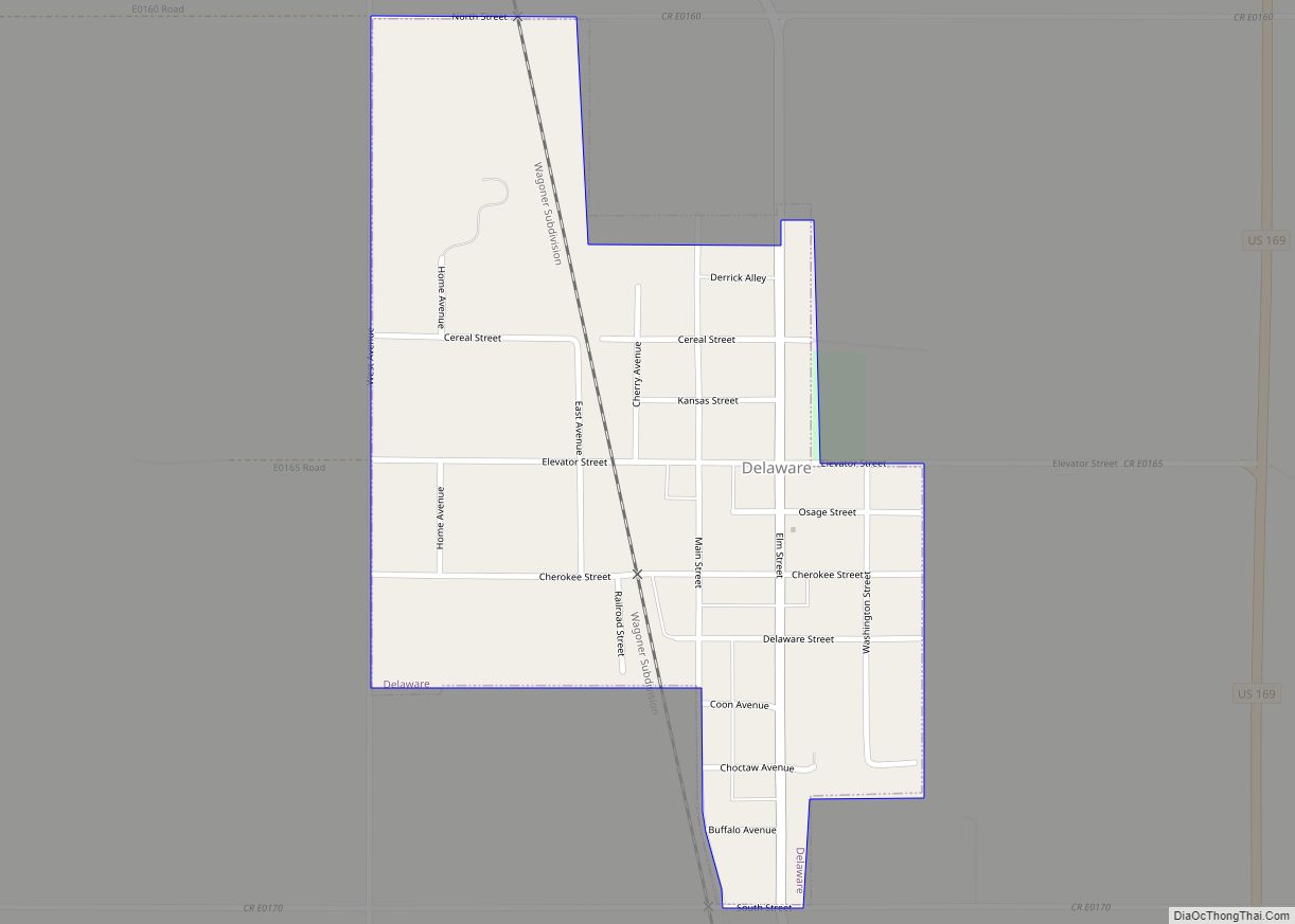
Lenapah is located just west of US Route 169 approximately fourteen miles south of Coffeyville, Kansas and 4.5 miles north of the community of Delaware. The Verdigris River flows past approximately six miles to the east.
According to the United States Census Bureau, the town has a total area of 0.4 square miles (1.0 km), all land.
See also
Map of Oklahoma State and its subdivision:- Adair
- Alfalfa
- Atoka
- Beaver
- Beckham
- Blaine
- Bryan
- Caddo
- Canadian
- Carter
- Cherokee
- Choctaw
- Cimarron
- Cleveland
- Coal
- Comanche
- Cotton
- Craig
- Creek
- Custer
- Delaware
- Dewey
- Ellis
- Garfield
- Garvin
- Grady
- Grant
- Greer
- Harmon
- Harper
- Haskell
- Hughes
- Jackson
- Jefferson
- Johnston
- Kay
- Kingfisher
- Kiowa
- Latimer
- Le Flore
- Lincoln
- Logan
- Love
- Major
- Marshall
- Mayes
- McClain
- McCurtain
- McIntosh
- Murray
- Muskogee
- Noble
- Nowata
- Okfuskee
- Oklahoma
- Okmulgee
- Osage
- Ottawa
- Pawnee
- Payne
- Pittsburg
- Pontotoc
- Pottawatomie
- Pushmataha
- Roger Mills
- Rogers
- Seminole
- Sequoyah
- Stephens
- Texas
- Tillman
- Tulsa
- Wagoner
- Washington
- Washita
- Woods
- Woodward
- Alabama
- Alaska
- Arizona
- Arkansas
- California
- Colorado
- Connecticut
- Delaware
- District of Columbia
- Florida
- Georgia
- Hawaii
- Idaho
- Illinois
- Indiana
- Iowa
- Kansas
- Kentucky
- Louisiana
- Maine
- Maryland
- Massachusetts
- Michigan
- Minnesota
- Mississippi
- Missouri
- Montana
- Nebraska
- Nevada
- New Hampshire
- New Jersey
- New Mexico
- New York
- North Carolina
- North Dakota
- Ohio
- Oklahoma
- Oregon
- Pennsylvania
- Rhode Island
- South Carolina
- South Dakota
- Tennessee
- Texas
- Utah
- Vermont
- Virginia
- Washington
- West Virginia
- Wisconsin
- Wyoming