Map of Junction City, Oregon
Junction City is a city in Lane County, Oregon, United States. As of the 2020 United States Census, it has a population of 6,747. The Junction City area is notable for its Scandinavian heritage, with the city’s Scandinavian Festival attracting over 100,000 visitors annually. Junction City was previously a center of recreational vehicle manufacturing. Junction ... Read more
Map of Junction City, Oregon
Map of Joseph city, Oregon
Joseph is a city in Wallowa County, Oregon, United States. Originally named Silver Lake and Lake City, the city formally named itself in 1880 for Chief Joseph (1840–1904) of the Nez Perce people. The population was 1,081 at the 2010 census. Joseph city overview: Name: Joseph city LSAD Code: 25 LSAD Description: city (suffix) State: ... Read more
Map of Joseph city, Oregon
Map of Jordan Valley city
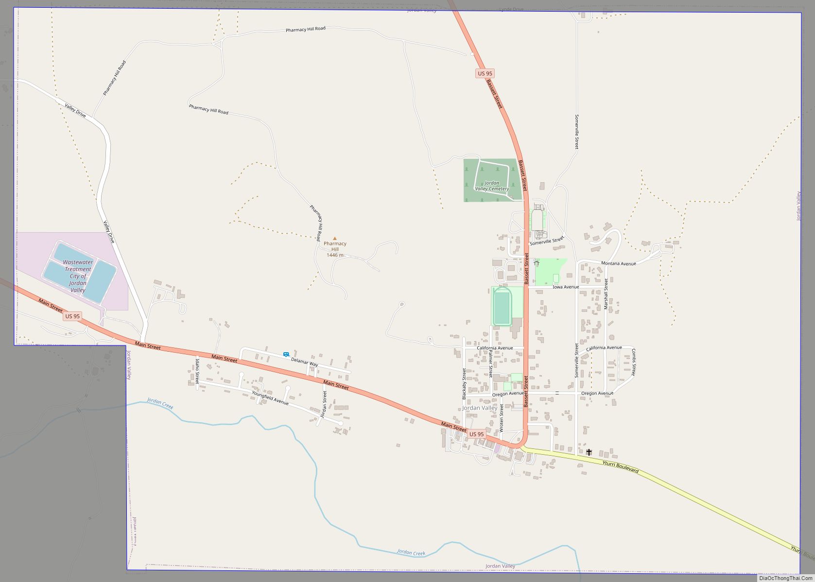
Jordan Valley is a city in Malheur County, Oregon, United States. It is part of the Ontario, OR–ID Micropolitan Statistical Area. The city lies along Jordan Creek, a tributary of the Owyhee River; the creek is named for a 19th-century prospector, Michael M. Jordan. The population was 181 at the 2010 census. Jordan Valley city ... Read more
Map of Jordan Valley city
Map of Johnson City, Oregon
Johnson City is a city in Clackamas County, Oregon, United States. The population was 566 at the 2010 census. Because of its small area, its population density is over 8,000 per square mile, making it the most densely populated city in Oregon. Johnson City city overview: Name: Johnson City city LSAD Code: 25 LSAD Description: ... Read more
Map of Johnson City, Oregon
Map of John Day city
John Day is a city located about 2 miles (3.2 km) north of Canyon City in Grant County, Oregon, at the intersection of U.S. Routes 26 and 395. The city was named for the nearby John Day River, which, along with Dayville, had been named for a Virginia member of the 1811 Astor Expedition, John Day. ... Read more
Map of John Day city
Map of Jennings Lodge CDP
Jennings Lodge is a census-designated place and unincorporated community in Clackamas County, Oregon, United States, between Milwaukie and Gladstone. For statistical purposes, the United States Census Bureau has defined Jennings Lodge as a census-designated place (CDP). The census definition of the area may not precisely correspond to local understanding of the area with the same ... Read more
Map of Jennings Lodge CDP
Map of La Pine city
La Pine is a city in Deschutes County, Oregon, United States, incorporated on December 7, 2006. La Pine is part of the Bend, Oregon Metropolitan Statistical Area. The population was 2,512 people as of the 2020 Census. La Pine is in an isolated area of Central Oregon, consisting of a loose collection of homes and ... Read more
Map of La Pine city
Map of La Grande city, Oregon
La Grande /ləˈɡrænd/ is a city in Union County, Oregon, United States. La Grande is Union County’s largest city, with a population of 13,082 at the time of the 2010 U.S. Census. The La Grande metro population is 25,076. It is the 16th largest metropolitan area in Oregon. La Grande is located within the Grande ... Read more
Map of La Grande city, Oregon
Map of Klamath Falls city
Klamath Falls (/ˈklæməθ/ KLAM-əth) is a city in, and the county seat of, Klamath County, Oregon, United States. The city was originally called Linkville when George Nurse founded the town in 1867. It was named after the Link River, on whose falls the city was sited. The name was changed to Klamath Falls in 1893. ... Read more
Map of Klamath Falls city
Map of Kirkpatrick CDP
Kirkpatrick is a census-designated place (CDP) in Umatilla County, Oregon, United States. The population was 172 at the 2000 census. It is part of the Pendleton–Hermiston Micropolitan Statistical Area. Kirkpatrick CDP overview: Name: Kirkpatrick CDP LSAD Code: 57 LSAD Description: CDP (suffix) State: Oregon County: Umatilla County Elevation: 1,306 ft (398 m) Total Area: 3.58 sq mi (9.28 km²) Land ... Read more
Map of Kirkpatrick CDP
Map of Kings Valley CDP
Kings Valley is an unincorporated community and census-designated place in Benton County, Oregon, United States. It is located on the Luckiamute River and Oregon Route 223, the Kings Valley Highway. As of the 2010 census it had a population of 65. Kings Valley was named after its first settler, Nahum King, who took out a ... Read more
Map of Kings Valley CDP
Map of Lakeside city, Oregon
Lakeside is a city in Coos County, Oregon, United States. The population was 1,699 at the 2010 census. Lakeside city overview: Name: Lakeside city LSAD Code: 25 LSAD Description: city (suffix) State: Oregon County: Coos County Incorporated: 1974 Elevation: 23 ft (7 m) Total Area: 2.29 sq mi (5.93 km²) Land Area: 2.00 sq mi (5.18 km²) Water Area: 0.29 sq mi (0.76 km²) Total Population: ... Read more
Map of Lakeside city, Oregon