Lake Oswego (/ɒsˈwiːɡoʊ/ oss-WEE-goh) is a city in the U.S. state of Oregon, primarily in Clackamas County, with small portions extending into neighboring Multnomah and Washington counties. Located about 8 miles (13 km) south of Portland and surrounding the 405-acre (164 ha) Oswego Lake, the town was founded in 1847 and incorporated as Oswego in 1910. The city was the hub of Oregon’s brief iron industry in the late 19th century, and is today a suburb of Portland. The population in 2010 was 36,619, a 3.8% increase over the 2000 population of 35,278.
| Name: | Lake Oswego city |
|---|---|
| LSAD Code: | 25 |
| LSAD Description: | city (suffix) |
| State: | Oregon |
| County: | Clackamas County, Multnomah County, Washington County |
| Founded: | 1847, incorporated 1910 |
| Elevation: | 249 ft (76 m) |
| Total Area: | 11.48 sq mi (29.75 km²) |
| Land Area: | 10.83 sq mi (28.05 km²) |
| Water Area: | 0.66 sq mi (1.70 km²) |
| Total Population: | 40,731 |
| Population Density: | 3,760.94/sq mi (1,452.08/km²) |
| ZIP code: | 97034–97035 |
| Area code: | 503 and 971 |
| FIPS code: | 4140550 |
| GNISfeature ID: | 2411606 |
| Website: | www.ci.oswego.or.us |
Online Interactive Map
Click on ![]() to view map in "full screen" mode.
to view map in "full screen" mode.
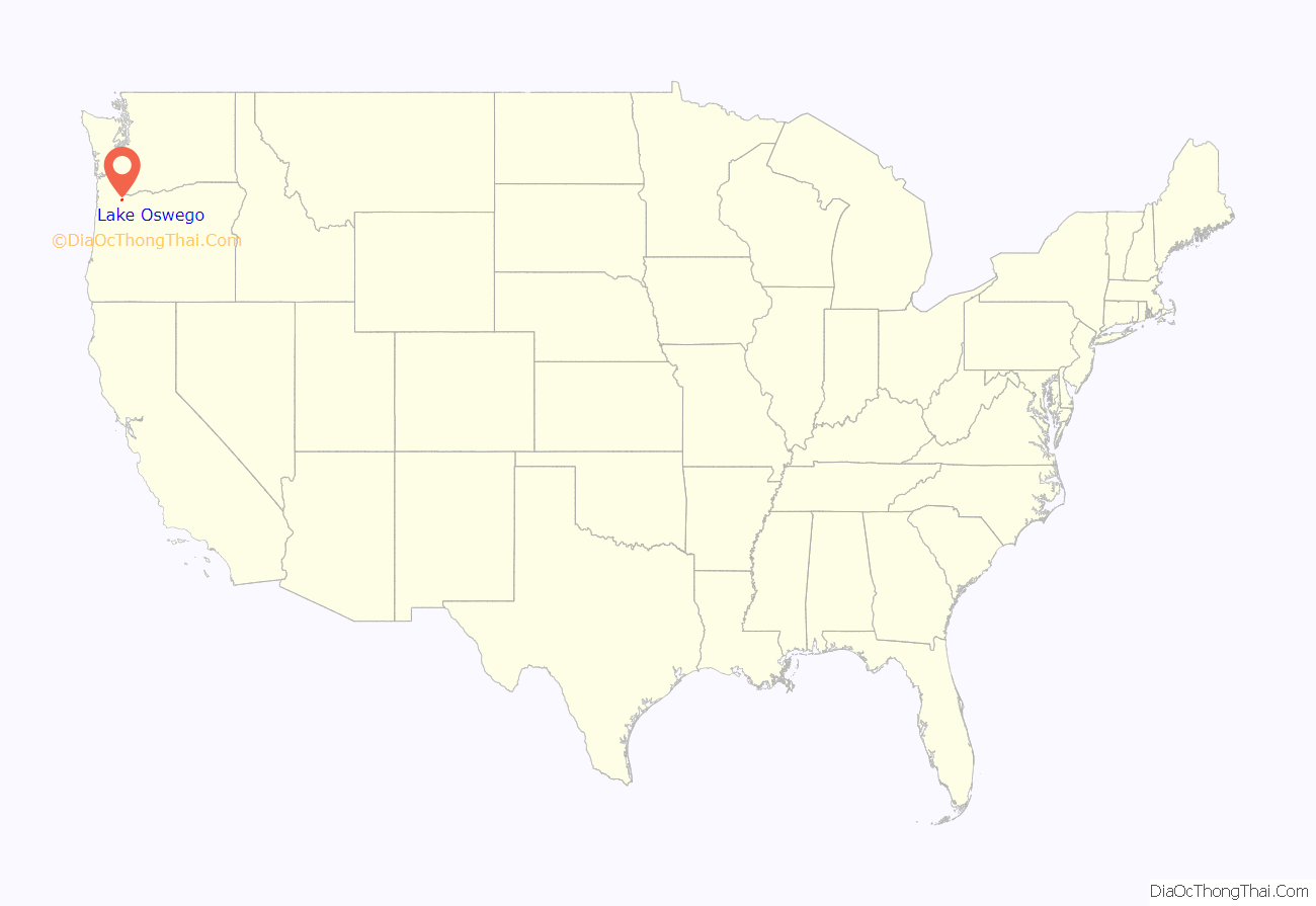
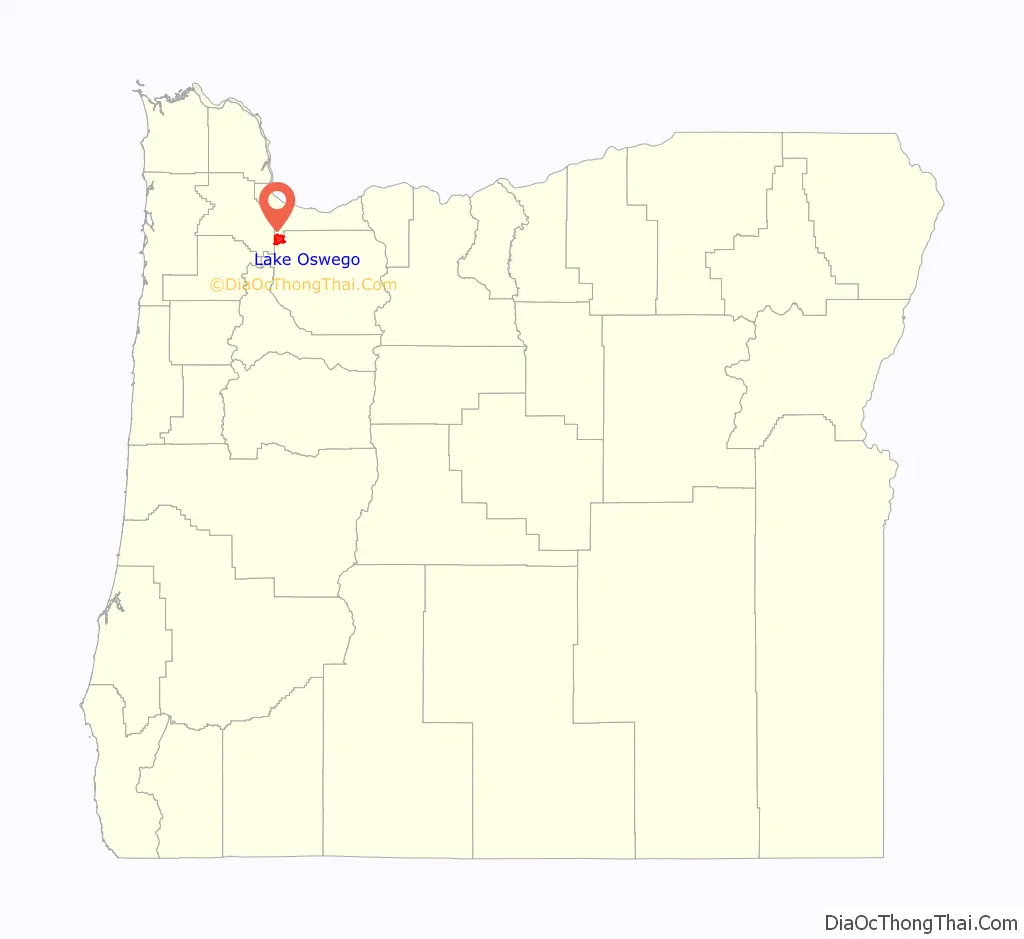
Lake Oswego location map. Where is Lake Oswego city?
History
Early history
The Clackamas people once occupied the land that later became Lake Oswego, but diseases transmitted by European explorers and traders killed most of the natives. Before the influx of non-native people via the Oregon Trail, the area between the Willamette River and Tualatin River had a scattering of early pioneer homesteads and farms.
19th century
As settlers arrived, encouraged by the Donation Land Claim Act of 1850 and the subsequent Homestead Act, they found the land underoccupied.
Albert Alonzo Durham founded the town of Oswego in 1847, naming it after Oswego, New York. He built a sawmill on Sucker Creek (now Oswego Creek), the town’s first industry.
In 1855, the federal government forcibly relocated the remaining Clackamas people to the Grand Ronde Indian Reservation in nearby Yamhill County.
During this early period in Oregon history, most trade proceeded from Portland to Oregon City via the Willamette River, and up the Tualatin River valley through Tualatin, Scholls, and Hillsboro. The thick woods and rain-muddied roads were major obstacles to traveling by land. The vestiges of river landings, ferry stops, and covered bridges of this period can still be seen along this area. A landing in the city’s present-day George Rogers Park is thought to have been developed by Durham around 1850 for lumber transport; another landing was near the Tryon Creek outlet into the Willamette.
In 1865, prompted by the earlier discovery of iron ore in the Tualatin Valley, the Oregon Iron Company was incorporated. Within two years, the first blast furnace on the West Coast was built, patterned after the arched furnaces common in northwestern Connecticut, and the company set out to make Oswego into the “Pittsburgh of the West”. In 1878, the company was sold off to out-of-state owners and renamed the Oswego Iron Company, and in 1882, Portland financiers Simeon Gannett Reed and Henry Villard purchased the business and renamed it the Oregon Iron and Steel Company.
The railroad arrived in Oswego in 1886, in the form of the Portland and Willamette Valley Railway. A 7-mile-long (11 km) line provided Oswego with a direct link to Portland. Prior to this, access to the town was limited to primitive roads and riverboats. The railroad’s arrival was a mixed blessing; locally, it promoted residential development along its path, which enabled Oswego to grow beyond its industrial roots, but nationally, the continued expansion of the freight railroad system gave easy local access to cheaper and higher quality iron from the Great Lakes region. This ultimately led to the local industry’s demise.
By 1890, the industry produced 12,305 tons of pig iron, and at its peak provided employment to around 300 men. The success of this industry greatly stimulated the development of Oswego, which by this time had four general stores, a bank, two barber shops, two hotels, three churches, nine saloons, a drugstore, and even an opera house.
The iron industry was a vital part of a strategy designed by a few Portland financiers who strove to control all related entrepreneurial ventures in the late 19th century. Control of shipping and railroads was held under the Oregon Steam Navigation Company, later to become the Oregon Railway and Navigation Company. This local monopoly responded to the area’s increasing demand for iron and steel, and grew to play a key role in economic history throughout the area.
20th and 21st centuries
The Oregon Iron and Steel Company adapted to the new century by undertaking programs in land development, selling large tracts of the 24,000 acres (97 km) of land it owned, and power, building a plant on Oswego Creek starting in 1905, and erecting power poles in subsequent years to supply power to Oswego citizens. With the water needs of the smelters tailing off, the recreational potential of the lake and town was freed to develop rapidly.
In 1910, the town of Oswego was incorporated. The Southern Pacific Railroad, which had acquired the P&WVR line at the end of the 19th century, widened it from narrow to standard gauge and in 1914 electrified it, providing rapid, clean, and quiet service between Oswego and Portland. The service was known as the Red Electric.
Passenger traffic hit its peak in 1920 with 64 trains to and from Portland daily. Within nine years of the peak, passenger service ended, and the line was used for intermittent freight service to Portland’s south waterfront until its abandonment in 1984. The line was preserved, however, and the Willamette Shore Trolley provides tourist rides on the line today.
One of the land developers benefiting from sales by OI&S was Paul Murphy, whose Oswego Lake Country Club helped promote the new city as a place to “live where you play.” Murphy was instrumental in developing the first water system to supply the western reaches of the city, and also played a key role in encouraging the design of fine homes in the 1930s and 1940s that ultimately established Oswego as an attractive place to live. In the 1940s and 1950s, continued development helped spread Oswego’s residential areas.
Mass transit service after the end of electric interurban service was provided by Oregon Motor Stages, but that company suspended all operations following a drivers’ strike in 1954. In 1955, a newly formed private company, Intercity Buses, Inc., began operating bus service connecting Oswego with downtown Portland and Oregon City. This service was taken over by TriMet in 1970.
In 1960, Oswego was renamed “Lake Oswego” when it annexed part of neighboring Lake Grove. The city has some nicknames including “Lake No-Negro”, “Lake Big Ego”, “Fake Oswego” and “Fake Lost Ego”. Additionally, it was spoken of as Nimbyville during a planning-related seminar on 2008 by Dennis Egner. A 2012 article in the Daily Journal of Commerce identified Egner as a long-range planning director for the city of Lake Oswego. According to historian James W. Loewen, locals often call it “Lake No Negro” in reference to its recognition status as an “elite white suburb”.
In August 2020, Lake Oswego received significant media attention when its resident received an anonymous letter from neighbors asking them to take down their “Black Lives Matter” sign from the window, complaining that it lowers property values, which prompted Mayor Studebaker to issue a response to this matter. A documentary titled Lake No Negro about Lake Oswego’s racially exclusive past was produced by a Lakeridge High School student in 2020
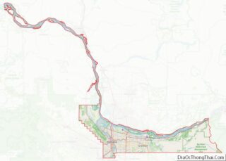
Lake Oswego Road Map
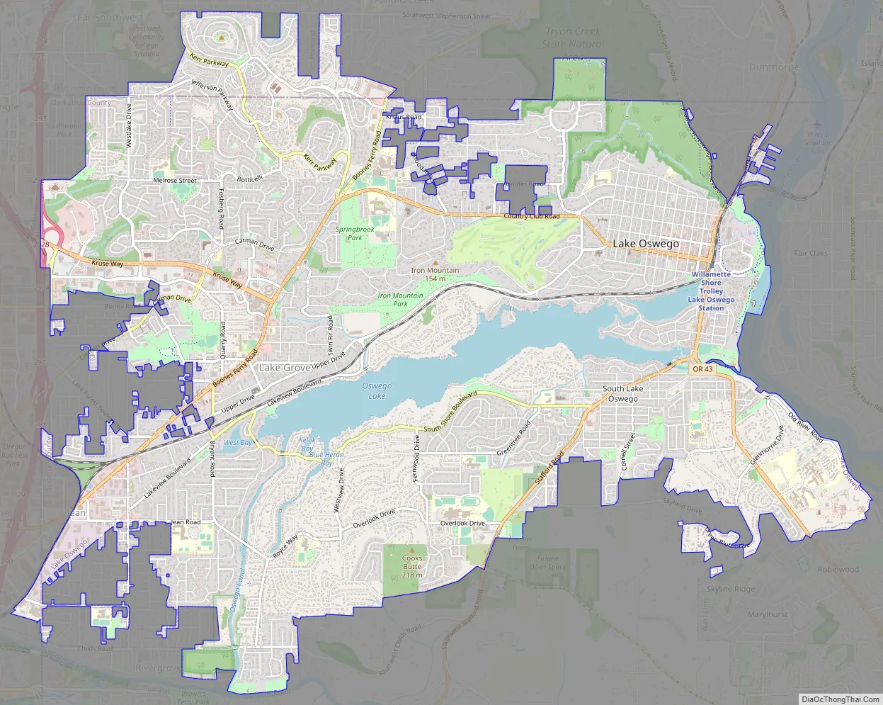
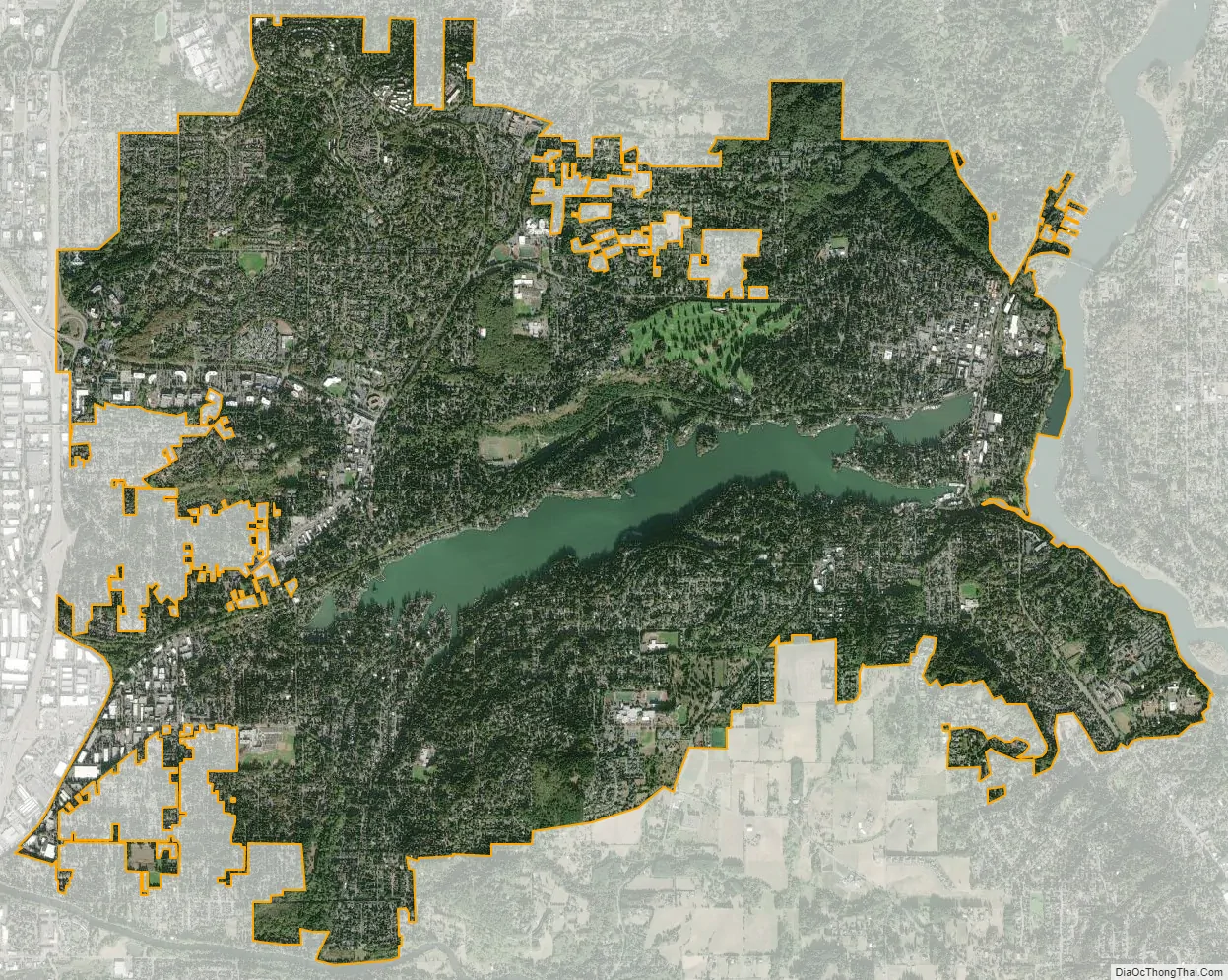
Lake Oswego city Satellite Map
Geography
According to the United States Census Bureau, the city has a total area of 11.35 square miles (29.40 km), of which 10.68 square miles (27.66 km) are land and 0.67 square miles (1.74 km) are covered by water. That area does not include more than 1,100 acres (4.5 km) of unincorporated land within the urban services boundary as defined by Clackamas County. Oswego Lake is a lake, originally named Waluga (wild swan) by Clackamas Indians, which has been expanded is and currently managed by the Lake Oswego Corporation. The lake supports watercraft, and a dock floats at the lake’s east end, where boaters can disembark and walk to the nearby businesses. The main canal from the Tualatin River was dug in 1872.
Every three years, the water level in the lake is lowered several feet by opening the gates on the dam and allowing water to flow into Oswego Creek and on to the Willamette River, enabling lakefront property owners to conduct repairs on docks and boathouses. In 2010, the lake was lowered about 24 feet (7.3 m) to allow for construction of a new sewer line, the lowest lake level since 1962, when the original sewer line was installed.
The city extends up Mount Sylvania and through Lake Grove towards Tualatin.
See also
Map of Oregon State and its subdivision: Map of other states:- Alabama
- Alaska
- Arizona
- Arkansas
- California
- Colorado
- Connecticut
- Delaware
- District of Columbia
- Florida
- Georgia
- Hawaii
- Idaho
- Illinois
- Indiana
- Iowa
- Kansas
- Kentucky
- Louisiana
- Maine
- Maryland
- Massachusetts
- Michigan
- Minnesota
- Mississippi
- Missouri
- Montana
- Nebraska
- Nevada
- New Hampshire
- New Jersey
- New Mexico
- New York
- North Carolina
- North Dakota
- Ohio
- Oklahoma
- Oregon
- Pennsylvania
- Rhode Island
- South Carolina
- South Dakota
- Tennessee
- Texas
- Utah
- Vermont
- Virginia
- Washington
- West Virginia
- Wisconsin
- Wyoming